- National Register of Historic Places listings in McDowell County, West Virginia
-
 Location of McDowell County in West Virginia
This is a list of the National Register of Historic Places listings in McDowell County, West Virginia.
This is intended to be a complete list of the properties and districts on the National Register of Historic Places in McDowell County, West Virginia, United States. The locations of National Register properties and districts for which the latitude and longitude coordinates are included below, may be seen in a Google map.[1]
There are 17 properties and districts listed on the National Register in the county.
-
- This National Park Service list is complete through NPS recent listings posted November 10, 2011.[2]
Contents: Counties in West Virginia Barbour - Berkeley - Boone - Braxton - Brooke - Cabell - Calhoun - Clay - Doddridge - Fayette - Gilmer - Grant - Greenbrier - Hampshire - Hancock - Hardy - Harrison - Jackson - Jefferson - Kanawha - Lewis - Lincoln - Logan - Marion - Marshall - Mason - McDowell - Mercer - Mineral - Mingo - Monongalia - Monroe - Morgan - Nicholas - Ohio - Pendleton - Pleasants - Pocahontas - Preston - Putnam - Raleigh - Randolph - Ritchie - Roane - Summers - Taylor - Tucker - Tyler - Upshur - Wayne - Webster - Wetzel - Wirt - Wood - Wyoming
Listings county-wide
[3] Landmark name Image Date listed Location City or town Summary 1 Algoma Coal and Coke Company Store April 17, 1992 County Route 17
37°25′10″N 81°25′35″W / 37.419444°N 81.426389°WAlgoma 2 Ashland Company Store May 5, 2005 County Route 17
37°24′33″N 81°21′14″W / 37.409167°N 81.353889°WAshland 3 Carter Coal Company Store April 17, 1992 Junction of WV 16 and County Route 12/8
37°20′01″N 81°40′28″W / 37.333611°N 81.674444°WCaretta 4 Carter Coal Company Store 
April 17, 1992 County Route 2
37°23′14″N 81°39′06″W / 37.387222°N 81.651667°WCoalwood Demolished March 29, 2008.[4] 5 Empire Coal Company Store April 17, 1992 U.S. Route 52
37°24′43″N 81°28′29″W / 37.411944°N 81.474722°WLandgraff No longer extant.[5] 6 Houston Coal Company Store 
April 17, 1992 U.S. Route 52
37°25′48″N 81°30′32″W / 37.43°N 81.508889°WKimball 7 James Ellwood Jones House April 2, 1992 North of U.S. Route 52, east of Turkey Gap Branch
37°21′54″N 81°22′25″W / 37.365°N 81.373611°WSwitchback 8 John J. Lincoln House July 16, 1992 North of U.S. Route 52
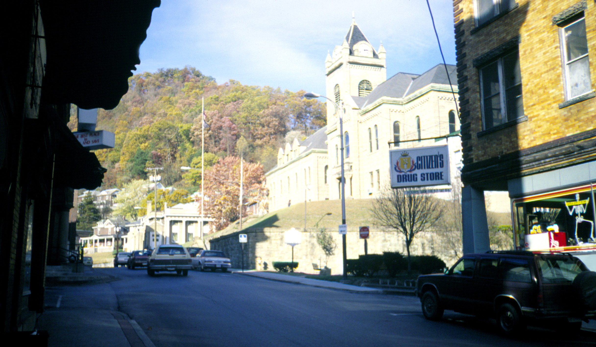
37°23′07″N 81°24′46″W / 37.385278°N 81.412778°WElkhorn 9 McDowell County Courthouse 
August 29, 1979 Wyoming St.
37°25′57″N 81°35′03″W / 37.4325°N 81.584167°WWelch 10 Page Coal and Coke Company Store April 17, 1992 WV 161
37°20′57″N 81°27′53″W / 37.349167°N 81.464722°WPageton 11 Peerless Coal Company Store April 17, 1992 South of U.S. Route 52
37°25′03″N 81°29′26″W / 37.4175°N 81.490556°WVivian 12 Pocahontas Fuel Company Store April 17, 1992 U.S. Route 52
37°22′32″N 81°21′48″W / 37.375556°N 81.363333°WMaybeury Demolished sometime after March 2005.[6] 13 Pocahontas Fuel Company Store April 17, 1992 U.S. Route 52
37°22′13″N 81°23′05″W / 37.370278°N 81.384722°WSwitchback 14 Pocahontas Fuel Company Store and Office Buildings April 17, 1992 County Route 8
37°17′28″N 81°25′25″W / 37.291111°N 81.423611°WJenkinjones 15 U.S. Coal and Coke Company Store April 17, 1992 County Route 13/2
37°21′05″N 81°32′51″W / 37.351389°N 81.5475°WReam Demolished sometime between March 2004 and 2006.[6] 16 Welch Commercial Historic District April 2, 1992 Roughly bounded by Wyoming St., Elkhorn Creek and the Tug River
37°25′57″N 81°35′08″W / 37.4325°N 81.585556°WWelch 17 World War Memorial 
April 9, 1993 U.S. Route 52
37°25′31″N 81°30′24″W / 37.425278°N 81.506667°WKimball See also
- List of National Historic Landmarks in West Virginia
- National Register of Historic Places listings in West Virginia
References
- ^ The latitude and longitude information provided in this table was derived originally from the National Register Information System, which has been found to be fairly accurate for about 99% of listings. For about 1% of NRIS original coordinates, experience has shown that one or both coordinates are typos or otherwise extremely far off; some corrections may have been made. A more subtle problem causes many locations to be off by up to 150 yards, depending on location in the country: most NRIS coordinates were derived from tracing out latitude and longitudes off of USGS topographical quadrant maps created under North American Datum of 1927, which differs from the current, highly accurate GPS system used by Google maps. Chicago is about right, but NRIS longitudes in Washington are higher by about 4.5 seconds, and are lower by about 2.0 seconds in Maine. Latitudes differ by about 1.0 second in Florida. Some locations in this table may have been corrected to current GPS standards.
- ^ "National Register of Historic Places: Weekly List Actions". National Park Service, United States Department of the Interior. Retrieved on November 10, 2011.
- ^ Numbers represent an ordering by significant words. Various colorings, defined here, differentiate National Historic Landmark sites and National Register of Historic Places Districts from other NRHP buildings, structures, sites or objects.
- ^ "Coalwood". Archived from the original on March 16, 2010. http://www.webcitation.org/5oGcTV2mg. Retrieved March 16, 2010.
- ^ "Aerial Photography of Empire Coal Company Store Site". Google Maps. Google. http://maps.google.com/maps?t=h&q=37.411944,-81.474722&ie=UTF8&ll=37.411943,-81.474717&spn=0.006391,0.009645&z=17. Retrieved April 27, 2010.
- ^ a b Dellamea, Chris. "Flat Top Field - McDowell County". Coalfields of the Appalachian Mountains. http://www.coalcampusa.com/sowv/flattop/mcdowell/mcdowell.htm. Retrieved April 27, 2010.
U.S. National Register of Historic Places in West Virginia Lists by county Barbour • Berkeley • Boone • Braxton • Brooke • Cabell • Calhoun • Clay • Doddridge • Fayette • Gilmer • Grant • Greenbrier • Hampshire • Hancock • Hardy • Harrison • Jackson • Jefferson • Kanawha • Lewis • Lincoln • Logan • Marion • Marshall • Mason • McDowell • Mercer • Mineral • Mingo • Monongalia • Monroe • Morgan • Nicholas • Ohio • Pendleton • Pleasants • Pocahontas • Preston • Putnam • Raleigh • Randolph • Ritchie • Roane • Summers • Taylor • Tucker • Tyler • Upshur • Wayne • Webster • Wetzel • Wirt • Wood • Wyoming

Other lists Municipalities and communities of McDowell County, West Virginia Cities 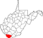
Towns CDPs Unincorporated
communitiesAlgoma | Antler | Apple Grove | Asco | Ashland | Atwell | Avondale | Beartown | Big Four | Bishop | Black Wolf | Bottom Creek | Canebrake | Capels | Caretta | Carlos | Carswell | Coalwood | Eckman | Elkhorn | English | Ennis | Erin | Faraday | Garland | Gilliam | Havaco | Hemphill | Hensley | Hull | Isaban‡ | Jacobs Fork | Jed | Jenkinjones | Johnnycake | Jolo | Krollitz | Kyle | Landgraff | Leckie | Lex | Lila | Litwar | Longpole | Maitland | McDowell | Mohawk | Mohegan | Monson | Newhall | Panther | Paynesville | Powhatan | Premier | Rift | Rockridge | Rolfe | Sandy Huff | Six | Skygusty | Squire | Superior | Switchback | Twin Branch | Union City | Upland | Vallscreek | Worth | Wyoming City | Yerba | Yukon
Footnotes ‡This populated place also has portions in an adjacent county or counties
Categories:- National Register of Historic Places in West Virginia by county
- McDowell County, West Virginia
-


Wikimedia Foundation. 2010.