- Davy, West Virginia
-
Davy, West Virginia — Town — Location of Davy, West Virginia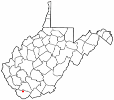
Coordinates: 37°28′47″N 81°39′0″W / 37.47972°N 81.65°WCoordinates: 37°28′47″N 81°39′0″W / 37.47972°N 81.65°W Country United States State West Virginia County McDowell Area – Total 1.3 sq mi (3.3 km2) – Land 1.3 sq mi (3.3 km2) – Water 0.0 sq mi (0.0 km2) Elevation 1,184 ft (361 m) Population (2000) – Total 373 – Density 288.8/sq mi (111.5/km2) Time zone Eastern (EST) (UTC-5) – Summer (DST) EDT (UTC-4) ZIP code 24828 Area code(s) 304 FIPS code 54-20500[1] GNIS feature ID 1538061[2] Davy is a town in McDowell County, West Virginia, USA. The population was 373 at the 2000 census. Davy was incorporated in 1948. It is a mostly residential community in a coal mining district along the main line of the Norfolk Southern Railway.
Geography
Davy is located at 37°28′47″N 81°39′0″W / 37.47972°N 81.65°W (37.479829, -81.650046)[3].
According to the United States Census Bureau, the town has a total area of 1.3 square miles (3.4 km2), all land.
Demographics
As of the census[1] of 2000, there were 373 people, 137 households, and 106 families residing in the town. The population density was 288.8 inhabitants per square mile (111.5 /km2). There were 170 housing units at an average density of 131.6 per square mile (50.8 /km2). The racial makeup of the town was 99.73% White and 0.27% Pacific Islander.
There were 137 households out of which 29.9% had children under the age of 18 living with them, 59.1% were married couples living together, 13.1% had a female householder with no husband present, and 22.6% were non-families. 21.2% of all households were made up of individuals and 10.2% had someone living alone who was 65 years of age or older. The average household size was 2.72 and the average family size was 3.13.
In the town the population was spread out with 23.9% under the age of 18, 8.8% from 18 to 24, 28.7% from 25 to 44, 26.8% from 45 to 64, and 11.8% who were 65 years of age or older. The median age was 37 years. For every 100 females there were 90.3 males. For every 100 females age 18 and over, there were 85.6 males.
The median income for a household in the town was $16,250, and the median income for a family was $23,000. Males had a median income of $15,417 versus $13,750 for females. The per capita income for the town was $8,116. About 37.3% of families and 41.8% of the population were below the poverty line, including 60.0% of those under age 18 and 15.4% of those age 65 or over.
References
- ^ a b "American FactFinder". United States Census Bureau. http://factfinder.census.gov. Retrieved 2008-01-31.
- ^ "US Board on Geographic Names". United States Geological Survey. 2007-10-25. http://geonames.usgs.gov. Retrieved 2008-01-31.
- ^ "US Gazetteer files: 2010, 2000, and 1990". United States Census Bureau. 2011-02-12. http://www.census.gov/geo/www/gazetteer/gazette.html. Retrieved 2011-04-23.
Municipalities and communities of McDowell County, West Virginia Cities 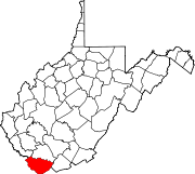
Towns CDPs Unincorporated
communitiesAlgoma | Antler | Apple Grove | Asco | Ashland | Atwell | Avondale | Beartown | Big Four | Bishop | Black Wolf | Bottom Creek | Canebrake | Capels | Caretta | Carlos | Carswell | Coalwood | Eckman | Elkhorn | English | Ennis | Erin | Faraday | Garland | Gilliam | Havaco | Hemphill | Hensley | Hull | Isaban‡ | Jacobs Fork | Jed | Jenkinjones | Johnnycake | Jolo | Krollitz | Kyle | Landgraff | Leckie | Lex | Lila | Litwar | Longpole | Maitland | McDowell | Mohawk | Mohegan | Monson | Newhall | Panther | Paynesville | Powhatan | Premier | Rift | Rockridge | Rolfe | Sandy Huff | Six | Skygusty | Squire | Superior | Switchback | Twin Branch | Union City | Upland | Vallscreek | Worth | Wyoming City | Yerba | Yukon
Footnotes ‡This populated place also has portions in an adjacent county or counties
Categories:- Populated places in McDowell County, West Virginia
- Towns in West Virginia


Wikimedia Foundation. 2010.