- Mohegan, West Virginia
-
Mohegan — Unincorporated community — Location within the state of West Virginia
 Mohegan
Coordinates: 37°27′11″N 81°37′50″W / 37.45306°N 81.63056°WCoordinates: 37°27′11″N 81°37′50″W / 37.45306°N 81.63056°W Country United States State West Virginia County McDowell Time zone Eastern (EST) (UTC-5) - Summer (DST) EDT (UTC-4) ZIP codes FIPS code GNIS feature ID Mohegan (also Monegan) is an unincorporated community on the Tug Fork River in McDowell County, West Virginia, United States. It sits at an altitude of 1,230 feet (375 m).
References
Municipalities and communities of McDowell County, West Virginia County seat: Welch Cities 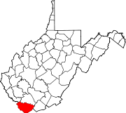
Towns CDPs Unincorporated
communitiesAlgoma | Antler | Apple Grove | Asco | Ashland | Atwell | Avondale | Beartown | Big Four | Bishop | Black Wolf | Bottom Creek | Canebrake | Capels | Caretta | Carlos | Carswell | Coalwood | Eckman | Elkhorn | English | Ennis | Erin | Faraday | Garland | Gilliam | Havaco | Hemphill | Hensley | Hull | Isaban‡ | Jacobs Fork | Jed | Jenkinjones | Johnnycake | Jolo | Krollitz | Kyle | Landgraff | Leckie | Lex | Lila | Litwar | Longpole | Maitland | McDowell | Mohawk | Mohegan | Monson | Newhall | Panther | Paynesville | Powhatan | Premier | Rift | Rockridge | Rolfe | Sandy Huff | Six | Skygusty | Squire | Superior | Switchback | Twin Branch | Union City | Upland | Vallscreek | Worth | Wyoming City | Yerba | Yukon
Footnotes ‡This populated place also has portions in an adjacent county or counties
Categories:- McDowell County, West Virginia geography stubs
- Populated places in McDowell County, West Virginia
- Unincorporated communities in West Virginia


Wikimedia Foundation. 2010.