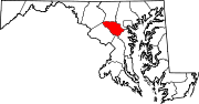
- North Laurel, Maryland
-
North Laurel, Maryland — CDP — 
Coordinates: 39°8′4″N 76°51′46″W / 39.13444°N 76.86278°WCoordinates: 39°8′4″N 76°51′46″W / 39.13444°N 76.86278°W Country United States State Maryland County Howard Area – Total 10.5 sq mi (27.2 km2) – Land 10.2 sq mi (26.4 km2) – Water 0.3 sq mi (0.8 km2) Elevation 299 ft (91 m) Population (2000) – Total 20,468 – Density 2,007.3/sq mi (775.0/km2) Time zone Eastern (EST) (UTC-5) – Summer (DST) EDT (UTC-4) FIPS code 24-56725 GNIS feature ID 1867298 North Laurel is a census-designated place (CDP) in Howard County, Maryland, United States. The population was 20,468 at the 2000 census. It is located adjacent to the city of Laurel.
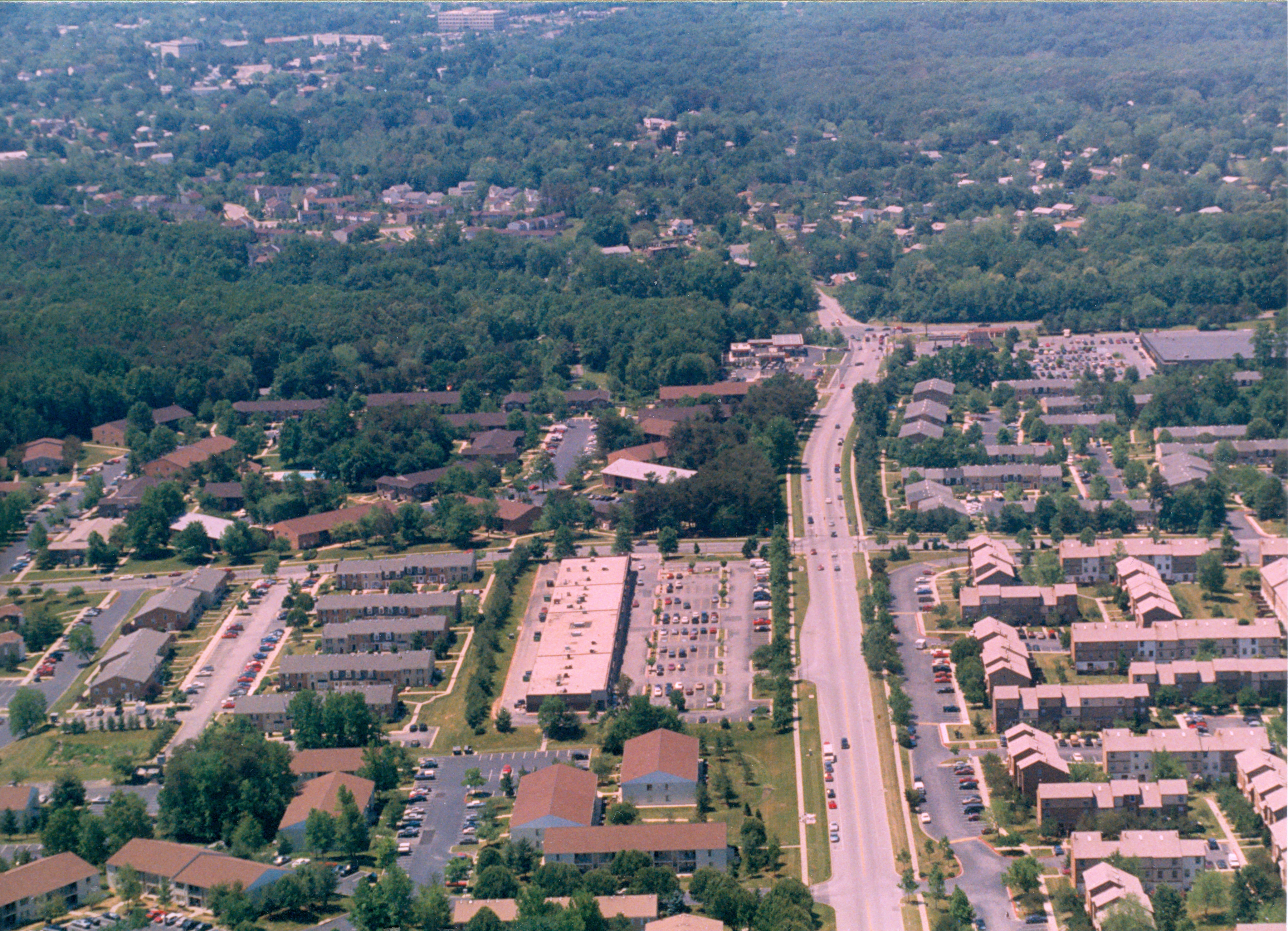
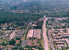 All Saint's Road and Whiskey Bottom Apartments 1998
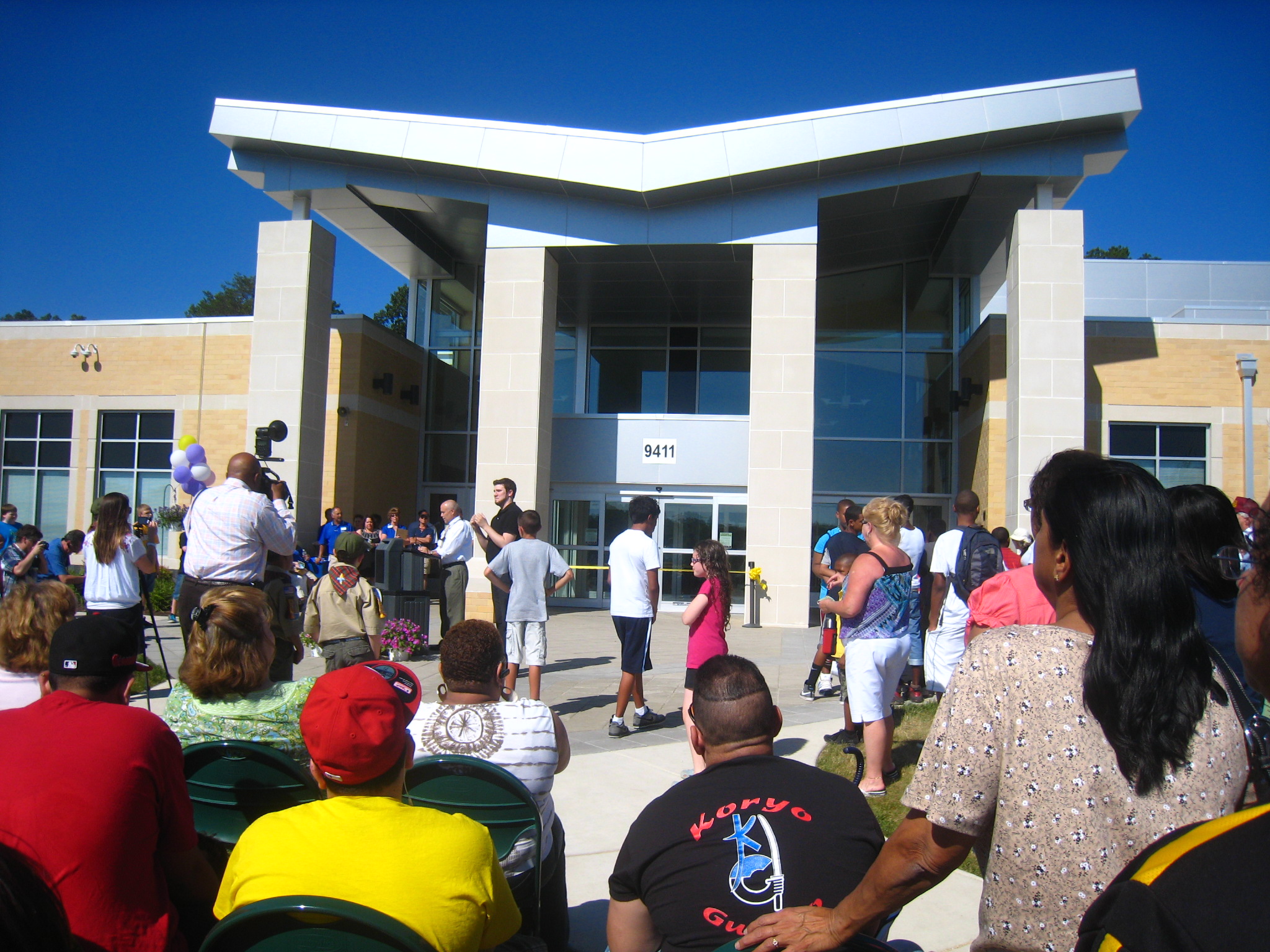
 North Laurel Community Center opening 3 June 2011
Geography
North Laurel is located at 39°8′4″N 76°51′46″W / 39.13444°N 76.86278°W (39.134343, -76.862690)[1].
According to the United States Census Bureau, the CDP has a total area of 10.5 square miles (27 km2), of which, 10.2 square miles (26 km2) of it is land and 0.3 square miles (0.78 km2) of it (3.04%) is water.
Demographics
As of the census[2] of 2000, there were 20,468 people, 7,235 households, and 5,281 families residing in the CDP. The population density was 2,007.3 people per square mile (774.8/km²). There were 7,453 housing units at an average density of 730.9/sq mi (282.1/km²). The racial makeup of the CDP was 71.42% White, 17.10% African American, 0.32% Native American, 6.97% Asian, 0.08% Pacific Islander, 1.49% from other races, and 2.62% from two or more races. Hispanic or Latino of any race were 4.00% of the population.
There were 7,235 households out of which 43.3% had children under the age of 18 living with them, 57.7% were married couples living together, 10.9% had a female householder with no husband present, and 27.0% were non-families. 19.2% of all households were made up of individuals and 2.6% had someone living alone who was 65 years of age or older. The average household size was 2.82 and the average family size was 3.27.
In the CDP the population was spread out with 29.9% under the age of 18, 7.5% from 18 to 24, 37.6% from 25 to 44, 20.3% from 45 to 64, and 4.8% who were 65 years of age or older. The median age was 33 years. For every 100 females there were 98.2 males. For every 100 females age 18 and over, there were 94.5 males.
The median income for a household in the CDP was $66,836, and the median income for a family was $75,068. Males had a median income of $48,043 versus $35,149 for females. The per capita income for the CDP was $27,991. About 2.5% of families and 3.4% of the population were below the poverty line, including 3.0% of those under age 18 and 5.2% of those age 65 or over.
References
- ^ "US Gazetteer files: 2010, 2000, and 1990". United States Census Bureau. 2011-02-12. http://www.census.gov/geo/www/gazetteer/gazette.html. Retrieved 2011-04-23.
- ^ "American FactFinder". United States Census Bureau. http://factfinder.census.gov. Retrieved 2008-01-31.
Municipalities and communities of Howard County, Maryland CDPs Columbia | Elkridge | Ellicott City | Jessup‡ | North Laurel | Savage-Guilford
Other
communitiesAnnapolis Junction | Benson | Clarksville | Cooksville | Daniels | Dayton | Dorsey | Dorsey's Search | Fulton | Glenelg | Glenwood | Guilford | Hanover | Harper's Choice | Henryton Heights | Hickory Ridge | Highland | Hopewell | Ilchester | Kings Contrivance | Linwood | Lisbon | Long Reach | Marriottsville | Oakland Mills | Owen Brown | Paternal Gift Farm | River Hill | Savage | Scaggsville | Simpsonville | Town Center, Columbia | West Friendship | Wilde Lake | Woodbine | Woodstock
Footnotes ‡This populated place also has portions in an adjacent county or counties
Categories:- Unincorporated communities in Maryland
- Populated places in Howard County, Maryland
- Census-designated places in Maryland


Wikimedia Foundation. 2010.