- National Register of Historic Places listings in Howard County, Indiana
-
 Location of Howard County in Indiana
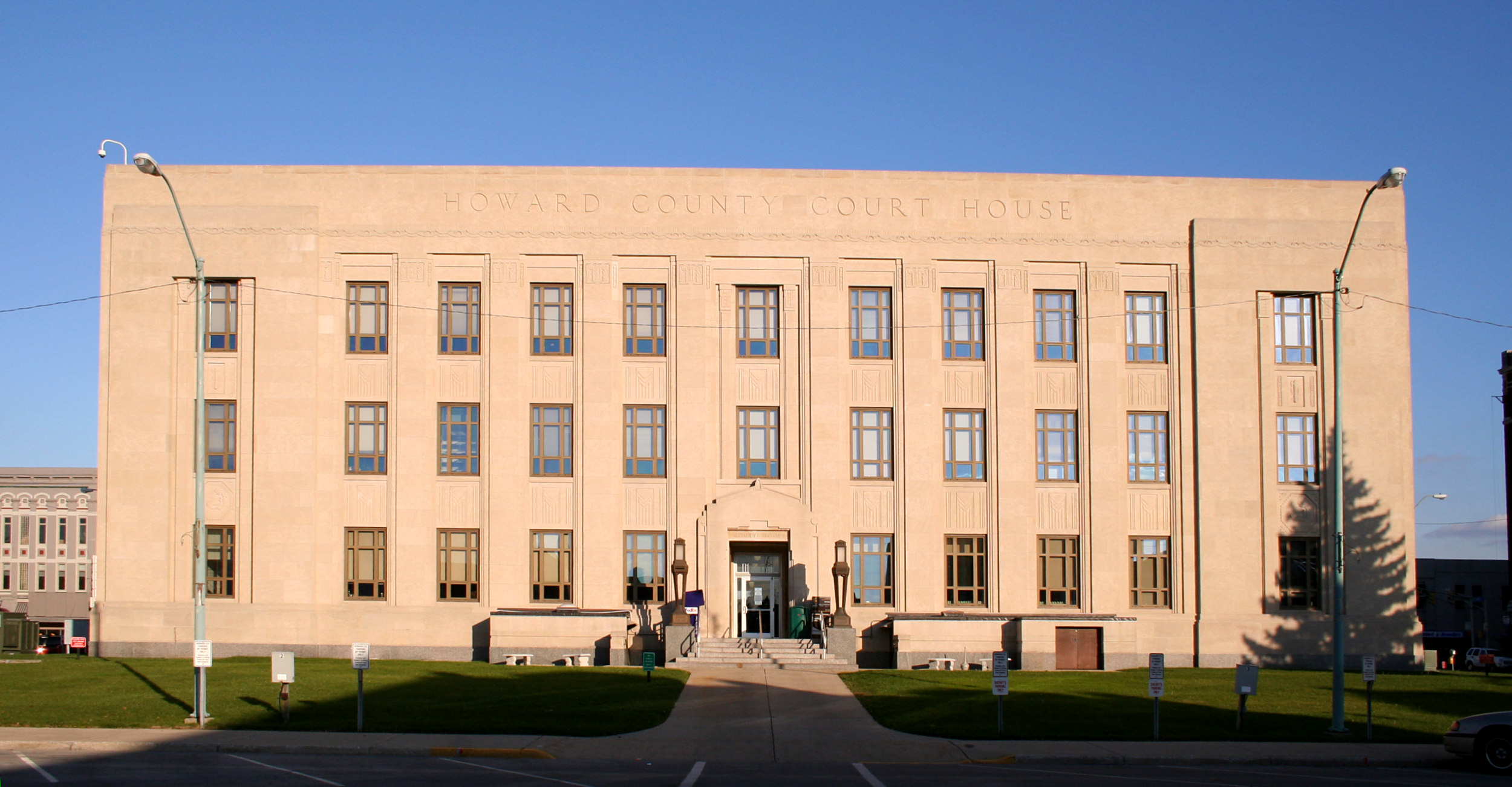
This is a list of the National Register of Historic Places listings in Howard County, Indiana.
This is intended to be a complete list of the properties and districts on the National Register of Historic Places in Howard County, Indiana, United States. Latitude and longitude coordinates are provided for many National Register properties and districts; these locations may be seen together in a Google map.[1]
There are 11 properties and districts listed on the National Register in the county.
-
- This National Park Service list is complete through NPS recent listings posted November 10, 2011.[2]
Current listings
[3] Landmark name [4] Image Date listed Location City or town Summary 1 Elwood Haynes House 
September 20, 1984 1915 S. Webster St.
40°27′47″N 86°08′13″W / 40.463056°N 86.136944°WKokomo 2 Hy-Red Gasoline Station 
September 1, 1983 203 E. Main St.
40°28′40″N 85°57′53″W / 40.477778°N 85.964722°WGreentown 3 Kokomo City Building 
June 4, 1981 221 W. Walnut St.
40°29′13″N 86°08′00″W / 40.486944°N 86.133333°WKokomo 4 Kokomo Country Club Golf Course 
September 20, 2006 1801 Country Club Dr.
40°27′43″N 86°08′36″W / 40.461944°N 86.143333°WKokomo 5 Kokomo Courthouse Square Historic District 
December 22, 2008 Bounded by Taylor St. on the north, Market St. on the east, Superior St. on the south, and Washington St. on the west
40°29′13″N 86°07′55″W / 40.486944°N 86.131833°WKokomo 6 Kokomo High School and Memorial Gymnasium 
June 17, 2005 303 E. Superior St. and 400 Apperson Way, N.
40°29′06″N 86°07′39″W / 40.485°N 86.1275°WKokomo 7 Lake Erie and Western Depot Historic District 
September 17, 2008 Generally bounded by W. Jefferson St. on the north, N. Main St. on the east, W. Jackson St. on the south, and N. Washington St. on the west
40°29′24″N 86°07′57″W / 40.49°N 86.1325°WKokomo 8 Learner Building 
September 20, 1984 107-111 E. Sycamore St.
40°29′10″N 86°07′50″W / 40.486111°N 86.130556°WKokomo 9 Old Silk Stocking Historic District 
December 22, 2008 Bounded by W. Jackson St. on the north, Washington St. on the east, Wildcat Creek on the south, and Phillips St. on the west
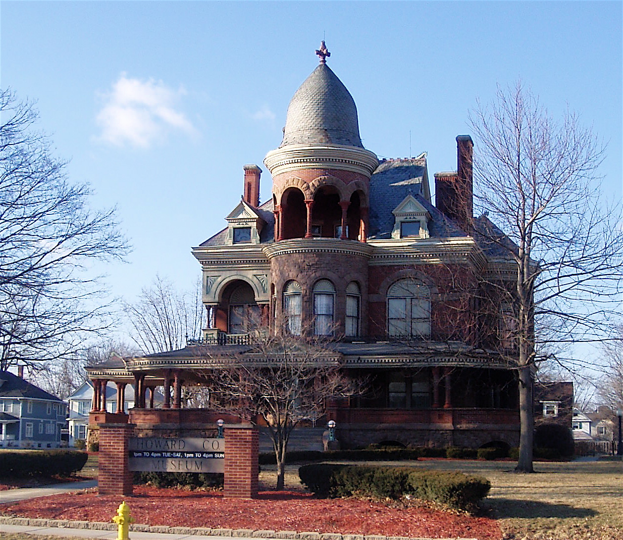
40°29′20″N 86°08′32″W / 40.488889°N 86.142222°WKokomo 10 Seiberling Mansion 
December 16, 1971 1200 W. Sycamore St.
40°29′13″N 86°08′39″W / 40.486944°N 86.144167°WKokomo 11 Henry W. Smith House 
March 9, 1979 5 miles (8 km) west of Kokomo
40°28′41″N 86°13′41″W / 40.478056°N 86.228056°WKokomo See also
- List of National Historic Landmarks in Indiana
- National Register of Historic Places listings in Indiana
References
- ^ The latitude and longitude information provided in this table was derived originally from the National Register Information System, which has been found to be fairly accurate for about 99% of listings. For about 1% of NRIS original coordinates, experience has shown that one or both coordinates are typos or otherwise extremely far off; some corrections may have been made. A more subtle problem causes many locations to be off by up to 150 yards, depending on location in the country: most NRIS coordinates were derived from tracing out latitude and longitudes off of USGS topographical quadrant maps created under North American Datum of 1927, which differs from the current, highly accurate GPS system used by Google maps. Chicago is about right, but NRIS longitudes in Washington are higher by about 4.5 seconds, and are lower by about 2.0 seconds in Maine. Latitudes differ by about 1.0 second in Florida. Some locations in this table may have been corrected to current GPS standards.
- ^ "National Register of Historic Places: Weekly List Actions". National Park Service, United States Department of the Interior. Retrieved on November 10, 2011.
- ^ Numbers represent an ordering by significant words. Various colorings, defined here, differentiate National Historic Landmark sites and National Register of Historic Places Districts from other NRHP buildings, structures, sites or objects.
- ^ "National Register Information System". National Register of Historic Places. National Park Service. . http://nrhp.focus.nps.gov/natreg/docs/All_Data.html.
U.S. National Register of Historic Places Topics Lists by states Alabama • Alaska • Arizona • Arkansas • California • Colorado • Connecticut • Delaware • Florida • Georgia • Hawaii • Idaho • Illinois • Indiana • Iowa • Kansas • Kentucky • Louisiana • Maine • Maryland • Massachusetts • Michigan • Minnesota • Mississippi • Missouri • Montana • Nebraska • Nevada • New Hampshire • New Jersey • New Mexico • New York • North Carolina • North Dakota • Ohio • Oklahoma • Oregon • Pennsylvania • Rhode Island • South Carolina • South Dakota • Tennessee • Texas • Utah • Vermont • Virginia • Washington • West Virginia • Wisconsin • WyomingLists by territories Lists by associated states Other  Category:National Register of Historic Places •
  Portal:National Register of Historic Places
Municipalities and communities of Howard County, Indiana County seat: Kokomo City 
Towns Townships Unincorporated
communitiesAlto | Cassville | Center | Darrough Chapel | Guy | Hemlock | Indian Heights | Jerome | Judson | Kappa Corner | New London | Oakford | Phlox | Plevna | Ridgeway | Shanghai | Sycamore | Vermont | West Liberty | West Middleton
Categories:- Howard County, Indiana
- National Register of Historic Places in Indiana by county
-


Wikimedia Foundation. 2010.