- Russiaville, Indiana
Infobox Settlement
official_name = Russiaville, Indiana
settlement_type =Town
nickname =
motto =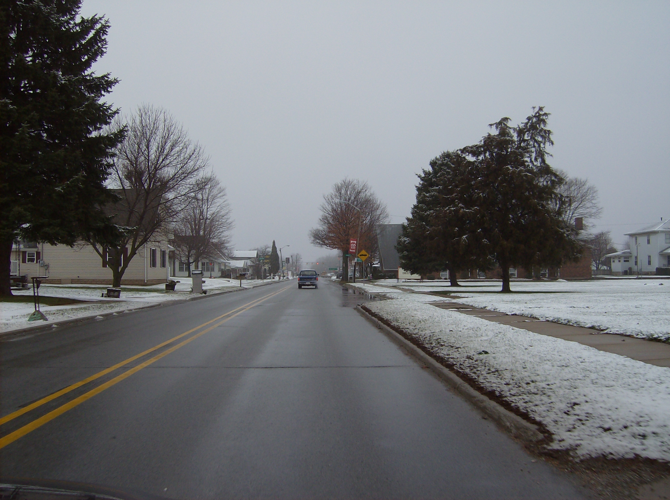
imagesize = 250px
image_caption = Along Main Street in Russiaville
image_
image_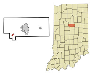
mapsize = 250px
map_caption = Location of Russiaville in the state ofIndiana
mapsize1 =
map_caption1 =subdivision_type = Country
subdivision_name =United States
subdivision_type1 = State
subdivision_name1 =Indiana
subdivision_type2 = County
subdivision_name2 = Howard
subdivision_type3 = Township
subdivision_name3 = Honey Creek
government_footnotes =
government_type =
leader_title =
leader_name =
leader_title1 =
leader_name1 =
established_title =
established_date =area_footnotes =
unit_pref = Imperial
area_magnitude =
area_total_km2 = 2.1
area_land_km2 = 2.1
area_water_km2 = 0.0
area_total_sq_mi = 0.8
area_land_sq_mi = 0.8
area_water_sq_mi = 0.0population_as_of = 2006
population_footnotes =
population_total = 1169
population_density_km2 = 525.6
population_density_sq_mi = 1361.4timezone = Eastern (EST)
utc_offset = -5
timezone_DST = EDT
utc_offset_DST = -4
elevation_footnotes =
elevation_m = 257
elevation_ft = 843
latd = 40 |latm = 25 |lats = 8 |latNS = N
longd = 86 |longm = 16 |longs = 19 |longEW = Wpostal_code_type =
ZIP code
postal_code = 46979
area_code = 765
blank_name = FIPS code
blank_info = 18-66546GR|2
blank1_name = GNIS feature ID
blank1_info = 0442420GR|3
website =
footnotes =Russiaville is a town in Honey Creek Township, Howard County,
Indiana ,United States , ZIP code 46979, telephone exchange (765) 883-xxxx. The population was 1,169 at the 2006 census. It is part of theKokomo, Indiana Metropolitan Statistical Area The town was named for a native American, Richardville, as indeed was the entire county as it was originally conceived in the years before the
American Civil War . The French pronunciation of "Ri-shar-ville" led through corruption to the current spelling, maintaining the approximate pronunciation "Roo-sha-ville" throughout its history. Seeming connection through spelling to Russia led to the naming of the town high school mascot "Cossacks" until county consolidation changed Russiaville High School to Western High School in 1949. Some theorize an alternate history, that during theCold War , residents consciously changed the pronunciation of Russiaville's name in order to disassociate their town fromRussia , the leading state of theSoviet Union . A map from the 1840s-1850s hanging in the Quaker Collection ofEarlham College inRichmond, Indiana , clearly shows a county named Richardville including the current town of Russiaville with the older spelling. Oral history has suggested "Rouchardville" as the earlier spelling, but Richardville is correct.Russiaville became a
Quaker settlement in the years before the Civil War, and a stop on theUnderground Railroad could be found in nearby New London, then the location of the Friends Meeting serving the entire area. There is a legend that the stop included a tunnel under the town from a house to a cave in the hollow of Honey Creek very near the location of the Friends Meetinghouse.Almost all of the town was destroyed on
April 11 ,1965 , by an F4 tornado that was part of the Palm Sunday Tornado Outbreak.Geography
Russiaville is located at coor dms|40|25|8|N|86|16|19|W|city (40.418852, -86.272010)GR|1.
According to the
United States Census Bureau , the town has a total area of 0.8square mile s (2.1km² ), all of it land.Demographics
As of the
census GR|2 of 2000, there were 1,092 people, 425 households, and 317 families residing in the town. Thepopulation density was 1,361.4 people per square mile (527.0/km²). There were 446 housing units at an average density of 556.0/sq mi (215.3/km²). The racial makeup of the town was 99.08% White, 0.09% Native American, 0.18% Asian, 0.27% from other races, and 0.37% from two or more races. Hispanic or Latino of any race were 1.28% of the population.There were 425 households out of which 39.8% had children under the age of 18 living with them, 60.0% were married couples living together, 11.5% had a female householder with no husband present, and 25.2% were non-families. 24.0% of all households were made up of individuals and 12.2% had someone living alone who was 65 years of age or older. The average household size was 2.57 and the average family size was 3.04.
In the town the population was spread out with 29.3% under the age of 18, 8.1% from 18 to 24, 31.6% from 25 to 44, 19.0% from 45 to 64, and 12.1% who were 65 years of age or older. The median age was 34 years. For every 100 females there were 92.9 males. For every 100 females age 18 and over, there were 91.6 males.
The median income for a household in the town was $40,875, and the median income for a family was $46,094. Males had a median income of $38,833 versus $25,875 for females. The
per capita income for the town was $20,804. About 4.4% of families and 5.7% of the population were below thepoverty line , including 7.6% of those under age 18 and 4.4% of those age 65 or over.Highway
* (East)
Education
School Districts
*
Western School Corporation [http://www.western.k12.in.us] (K-12)Western High School competes in theMid-Indiana Conference (MIC) for athletics.Local Churches
*First Baptist Church
*Honeycreek Missionary Baptist Church
*Lynn Friends Church
*Main Street Christian Church
*New London Friends Church
*Russiaville Friends Church
*Russiaville United Methodist ChurchBusiness
Some local businesses in Russiaville are Martin Bros, NAPA Auto Parts, Waddels IGA, The Rose Garden flower shop, Subway, Pizza King, a doctor's office, Stout and Sons Funeral Service and Furniture Store, a Phillip's 66, a Petro Plus, and an ice cream parlor.
Local Media
Newspapers
*"Western Union", Western High School Student NewspaperFestivals
* Western Days: First week of June
* [http://kohkohmah.com/index.html Koh-Koh-Mah & Foster Living History Encampment] , mid-SeptemberMovies Filmed in Russiaville
*"
The Ryan White Story " (1988), starringJudith Light andLukas Haas References
External links
* [http://www.western.k12.in.us Western School Corporation]
* [http://www.howard-county.net Howard County Community Net]
Wikimedia Foundation. 2010.