- Norrisville, Maryland
-
Coordinates: 39°42′17″N 76°32′05″W / 39.70472°N 76.53472°W Norrisville is an unincorporated community in Harford County, Maryland, just south of the Pennsylvania state line in the extreme northwest section of the county. It is primarily a farming community full of rolling hills and small valleys, and is part of the Deer Creek watershed. The area is served by two state roads, Maryland routes 23 and 136. A demographic profile estimates that the Norrisville area had a population of 2,931 as of 2000. It lies at an elevation of 741 feet (226 m). Norrisville is part of the White Hall zip code 21161, whose post office is located just over the Baltimore County line.
References
Municipalities and communities of Harford County, Maryland Cities 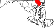
Town CDPs Aberdeen Proving Ground | Bel Air North | Bel Air South | Edgewood | Fallston | Jarrettsville | Joppatowne | Perryman | Pleasant Hills | Riverside
Other
communitiesAbingdon | Benson | Berkley | Cardiff | Castleton | Churchville | Clayton | Creswell | Darlington | Dublin | Emmorton | Fairview | Forest Hill | Glenwood | Joppatowne | Hopewell Village | Joppa | Kalmia | Norrisville | Pylesville | Street | Taylor | Whiteford
Categories:- Unincorporated communities in Maryland
- Populated places in Harford County, Maryland
- Maryland geography stubs

Wikimedia Foundation. 2010.