- Fallston, Maryland
Infobox Settlement
official_name = Fallston, Maryland
settlement_type = CDP
nickname =
motto =
imagesize =
image_caption =
image_
imagesize =
image_caption =
image_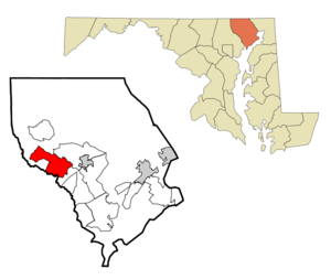
mapsize = 250x200px
map_caption = Location of Fallston, Maryland
mapsize1 =
map_caption1 =subdivision_type = Country
subdivision_name =United States
subdivision_type1 = State
subdivision_name1 =Maryland
subdivision_type2 = County
subdivision_name2 = Harford
government_footnotes =
government_type =
leader_title =
leader_name =
leader_title1 =
leader_name1 =
established_title =
established_date =unit_pref = Imperial
area_footnotes =area_magnitude =
area_total_km2 = 36.3
area_land_km2 = 36.3
area_water_km2 = 0.0
area_total_sq_mi = 14.0
area_land_sq_mi = 14.0
area_water_sq_mi = 0.0population_as_of = 2000
population_footnotes =
population_total = 8427
population_density_km2 = 232.0
population_density_sq_mi = 600.9timezone = Eastern (EST)
utc_offset = -5
timezone_DST = EDT
utc_offset_DST = -4
elevation_footnotes =
elevation_m = 142
elevation_ft = 466
latd = 39 |latm = 31 |lats = 55 |latNS = N
longd = 76 |longm = 26 |longs = 17 |longEW = Wpostal_code_type =
ZIP code
postal_code = 21047
area_code = 410
blank_name = FIPS code
blank_info = 24-27700
blank1_name = GNIS feature ID
blank1_info = 0584343
website =
footnotes =Fallston is a
census-designated place (CDP) in Harford County,Maryland ,United States . The population was 8,427 at the 2000 census.Geography
Fallston is located at coor dms|39|31|55|N|76|26|17|W|city (39.532006, -76.438021)GR|1.
According to the
United States Census Bureau , the CDP has a total area of 14.0square mile s (36.3km² ), all of it land.Demographics
As of the
census GR|2 of 2000, there were 8,427 people, 2,875 households, and 2,550 families residing in the CDP. Thepopulation density was 600.9 people per square mile (232.1/km²). There were 2,906 housing units at an average density of 207.2/sq mi (80.0/km²). The racial makeup of the CDP was 97.33% White, 0.76% African American, 0.12% Native American, 1.10% Asian, 0.09% from other races, and 0.59% from two or more races. Hispanic or Latino of any race were 0.88% of the population.There were 2,875 households out of which 37.3% had children under the age of 18 living with them, 81.5% were married couples living together, 5.3% had a female householder with no husband present, and 11.3% were non-families. 9.6% of all households were made up of individuals and 3.5% had someone living alone who was 65 years of age or older. The average household size was 2.93 and the average family size was 3.13.
In the CDP the population was spread out with 25.8% under the age of 18, 5.5% from 18 to 24, 23.0% from 25 to 44, 34.8% from 45 to 64, and 10.9% who were 65 years of age or older. The median age was 43 years. For every 100 females there were 98.6 males. For every 100 females age 18 and over, there were 95.2 males.
The median income for a household in the CDP was $84,296, and the median income for a family was $87,686. Males had a median income of $62,112 versus $37,500 for females. The
per capita income for the CDP was $31,093. About 2.2% of families and 2.3% of the population were below thepoverty line , including 3.4% of those under age 18 and 2.4% of those age 65 or over.Business
Fallston mostly consists of farms or residential housing. There is, though a strip of Belair Road (Rt 1) running through the south-east side of the town (technically outside of Fallston proper, in an area once known as 'Benson'). This part of Fallston is packed with much business. As of early 2007, plans for a construction of a Walmart Super Store and other businesses were planned. It was not until mid 2007 that this massive project was undertaken and given a name, 'Fallston Commons'. It covers a mass of over 800 square acres. The construction will be a boulevard, consisting of two parallel roads running side-by-side. Approximately 300 senior citizen town homes will be build in addition to an assisted living retirement home. Besides the Walmart Super Store, a Starbucks, and a Wendy's will be built in addition to numerous other businesses. Walmart is funding the massive project and will turn part of Belair Road into a six-lane highway and will add four new intersections and stop lights to assist in managing the traffic. The end date for the project is estimated to be at late 2008 to early 2009.
Notable Attractions
The center of the community is generally considered to be
Fallston High School or theParks and Recreational fields.The presitigous
Ladew Topiary Gardens as well as the historic villageJerusalem Mill , the Jericho Road Covered Bridge and theGunpowder Falls State Park are located nearby.Notable Residents
*Jim Hunter, Orioles broadcaster.
*Scott Garceau , Sports broadcaster.
*Fred Manfra , Orioles broadcaster.
*Melvin Mora , Professional Baseball Player, currently with the Baltimore Orioles.
*Steve Rouse , Radio and Television Personality
*Bill Ripken , former Orioles player
*Mickey Cucchiella , Comedian and Radio PersonalityReferences
External links
Wikimedia Foundation. 2010.