- National Register of Historic Places listings in Harlan County, Kentucky
-
 Location of Harlan County in Kentucky
This is a list of the National Register of Historic Places listings in Harlan County, Kentucky.
It is intended to be a complete list of the properties on the National Register of Historic Places in Harlan County, Kentucky, United States. The locations of National Register properties for which the latitude and longitude coordinates are included below, may be seen in a Google map.[1]
There are 5 properties listed on the National Register in the county.
-
- This National Park Service list is complete through NPS recent listings posted November 10, 2011.[2]
Current listings
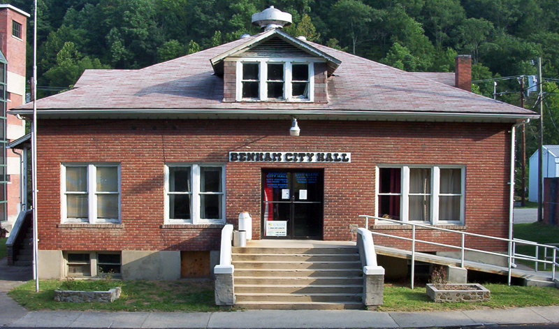
[3] Landmark name Image Date listed Location City or town Summary 1 Benham Historic District 
July 21, 1983 KY 160, Central Ave., and McKnight and Cypress Sts.
36°57′48″N 82°57′02″W / 36.963333°N 82.950556°WBenham 2 Cumberland Central Business District March 14, 1996 Roughly bounded by Freeman St., Huff Dr., the Poor Fork of the Cumberland River, Cumberland Ave. and W. Main St.
36°58′31″N 82°59′27″W / 36.975278°N 82.990833°WCumberland 3 Harlan Commercial District March 20, 1986 Roughly bounded by Mound, Second, Clover, and Main Sts.
36°50′49″N 83°19′20″W / 36.846944°N 83.322222°WHarlan 4 Lynch Historic District September 15, 2003 Roughly bounded by city limits, L&N railroad bed, Big Looney Creek, and 2nd, Mountain, Highland Terrace, Liberty, and Church Sts.
36°57′52″N 82°55′04″W / 36.964444°N 82.917778°WLynch 5 Pine Mountain Settlement School 
September 6, 1978 East of Bledsoe on KY 510
36°56′55″N 83°10′59″W / 36.948611°N 83.183056°WBledsoe See also
- List of National Historic Landmarks in Kentucky
- National Register of Historic Places listings in Kentucky
References
- ^ The latitude and longitude information provided in this table was derived originally from the National Register Information System, which has been found to be fairly accurate for about 99% of listings. For about 1% of NRIS original coordinates, experience has shown that one or both coordinates are typos or otherwise extremely far off; some corrections may have been made. A more subtle problem causes many locations to be off by up to 150 yards, depending on location in the country: most NRIS coordinates were derived from tracing out latitude and longitudes off of USGS topographical quadrant maps created under the North American Datum of 1927, which differs from the current, highly accurate WGS84 GPS system used by Google maps. Chicago is about right, but NRIS longitudes in Washington are higher by about 4.5 seconds, and are lower by about 2.0 seconds in Maine. Latitudes differ by about 1.0 second in Florida. Some locations in this table may have been corrected to current GPS standards.
- ^ "National Register of Historic Places: Weekly List Actions". National Park Service, United States Department of the Interior. Retrieved on November 10, 2011.
- ^ Numbers represent an ordering by significant words. Various colorings, defined here, differentiate National Historic Landmark sites and National Register of Historic Places Districts from other NRHP buildings, structures, sites or objects.
U.S. National Register of Historic Places Topics Lists by states Alabama • Alaska • Arizona • Arkansas • California • Colorado • Connecticut • Delaware • Florida • Georgia • Hawaii • Idaho • Illinois • Indiana • Iowa • Kansas • Kentucky • Louisiana • Maine • Maryland • Massachusetts • Michigan • Minnesota • Mississippi • Missouri • Montana • Nebraska • Nevada • New Hampshire • New Jersey • New Mexico • New York • North Carolina • North Dakota • Ohio • Oklahoma • Oregon • Pennsylvania • Rhode Island • South Carolina • South Dakota • Tennessee • Texas • Utah • Vermont • Virginia • Washington • West Virginia • Wisconsin • WyomingLists by territories Lists by associated states Other Municipalities and communities of Harlan County, Kentucky Cities Benham | Cumberland | Evarts | Harlan | Loyall | Lynch | Wallins Creek

CDP Unincorporated
communitiesAlva | Cranks | Dayhoit | Highsplint | Pathfork
Categories:- National Register of Historic Places in Kentucky by county
- Harlan County, Kentucky
-


Wikimedia Foundation. 2010.