- Dayhoit, Kentucky
-
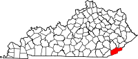
Dayhoit, Kentucky — Unincorporated community — Coordinates: 36°50′23″N 83°22′37″W / 36.83972°N 83.37694°WCoordinates: 36°50′23″N 83°22′37″W / 36.83972°N 83.37694°W Country United States State Kentucky County Harlan Population (2000) – Total 458 Time zone Eastern (EST) (UTC-5) – Summer (DST) EDT (UTC-4) ZIP code 40824 Dayhoit is an unincorporated community in Harlan County, Kentucky, United States. Although it is unincorporated, it has a post office, with the ZIP code of 40824.[1] The population of the ZCTA for 40824 was 458 at the 2000 census.[2]
References
- ^ Zip Code Lookup
- ^ "American FactFinder". United States Census Bureau. http://factfinder.census.gov. Retrieved 2008-01-31.
Municipalities and communities of Harlan County, Kentucky Cities Benham | Cumberland | Evarts | Harlan | Loyall | Lynch | Wallins Creek
CDP Unincorporated
communitiesAlva | Cranks | Dayhoit | Highsplint | Pathfork
Categories:- Populated places in Harlan County, Kentucky
- Unincorporated communities in Kentucky
- Kentucky geography stubs

Wikimedia Foundation. 2010.