- Benham, Kentucky
Infobox Settlement
official_name = Benham, Kentucky
other_name =
native_name =
nickname = The Little Town That International Harvester, Coal Miners, and Their Families Built
settlement_type =City
motto =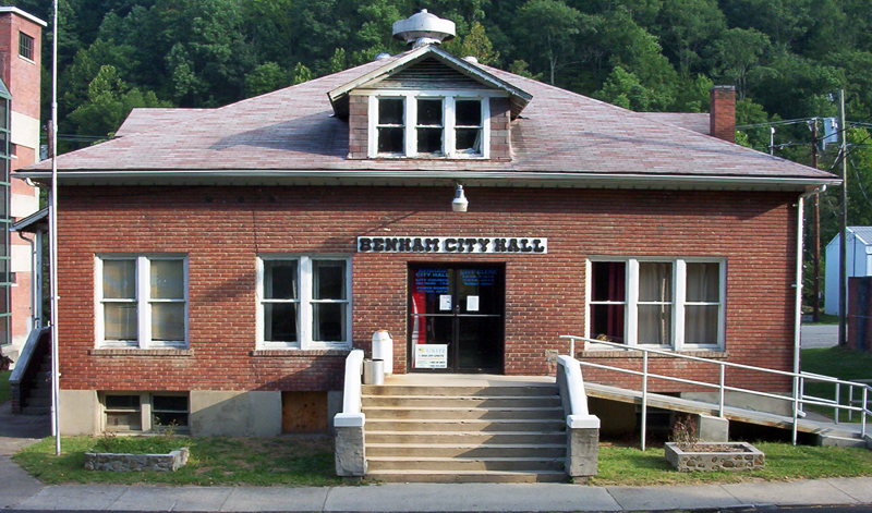
imagesize =
image_caption = Benham City Hall
flag_size =
image_
seal_size =
image_shield =
shield_size =
image_blank_emblem =
blank_emblem_type =
blank_emblem_size =
mapsize = 250px
map_caption = Location of Benham within Kentucky
mapsize1 =
map_caption1 =
image_dot_
dot_mapsize =
dot_map_caption =
dot_x =
dot_y =
pushpin_
pushpin_label_position =
pushpin_map_caption =
pushpin_mapsize =
subdivision_type = Country
subdivision_name =United States
subdivision_type1 = State
subdivision_name1 =Kentucky
subdivision_type2 = County
subdivision_name2 = Harlan
government_footnotes =
government_type =
leader_title =
leader_name =
leader_title1 =
leader_name1 =
leader_title2 =
leader_name2 =
leader_title3 =
leader_name3 =
leader_title4 =
leader_name4 =
established_title =
established_date =
established_title2 =
established_date2 =
established_title3 =
established_date3 =
area_magnitude =
unit_pref = Imperial
area_footnotes =
area_total_km2 = 1.0
area_land_km2 = 1.0
area_water_km2 = 0.0
area_total_sq_mi = 0.4
area_land_sq_mi = 0.4
area_water_sq_mi = 0.0
area_water_percent =
area_urban_km2 =
area_urban_sq_mi =
area_metro_km2 =
area_metro_sq_mi =
area_blank1_title =
area_blank1_km2 =
area_blank1_sq_mi =
population_as_of = 2000
population_footnotes =
population_note =
population_total = 599
population_density_km2 = 593.0
population_density_sq_mi = 1,519.2
population_metro =
population_density_metro_km2 =
population_density_metro_sq_mi =
population_urban =
population_density_urban_km2 =
population_density_urban_sq_mi =
population_blank1_title =
population_blank1 =
population_density_blank1_km2 =
population_density_blank1_sq_mi =
timezone = EST
utc_offset = -5
timezone_DST = EDT
utc_offset_DST = -4
latd = 36 |latm = 57 |lats = 53 |latNS = N
longd = 82 |longm = 57 |longs = 13 |longEW = W
elevation_footnotes =
elevation_m = 485
elevation_ft = 1591
postal_code_type =ZIP code
postal_code = 40807
area_code = 606
blank_name = FIPS code
blank_info = 21-05662
blank1_name = GNIS feature ID
blank1_info = 0486849
website =
footnotes =Benham is a city in Harlan County,
Kentucky ,United States . The population was 599 at the 2000 census and estimated at 538 in 2007.Geography
Benham is located at coor dms|36|57|53|N|82|57|15|W|city (36.964832, -82.954035)GR|1.
According to the
United States Census Bureau , the city has a total area of 0.4square mile s (1.0km² ), all of it land.Demographics
As of the
census GR|2 of 2000, there were 599 people, 248 households, and 181 families residing in the city. Thepopulation density was 1,519.2 people per square mile (593.0/km²). There were 288 housing units at an average density of 730.4/sq mi (285.1/km²). The racial makeup of the city was 88.81% White, 9.85% African American, 0.33% Native American, 0.17% Asian, 0.33% from other races, and 0.50% from two or more races. Hispanic or Latino of any race were 0.50% of the population.There were 248 households out of which 31.0% had children under the age of 18 living with them, 59.3% were married couples living together, 9.7% had a female householder with no husband present, and 27.0% were non-families. 26.6% of all households were made up of individuals and 19.4% had someone living alone who was 65 years of age or older. The average household size was 2.42 and the average family size was 2.88.
The age distribution was 22.9% under the age of 18, 4.5% from 18 to 24, 24.9% from 25 to 44, 28.2% from 45 to 64, and 19.5% who were 65 years of age or older. The median age was 44 years. For every 100 females there were 93.9 males. For every 100 females age 18 and over, there were 83.3 males.
The median income for a household in the city was $25,250, and the median income for a family was $33,333. Males had a median income of $35,000 versus $24,844 for females. The
per capita income for the city was $16,174. About 18.1% of families and 20.2% of the population were below thepoverty line , including 26.8% of those under age 18 and 18.7% of those age 65 or over.Gallery
References
External links
Wikimedia Foundation. 2010.