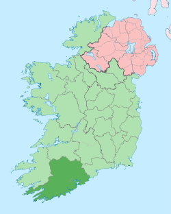
- County Cork
-
"Cork County" redirects here. For the UK Parliament constituency, see Cork County (UK Parliament constituency).For the vehicle company otherwise known as Saleen, see Saleen, Incorporated.
County Cork
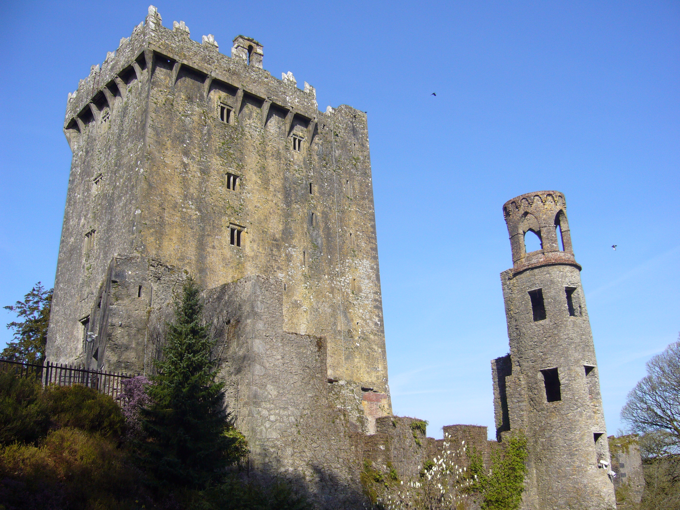
Contae ChorcaíBlarney Castle
Country Ireland Province Munster Dáil Éireann Cork East
Cork North Central
Cork North West
Cork South Central
Cork South WestEU Parliament South County seat Cork Government - Type County Council, City Council Area - Total 7,499 km2 (2,895.4 sq mi) Area rank 1st Population (2011) 518,128
(399,216 excl. Cork City)- Rank 3rd Code C Website corkcoco.ie County Cork (Irish: Contae Chorcaí) is a county in Ireland. It is located in the South-West Region and is also part of the province of Munster. It is named after the city of Cork (Irish: Corcaigh). Cork County Council is the local authority for the county. Cork is Ireland's largest county by area and third-largest by population, with 518,218 inhabitants in 2011.
Contents
Local government and political subdivisions
County Cork is located in the province of Munster. It borders four other counties: Kerry to the west, Limerick to the north, Tipperary to the north-east and Waterford to the east. The county, excluding Cork city, is administered by Cork County Council. Cork city, which does not form part of the county under Irish local government law, is administered separately by Cork City Council. Both city and county are part of the South-West Region. For purposes other than local government, such as the formation of sporting teams, County Cork is often taken to include both city and county. The population of Cork city stood at 119,418 in 2011, and that of the remainder of the county at 361,877.
The remit of Cork County Council includes some suburbs of the city not within the remit of Cork City Council. Both local authorities are responsible for certain local services such as sanitation, planning and development, libraries, the collection of motor taxation, local roads and social housing. The county is part of the South constituency for the purposes of European elections. For elections to Dáil Éireann, the county is divided into five constituencies - Cork East, Cork North Central, Cork North West, Cork South Central and Cork South West. Together they return 19 deputies (TDs) to the Dáil.
For standardized European statistical purposes, both Cork County Council and Cork City Council rank equally as first level local administrative units of the NUTS 3 South-West Region. There are 34 such LAU 1 entities in the Republic of Ireland.
Geography and political subdivisions
The county borders counties Kerry to the west, Limerick to the north, South Tipperary to the north-east and Waterford to the east.
Mountains and upland habitats
The county's main mountain ranges include: the Slieve Miskish and Caha Mountains on the Beara Peninsula, the Ballyhoura Mountains on the border with Limerick and the Shehy Mountains which contain Knockboy (706 m) the highest point in Cork. The Shehy Mountains are on the border with Kerry and may be accessed from the area known as Priests Leap, near the village of Coomhola. The Galtee Mountains are located across parts of Tipperary, Limerick and Cork and are Ireland's highest inland mountain range. The upland areas of the Ballyhoura, Boggeragh, Derrynasaggart and the Mullaghareirk Mountain ranges add to the range of habitats found in the county. Important habitats in the uplands include blanket bog, heath, glacial lakes and upland grasslands. Cork has the 13th highest county peak in Ireland.
Rivers and Lakes
The three great rivers the Bandon, the Lee and the Blackwater and their valleys dominate central Cork. Habitats of the valleys and floodplains include woodlands, marshes, fens and species-rich limestone grasslands. The river Bandon flows through many towns including Dunmanway in the west to the town of Bandon before draining into Kinsale Harbour on Ireland's south coast. Cork has two well-known sea loughs, Lough Hyne and Lough Mahon, and also contains many small lakes. An area has formed where the River Lee breaks into a network of channels weaving through a series of wooded islands. There are 85 hectares of swamp around Cork's wooded area. The Environmental Protection Agency (EPA) carried out a survey of surface waters in County Cork between 1995 and 1997 which identified 125 rivers and 32 lakes covered by the regulations.
Coastline
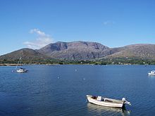
See also: List of islands of IrelandCork has a mountainous and flat landscape with many beaches and sea cliffs along its coast. The southwest of Ireland is known for its peninsulas and some in Cork include the Beara Peninsula, Sheep's Head, Mizen Head and Brow Head. Brow head is the most southerly point of mainland Ireland. There are many islands off the coast of the county in particular off West Cork. Carbery's Hundred Isles is a term used to describe the islands around Long Island Bay and Roaringwater Bay. Fastnet Rock lies in the Atlantic Ocean 11.3 km south of mainland Ireland making it the most southerly point of Ireland. Many notable islands lie off Cork including Bere Island, Great Island, Sherkin Island and Cape Clear. Cork has 1,094 km of coastline, the second longest coastline of any county after Mayo which has 1,168 km.
Land and Forestry
Like many parts of Munster, Cork has rich fertile agricultural land and many bog and peatlands. Cork consists of approximately 74,000 hectares of peatlands which amounts to 9.8% of the county's total land area. And the county contains approximately 79,188 hectares (195,677 acres) of forest and woodland area or 10.5% of Corks land area which is decently higher than the national average of 9%.
Wildlife
The Hooded Crow, corvus cornix is a common bird, particularly in areas nearer the coast. Due to this bird's ability to (rarely) prey upon small lambs, the gun clubs of Cork County have killed a large number of these birds in modern times.[1]
A collection of the marine algae is housed in the Herbarium of the botany department of the University College Cork.[2]
Parts of the South West coastline are a hotspots for sightings of rare birds, with Cape Clear being a prime location for bird watching. The island is also home to one of only a few Gannet colonies around Ireland and the UK.
A major attraction to the coastline of Cork is whale watching, with sightings of fin whales, basking sharks, pilot whales, minke whales, and other species being frequent.
History
Main article: History of CorkThe county is colloquially referred to as "The Rebel County". This name has 15th Century origins, however from the 20th century the name has been more commonly attributed to the prominent role Cork played in the Irish War of Independence (1919–1921) when it was the scene of considerable fighting; in addition, it was an anti-treaty stronghold during the Irish Civil War (1922–23). Much of what is now county Cork was once part of the Kingdom of Deas Mumhan (South Munster), anglicised as "Desmond", ruled by the MacCarthy Mór dynasty. After the Norman Invasion in the 12th century, the McCarthy clan were pushed westward into what is now West Cork and County Kerry. Dunlough Castle, standing just north of Mizen Head, is one of the oldest castles in Ireland (A.D. 1207). The north and east of Cork were taken by the Hiberno-Norman FitzGerald dynasty, who became the Earls of Desmond. Cork City was given an English Royal Charter in 1318 and for many centuries was an outpost for Old English culture. The Fitzgerald Desmond dynasty was destroyed in the Desmond Rebellions of 1569–1573 and 1579–83. Much of county Cork was devastated in the fighting, particularly in the Second Desmond Rebellion. In the aftermath, much of Cork was colonised by English settlers in the Plantation of Munster.
In 1491 Cork played a part in the English Wars of the Roses when Perkin Warbeck a pretender to the English throne, landed in the city and tried to recruit support for a plot to overthrow Henry VII of England. The mayor of Cork and several important citizens went with Warbeck to England but when the rebellion collapsed they were all captured and executed. Cork's nickname of the 'rebel city' originates in these events.
Historical populations Year Pop. ±% 1653 54,250 — 1659 63,031 +16.2% 1821 730,444 +1058.9% 1831 810,732 +11.0% 1841 854,118 +5.4% 1851 649,308 −24.0% 1861 544,818 −16.1% 1871 517,076 −5.1% 1881 495,607 −4.2% 1891 438,432 −11.5% 1901 404,611 −7.7% 1911 392,104 −3.1% 1926 365,747 −6.7% 1936 355,957 −2.7% 1946 343,668 −3.5% 1951 341,284 −0.7% 1956 336,663 −1.4% 1961 330,443 −1.8% 1966 339,703 +2.8% 1971 352,883 +3.9% 1979 396,118 +12.3% 1981 402,465 +1.6% 1986 412,735 +2.6% 1991 410,369 −0.6% 1996 420,510 +2.5% 2002 447,829 +6.5% 2006 481,295 +7.5% 2011 518,218 +7.7% [3] In 1601 the decisive Battle of Kinsale took place in County Cork, which was to lead to English domination of Ireland for centuries. Kinsale had been the scene of a landing of Spanish troops to help Irish rebels in the Nine Years War (1594–1603). When this force was defeated, the rebel hopes for victory in the war were all but ended. County Cork was officially created by a division of the older County Desmond in 1606.
In the 19th century, Cork was a centre for the Fenians and for the constitutional nationalism of the Irish Parliamentary Party, from 1910 that of the All-for-Ireland Party. The county was a hotbed of guerrilla activity during the Irish War of Independence (1919–1921). Three Cork Brigades of the Irish Republican Army operated in the county and another in the city. Prominent actions included the Kilmichael Ambush in November 1920 and the Crossbarry Ambush in March 1921. The activity of IRA flying columns, such as the one under Tom Barry in west Cork, was popularised in the Ken Loach film The Wind That Shakes The Barley. On December 11, 1920 Cork City centre was gutted by fires started by the Black and Tans in reprisal for IRA attacks. Over 300 buildings were destroyed, many other towns and villages around the county suffered a similar fate including Fermoy.[4]
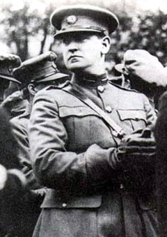
During the Irish Civil War (1922–23), most of the IRA units in Cork sided against the Anglo-Irish Treaty. From July to August 1922 they held the city and county as part of the so called Munster Republic. However, Cork was taken by troops of the Irish Free State in August 1922 in the Irish Free State offensive, that included both overland and seaborne attacks. For the remainder of the war, the county saw sporadic guerrilla fighting until the Anti-Treaty side called a ceasefire and dumped their arms in May 1923. Michael Collins, a key figure in the War of Independence, was born near Clonakilty and assassinated during the civil war in Béal na Bláth, both in West Cork.
Irish language
County Cork has two Gaeltacht areas where the Irish language is the primary medium of everyday speech. These are Múscraí (Muskerry) in the north of the county, especially the villages of Cúil Aodha (Coolea) and Béal Átha an Ghaorthaidh (Ballingeary), and Oileán Chléire (Cape Clear Island), an island in the west. Ballingeary is an important centre for Irish-language tuition, with an active summer school, Coláiste na Mumhan, or the College of Munster.
Anthem
The song "The banks of my own lovely Lee" is the song traditionally associated with the county. It is often heard at GAA fixtures involving the county, as well as at soccer matches.[5]
Media
There are several media publications printed and distributed in County Cork. These include publications from Thomas Crosbie Holdings, most notably the Irish Examiner (formerly the Cork Examiner) and its sister publication, the Evening Echo. Local and regional newspapers include the The Cork News,[6] Carrigdhoun, the Cork Independent, The Corkman, the Mallow Star, the Douglas Post, the East Cork Journal and the Southern Star.
Radio stations available in the county include: Cork's 96FM and dual-franchise C103 (formerly 103FM County Sound), CRY 104.0FM, Red FM, and Life FM.
Places of interest
 One of many bays in Cork.
Attractions include the Blarney Stone and Cobh, the port where many Irish emigrants boarded for their voyage to Australia, Canada, New Zealand, South Africa or the United States and also the last stop of the Titanic, before departing on its fated journey. It is home the World's Oldest Yacht Club, the Royal Cork Yacht Club in Crosshaven.
West Cork is a popular destination for British, German, French and Dutch tourists, who visit the small villages and islands at Carbery's Hundred Isles including Sherkin Island, Oileán Chléire or Cape Clear Island and Dursey Island. Mizen Head, the "southwesternmost point in Ireland" is also in West Cork, as is Sheep's Head. West Cork is noted for its rugged natural beauty, fine beaches and distinct social atmosphere.
In 2010 the Cork and Swansea re-opened to allow tourists and visitors to travel from Cork to Swansea.[7]
Economy
Main article: Economy of CorkThe South-West region comprising counties Cork and Kerry contribute € 24,877 billion ($39.3 billion USD)(2005 values; 2008 exchange rate) towards the Irish GDP.[8] The harbour area to the immediate east of the city is home to a large number of pharmaceutical and medical companies. Mahon Point Shopping Centre is Cork and Munster's largest shopping center and has over 75 stores including a retail park.
People
The people of County Cork are often very vocal in their praise and admiration of their home county. This is especially true if they are based outside of Cork or are speaking of it to people of other counties. This has become somewhat of a joke among other Irish people. Cork people even sometimes refer to their native county as a separate country, the so-called "People's Republic of Cork" and claim to desire independence from the rest of the country. There is also a joking belief among the population of Cork that it is the "Real" capital of Ireland and they frequently refer to it as such.
Leading population centers Rank City Population Barony
Cork
(County Capital)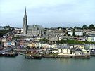
Cobh1 Cork 190,384 Cork 2 Carrigaline 12,835 Kinalea 3 Cobh 11,303 Barrymore 4 Mallow 10,241 Fermoy 5 Midleton 10,048 Barrymore 6 Youghal 6,785 Imokilly 7 Fermoy 5,873 Condons & Clangibbon 8 Bandon 5,822 Carbery East based on Irish Census 2006 Records Demographics
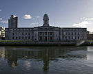
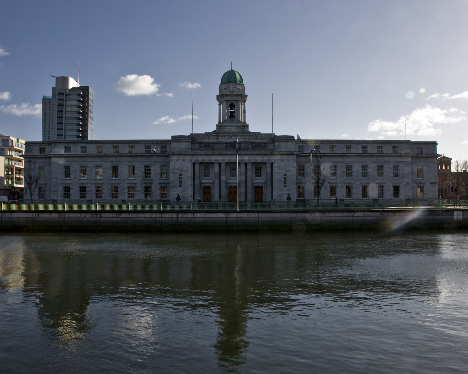
Main article: List of towns and villages in County CorkCork is the largest city in the county and the second most populous city in the Republic of Ireland, with a 2006 estimated population of 190,384. Cork city is the third most populous city on the island of Ireland. According to the 2006 Census statistics, the county has 11 towns with a population of over 4,000. Cork has a population of just under 500,000 making it Ireland's fourth most populous county and the Republic of Ireland's second most populous county. The county has a population density of 64 persons/km2 which is much higher than neighbouring Kerry and Tipperary although quite low by world standards, and Cork has a mostly rural landscape as a large percentage of the population live in urban areas.
Historical populations Year Pop. ±% 1653 54,250 — 1659 63,031 +16.2% 1821 730,444 +1058.9% 1831 810,732 +11.0% 1841 854,118 +5.4% 1851 649,308 −24.0% 1861 544,818 −16.1% 1871 517,076 −5.1% 1881 495,607 −4.2% 1891 438,432 −11.5% 1901 404,611 −7.7% 1911 392,104 −3.1% 1926 365,747 −6.7% 1936 355,957 −2.7% 1946 343,668 −3.5% 1951 341,284 −0.7% 1956 336,663 −1.4% 1961 330,443 −1.8% 1966 339,703 +2.8% 1971 352,883 +3.9% 1979 396,118 +12.3% 1981 402,465 +1.6% 1986 412,735 +2.6% 1991 410,369 −0.6% 1996 420,510 +2.5% 2002 447,829 +6.5% 2006 481,295 +7.5% [9][10][11][12][13][14] See also
- List of abbeys and priories in the Republic of Ireland (County Cork)
- Lord Lieutenant of Cork
- High Sheriff of County Cork
References
- ^ C. Michael Hogan. 2009. Hooded Crow: Corvus cornix, GlobalTwitcher.com, ed, N. Stromberg
- ^ Cullinane, J.P. 1973 Phycology of the South Coast of Ireland. University College Cork
- ^ for post 1821 figures 1653 and 1659 figures from Civil Survey Census of those years Paper of Mr Hardinge to Royal Irish Academy March 14 1865 For a discussion on the accuracy of pre-famine census returns see JJ Lee “On the accuracy of the pre-famine Irish censuses” in Irish Population Economy and Society edited by JM Goldstrom and LA Clarkson (1981) p54 in and also New Developments in Irish Population History 1700-1850 by Joel Mokyr and Cormac Ó Gráda in The Economic History Review New Series Vol. 37 No. 4 (Nov. 1984) pp. 473-488.
- ^ Rebelcork.com
- ^ Corkindependent.com
- ^ Thecorknews.ie
- ^ "Cork to Swansea Ferry". Fastnet Line. 16 February 2010. http://www.fastnetline.com.
- ^ Cork / Kerry GDPPDF (309 KB)
- ^ For 1653 and 1659 figures from Civil Survey Census of those years, Paper of Mr Hardinge to Royal Irish Academy March 14, 1865.
- ^ Census for post 1821 figures.
- ^ Histpop.org
- ^ Nisranew.nisra.gov.uk
- ^ Lee, JJ (1981). "On the accuracy of the Pre-famine Irish censuses". In Goldstrom, J. M.; Clarkson, L. A.. Irish Population, Economy, and Society: Essays in Honour of the Late K. H. Connell. Oxford, England: Clarendon Press.
- ^ Mokyr, Joel; O Grada, Cormac (November). "New Developments in Irish Population History, 1700–1850". The Economic History Review 37 (4): 473–488. doi:10.1111/j.1468-0289.1984.tb00344.x. http://www3.interscience.wiley.com/journal/120035880/abstract
External links
- Cork County Council
- Guide to County Cork for Tourism & Business
- County Cork Travel guide
- People's Republic of Cork
- Cork's War of Independence
Counties of Ireland The counties are listed per provinceConnacht 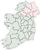
Munster Clare · Cork (Cork City) · Kerry · Limerick (Limerick City) · Tipperary (North Tipperary • South Tipperary) · Waterford (Waterford City)
Leinster Ulster Italics denote non-administrative counties. Brackets denote eponymous cities or non-traditional counties. † denotes counties of Northern IrelandCoordinates: 51°58′N 8°35′W / 51.967°N 8.583°W

County Limerick County Tipperary County Kerry 
County Waterford  County Cork

Atlantic Ocean Celtic Sea Categories:- County Cork
- Munster
- Counties of the Republic of Ireland
- Local administrative units of the Republic of Ireland


Wikimedia Foundation. 2010.