- Mullaghareirk Mountains
-
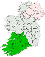
The Mullaghareirk Mountains (from Irish: Mullach an Radhairc, meaning "The summit of the view") is a range of mountains in Ireland that stretches from the borders of County Kerry County Limerick to Newmarket, County Cork. The villages of Mountcollins, Tournafulla, Brosna and Rockchapel are set in the mountains.
The mountains peak at 408 metres (1,339 ft). The Allaughaun River, a tributary of the River Feale, rises at the east end of the range.
Coordinates: 52°20′N 9°08′W / 52.333°N 9.133°W
Mountains and hills of Munster List of mountains in Ireland Ballyhoura Mountains Carron Mountain • Seefin
Boggeragh Mountains Caha Mountains Hungry Hill • SugarloafComeragh Mountains Derrynasaggart Mountains Dingle Peninsula Benoskee • BrandonGaltee Mountains Galteemore • LyracappulIveragh Peninsula BenteeKnockmealdown Mountains Macgillycuddy's Reeks Mangerton Mountains Shehy Mountains Silvermine Mountains Slieve Mish Mountains Bartregaum • CaherconreeSlieve Miskish Mountains Others An Triúr Deirfiúr • Devil's Bit • Geokaun Mountain • Mount Gabriel • Mullaghareirk Mountains • Paps of Anu • Purple Mountain • Slieve Aughty • Slievecallan • SlievenamonCategories:- Mountains and hills of County Cork
- County Cork geography stubs
- County Limerick geography stubs
- County Kerry geography stubs
Wikimedia Foundation. 2010.
