- Carrauntoohil
-
Carrauntoohil Corrán Tuathail 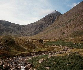
Carrauntoohil (middle) looking south along the Hag's GlenElevation 1,038 m (3,406 ft) Prominence 1,038 m (3,406 ft) Parent peak none - HP Ireland Listing Country high point
Hewitt, MarilynTranslation Tuathal's sickle/Tuathal's serrated mountain[1] (Irish) Location Location in the Republic of Ireland

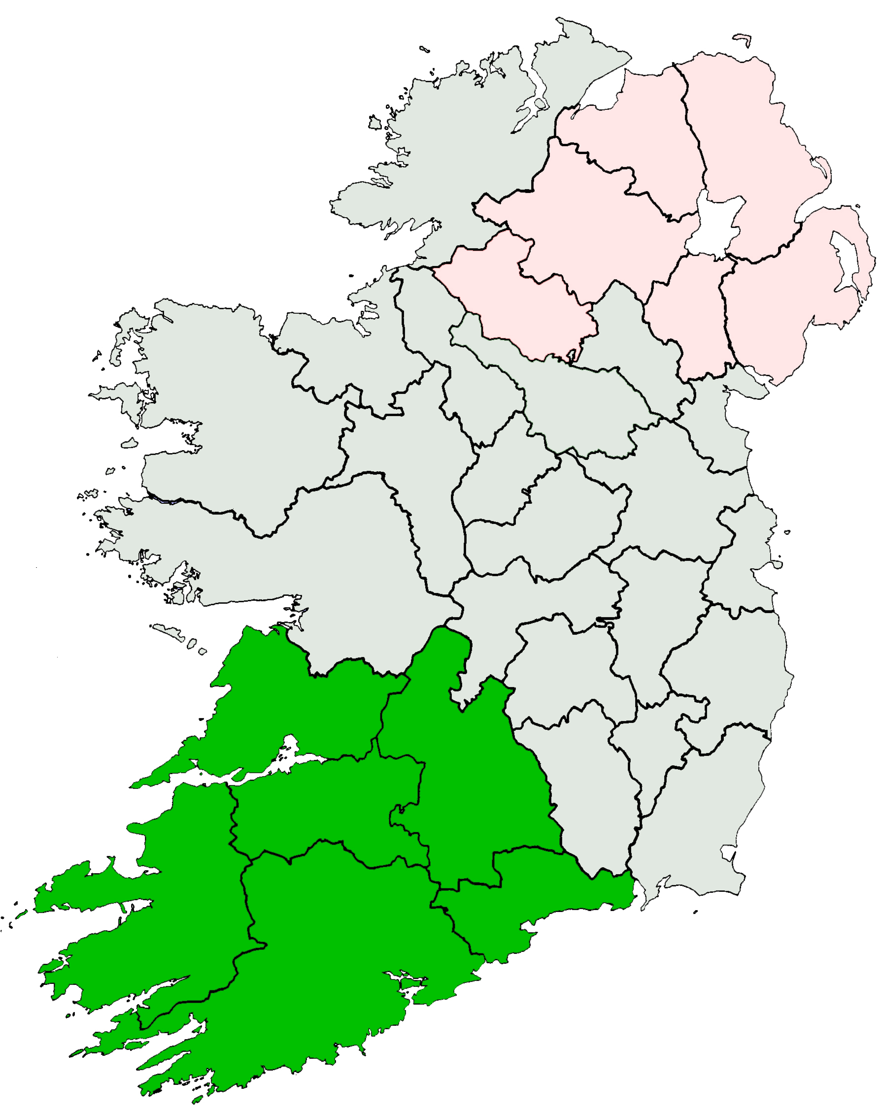
Location County Kerry, Republic of Ireland Range Macgillycuddy's Reeks Coordinates 51°59′58″N 9°44′34″W / 51.999447°N 9.742744°WCoordinates: 51°59′58″N 9°44′34″W / 51.999447°N 9.742744°W Topo map OSI Discovery 78 OSI/OSNI grid V803844 Carrauntoohil or Carrantuohill[2] (
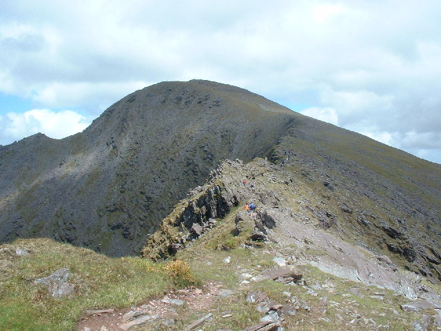
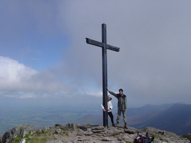
 /ˌkærənˈtuːl/, from Irish: Corrán Tuathail)[1] is the highest peak in Ireland. Located in County Kerry, it is 1,038 metres (3,406 ft)[3] tall and is the central peak of the Macgillycuddy's Reeks range. There are two other peaks in this range higher than 1,000 m—Beenkeragh (1,010 m) and Caher (1,001 m). The peak of Carrauntoohil is topped by a large metal cross 5 metres (16 ft) tall.
Contents
Climbing Carrauntoohil
The mountain is most often climbed from the north-east, along the Hag's Glen and up the steep Devil's Ladder to the col between Carrauntoohil and Cnoc na Péiste, and then north-west to the summit. The route has become more dangerous in recent years due to loose stones and crowding.[4] No special equipment is needed to climb the mountain, but caution is advised. Alternatively, one can walk the two other 1,000 m peaks in a "horseshoe" trip, starting from the west. The traverse from highest point to the second highest involves a light scramble.
Gallery 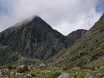 Northeast face of Carrauntoohil
 Northeast face of Carrauntoohil and the Hag's Tooth
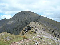 Carrauntoohil peak from the southwest approach
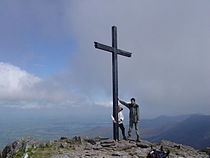 Hillwalkers on the summit
References
- ^ a b "Carrauntoohil". Placenames Database of Ireland. http://www.logainm.ie/?text=Carrauntoohil. Retrieved 2010-01-28.
- ^ "Carrauntoohil". Mountain Views. http://www.mountainviews.ie/mv/index.php?mtnindex=1. Retrieved 2006-11-03.
- ^ "Highest Mountains in Ireland". Ordnance Survey Ireland. http://www.osi.ie/en/faq/faqs.aspx#faq1. Retrieved 2009-10-12.
- ^ "Devil's Ladder Route". Kerry mountain rescue. http://www.kerrymountainrescue.ie/routes/devils_ladder.html. Retrieved 2007-01-10.
External links
See also
- List of mountains in Ireland
- List of Irish counties by highest point
- List of highest points of European countries
- List of countries by highest point
Munster Carrauntoohil (Corrán Tuathail) - 1,038 m (3,406 ft)
Leinster Ulster Connacht Mountains and hills of Munster Ballyhoura Mountains Carron Mountain • Seefin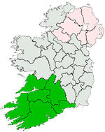
Boggeragh Mountains Caha Mountains Hungry Hill • SugarloafComeragh Mountains Derrynasaggart Mountains Dingle Peninsula Benoskee • BrandonGaltee Mountains Galteemore • LyracappulIveragh Peninsula BenteeKnockmealdown Mountains Macgillycuddy's Reeks Carrauntoohil • KnocknapeastaMangerton Mountains Shehy Mountains Silvermine Mountains Slieve Mish Mountains Bartregaum • CaherconreeSlieve Miskish Mountains Others An Triúr Deirfiúr • Devil's Bit • Geokaun Mountain • Mount Gabriel • Mullaghareirk Mountains • Paps of Anu • Purple Mountain • Slieve Aughty • Slievecallan • SlievenamonCategories:- Untranslated Irish place names
- Marilyns of Ireland
- Hewitts of Ireland
- Mountains and hills of County Kerry


Wikimedia Foundation. 2010.