- Mount Gabriel
-
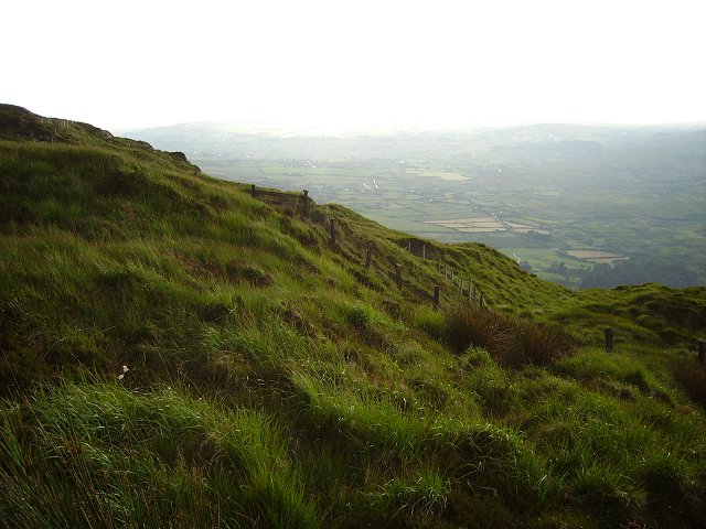
 The mountainside to the west of the summit
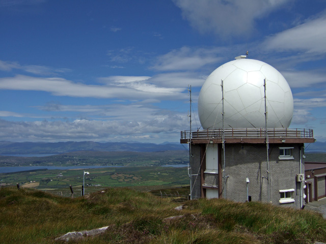
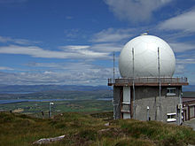 A radar dome on the summit
Mount Gabriel (Irish: Cnoc Osta) is a mountain on the Mizen Peninsula situated immediately to the north of the town of Schull, in West Cork, Ireland.
Mt. Gabriel is 407m high and is the highest eminence in the coastal zone south and east of Bantry Bay. A roadway serving the radar installations on the summit is open to the public.
From the peak of Mt. Gabriel, there are spectacular views South over Schull Harbour and Long Island Bay. To the east and southeast, the views take in Roaring Water Bay and its many islands, popularly known as Carbery's Hundred Isles. North and West is a panoramic view of the mountains of the Beara Peninsula and South Kerry.
The Fastnet Rock is situated some 18 km to the South, clearly visible in fine weather..
Contents
Mining
All over the southern and eastern slopes of the mountain is evidence of Bronze Age mining activity. The principal ore mined for was Copper. Some of the archaeological items found on the mountain are now found in the National Museum in Dublin.
Radar domes
In the late 1970s, as part of the development of Eurocontrol (the European air traffic control system), two radar domes were built on the top of the mountain.
1982 the Irish National Liberation Army, an Irish republican paramilitary group blew up the radar domes, claiming that they were being used by NATO in violation of Irish neutrality.
Coordinates: 51°33.00′N 9°32.19′W / 51.55°N 9.5365°W
See also
References
- Government debate on Irish Air Traffic control, historical-debates.oireachtas.ie
External links
- Schull's Website, schull.ie
- Schull.org
- References to mining, goodprovenance.com
- Official website — National Museum of Ireland, museum.ie
See also
Mountains and hills of Munster List of mountains in Ireland Ballyhoura Mountains Carron Mountain • Seefin
Boggeragh Mountains Caha Mountains Hungry Hill • SugarloafComeragh Mountains Derrynasaggart Mountains Dingle Peninsula Benoskee • BrandonGaltee Mountains Galteemore • LyracappulIveragh Peninsula BenteeKnockmealdown Mountains Macgillycuddy's Reeks Mangerton Mountains Shehy Mountains Silvermine Mountains Slieve Mish Mountains Bartregaum • CaherconreeSlieve Miskish Mountains Others An Triúr Deirfiúr • Devil's Bit • Geokaun Mountain • Mount Gabriel • Mullaghareirk Mountains • Paps of Anu • Purple Mountain • Slieve Aughty • Slievecallan • SlievenamonCategories:- Untranslated Irish place names
- Mountains and hills of County Cork
- National Monuments in County Cork
- County Cork geography stubs
Wikimedia Foundation. 2010.