- County Tipperary
-
County Tipperary
Contae Thiobraid Árann
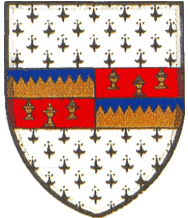
Coat of arms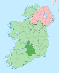
Country Ireland Province Munster Dáil Éireann Tipperary North
Tipperary SouthEU Parliament South County seat North: Nenagh
South: ClonmelArea - Total 4,303 km2 (1,661.4 sq mi) Area rank 6th Population (2011) 158,652 - Rank 11th[1] Car plates North: TN
South: TSCounty Tipperary (Irish: Contae Thiobraid Árann) is a county of Ireland. The area is covered by two local authorities, North Tipperary County Council, part of the Mid-West Region and South Tipperary County Council, part of the South-East Region. It is located in the province of Munster and is named after the town of Tipperary. The population is 158,652 according to the 2011 census.
Contents
Geography and political subdivisions

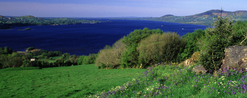
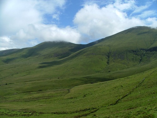
Tipperary is the sixth largest of the 32 counties by area and the 11th largest by population.[2] It is the third largest of Munster’s 6 counties by size and the third largest by population. The region is part of the central plain of Ireland, but the diversified terrain contains several mountain ranges: the Knockmealdown, the Galtee, the Arra Hills and the Silvermine. The southern portion of the county is drained by the River Suir; the northern by tributaries of the Shannon which widens into Lough Derg. No part of the county touches the coast. The centre is known as 'the Golden Vale', a rich pastoral stretch of land in the Suir basin which extends into counties Limerick and Cork.
Baronies
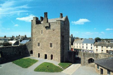
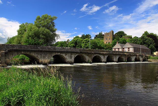
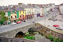 Cahir on the banks of the Suir
There are six historic baronies in North Tipperary: Eliogarty, Ikerrin, Ormond Upper, Ormond Lower, Owney and Arra and Kilnamanagh Upper, with a further six lying in South Tipperary: Clanwilliam, Kilnamanagh Lower, Iffa and Offa East, Iffa and Offa West, Middle Third, and Slievardagh.
Civil parishes and townlands
Main article: Civil parishes in IrelandParishes were delineated after the Down Survey as an intermediate subdivision, with multiple townlands per parish and multiple parishes per barony. The civil parishes had some use in local taxation and were included on the nineteenth century maps of the Ordnance Survey of Ireland.[3] For poor law purposes, District Electoral Divisions replaced the civil parishes in the mid-nineteenth century. There are 199 civil parishes in the county.[4] Townlands are the smallest officially defined geographical divisions in Ireland; there are 3159 townlands in the county.[5]
Towns and villages
 Landscape in the Knockmealdowns
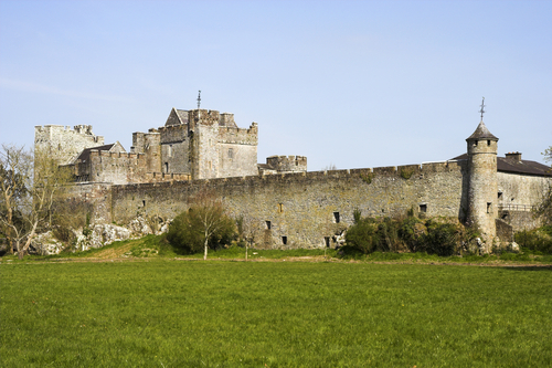
Historical populations Year Pop. ±% 1653 31,597 — 1659 26,684 −15.5% 1821 346,896 +1200.0% 1831 402,563 +16.0% 1841 435,553 +8.2% 1851 331,567 −23.9% 1861 249,106 −24.9% 1871 216,713 −13.0% 1881 199,612 −7.9% 1891 173,188 −13.2% 1901 160,232 −7.5% 1911 152,433 −4.9% 1926 141,015 −7.5% 1936 137,835 −2.3% 1946 136,014 −1.3% 1951 133,313 −2.0% 1956 129,415 −2.9% 1961 123,822 −4.3% 1966 122,812 −0.8% 1971 123,565 +0.6% 1979 133,741 +8.2% 1981 135,261 +1.1% 1986 136,619 +1.0% 1991 132,772 −2.8% 1996 133,535 +0.6% 2002 140,131 +4.9% 2006 149,244 +6.5% 2011 138,652 −7.1% [6][7][8][9][10][11] 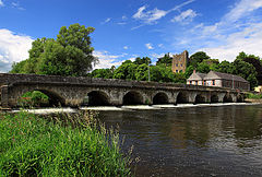 Ardfinnan Castle, Ardfinnan.
- Ballina - Béal an Átha
- Bansha - An Bháinseach
- Borrisokane - Buiríos Uí Chéin
- Borrisoleigh- Buiríos Ó Luigheach
- Cahir - Cathair Dún Iascaigh or An Chathair
- Carrick-on-Suir - Carraig na Siúire
- Cashel - Caiseal
- Castleiney - Caisleán Aoibhne
- Clonmel - Cluain Meala
- Clonmore - An Cluain Mhór
- Clonoulty - Cluain Ultaigh
- Cloughjordan - Cloch Shiurdáin
- Drom - Drom
- Dundrum - Dún Droma
- Emly - Imleach Iubhair
- Fethard - Fíodh Ard
- Golden - Gaibhlean
- Hollyford - Áth an Chuillinn
- Holycross - Mainistir na Croiche
- Horse and Jockey - An Marcach
- Killenaule - Cill an Áil
- Kilmoyler
- Lorrha - Lothra
- Knockgraffon
- Lisronagh - Lios Ruanach
- Littleton - An Baile Beag
- Loughmore - Luach Magh
- Milestone - Cloch an Mhíle
- Nenagh - An tAonach
- New Inn - Loch Cheann
- Newport - An Tulach Sheasta
- Ninemilehouse - Tigh na Naoi Míle
- Rearcross
- Roscrea - Ros Cré
- Rosegreen - Faiche Ró
- Rossmore - An Ros Mór
- Templemore - An Teampall Mór
- Thurles - Dúrlas Éile
- Tipperary Town - Tiobraid Árann
- Toomevara - Tuaim Uí Mheara
- Two-Mile Borris - Buiríos Léith
- Upperchurch - An Teampall Uachtarach'
History
Tipperary was one of the first parts of Ireland to be shired during the 13th century following the Norman invasion of Ireland.[citation needed] For all local government purposes the county is divided into North Tipperary (county town: Nenagh) and South Tipperary (county town: Clonmel). This division dates back to the Local Government (Ireland) Act 1898, with the county's two "ridings" having had separate assize courts for much longer. The use of riding for the divisions was an historical misnomer, since the word derives from the dividing of an area into three parts. The expression "riding" has been discontinued for official purposes since 2002 (Local Government Act, 2001 section 10 and schedule 5).
Local government and politics
The area of the county is now covered by two local administrative authorities: North Tipperary County Council and South Tipperary County Council. They rank equally as first level local administrative units of the NUTS 3 Mid-West Region for Eurostat purposes. There are 34 LAU 1 entities in the Republic of Ireland. Both local authorities are responsible for certain local services such as sanitation, planning and development, libraries, the collection of motor taxation, local roads and social housing. The county is part of the South constituency for the purposes of European elections. For elections to Dáil Éireann, the county is divided into two constituencies: Tipperary North and Tipperary South. Together they return 6 deputies (TDs) to the Dáil.
Culture
Tipperary is sometimes referred to as the "Premier County", a description attributed[citation needed] to Thomas Davis, Editor of The Nation newspaper in the 1840s as a tribute to the nationalistic feeling in Tipperary and said[citation needed] that "where Tipperary leads, Ireland follows". Tipperary was the subject of the famous song "It's a Long Way to Tipperary" written by Jack Judge, whose grandparents came from the county. It was popular with regiments of the British army during World War I. The song "Slievenamon", which is traditionally associated with the county, was written by Charles Kickham from Mullinahone, and is commonly sung at sporting fixtures involving the county.[12]
Economy
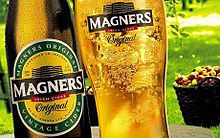 Magners, Tipperary's most famous export
The area around Clonmel is the economic hub of the county: to the west of the town the manufacturers Bulmers (brewers) and Merck & Co. (pharmaceuticals). There is much fertile land, especially in the region known as the Golden Vale, one of the richest agricultural areas in Ireland. Dairy farming and cattle raising are the principal occupations.[citation needed] Other industries are slate quarrying and the manufacture of meal and flour.
Tipperary is famous for its horse breeding industry and is the home of Coolmore Stud, the largest thoroughbred breeding operation in the world.[citation needed]
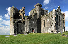
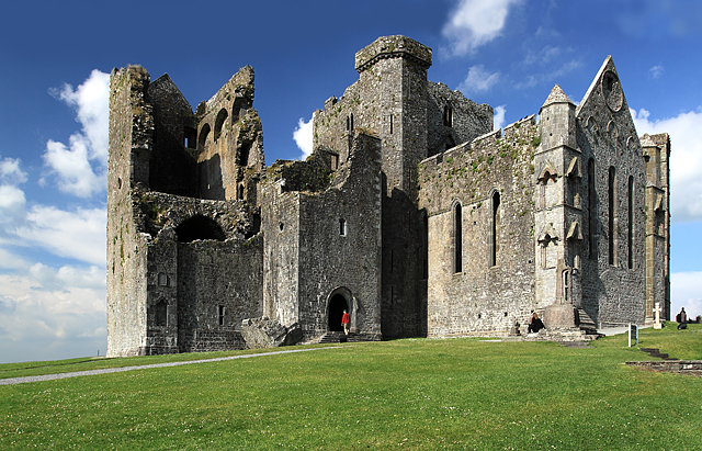
Tourism plays a significant role in County Tipperary - Lough Derg, Thurles, Rock of Cashel, Ormonde Castle, Ahenny High Crosses, Cahir Castle, Bru Boru Heritage Centre and Tipperary Crystal are some of the primary tourist destinations in the county.
Transport
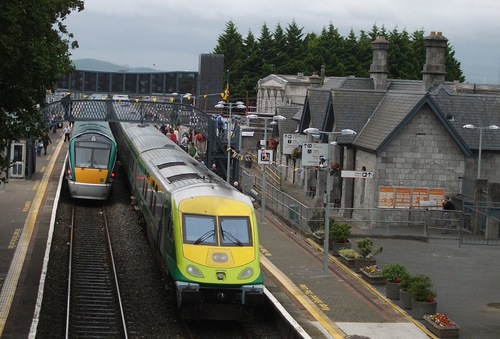
Road transport dominates in County Tipperary. The M7 motorway crosses the north of the county through Roscrea and Nenagh and the M8 motorway bisects the county from north of Two-Mile Borris to the County Limerick border. Both routes are amongst some of the busiest roads on the island. The Limerick to Waterford N24 crosses the southern half of Tipperary, travelling through Tipperary Town, Bansha, north of Cahir and around Clonmel and Carrick-on-Suir. Tipperary also has a number or railway stations situated on the Dublin to Cork, Dublin to Limerick and Limerick to Waterford rail lines.
Sports
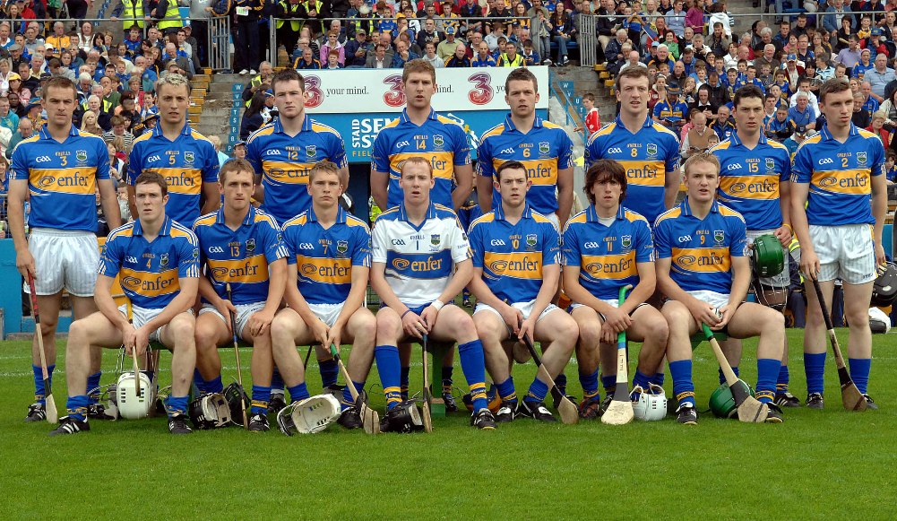
County Tipperary has a strong sporting history and is home to the Gaelic Games of Hurling, Gaelic football, Camogie and Handball. It nurtures the ancient game of hurling and since the 19th century its teams have regularly been champions of Ireland.
Places of interest
- Ahenny High Crosses
- Kilcash Castle (also Ireland's oldest church in Kilcash)
- Ormonde Castle, Carrick-on-Suir
- Athassel Priory
- Cahir Castle
- Coolmore Stud
- Dromineer
- Fethard
- Galtymore - a munro, and the highest mountain in County Tipperary (919m).
- Glen of Aherlow
- Glengarra Wood
- Holy Cross Abbey
- Lough Derg
- Mitchelstown Cave
- Nenagh
- Redwood Castle (Castle Egan)
- Rock of Cashel
- Slievenamon - Sliabh na mBan - mountain associated with many Irish legends (721m)
- Thurles.
See also
- List of civil parishes of North Tipperary
- List of civil parishes of South Tipperary
- Vehicle registration plates of Ireland
- List of abbeys and priories in the Republic of Ireland (County Tipperary)
- Tipperary Hill, a neighbourhood in Syracuse, New York, United States, inhabited by many descendants of County Tipperary.
- Lord Lieutenant of Tipperary
- High Sheriff of Tipperary
References
- ^ http://www.cso.ie/census/Table1.htm
- ^ Corry, Eoghan (2005). The GAA Book of Lists. Hodder Headline Ireland. pp. 186–191.
- ^ "Interactive map (civil parish boundaries viewable in Historic layer)". Mapviewer. Ordnance Survey of Ireland. http://ims0.osiemaps.ie/website/publicviewer/main.aspx. Retrieved 9 March 2010.
- ^ Placenames Database of Ireland - Tipperary civil parishes.
- ^ Placenames Database of Ireland - Tipperary townlands.
- ^ For 1653 and 1659 figures from Civil Survey Census of those years, Paper of Mr Hardinge to Royal Irish Academy March 14, 1865.
- ^ Census for post 1821 figures.
- ^ http://www.histpop.org
- ^ http://www.nisranew.nisra.gov.uk/census
- ^ Lee, JJ (1981). "On the accuracy of the Pre-famine Irish censuses". In Goldstrom, J. M.; Clarkson, L. A.. Irish Population, Economy, and Society: Essays in Honour of the Late K. H. Connell. Oxford, England: Clarendon Press.
- ^ Mokyr, Joel; O Grada, Cormac (November). "New Developments in Irish Population History, 1700-1850". The Economic History Review 37 (4): 473–488. doi:10.1111/j.1468-0289.1984.tb00344.x. http://www3.interscience.wiley.com/journal/120035880/abstract.
- ^ http://www.irishpage.com/songs/slevmoan.htm
External links
- Tipperary Institute
- County Tipperary Historical Society
- A website dedicated to the genealogical records of the county. It offers fragments of the 1766 census, the complete Down Survey, as well as a ream of other useful information
- Score for 'Quality of Life' in County Tipperary
Counties of Ireland The counties are listed per province Connacht 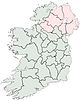
Munster Clare · Cork (Cork City) · Kerry · Limerick (Limerick City) · Tipperary (North Tipperary • South Tipperary) · Waterford (Waterford City)
Leinster Ulster Italics denote non-administrative counties. Brackets denote eponymous cities or non-traditional counties. † denotes counties of Northern Ireland Categories:- County Tipperary
- Munster
- Counties of the Republic of Ireland


Wikimedia Foundation. 2010.