- Carrick-on-Suir
Infobox Irish Place
name = Carrick-on-Suir
gaeilge = Carraig na Siuire
crest
motto =
map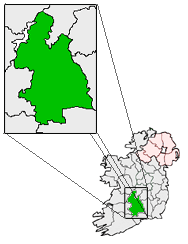
pin coords = left: 82px; top: 102px
north coord = 52.346509
west coord = 7.411995
irish grid = S398218
area =
elevation =
province =Munster
county =County Tipperary
town pop = 5856
rural pop = 50
census yr = 2006
web = www.carrick-on-suir.ie
|Carrick-on-Suir ( _ga. Carraig na Siuire) is a town in
County Tipperary , Ireland. As the name – meaning "the rock of the Suir" – suggests, the town is situated on theRiver Suir . The [http://beyond2020.cso.ie/Census/TableViewer/tableView.aspx?ReportId=1770 CSO 2006 Census] of the town gives the population as 5,906 (including suburbs or environs) and shows that it has grown by 5.7% since2002 .Location
Carrick-on-Suir is situated in the south-eastern corner of
County Tipperary , 13 miles east ofClonmel , and 17 miles northwest ofWaterford . The town lies over three county lines, namely Tipperary, Waterford and Kilkenny. which marks the Tipperary-Waterford border. The main portion of Carrick-on-Suir north of the river and lying in Tipperary is known locally as "Carrick Mór" ("Big Rock"), though this is rarely used.The town is connected to
Limerick andWaterford by the N24 road and a rail link.Carrick on Suir railway station opened on15 April 1853 . [cite web | title=Carrick on Suir station | work=Railscot - Irish Railways | url=http://www.railscot.co.uk/Ireland/Irish_railways.pdf | accessdate=2007-09-07|format=PDF] Since2004 , three trains a day and numerous buses run toWaterford . There is a recently refurbished riverside walk toClonmel along a former canal tow-path.Carrick-on-Suir lies on the south-eastern edge of the Tipperary South constituency of
Dáil Éireann .History
Carrick-on-Suir (originally called Carrig Mac Griffin) was formed on an island settlement upstream of Waterford. (The town remained as an island until the 18th century, when small rivers were diverted to form dry land north and west of the town).The earliest known records of a settlement are dated to 1247, when a charter of 3 fairs per year was awarded to Matthew Fitzgriffin, Lord of the manor of Carrick, and a member of the Anglo-Norman nobility.
By the early 14th century, Carrick Mac Griffin had become home to a prosperous Anglo-Norman family - the Butlers. The first significant leader of the Butler clan, Edmond le Bottiler, became Earl of Carrig in 1315. His son later received the title Earl of Ormonde, and this title would be used henceforth. The most notable members of the Butler clan were Thomas (Black Tom) Butler, the 10th Earl of Ormond who built the Tudor Manor House extension to the
Ormonde Castle and James, 12th Earl and 1st Duke of Ormond, who founded the woollen industry of the mid-17th Century.Edmond le Bottiler erected two large, heavily garrisoned castle keeps named the Plantagenet Castle on the north bank of the
Suir , just east of what is now Main St. In the 1400s, a four towered castle was erected on the same site, two of which are now incorporated into the Elizabethan Manor House built by Black Tom Butler, c. 1560. The Manor House still stands today, having being extensively refurbished by the State in the 1990s and is open to the public.In 1649, the town was taken by English Parliamentarians during the
Cromwellian conquest of Ireland . They captured Carrick by stealth after discovering an undefended gate as part of operations during theSiege of Waterford . Irish troops fromUlster under a Major Geoghegan tried to re-take Carrick but were eventually beaten off with the loss of over 500 killed.In 1670 the Butlers set up a woollen industry in the town. By 1799, the town enjoyed some prosperity from the woollen industry, fishing, basketweaving and other river related businesses - the population reached around 11,000 by this point. Over the next 120 years however, the town suffered from high taxes and levies imposed by the British on the woollen industry, leading to high unemployment, poverty and emigration. The Great Famine also contributed greatly to the depopulation of the town.
With the coming of Independence and the Civil War, Carrick was initially occupied by the IRA until the town fell to the Free State army in 1922. By this stage, industrialisation had reached Carrick with the establishment of cotton factories and a local creamery. Most significant however for the economic development of the town was the arrival of the tanning industry in the 1930s, providing regular, dependable employment in the town for the first time. The local town council also embarked on building social housing projects in an effort to deal with appalling living conditions in the town for those economically disadvantaged. Despite these developments, economic opportunities were limited and poverty widespread - the town saw widespread emigration to
Dublin , Britain and further afield especially during the long recessions of the 40s and 50s.The closure of the Pollack & Plunder tannery in 1985 caused immense hardship in the town, as a significant proportion of the population (Carrick's population was roughly 4,000 by this point) were employed there or were dependent on someone who was. Carrick suffered a prolonged recession throughout the 80s and early 90s, again leading the population to drop due to emigration - a fatesuffered by other small, rural Irish towns during the period. By the late-90s, the economy of the town was on the upswing - unemployment had dropped, the SRAM bicycle component factory had opened as had numerous small businesses, and the population began to increase again for the first time in 2 centuries.
Carrick's local infrastructure (in particular health and transport) still remains relatively undeveloped, due to its location on the border of 3 counties (and subsequent lack of political muscle both at county and national level), and the nearby larger towns of
Clonmel andWaterford . As of 2006, no large manufacturing operation remains in the town - the SRAM plant closed in 2006, but Carrick continues to prosper economically. The population continues to increase, and the town expands with ongoing significant house building projects. The future of Carrick is likely to be that of a commuter town, servicing those working inWaterford andClonmel - a role it has been performing for decades.River Suir
The river is tidal through the town and the tide turns above Glanbia upstream of Carrick-on-Suir. Flood waters spill on to the land above Glanbia on the County Waterford side of the river. Carrick has a one-in-50 year flood defence system with quay walls ranging in height from 1.2m to 1.5m. Currently the walls give protection from flooding caused by high tides. Carrick is less than 10 m above sea level and could be affected by
global warming in the future. Flooding still occurs along the Glen/Mill River and Markievicz Tce.Town Landmarks
In 1447 a stone bridge was built, now known as the "Old Bridge". A new, more modern bridge (later named after
John Dillon ) was built in the early 20th century. The central part of the Old Bridge (and likewise the Dillon bridge) was destroyed by retreating IRA forces in 1922 in an attempt to slow the advance of the Free State army, but both were rebuilt by 1927.Carrick's Town Clock was erected in 1784. A public park was created in the Fair Green in the 1860s. The town fair continues to this day, having been moved from the Fair Green in the 1920s to a new site just west of the Fair Green.
Carrick-on-Suir and Carrick-Beg are home to three Catholic churches. In Carrick Mór lies St Nicholas' church and it is the largest church in the town. This church was built in 1879, replacing an earlier church of the same name built in 1804. In Carrick Beg are the small St Molleran's parish church (parts of which date back to the 1200s) and the larger
Franciscan friary. TheFranciscan order's presence in Carrick dates back to 1336 with the granting of land for a friary by the 1st Earl of Ormond. However, the suppression of monasteries by Henry VIII led to the closure of the friary. Just prior to the invasion ofIreland by Cromwell, the friars had returned for an 11 year period, before being shut down again and the friars having to go underground to avoid persecution. It was not until 1820 and the onset ofCatholic Emancipation that the friars were able to fully return and a new chapel was built. The friars served the local community until the lack of vocations to the order led to the order finally leaving Carrick-Beg in2006 .The local
Church of Ireland community was relatively substantial until independence from theUK , when the majority left for Britain andNorthern Ireland . The local Church of Ireland church on Main Street was abandoned until the late 1980s, when the church building and grounds were renovated and now serve as a heritage centre.There are two theatres in Carrick-on-Suir, the Brewery Lane theatre and the Operatic Society. While the Operatic society tends to focus on musicals, operas and pantomimes, Brewery Lane usually does dramas which can be serious, or often black comedy. Many of these are Irish.
port
Gaelic games
*Carrick-on-Suir is home to three
Gaelic Athletic Association clubs - the Carrick Davins (named after the first GAA presidentMaurice Davin ),Carrick Swans GAA (both of whom play in Tipperary) and St Molleran's (who play in Waterford).Football
*Carrick is also home to Carrick United AFC, a noted junior (non-league, amateur)
soccer team that plays in the Waterford & District League. The club has enjoyed considerable success in the Waterford & District League, Munster Senior and Junior Cups and also in the FAI Junior Cup.
*Rock Rovers, another local amateursoccer team, plays in the Tipperary Southern & District League.Rugby
The local amateur rugby team, Carrick-on-Suir RFC, is located in Tybroughney, on the
County Tipperary side of theSuir . They play in the Munster Junior League.Golf
The town also has its own 18-hole Golf Club and the Seán Kelly swimming pool and fitness centre.
Clubs and Societies
*The Carrick-on-Suir Musical Society (formed in
1943 ) is a well known and national award winning musical and amateur operatic society. The Musical Society recently bought and refurbished the Strand Theatre on Main Street for use by the Society. The Brewery Lane Drama Society (formed in1955 ) performs several major productions a year at their 75 person capacity theatre, which was formerly a malt house owned bySmithwicks .
*TheIrish Traction Group is based in Carrick-on-Suir.People
Notable people from the town include:
* The legendaryClancy Brothers folk music group
*Maurice Davin - first president of theGaelic Athletic Association ,1884 -1887
*Michael Anthony Fleming - Roman Catholic bishop of St John's, Newfoundland, Canada
* Seán Kelly
*Tom Kiely - Olympic decathlon gold medallist at the1904 Summer Olympics
*Mick Roche - former Tipperary hurler.ee also
* List of abbeys and priories in Ireland (County Tipperary)
* List of towns in IrelandExternal links
* [http://www.carrick-on-suir.ie Carrick-on-Suir official website]
* [http://www.southeastireland.com/content.asp?id=81 A history of Carrick-on-Suir]
* [http://homepage.eircom.net/~ancaislean An Caislean Bed and Breakfast] - includes extensive detail about the locality and its history
* [http://www.mapquest.com/maps/map.adp?formtype=address&searchtype=address&country=IE&addtohistory=&city=carrick-on-suir Carrick-on-Suir on Mapquest]
* [http://www.carraighotel.com The Carraig Hotel 3***]
* [http://homepage.eircom.net/~theswanclub Carrick Swans]
* [http://carrickonsuirdavins.tipperary.gaa.ie/index.html Carrick Davins]
* [http://www.carrickrugby.com/index.html Carrick-on-Suir RFC]
* [http://www.carrickmusicals.com Carrick-on-Suir Musical Society]
* [http://www.carrickgolfclub.com Carrick-on-Suir Golf Club, official website of the picturesque course]References
Wikimedia Foundation. 2010.