- Dromineer
-
This article is about a village in Tipperary. For the similarly named village in Armagh, see Dromintee.
Dromineer
Drom Inbhir— Town — Location in Ireland
 Dromineer
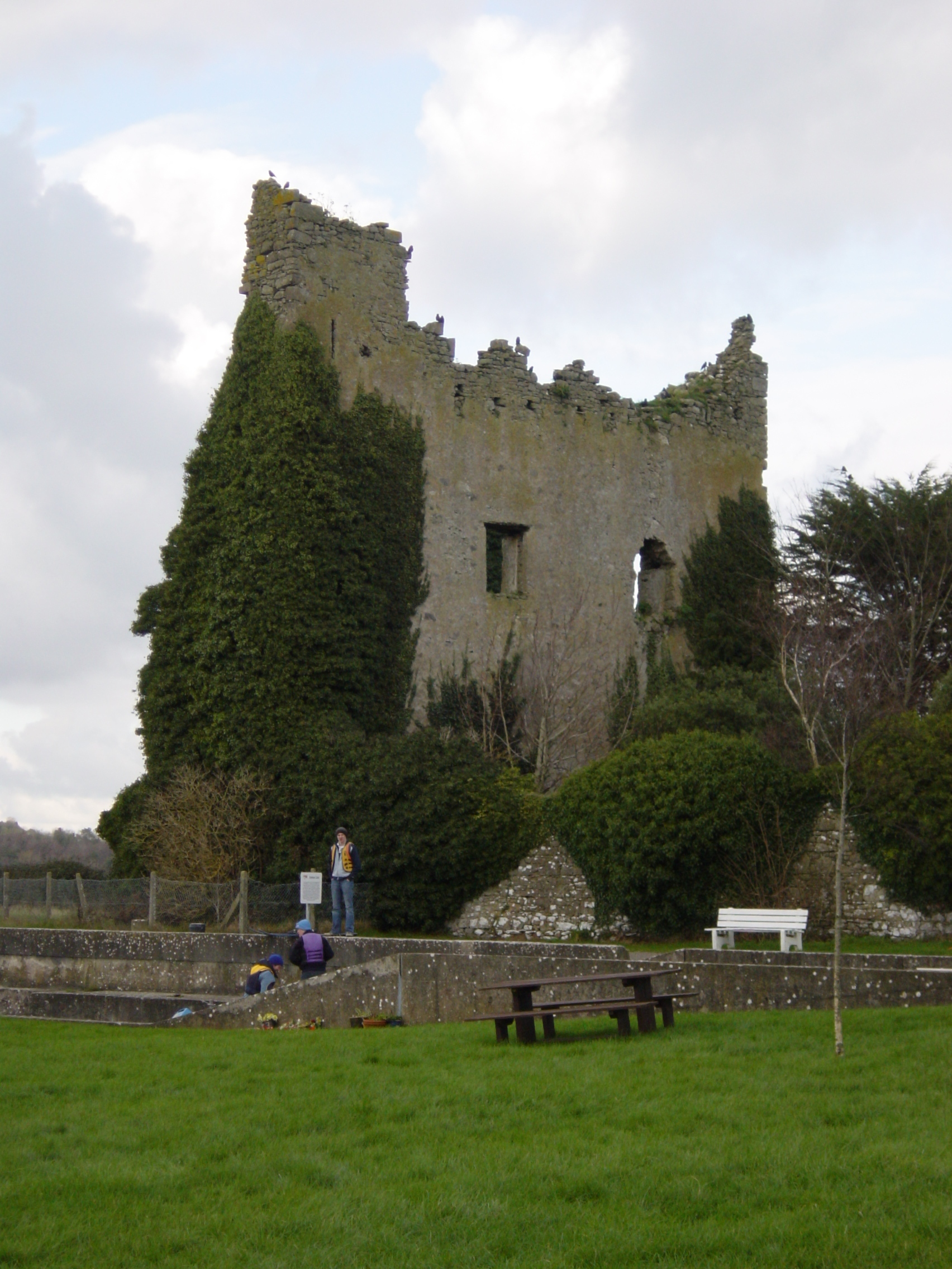
Coordinates: 52°33′N 8°10′W / 52.55°N 8.16°WCoordinates: 52°33′N 8°10′W / 52.55°N 8.16°W Country Ireland Province Munster County North Tipperary Elevation 43 m (141 ft) Population (2006) - Urban 118 Time zone WET (UTC+0) - Summer (DST) IST (WEST) (UTC-1) Irish Grid Reference R815858  Dromineer Castle
Dromineer (Irish: Drom Inbhir, meaning "ridge of the river mouth") is a small village in North Tipperary, Ireland. It is situated on the shores of Lough Derg on the River Shannon. The village is located 10 kilometres north of Nenagh. It is a civil parish in the historical barony of Ormond Lower.
Features
Home to an 11th century towerhouse, idyllic scenery, a public harbour and other facilities, it is a popular place to visit, especially for those out boating on the lake. The name Dromineer in Irish is "Drom Inbhir", meaning the back or the ford of the river.
Amenities in Dromineer include restaurant and pub (The Whiskey Still), accommodation (such as The Dromineer Hostel) and a children's playground.
Dromineer is home to the Lough Derg Lifeboat, which is the RNLI's third inland lifeboat station and was the first inland station in the Republic of Ireland.
Sport
- Kildangan GAA is the local Gaelic Athletic Association club.
- Fishing is a popular activity on both the lake and the nearby Nenagh river from Nenagh Boat Club, Lough Derg Yacht Club and Shannon Sailing.
- Lough Derg Yacht Club, which is the third-oldest yacht club in the world[citation needed] and one of two clubs with a fleet of Shannon-One-Design sailing dinghies.
- Irish Paramotoring Club.
See also
- List of civil parishes of North Tipperary
Places in North Tipperary County town: Nenagh Towns 
Villages Ballina · Ballingarry · Borrisoleigh · Borrisokane · Castleiney · Dromineer · Faddan More · Holycross · Horse and Jockey · Lagganstown · Littleton · Lorrha · Loughmore · Milestone · Portroe · Puckane · Rearcross · Silvermines · Terryglass · Toomevara · Two-Mile Borris · UpperchurchBaronies List of townlands in County Tipperary · Category:Mountains and hills of County Tipperary · Category:Rivers of County Tipperary · Category:Geography of North Tipperary · Baronies of Tipperary Categories:- River Shannon
- Towns and villages in North Tipperary
- County Tipperary geography stubs


Wikimedia Foundation. 2010.