- M7 motorway (Ireland)
-
M7 motorway

Route information Part of 

Length: 186 km (116 mi) History: Construction dates: 1983 (Naas bypass, J7-J8)
1993 (Newbridge Bypass, J8-J10)
1997 (Portlaoise bypass)
2003 (Kildare bypass)
2004 (Monasterevin bypass)
2004 (Limerick Southern Ring Road - Phase I)
2010 (Portlaoise to Borris-in-Ossory, Nenagh to Limerick, Castletown to Nenagh)Major junctions From: (N7 from Dublin) Naas 


To: Rossbrien Interchange - Limerick Location Primary
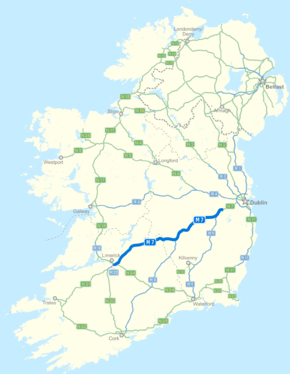
destinations:Newbridge (M9 to Waterford), Monasterevin, Portlaoise (M8 to Cork), Mountrath, Borris-in-Ossory, Roscrea, Toomevara, Nenagh, Limerick (M20 to Cork/Kerry) Road network The M7 motorway (Irish: Mótarbhealach M7) is a motorway in Ireland. The motorway runs continuously from the outskirts of Naas in County Kildare to Rossbrien on the outskirts of Limerick City.[1] The M7 forms part of the Dublin to Limerick N7 national primary road. The section of the motorway bypassing Naas, an 8 km stretch, was the first section of motorway to open in the Republic of Ireland, in 1983. Following substantial works to extend the M7 to Limerick; by the end of 2010, the motorway replaced almost all of the single-carriageway N7 now designated R445. At 186 km, the M7 is the longest motorway in Ireland.
Contents
Route
Naas to Limerick
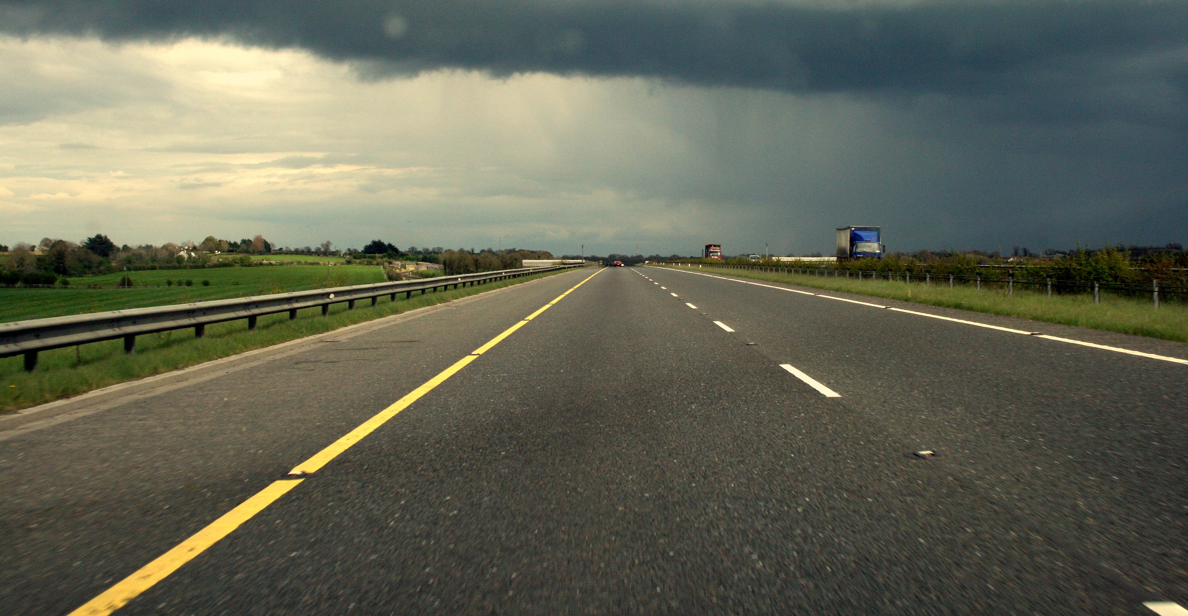
The N7 leads directly into the M7 motorway at the Maudlin's Interchange near Naas (junction 9 on the N7-M7 corridor), and proceeds southwestwards, bypassing Naas, Newbridge, Kildare, Monasterevin, Ballybrittas, Portlaoise, Mountrath, Borris-in-Ossory, Roscrea, Moneygall, Toomevara, Nenagh and Annacotty. As of December 2010, the M7 is approximately 186 km in length and ends at the Rosbrien interchange (junction 30) outside Limerick. Here, the road connects to the Limerick Southern Ring Road - Phase 2 and continues as the N18. At junction 30 there is also a slip-road to the M20 Limerick - Cork/Kerry road. Along this section of the M7 there is a fly-over for the N24 Limerick to Waterford road at junction 29. Southwest of Portlaoise it forms an interchange with the M8 Dublin-Cork motorway at junction 19 and at junction 11 there is an interchange with the M9 Dublin - Waterford motorway
History
The M7 was constructed in stages between 1983 and 2010 to replace the old national route which ran (in order from east to west) through the villages and towns of Naas (1983), Newbridge (1993), Kildare (December 2003), Monasterevin (November 2004), Portlaoise (29 May 1997), Mountrath and Borris-in-Ossory (both 28 May 2010), Roscrea, Moneygall and Toomevara (all 22 December 2010), Nenagh (about 1996) and Birdhill (28 September 2010) and the city of Limerick (May 2004). Today, junctions provide access to all of these places. The old route has been re-classified as a regional road, the R445. A restricted-access junction (junction 11) connects the M7 to the M9 motorway to Waterford, also allowing access from the M9 to eastbound carriageway of the M7.
Until summer 2006, junction numbers started at seven, although only the first five junctions were numbered. This junction numbering scheme was devised when it was believed that a motorway would be built from Naas to the yet-to-be-constructed junction 8 on the M50. While a motorway reservation still exists, it is now unlikely to be built, having being superseded by the widening of the N7 between Newlands Cross and Naas to three lanes and the grade separation of this section. The junction numbers were renumbered to fit into this scheme in July–August 2006.
The construction of the Nenagh to Limerick section was slow and difficult. Work on this section began on December 7, 2006 and was initially due to be completed in May 2009.[2] The total length of the scheme is 38 km (24 mi), of which 10 km (6.2 mi) was the upgrading of the single carriageway Nenagh bypass. The road opened in three stages. The Nenagh bypass re-opened to motorway standard on 17 December 2009 and the Nenagh to Birdhill section opened on 1 April 2010. Problems were encountered while constructing the road over two sections of deep bog at Annaholty and Drominboy near Birdhill and this delayed the opening of the Birdhill to Limerick section by over a year. Parts of the road collapsed over the two bogs and the sections were rebuilt and opened on 28 September 2010.[3] This scheme was originally to be built as a high-quality dual carriageway (HQDC), but it was re-designated motorway by Statutory Instrument on 17 July 2008.
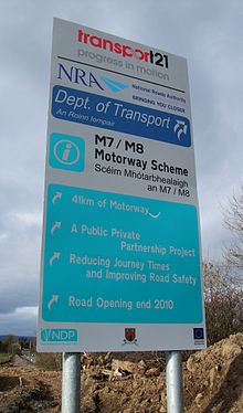
In June 2007, construction commenced on a 28 km (17 mi) section of the M7 motorway between Portlaoise and Castletown, which opened on May 28, 2010 and is subject to a toll north of the M7-M8 interchange. This M7 scheme runs between junctions 18 and 21 on the N7-M7 corridor and bypasses Borris-in-Ossory and Mountrath, this section includes a tie-in to the new 143 km M8.
In March 2008, construction commenced on a 36 km section (22 miles) of the M7 route between Castletown, County Laois and Nenagh, tying into the Portlaoise-Castletown scheme mentioned above at the Borris-in-Ossory junction. It runs between junctions 21 and 24 on the N7-M7 corridor. This scheme was originally planned to proceed as a High Quality Dual Carriageway (HQDC), which would have seen it built to many of the same engineering standard as a motorway, with a design speed of 120 km/h, however a Statutory Instrument was passed on 17 July 2008, re-designating this and many other new HQDC schemes as motorway. Consequently, when this scheme was complete, it opened with full motorway regulations on 22 December 2010.
In May 2004 work was completed on phase 1 of the Limerick Southern Ring Road which consists of approximately 10 km (6.2 mi) of dual carriageway, and joins the M20 road to Cork and the N21 road to Kerry. Two grade separated junctions allow access to Limerick city at Annacotty via the R445 and at Ballysimon via the N24. The N20 Carew park link road was closed permanently to inbound traffic from both the M7 and M20 in June 2010 to facilitate phase 2 of the Limerick southern ring road project. The dual carriageway was redesignated as M7 in 2009. Phase 2 of the Limerick Southern Ring Road opened as part of the N18 and was completed in July 2010.
Junctions

 Raised section of the Kildare bypass.

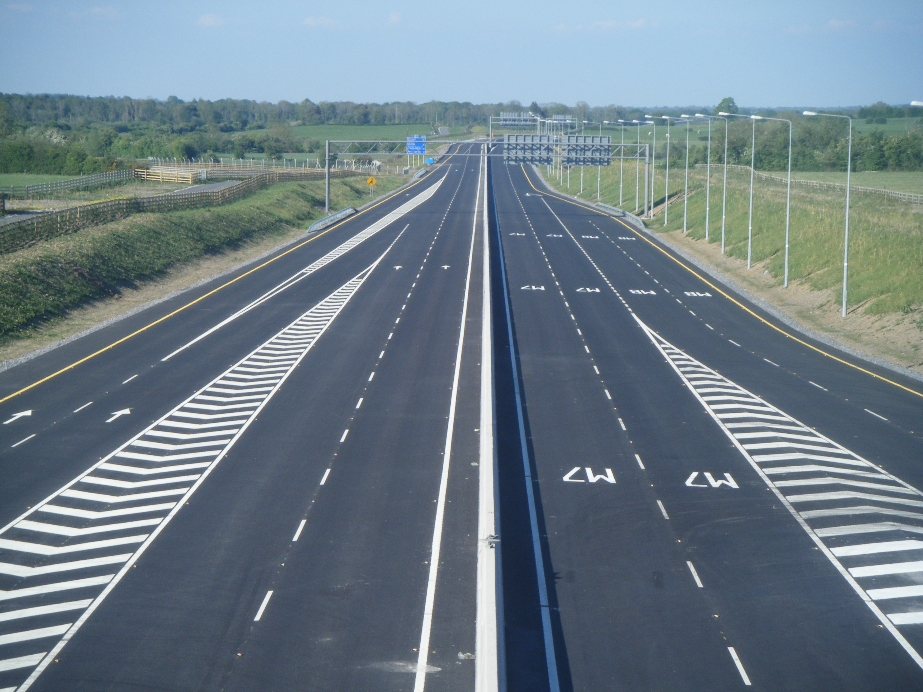
 The M7/M8 interchange at M7 junction 19 just days before the scheme opened to traffic on 28 May 2010.
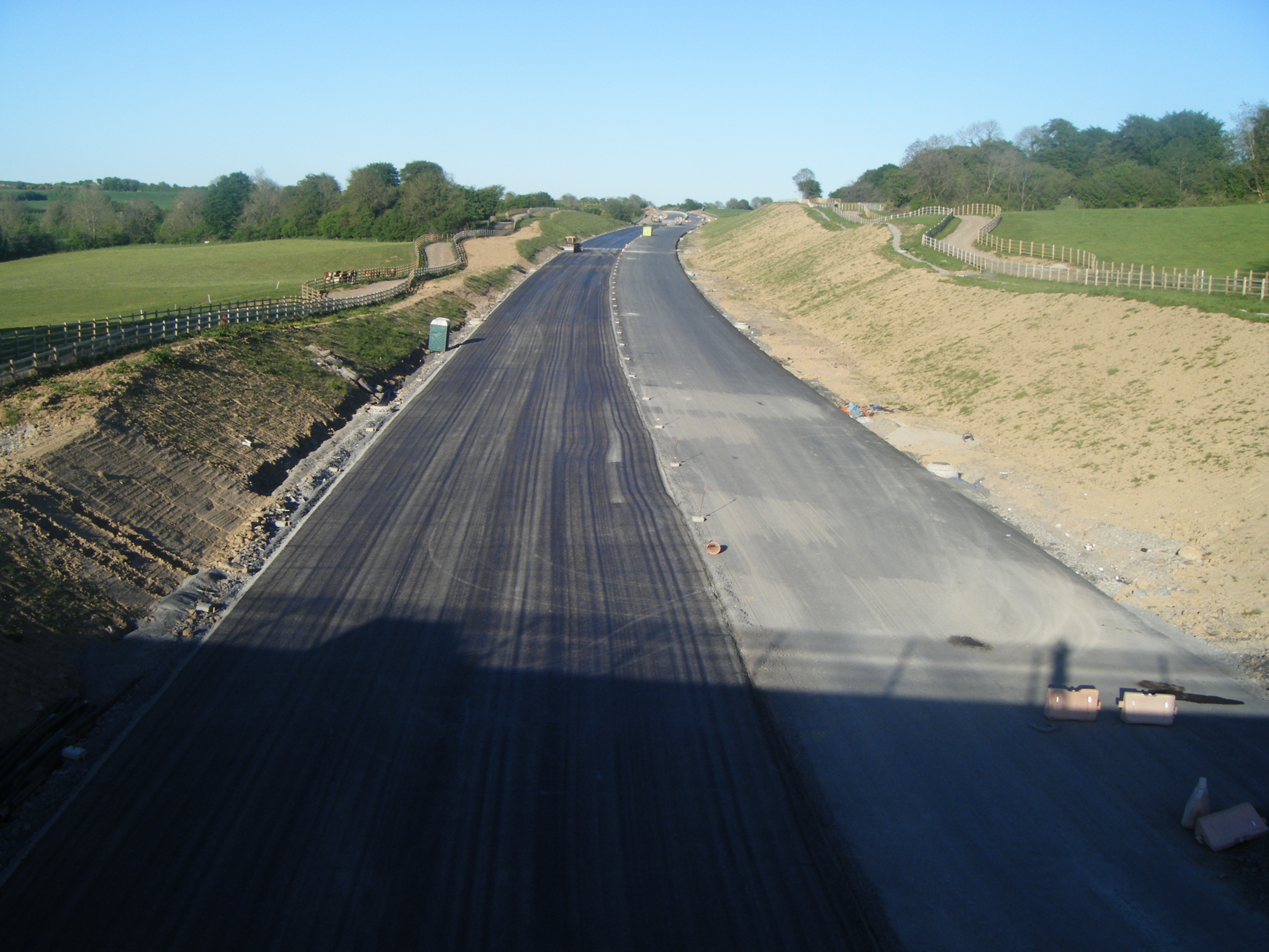
 The M7 Castletown-Nenagh Scheme under construction east of Dunkerrin, 22 May 2010.
N7 Naas dual carriageway Eastbound Junction Westbound M50 motorway 

M50 motorway Newlands Cross (at grade); Belgard Road for Tallaght;
Fonthill Road for Clondalkin (R113)— Newlands Cross (at grade); Belgard Road for Tallaght;
Fonthill Road for Clondalkin (R113)Kingswood Interchange: Outer Ring Road (R136) 
Kingswood Interchange: Outer Ring Road (R136) Citywest Road (N82) 
Citywest Road (N82) Rathcoole 
Rathcoole Steelstown Interchange: Steelstown 
Steelstown Interchange: Steelstown Castlewarden Interchange: Castlewarden (R445) 
Castlewarden Interchange: Castlewarden (R445) Kill Interchange: Kill (R445) 
Kill Interchange: Kill (R445) Johnstown Interchange: Johnstown (R445) 
Johnstown Interchange: Johnstown (R445) M7 motorway Eastbound Junction Westbound Maudlins Interchange: Naas North, Sallins (R445) 
Maudlins Interchange: Naas North, Sallins (R445) Naas South, Caragh and Togher services 
Naas South, Caragh and Togher services No access The SOUTH EAST (M9  )
)
The Curragh, Newbridge (R445) 
The Curragh Kildare, Nurney (R415) 
Kildare Nurney (R415) Monasterevin (R445), Junction 14 Mayfield service area. 
Monasterevin (R445), Junction 14 Mayfield service area. Portarlington, Emo, The Heath (R423) 
Portarlington, Emo, The Heath (R423) Portlaoise (R445) (Carlow, Tullamore, N80) Portlaoise (R445) (Carlow, Tullamore, N80) Abbeyleix (N77); Portlaoise (R423) Abbeyleix (N77); Portlaoise (R423) Portlaoise (R445) 
Mountrath, Castletown, Tullamore (R445) 
No access The SOUTH (M8 ) - Cork, Cashel, FermoyBorris-in-Ossory 
Borris-in-Ossory Roscrea Templemore (N62) Roscrea Templemore (N62) Moneygall 
Moneygall, Cloghjordan Toomevara, Nenagh (R445) 
Toomevara, Nenagh (R445) Knockalton, Nenagh, Thurles (R498) 
Knockalton, Nenagh, Thurles (R498) Carrigatoher, Nenagh (R445), (N52) Carrigatoher, Nenagh (R445), (N52) Birdhill, Killaloe, Ballina (R494)[4] 
Birdhill, Killaloe, Ballina (R494) Annacotty, Limerick (east) (R445), Newport (R503) 
Annacotty, Limerick (east) (R445), Newport (R503) Ballysimon Interchange, Limerick (centre) (R527), Waterford (N24) Ballysimon Interchange, Limerick (centre) (R527), Waterford (N24) Rossbrien Interchange, Limerick (city centre) (R509), Cork (M20 )Rossbrien Interchange, Cork (M20 )Continues as N18 dual carriageway. Motorway service areas
The National Roads Authority plans to construct on-line motorway service areas at approximately 60-kilometre intervals along each of Ireland's interurban routes. Under this plan, the M7 will have two such areas: one will be located near Mountrath (junction 15), while the other will be sited between Nenagh and Roscrea, near junction 23.[5] As of January 2009, no details regarding the physical construction of the M7 service areas have been announced.
An independently owned service area, Junction 14 Mayfield, was opened in June 2011. Accessed from either direction, traffic must use the existing junction 14 slip roads with eastbound traffic then crossing to the south side of the motorway by bridge.[6]
Roadside Art on M7
Roadside art is funded under the Percentage For Arts Scheme where 1% of the scheme budget is allocated to roadside art with a cap of €63,000. The local authorities decide on a theme and are responsible for commissioning the work, usually by open competition.[7] There are several examples along the M7
- Perpetual Motion, a large sphere with road markings situated where the N7 becomes the M7 at Naas. Created by Remco de Fouw in collaboration with Rachel Joynt in 1995. RTE radio show about Perpetual Motion
- Race of The Black Pig on the Kildare bypass. Artist Dan George created (2003) this 0.4 km long installation in three segments, East, Central and West groups.[8]
- The Hitchhiker on the Monasterevin bypass. Artist Willie Malone created this phosphor bronze installation (2005) to represent the wheel. Jointly commissioned by Kildare and Laois County Councils.[9]. In March 2011 The Hitchhiker was removed from the side of the motorway by persons unknown.[10]
- Doon a two-part earthwork with stainless steel superstructure located on the Portlaoise bypass. Viewed from the air the implication is that the earthwork ring stretches across the motorway. Artists Robert McColgan and Irene Benner.
- Architects of the Land, limestone figures of a Man and a Bull, one each side of M7 Nenagh Bypass. Artist Colin Grehan created the sculpture in 2001 from two massive limestone blocks. The mans legs merge into plough shears, his pose designed to indicate an imaginary link to the bull across the carriageways.[11]
Future
Motorway redesignations affecting the M7
On 30 September 2008, the Irish National Roads Authority released the second tranche of potential motorway redesignations. These included parts of the present N7/M7 route.[12]
The M7 was to end at junction 28, where it would have blended into the N7 southern ring road scheme. On the 10th July 2009, minsterial approval was given for 10 km of the Limerick southern-ring and the N7/N20 interchange (and all relevant slip-roads) to be redesignated to motorway status.[13])
If various other schemes on the N7 are to be redesignated motorway (e.g., the section from Dublin to Naas), the route could reach up to 220 km in length.
Widening
It is proposed to widen 13 km of the existing two-lane dual carriageway to D3M standard between the maudlin's interchange (J9) and the M7/M9 junction (J11).[14] The upgrade would include widening the existing carriageways to three lanes in each direction and modifying bridges and junctions on the route to accommodate the extra lane.
See also
- Roads in Ireland
- Motorways in Ireland
- National primary road
- National secondary road
- Regional road
References
- ^ Ordnance Survey Map of Ireland, 2010, Motoring Schemata Section
- ^ "Welcome to N7 Nenagh to Limerick". N7nenaghtolimerick.com. http://n7nenaghtolimerick.com/. Retrieved 2010-06-01.
- ^ RTÉ News: Opening of Nenagh-Limerick Motorway Link
- ^ Hayden, James. "Section of M7 Nenagh-Limerick motorway opens - Tipperary Today". Tipperarystar.ie. http://www.tipperarystar.ie/news/Section-of-M7-NenaghLimerick-motorway.6209695.jp. Retrieved 2010-06-01.
- ^ NRA p.25.
- ^ http://www.hgvireland.com/06/12/new-motorway-service-station-open-this-week/
- ^ http://www.arts-sport-tourism.gov.ie/pdfs/English-text5.htm
- ^ "Kildare County Council Arts Service - Race of the black pig". Kildare.ie. http://kildare.ie/ArtsService/Introductions/PublicArtEntries/Raceoftheblackpig/#d.en.21202. Retrieved 2010-06-01.
- ^ "Kildare County Council Arts Service - The hitch hiker". Kildare.ie. http://kildare.ie/ArtsService/Introductions/PublicArtEntries/Thehitchhiker/#d.en.21222. Retrieved 2010-06-01.
- ^ http://www.independent.ie/entertainment/arts/oneton-hitchhiker-statue-goes-walkabout-2586463.html
- ^ "Nenagh Arts Centre's Blog". Nenaghartscentre.wordpress.com. http://nenaghartscentre.wordpress.com. Retrieved 2010-06-01.
- ^ http://www.transport.ie/upload/general/10978-8.pdf
- ^ "300km of roads to be assigned as motorways - The Irish Times - Tue, Jul 14, 2009". The Irish Times. 2009-07-14. http://www.irishtimes.com/newspaper/ireland/2009/0714/1224250638091.html. Retrieved 2010-06-01.
- ^ [1][dead link]
External links
- Roads Act 1993 (Classification of National Roads) Order 2006 – Department of Transport
- M7 Portlaoise to Castletown scheme website
Roads in Ireland Motorways National primary roads National secondary roads Regional roads (R101–R399) R101 · R102 · R103 · R104 · R105 · R106 · R107 · R108 · R109 · R110 · R111 · R112 · R113 · R114 · R115 · R116 · R117 · R118 · R119 · R120 · R121 · R122 · R123 · R124 · R125 · R126 · R127 · R128 · R129 · R130 · R131 · R132 · R133 · R134 · R135 · R136 · R148 · R149 · R150 · R151 · R152 · R153 · R154 · R155 · R156 · R157 · R158 · R159 · R160 · R161 · R162 · R163 · R164 · R165 · R166 · R167 · R168 · R169 · R170 · R171 · R172 · R173 · R174 · R175 · R176 · R177 · R178 · R179 · R180 · R181 · R182 · R183 · R184 · R185 · R186 · R187 · R188 · R189 · R190 · R191 · R192 · R193 · R194 · R195 · R196 · R197 · R198 · R199 · R200 · R201 · R202 · R203 · R204 · R205 · R206 · R207 · R208 · R209 · R210 · R211 · R212 · R213 · R214 · R229 · R230 · R231 · R232 · R233 · R234 · R235 · R236 · R237 · R238 · R239 · R240 · R241 · R242 · R243 · R244 · R245 · R246 · R247 · R248 · R249 · R250 · R251 · R252 · R253 · R254 · R255 · R256 · R257 · R258 · R259 · R260 · R261 · R262 · R263 · R264 · R265 · R266 · R267 · R268 · R277 · R278 · R279 · R280 · R281 · R282 · R283 · R284 · R285 · R286 · R287 · R288 · R289 · R290 · R291 · R292 · R293 · R294 · R295 · R296 · R297 · R298 · R299 · R310 · R311 · R312 · R313 · R314 · R315 · R316 · R317 · R318 · R319 · R320 · R321 · R322 · R323 · R324 · R325 · R326 · R327 · R328 · R329 · R330 · R331 · R332 · R333 · R334 · R335 · R336 · R337 · R338 · R339 · R340 · R341 · R342 · R343 · R344 · R345 · R346 · R347 · R348 · R349 · R350 · R351 · R352 · R353 · R355 · R356 · R357 · R358 · R359 · R360 · R361 · R362 · R363 · R364 · R365 · R366 · R367 · R368 · R369 · R370 · R371 · R372 · R373 · R374 · R375 · R376 · R377 · R378 · R379 · R389 · R390 · R391 · R392 · R393 · R394 · R395 · R396 · R397 · R398 · R399Regional roads (R400–R699) R400 · R401 · R402 · R403 · R404 · R405 · R406 · R407 · R408 · R409 · R410 · R411 · R412 · R413 · R414 · R415 · R416 · R417 · R418 · R419 · R420 · R421 · R422 · R423 · R424 · R425 · R426 · R427 · R428 · R429 · R430 · R431 · R432 · R433 · R434 · R435 · R436 · R437 · R438 · R439 · R440 · R441 · R442 · R443 · R444 · R445 · R446 · R448 · R449 · R458 · R459 · R460 · R461 · R462 · R463 · R464 · R465 · R466 · R467 · R468 · R469 · R470 · R471 · R472 · R473 · R474 · R475 · R476 · R477 · R478 · R479 · R480 · R481 · R482 · R483 · R484 · R485 · R486 · R487 · R488 · R489 · R490 · R491 · R492 · R493 · R494 · R495 · R496 · R497 · R498 · R499 · R500 · R501 · R502 · R503 · R504 · R505 · R506 · R507 · R509 · R510 · R511 · R512 · R513 · R514 · R515 · R516 · R517 · R518 · R519 · R520 · R521 · R522 · R523 · R524 · R525 · R526 · R527 · R548 · R549 · R550 · R551 · R552 · R553 · R554 · R555 · R556 · R557 · R558 · R559 · R560 · R561 · R563 · R564 · R565 · R566 · R567 · R568 · R569 · R570 · R571 · R572 · R573 · R574 · R575 · R576 · R577 · R578 · R579 · R580 · R581 · R582 · R583 · R584 · R585 · R586 · R587 · R588 · R589 · R590 · R591 · R592 · R593 · R594 · R595 · R596 · R597 · R598 · R599 · R600 · R601 · R602 · R603 · R604 · R605 · R606 · R607 · R608 · R609 · R610 · R611 · R612 · R613 · R614 · R615 · R616 · R617 · R618 · R619 · R620 · R621 · R622 · R623 · R624 · R626 · R627 · R628 · R629 · R630 · R631 · R632 · R633 · R634 · R635 · R637 · R638 · R639 · R659 · R660 · R661 · R662 · R663 · R664 · R665 · R666 · R667 · R668 · R669 · R670 · R671 · R672 · R673 · R674 · R675 · R676 · R677 · R678 · R679 · R680 · R681 · R682 · R683 · R684 · R685 · R686 · R687 · R688 · R689 · R690 · R691 · R692 · R693 · R694 · R695 · R696 · R697 · R698 · R699Regional roads (R700–R940) R700 · R701 · R702 · R703 · R704 · R705 · R706 · R707 · R708 · R709 · R710 · R724 · R725 · R726 · R727 · R729 · R730 · R731 · R733 · R734 · R735 · R736 · R737 · R738 · R739 · R740 · R741 · R742 · R743 · R744 · R745 · R746 · R747 · R748 · R749 · R750 · R751 · R752 · R753 · R754 · R755 · R756 · R757 · R758 · R759 · R760 · R761 · R762 · R763 · R764 · R765 · R766 · R767 · R768 · R769 · R770 · R772 · R773 · R774 · R801 · R802 · R803 · R804 · R805 · R806 · R807 · R808 · R809 · R810 · R811 · R812 · R813 · R814 · R815 · R816 · R817 · R818 · R819 · R820 · R821 · R822 · R824 · R825 · R826 · R827 · R828 · R829 · R830 · R831 · R833 · R834 · R835 · R836 · R837 · R838 · R839 · R840 · R841 · R842 · R843 · R846 · R847 · R848 · R849 · R851 · R852 · R853 · R854 · R855 · R857 · R858 · R859 · R860 · R863 · R864 · R865 · R866 · R867 · R868 · R870 · R871 · R873 · R874 · R875 · R876 · R877 · R880 · R883 · R884 · R885 · R886 · R887 · R888 · R889 · R890 · R891 · R895 · R896 · R898 · R899 · R900 · R901 · R902 · R903 · R904 · R906 · R907 · R908 · R909 · R910 · R911 · R913 · R914 · R915 · R916 · R917 · R918 · R919 · R920 · R921 · R922 · R923 · R924 · R925 · R926 · R927 · R928 · R929 · R930 · R931 · R932 · R933 · R934 · R935 · R936 · R937 · R940See also: National Development Plan · National Roads Authority · Local roads · Trunk roads Transport in Dublin Air Rail Tram*Road Bus corridorsR101 · R102 · R103 · R104 · R105 · R106 · R107 · R108 · R109 · R110 · R111 · R112 · R113 · R114 · R115 · R116 · R117 · R118 · R119 · R120 · R121 · R122 · R123 · R124 · R125 · R126 · R127 · R128 · R129 · R130 · R131 · R132 · R133 · R134 · R135 · R136 · R148 · R156 · R403 · R445 · R761 · R810 · R817 · R821 · R822 · R824 · R825 · R826OtherWater CanalsPortsAgencies *=Tram systems no longer run. Information in parentheses shows the operator(s) Categories:- Motorways in the Republic of Ireland
- Roads in County Tipperary
- Roads in County Kildare
- Roads in County Laois


Wikimedia Foundation. 2010.