- Borris-in-Ossory
Infobox Irish Place
name = Borris-in-Ossory
gaeilge = Buiríos Mór Osraí
crest
motto =
map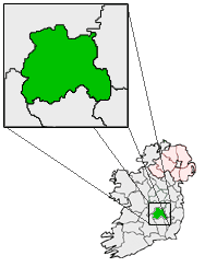
pin coords = left: 83px; top: 71px
north coord =
west coord =
irish grid =
area =
elevation =
province =Leinster
county =County Laois
town pop =
rural pop =
census yr =
web =
|Borris-in-Ossory ("Buiríos Mór Osraí" in Irish) is a village in west
County Laois , Ireland, on the N7 National PrimaryDublin toLimerick route close to theCounty Tipperary border between the towns ofMountrath andRoscrea .cite web | title=Borris in Ossory Village Plan | work=Laois County Council, June 2007 | url=http://www.laois.ie/media/Media,4024,en.pdf | accessdate=2008-06-28]Features
The village contains facilities such as a school, churches, community hall and convenience retail outlets and low to medium order services. Recent development includes the construction of new residential estates to the north-west of the village and to the south of the Main Street. The village centre comprises the Main Street and includes retail, commercial, institutional, educational and residential functions. Landmark buildings include the
Church of Ireland and former courthouse. The renovated O’Brien Hall has a communal and recreational role within the local community. There is an extensive range of Community Groups in the village and a Play School, Crèche, After School Club and school collection services.Transport
The village is located on the N7 National Primary Route with access to several Regional Routes. It is served by inter urban bus links to Dublin, Limerick,
Galway ,Cork andCarlow and a town link service connects nearby towns and villages. Ballybrophy Railway Junction is located approximately 5km south of the village.Education
Convent of Mercy National School currently has 5 classrooms and is currently preparing plans for a new 8 classroom school extension. The school was built in 1965. [cite web | title=Convent of Mercy, Borris-in-Ossory | work=Convent of Mercy website | url=http://www.iol.ie/~hyregan/borris/history.html | accessdate=2008-06-28]
Religion
*St. Canice's, Main Street
port
The local
Gaelic Athletic Association club isBorris-in-Ossory GAA . The Gaelic playing fields are located 1.5km to the east of the village. The amenities include a playing pitch, dressing and meeting rooms.ee also
* List of towns in Ireland
References
External links
* [http://www.from-ireland.net/lewis/laois/binossory.htm Borris in Ossory - Lewis Topographical Dictionary, 1837]
Wikimedia Foundation. 2010.