- Ballina, County Mayo
-
Ballina
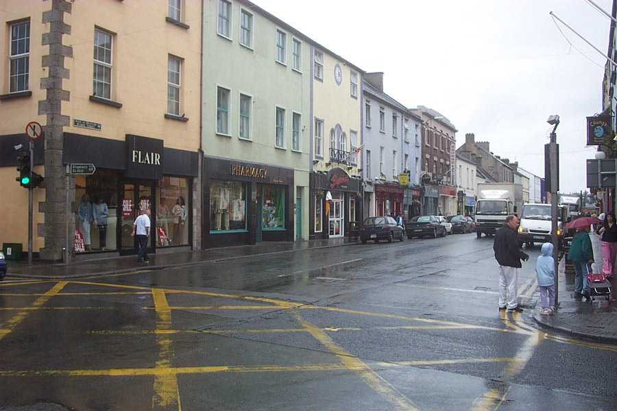
Béal an Átha— Town — Ballina town centre
Coat of armsLocation in Ireland
 Ballina
Coordinates: 54°07′00″N 9°10′00″W / 54.1167°N 9.1667°WCoordinates: 54°07′00″N 9°10′00″W / 54.1167°N 9.1667°W Country Ireland Province Connacht County County Mayo Elevation 7 m (23 ft) Population (2006)[1] – Urban 10,056 – Environs 353 Irish Grid Reference G240192 Ballina (Irish: Béal an Átha or Béal Átha an Fheadha, lit. mouth of the ford) is a large town in north County Mayo in Ireland. It lies at the mouth of the River Moy near Killala Bay, in the Moy valley and Parish of Kilmoremoy, with the Ox Mountain range to the east and the Nephin Beg mountains to the west. The town occupies two Baronies; Tirawley on the west bank of the Moy River, and Tireragh, a Barony within the County of Sligo, on its east banks. Ballina is the postal address for a great deal of North Mayo including those who live in Erris, many miles to its north west.
The recorded population of Ballina's urban area is 10,409. Census 2006 figures released by the Central Statistics Office in September 2007 showed that Ballina had the highest rate of unemployment amongst large towns in the Republic of Ireland. Some 15.8% of Ballina's population was out of work when the 2006 census was taken.[2][3] Unlike neighbouring towns such as Castlebar and Sligo, it is claimed that Ballina suffered from a lack of government investment for many years because it was not effectively represented in Dáil Éireann.[4]
Contents
History
According to Encyclopædia Britannica the first signs of settlement on the site of the town dates from around 1375 when an Augustinian friary was founded. Belleek, now part of the town, pre-dates the town’s formation, and can be dated back to the late 15th century, or early 16th century[citation needed]. However, what is now known as Belleek Castle was built in 1831. Ballina was officially established as a town in 1723 by O'Hara, Lord Tyrawley.[citation needed]
Belleek Estate
The Belleek estate once occupied lands from the Moy River to the modern-day Killala Road. This included part of the ‘Old French Road’ which General Humbert marched on from Killala, and beside part of which in the Killala Road-Belleek area was Belleek’s reservoir – presumably destroyed in the construction of Coca-Cola’s ‘Ballina Beverages’ factory; the ‘Old French Road’ is now closed off at that point, with what amounts to diversion road signs claiming Humbert marched where he did not.[citation needed]
Old borders
 Humbert Monument on Humbert Street in Ballina
Ballina is located on the west side of the County Mayo - County Sligo border. Part of what is now the town was once (prior to the Local Government Act, 1898) part of County Sligo, with the border for the most part once being the River Moy, east of which was in Sligo, including Ardnare], and Crockets Town (the Quay).[5]
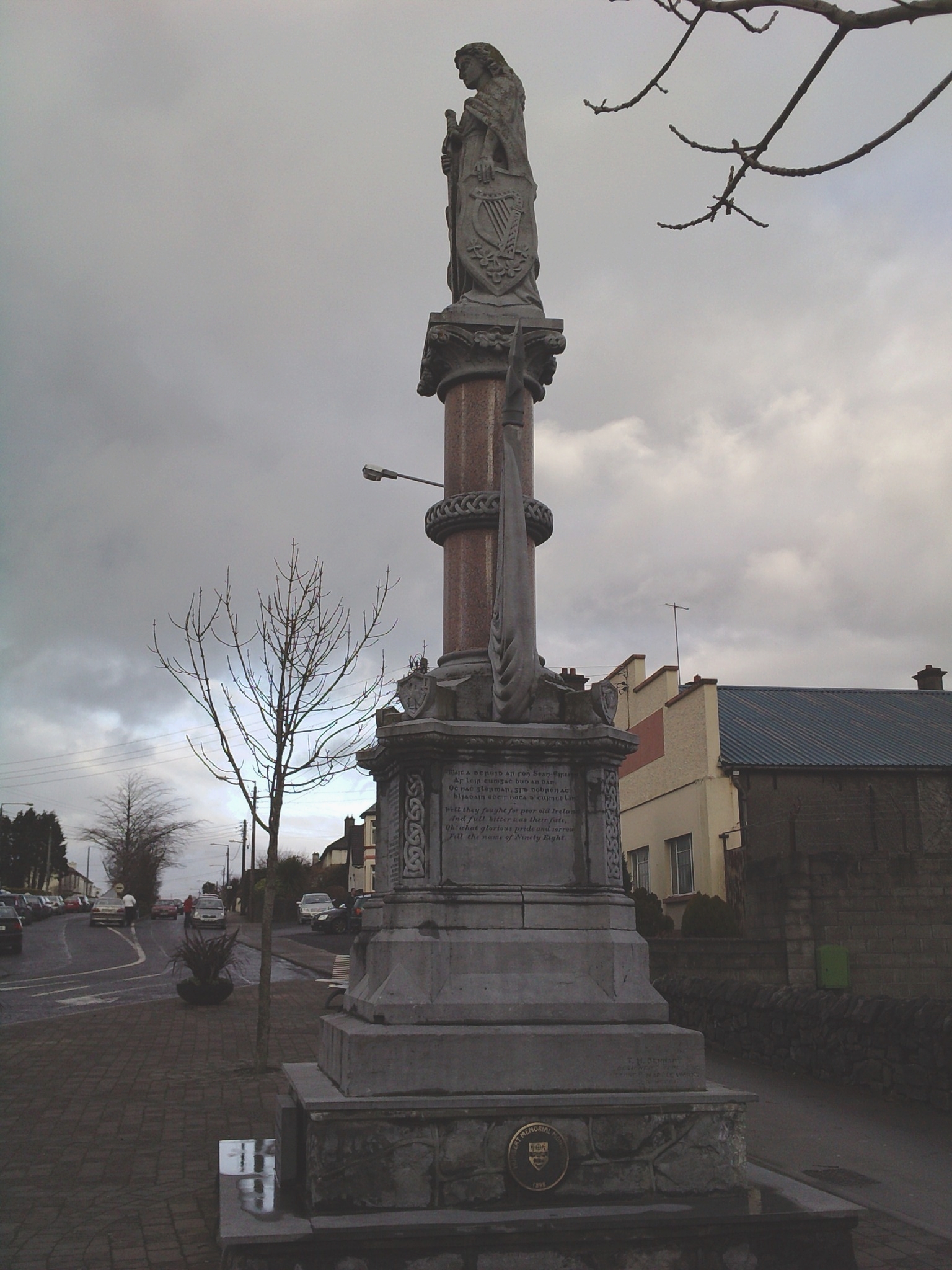
General Humbert and the French Landing - 1798
The Centenary memorial (the Humbert Monument) was dedicated on 11 May 1898 to commemorate the 100th anniversary of the French landing at Killala in support of the Irish Rebellion of 1798. The monument was originally sculptured by a Dublin Craftsman but in recent years it has been restored locally. The figure on the monument is not Humbert but Mother Ireland. Maud Gonne, a famous Irish woman, unveiled the monument. At the event Maud Gonne famously poured water over another speaker's (an IRB member) head. The monument was moved to its current location on Humbert Street in 1987, where is was re-dedicated by Maud Gonne's son, Seán MacBride.
Megalithic tomb
The Dolmen of the Four Maols is located on 'Primrose Hill' behind Ballina's Railway Station. The dolmen dates from c2,000 B.C.[citation needed] and is sometimes called locally the 'Table of the Giants'. Legend has it that the dolmen is the burial place of the four Maols. The four Maols murdered Ceallach[disambiguation needed
 ], a 7th century Bishop of Connacht and were hung at Ardnaree - the Hill of Executions. Tradition says that their bodies were buried under the dolmen.[6]
Architecture, planning, and housing
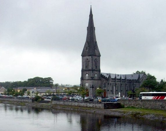
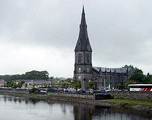 St Muredach's Cathedral on the banks of the River Moy in Ballina
The town has some notable architecture, including the 15th-century Moyne Abbey, and St Muredach's Cathedral, which is the Cathedral Church of the Roman Catholic Diocese of Killala. Work on the Cathedral began in 1827. The stone was quarried locally and the roof and ceiling were completed before the Great Famine (1845). The spire was completed in 1855 and by 1875 the organ had been commissioned. Outside Ballina, on a small hill to the west, stands a dolmen, thought to have been erected 4000 years ago. The only all-boys' secondary school in the town, St. Muredach's College, celebrated its centenary on 10 September 2006.
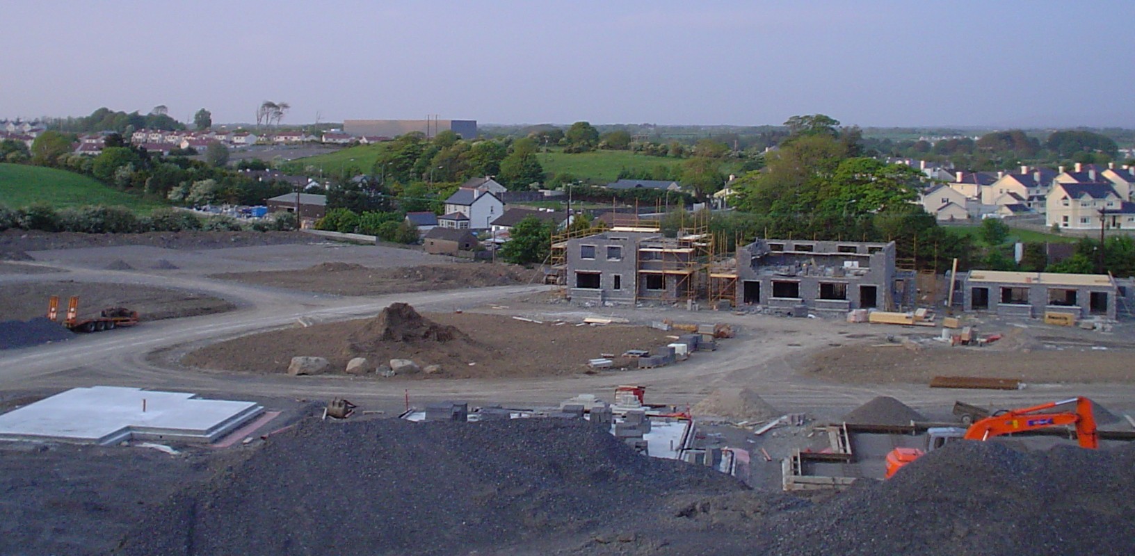
Ballina has many listed buildings including Georgian Housing on the Banks of the Moy, the Ice House Building which has been converted into an exclusive hotel,[2] and the former provincial bank, which now houses the Jackie Clarke Museum. The streets of Ballina consist mainly of three and four storey Georgian and Victorian buildings, though the structures of several buildings are actually far older.
Infrastructure
Education
The primary schools that serve the town include Scoil Iosa of the Convent of Mercy (mixed), Scoil Padraig (all-boys), the Quay NS (mixed), Culleens NS on the Killala Road (mixed), Breaffy NS (mixed), Behy NS (mixed) and Scoil na gCeithre Maol (mixed), a gaelscoil situated by the Ridgepool, which is set to transfer to a larger facility on the Killala road for the coming school year. There are also at least 3 Montessori schools and many pre-schools.
There are three secondary schools - St Muredach's College (all-male)[3], Moyne College (mixed)[4], and St Marys of the Convent of Mercy (all-female)[5]. Other local mixed secondary school options include schools in Crossmolina, Foxford and Lacken Cross (past Killala).
A large, ultra-modern facility opened on McDermott Street (convent road) for the 2009-2010 school year to serve the needs of children with mild learning disabilities. It is an amalgamation of the 2 old special needs schools, St. Dympna's and St. Nicholas'.
The Newman Institute of education is located in a new campus on Abbey St. It is a charitable organisation working in conjunction with the Catholic Diocese of Killala in the field of Catholic education.
Communications and media
Ballina is one of the towns due to have a MAN (Metropolitan Area Network), the ductings and fiber optic cables are in place, but with no ISP Connections. The MANs are being built for the Department of Communications, they will be run by a private operator, but will remain the property of the government.
Local media
The Western People is a local newspaper based in Ballina and until recently was also printed at its premises in the town. It is owned by the Cork-based Thomas Crosbie Holdings. Two weekly freesheets, the Mayo Advertiser and "The Northwest Express" are distributed throughout Ballina. The Connaught Telegraph, published in Castlebar and the Mayo News published in Westport, also carry local news related to Ballina, though are less popular and sold in few outlets. Mid West Radio is the local station with an office in the town. An online news service, MayoToday.ie, also carries news and information related to Ballina; the website, which is based in the town, is one of the first regional news websites in Ireland.
Historically there has been a number of newspapers directly linked with the town, these include:
- Ballina Advertiser, Mayo And Sligo Commercial Gazette (10 Jan 1840 – 10 Nov 1843)
- Ballina Chronicle (2 May 1849 – 14 Aug 1851; M/W Connaught Watchman)
- Ballina Herald (1844 – Oct 1961; C/A 'Ballina Herald and Mayo and Sligo Advertiser')
- Ballina Herald and Mayo and Sligo Advertiser (Oct 1891 - 28 Apr 1962; M/W 'Western People')
- Ballina Impartial, or Tyrawly Advertiser (13 Jan 1823 – 16 Nov 1835)
- Ballina Journal and Connaught Advertiser (C/A 1880 - 11 Mar 1895)
- Connaught Watchman (2 Aug 1851 – 3 Oct 1863)
- INK Magazine - (Feb 2011 - Present)
- Tyrawly Herald; or Mayo and Sligo Intelligencer (1844–1870)
- Western Gem (1843)
- Western Journal (1977 - 15 Feb 1980; C/A Sligo Journal 22 Feb 1980 – 11 Mar 1983)
- Western People (1883 – present) Western People
- Western Star (1835–1837)
[M/W = merged with; C/A = continued as |Source: National Library of Ireland
Ballina was one of the first towns in the West to embrace local (unlicenced) radio in the early 1980s, and throughout the 1980s had a number of local stations before the advent of legalised local radio in 1989.
The stations included: ARW - Alternative Radio West, which operated from Lord Edward Street, Castle Radio - which was based in Belleek Castle, Westward Radio - broadcast from Howley Street (Later Teeling St), Holiday FM and TCR both of which were based on Tone Street.
Transport links
Roads
The N26 is the main road to Dublin, it leaves the town south to Foxford, and after Swinford joins the N5 to Dublin. N59 comes from Belmullet and Crossmolina in the west, goes through the town to Sligo to the northeast. The R314 is a regional road to Killala, and then Ballycastle. The R294 goes to south County Sligo via 'the Windy Gap' in the Ox Mountains. It is used as an alternative route to Dublin, via Tubbercurry and Boyle.
There is a plan to build a ring road around the town, but this has been in place for a number of years. A small stretch of the N26 leaving the town to Foxford was recently upgraded. Stage 2 from this section to Bahola is currently at preliminary design and is to consist of 18.1 km of Type 2 dual carriageway encompassing a bypass of Foxford. The scheme is currently with An Bord Pleanála.[7] An inner-relief road was completed just before Christmas 2005, it links the Killala Road (R314) and Crossmolina Road (N59) - it goes through ‘Rockwell’ housing estate on the Killala Road and joins up to other roads at St Patrick's Church, near the Crossmolina Road. A section of the N59 from the town to the Sligo border is currently been upgraded.
The 'Ballina and Environs Development Plan, 2003-2009' plans for cycle lanes "on all major traffic routes leading into town”, and for the building of stage one of the "outer ring road linking the N26 (Foxford Road) with the N59 – West (Crossmolina Road), and the R314 (Killala Road)”.[8]
Bridges
There are 2 main bridges straddling the Moy in the town centre. The first, the Armstrong and West, or Lower bridge, was built in 1835. The second, the Ham or Upper bridge, was built in the following year of 1836 by Thomas Ham at a cost of £3,000.00. Both bridges are limestone, and have 4 and 5 arches respectively. Traffic flows in a one-way direction around these 2 bridges and is often heavily backed up on both sides, the reason for calls for a third bridge further down the river.
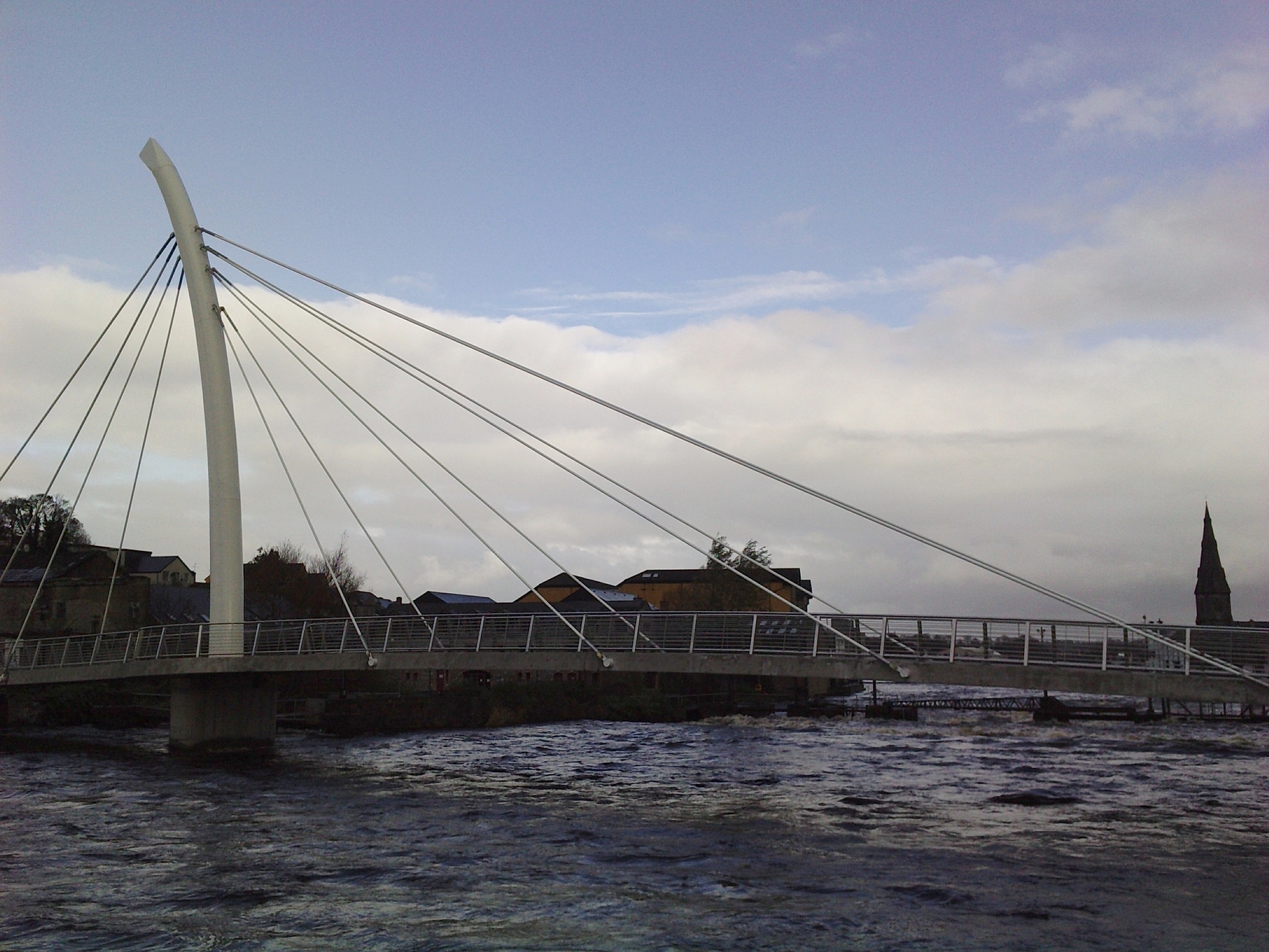
 The Salmon Weir Bridge over the River Moy.
The Salmon Weir Bridge is a pedestrian bridge over the River Moy from Barrett St. to Ridge Pool Rd. The bridge, which was designed to resemble a fishing rod, was opened in July 2009.
Bus
Ballina Bus Station is host to a Bus Éireann bus depot. Bus Éireann have stated that they intend to develop services similar to the 24-hour Dublin-Belfast route on the Ballina-Dublin route.[9] The route currently runs 7 services a day between Ballina and the capital. In 2007 Bus Éireann launched a direct bus from Dublin Airport to Ballina. A Ballina to Enniscrone bus(which is run by several companies during the summer months) was the first chartered bus service in the country.
Rail
Ballina Train Station is located on the N26 beside the bus station. Departing trains stop at Foxford before terminating at Manulla junction where passengers can connect to trains going to Castlebar, Westport or Dublin (Heuston Station). Trains to Dublin operate three times daily and on Friday evenings a train operates direct from Dublin to Ballina. Ballina is a major rail freight hub, with a direct freight line from the town to Waterford Port transporting pulpwood for Coillte, and as of late 2009, a direct Dublin Port line. This new line is used to transport containers of Coca-Cola concentrate from the town’s plant, removing almost 4,000 trucks off Irish roads. It was suggested in the McCarthy Report the line from the Manulla junction to Ballina be closed, resulting in the loss of these freight lines. However CIE has since stated that it has absolute no intention to close this line, which it said is the only profitable freight line in the country.
Air
Ireland West Airport Knock (Knock Airport, NOC) is about 50.7 km, or 31.5 miles from Ballina. There are nine or more services a day from the airport to London, Birmingham, Bristol, Manchester, Dublin and Glasgow. Bus Éireann now runs a shuttle service about five times a day from the airport to Charlestown, from where commuters can get a connecting bus to Ballina. Sligo Airport is about 69 km, or 43 miles from Ballina and has two flights a day to Dublin, operated by Aer Arann.
Retail
Ballina is the principle service centre in North Mayo. Whilst Ballina is the largest town in County Mayo in terms of area, it has taken second place behind Castlebar in terms of total retail and service sector floor areas. The population of the town is growing faster than its neighbouring hub, but the deficit in its retail and commercial sector also continues to grow. There are a number of national multiple retailers within the town centre, including Tesco, Penneys, A|wear, swamp, Easons, Shaws and Dunnes Stores which are all key anchors and attract customers to the town centre. While the larger retailers have the most significant proportion of retail space, there is a very large quantity of small, local, high-quality retailers in the town. Over 1,000 jobs will be created with the planned €80 million shopping complex in Ballina. The planned multi-tenant development, which will be the largest of its kind in the county is planned for the Humbert Street carpark, with UK retailer Marks & Spencer rumoured to become the anchor tenant.[10]
Social life and culture
Ballina has a very lively entertainment scene with ample choice when it comes to eating out and hitting the town. A longstanding reputation for being a great place to eat out, Ballina has a wide variety of restaurants serving Irish, European and Asian cuisine.
With its diverse range and large number of traditional and contemporary style pubs, Ballina has something for everyone, whether that’s traditional Irish music, live bands, DJ’s or somewhere quiet where you can have a relaxing chat. For those who wish to party into the early hours Ballina has a great selection of late bars and 2 nightclubs.
The Old Newman Institute building on Barrett Street is home to the Ballina Arts Centre, which is currently redeveloping the centre to incorporate a 240-seat auditorium, dance studio, studio rehearsal space, a second exhibition gallery and coffee shop/restaurant. The sod was officially turned on the project on 19.10.09. Ballina Arts Centre is access-driven and participatory in ethos.
In 2009 the Jackie Clarke Collection [11] is set to go on display when the Clarke Museum opens in the old provincial bank. The Jackie Clarke Library and Archive is one of the most important Irish collections in the world. During his lifetime Jackie sourced and purchased many unique documents that scholars had believed to be lost, including sole surviving copies of publications, rare handbills and proclamations, unpublished manuscripts and political writings. The breadth and importance of Jackie’s passionate lifelong project was relatively unknown until after his death in 2000. He donated all his collections to the state, under the condition they would stay in Ballina.
Tourism, sports and events
Tourism
Ballina's location on the River Moy favours salmon fishing, and one of the best spots, the Ridge Pool, is situated in the heart of the town.
Sport
- Ballina Stephenites, is one of the local Gaelic Athletic Association club teams. The name also refers to the town’s Gaelic Athletic Association grounds, James Stephens Park.
- Ballina Town FC is one of the town's soccer clubs, playing their home matches at Belleek Park.The town is also represented by Ballina United.
- In basketball, Team Loftus Recycling represent the town in Men's Division 1. Until recntly the club performed in the National Super League as Team Merry Monk. However, financial difficulties led to the club's demotion.
- Ballina also has Mayo's only Gymnastics Training Centre, Nadia Gym, just around the corner from Juck Collins, who is well known around the community for his work as a security guard in a local shopping centre, supervalu. He was presented with a medal at the 2009 Slamon Festival for his commitment.
- Ballina Golf Club is an 18 hole parkland golf course on the outskirts of the town on the Bonniconlon Road. Ballina Golf Club is set in a scenic location overlooking the Moy Valley. The course is a Par 71 course, 5933 metres long.
- Ballina is also one of the bigger clubs in the county as regards athletics, with a floodlight outdoor 400m track and a large cross country pitch which often holds the AAI Connaght and Mayo finals.
- The town also has a notable martial arts school, Moy Valley Freestyle. This school studies a freestyle form of martial arts.
- The local triathlon club Liquid Motion holds a triathlon in the town every summer, usually in July to coincide with The Ballina Street and Arts festival.
Ballina Salmon Festival
The Ballina Salmon Festival is held annually in July in the town. The festival includes Heritage Day, where most of the centre of the town is closed to traffic and the streets fill with arts and craft stalls and demonstrations of transport from days gone by. The festival finale was a Mardi Gras followed by a fireworks display, until 2010, when financial restrictions precluded the organisers from holding the Mardi Gras.
The Salmon Festival for 2011 will take place between Sunday 10 July and Sunday 17 July.
Additional information
Prominent residents (past and present)
- Edward Whelan (1824 – 10 December 1867)
- Mary Robinson (Born 21 May 1944)
- Ray Foley, DJ on Today FM[12]
- Jack Charlton owns a holiday home in Ballina.
- Fr. Parick Smyth - involved in Eureka Stockade, Ballarat. Australia.[13]
- Gavin Duffy Connacht/Irish rugby player
- Liam Corrigan Former Mayo Hurling All-Star.
Twin towns and sister cities
Ballina is twinned with:
 Craigavon, Northern Ireland, United Kingdom
 Athis-Mons, Île-de-France, France
 Pittsfield, Massachusetts, United States of America
- Scranton, Pennsylvania, United States of America
 Ballina, New South Wales, Australia[14]
Photo gallery
-
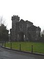
Gate House at Belleek Forest Park.
-

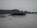
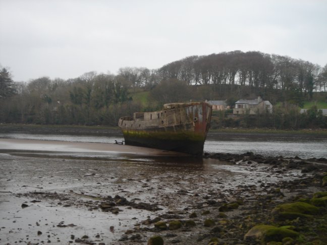
The concrete ship the 'SS Creteboom' in the River Moy.
-

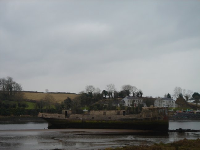
A side view of the Creteboom.
-
The Folrette also in the Moy river.
-
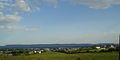
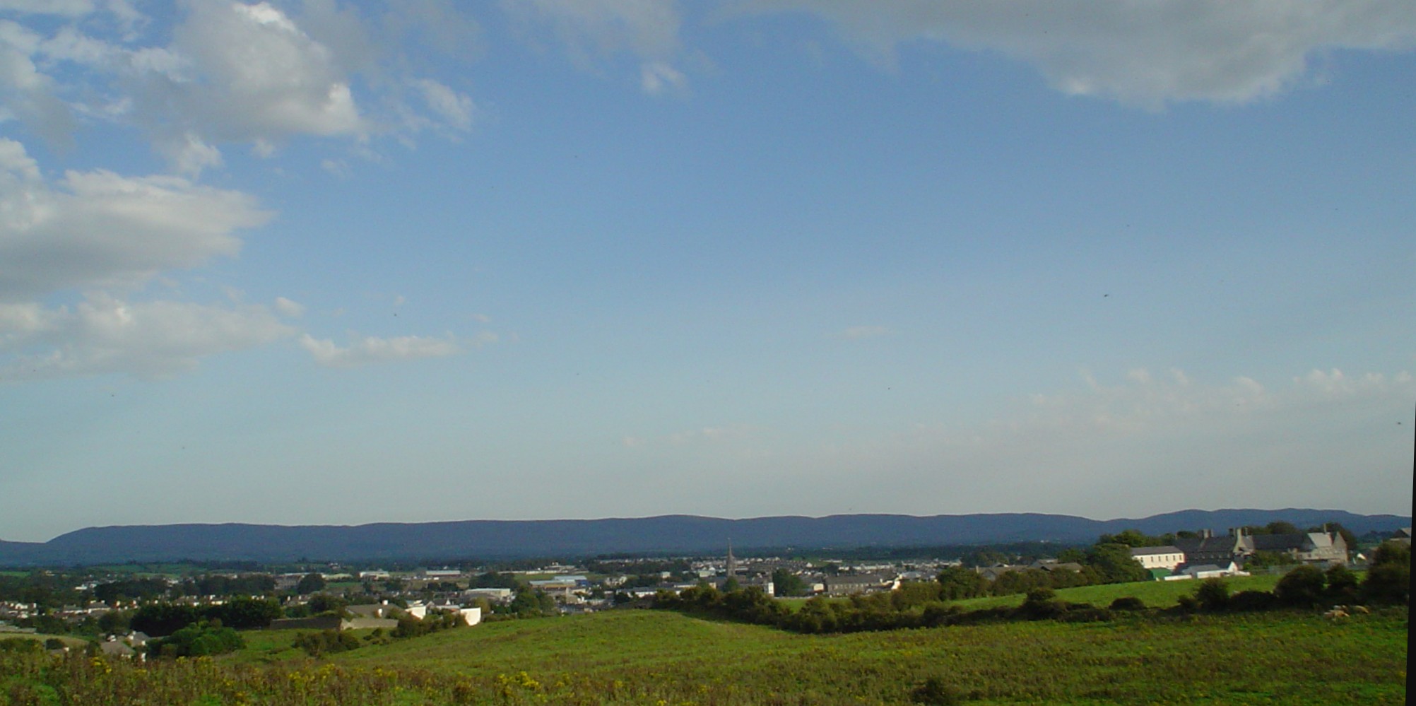
A view of the town from a beside Leigue graveyard - one of the highest points in area.
-
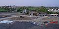
A view of Rockwell housing estate and the Killala Road area.
-
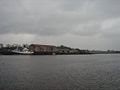
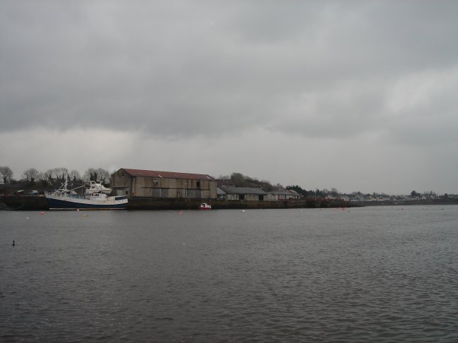
The Quay, at Crocketstown, Ballina.
-

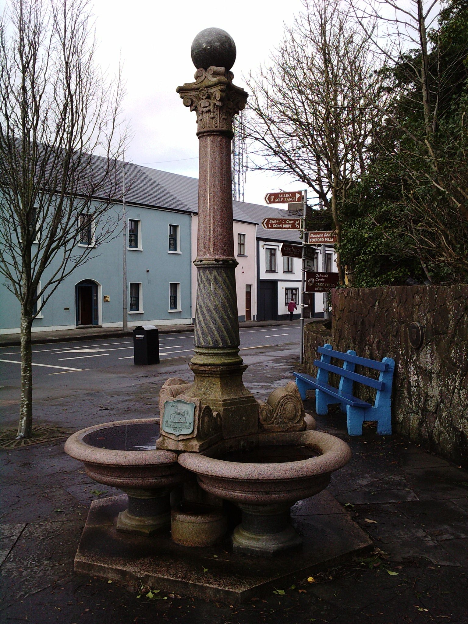
The Font, Teeling street, Ballina.
-
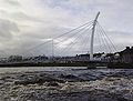
The pedestrian footbridge over the River Moy (Ridge Pool) in Ballina.
-

The pedestrian footbridge over the River Moy (Ridge Pool) in Ballina.
See also
References
- ^ "Census 2006 – Volume 1 – Population Classified by Area" (PDF). Central Statistics Office Census 2006 Reports. Central Statistics Office Ireland. April 2007. http://www.cso.ie/census/documents/census2006_volume_1_pop_classified_by_area.pdf. Retrieved 2011-05-07.
- ^ Irish Census 2006 - Principal Economic Status and Industries: Ballina, County Mayo had the highest unemployment rate among large Irish towns with 15.8% unemployed; Tralee: 14.2% and Dundalk: 13.9%
- ^ Census 2006 Volume 7 - Principal Economic Status and Industries
- ^ [1]
- ^ http://www.rootsweb.ancestry.com/~irlsli/borders.html
- ^ http://www.megalithicireland.com/Ballina.htm
- ^ http://www.nra.ie/RoadSchemeActivity/MayoCountyCouncil/N26BallinatoBoholaStage2/SchemeName,16467,en.html
- ^ http://www.mayococo.ie/en/Planning/DevelopmentAreaPlans/CountyAreaDevelopmentPlans/PDFFile,1957,en.pdf
- ^ http://www.insidegovernment.ie/newswire_detail.php?iResearchId=6718
- ^ http://www.mayonews.ie/index.php?option=com_content&task=view&id=3991&Itemid=38
- ^ http://www.mayococo.ie/en/Services/ClarkeCollection/
- ^ http://www.todayfm.com/Shows/Weekdays/Ray-Foley/team.aspx
- ^ http://eureka.imagineering.com.au/biographies.htm
- ^ "Sister City Agreement". http://www.ballina.nsw.gov.au/cmst/ballina004/view_doc.asp?id=188&cat=161. Retrieved 2009-07-10.
External links
- Ballina Town Council
- Ballina railway station
- Moy Valley website of Ballina Chamber of Commerce
- Ballina Salmon Festival, including Street & Arts Festival
- Northwest Fisheries
- Ballina Rugby Club
- Ballina Golf Club
- Belleek Castle - Hotel, Restaurant & Weddings
- Mount Falcon - Historical Castle, Hotel & Fishery
- Ballina Live Online Portal For Ballina Mayo
- MayoToday.ie - Online News and Information for Ballina and County Mayo
Places in County Mayo Towns 
Villages
and townlands- Attymass
- Aughagower
- Aughleam
- Balla
- Ballindine
- Ballintubber
- Ballycastle
- Ballyglass
- Bangor Erris
- Bekan
- Belcarra
- Belderrig
- Bellacorick
- Bellavary
- Binghamstown
- Bohola
- Bonniconlon
- Breaffy
- Carracastle
- Carrowteige
- Castlehill
- Charlestown
- Charlestown-Bellahy
- Cill Ghallagáin
- Cogaula
- Cong
- Corrimbla
- Corroy
- Cregganbaun
- Cross
- Crossmolina
- Delphi
- Derrew
- Doohoma
- Dooniver
- Drummin
- Errew
- Glenamoy
- Glencastle
- Glengad
- Glenhest
- Gob an Choire
- Gweesalia
- Hollymount
- Islandeady
- Keel
- Kilcummin
- Kilkelly
- Killala
- Kilmaine
- Kilmeena
- Kilmovee
- Knock
- Lahardane
- Lecanvey
- Louisburgh
- Mayo
- Meelick
- Moygownagh
- Mulranny
- Murrisk
- Neale
- Newport
- Pontoon
- Rakestreet
- Robeen
- Rossport
- Shammer
- Shrule
- Strade
- Tourmakeady
- Tulrahan
- Turlough
Baronies - List of townlands in County Mayo
- Category:Geography of County Mayo
Categories:- Untranslated Irish place names
- Towns and villages in County Mayo
- 1375 establishments


Wikimedia Foundation. 2010.