- Islandeady
Infobox Irish Place
name = Islandeady
gaeilge = Oileán Éadaígh
crest
motto = Ar Aghaidh Le Cheile
map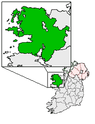
pin coords = left: 68px; top: 70px
north coord = 53.8166667
west coord = 9.4000
irish grid = M092879
area = 4,202 (hectares)
elevation = 57 m
province =Connacht
county =County Mayo
town pop = 1,550
rural pop = -
census yr = 2003
web = www.islandeady.ie
|Islandeady (Irish place name|Oileán Éadaígh|The Island of Eiden ) is a village in
County Mayo ,Ireland .It is situated between the towns ofCastlebar andWestport . Islandeady meets Castlebar to the east, Westport and Newport to the west, Ayle near Killawalla to the south and the northern end of theparish is overlooked by Nephin Mór.The main route by road is the N5. The parish has fournational schools and a private secondry school.History
The name Islandeady or Oileán Éadaígh may be derived from the 13th Century St.Eiden who founded a church in the hillside cemetery. Tradition says that
St.Patrick , on his way toCroagh Patrick , visited Raheens. Also it is noted that Islandeady would have belonged to the 'Patrician lands ofConnacht '. The date given by historians to St.Patrick'smissionary work in Islandeady is 440 A.D., where he preached on the shores of a lake in the peaceful little parish.Geography
Islandeady boasts many kinds of land, fertile plains, bog, marsh, moor land, mountain rock and stony soil. Lakes and rivers are abound in number and variety. The main lakes are Bilberry and Lough Lannagh, but there are many lesser known ones too.
Sport
GAA
*Islandeady has a local
GAA football team, their home games are played in St.Eidens Park.Fishing
*The McConville Cup trout angling competition is held in July on Bilberry lake and Lough Lannagh annually.
Transport
Islandeady railway station opened on
1 May 1914 , but finally closed on17 June 1963 .External Links
* [http://towns.mayo-ireland.ie/webX?14@@.ee798fb Mayo-Towns.ie]
Wikimedia Foundation. 2010.