- N5 road (Ireland)
-
For other roads called N5, see N5 (disambiguation).
N5 road
Route information Length: 134 km (83 mi) Location Primary
destinations:(bypassed towns in italics)
- County Longford
- County Roscommon
- Termonbarry
- Scramoge
- Strokestown †
- Tulsk † (N61)
- Ballaghaderreen †
- County Mayo
- † Bypasses planned.
Road network The N5 road is a national primary road in Ireland, connecting Longford town with Westport. It is the main access route from Dublin (via the M4/N4) to most of Co Mayo, including the county's largest towns - Castlebar, Ballina (via the N26) and Westport.
Almost all of the route has been improved in recent years, with the construction of a number of bypasses and extensive resurfacing works on stretches not bypassed. From Longford the N5 passes through Strokestown and Ballaghaderreen, before crossing the N17 at an interchange near Knock International Airport. The N26 to Ballina leaves the N5 just outside Swinford.
 The Charlestown bypass in Co Mayo
Contents
Standard of route
The N5 is a two-lane, single carriageway route throughout its entire length. The road has wide driving lanes and hard shoulders for 50km between Castlebar and just west of Ballaghderreen, between Ballaghaderreen and Frenchpark (10km) and between Strokestown and Longford (20km). The rest of the route has just short sections with hard shoulders but many remaining stretches were widened slightly during resurfacing works in the past 10 years.
Almost all of the route has a modern asphalt surface laid after the year 2000. The only areas with a lower quality surface are short stretches through Strokestown, around Bellanagare, and about 4km or so close to Westport. There is only a very short section of about 2.5km through Strokestown that still has a substandard and bumpy surface. The 2011 National Roads Allocations include a 450,000 euro grant to Roscommon County Council to upgrade the road surface in Strokestown.
Campaign to upgrade route
The standard of the N5 road has been a political issue in Mayo for many years. Local politicians have argued that because the N5 is the main access route to the county, it should be upgraded to a consistent standard - a single carriageway road with hard shoulders, bypassing all towns along the route.
Political arguments were given more weight when several major multinational firms based in Mayo joined forces to lobby the government to upgrade the N5. The Mayo Industries Group is made up of household names including Coca-Cola (through its Mayo subsidiary Ballina Beverages), Allergan Pharmaceuticals, Baxter and Hollister.
Completed schemes
Charlestown bypass
An 18 km (11 mi) long single carriageway bypass of Charlestown, from east of Carracastle to the end of the Swinford bypass at Cloonlara, began construction in March 2006 and opened on November 2, 2007. It cost €81 million to build.
It is named the John Healy Road in honour of the late Irish Times journalist who wrote about the economic decline of Charlestown in the 1960s.
Scramoge - Cloonmore
An 8km stretch of standard single carriageway between Strokestown and Longford commenced construction in September 2001 and was officially opened on May 10, 2004 at a cost of €21 million. The project includes two river bridges, one rail bridge, 500 metres of culverts and 600,000 cublic metres of earthworks - including excavation of 350,000 cubic metres of peat.
Swinford bypass
A 5km single carriageway bypass of Swinford was completed in 1993. It incorporates a major junction with the N26 road to Ballina.
Castlebar - Turlough
This 10km single carriageway includes a bypass of Turlough village and a relief road around Castlebar. It opened in 1990.
Planned schemes
Longford bypass
This is a 2.6km standard single carriageway link between the existing N4 and the existing N5. It will provide a bypass to the northwest of Longford town so that traffic between Dublin and Mayo will no longer have to pass through Longford town centre. The scheme will include rail and river bridge crossings and access will be restricted to the proposed roundabouts at either end of the scheme. This scheme is one of the few road projects due to go to construction in Ireland in 2011. http://www.transport.ie/pressRelease.aspx?Id=280. Construction commenced in April 2011.
Ballaghderreen bypass
This scheme will comprise of 13.6km of standard single carriageway and provide a bypass to the north of Ballaghadereen town. The project will include realignment/bridging of local road junctions and a major grade separated junction between the N5 and R293 to provide access to the town. An Bord Pleanála approved the scheme in 2008. In 2010, Taoiseach Brian Cowen announced that the road would go to construction in 2011 (http://www.westernpeople.ie/news/eyqlojcwkf/) but it has not been included in the list of project starts in the 2011 roads programme. http://www.transport.ie/pressRelease.aspx?Id=280
Scramoge - Ballaghaderreen
The project involves the upgrade of the N5 in Co Roscommon between Rathkeery at the eastern end of the Ballaghaderreen bypass and Bumlin, near Scramoge, a distance of approximately 35km. It will bypass Strokestown, Tulsk and Frenchpark. A preferred route has been selected.
Westport - Bohola
This 40km project will comprise of a new road from the N59, north of Westport in the townland of Deerpark East, to the N5, east of Bohola village, bypassing Westport, Castlebar, Ballavary and Bohola. A preferred route has been selected.
Route through Longford and Roscommon
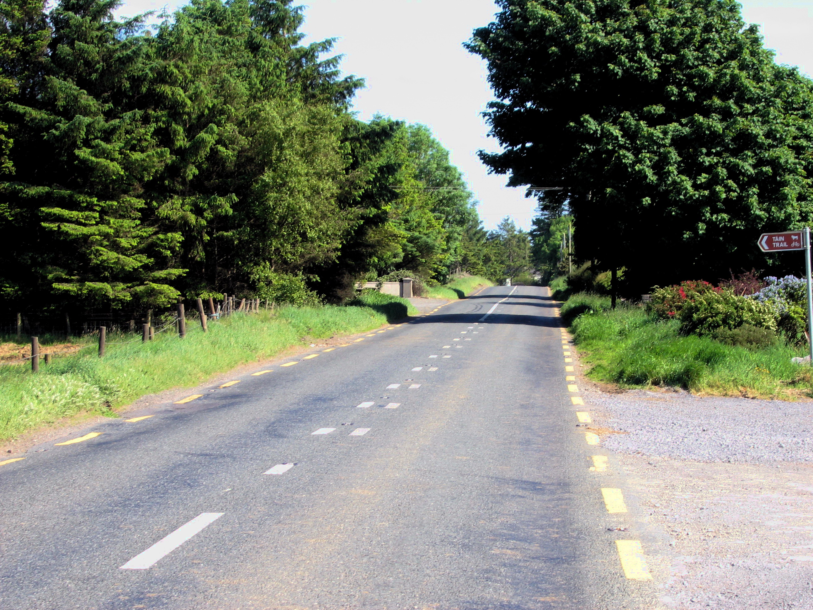
The N5 leaves the N4 on the northeast side of Longford. The route follows Major's Well Road, New Street, Ballymahon Street (and Dublin Street), Main Street and Richmond Street. 12 km (7.5 mi) west of the town, the road causes congestion in Longford town. The N5 crosses the River Shannon into County Roscommon at Tarmonbarry Bridge. The road passes by Scramoge along a realignment (opened in May 2004) on the way to Strokestown. West of Strokestown, at Tulsk, the N61 crosses the N5. The route continues northwest (see thumbnail) to Ballaghaderreen.
 The N5 near Tulsk in Co Roscommon in 2006, before upgrade works
Route through Mayo
The N5 continues west bypassing Carracastle and Charlestown (bypass opened 2007). The N17 crosses the route near Charlestown. The N26 joins the N5 at Cloonlara just east of Swinford (bypassed to the south by the N5 Swinford Bypass). The N5 runs west/southwest through Bohola to Bellavary, where it meets the N58. The N5 continues west towards Castlebar, which is of good quality (constructed 1990) where it bypasses the town on the southeastern side. West/southwest of Castlebar, the road enters Westport along Castlebar Street, Bridge Street and Shop Street (the N5 also runs via James Street and North Mall). At The Octagon in Westport town centre, the N5 meets the N59. The N5 is County Mayo's busiest road with traffic counts of almost 18,000 on the Castlebar relief road. The section between Westport and Castlebar sees over 13,000 vehicles daily, the section with the lowest volumes is the Charlestown bypass and Co.Roscommon section with no more than 7,000 vehicles. It dips as low as 5,000 at Frenchpark.
Map of Route
Confusion over termination point
Under the Local Government (Roads and Motorways) Act (Declaration of National Roads) Order 1977 - which defined the original national primary and secondary routes - the N5's terminus was set at Castlebar. The section of road between Castlebar and Westport was designated part of the N60, a national secondary route. Outdated road signage (which should have been replaced by the local authority or at least corrected) in Castlebar also indicates that the N5 commences on the Castlebar inner relief road at the Westport Road roundabout.
However the road between Westport and Castlebar was upgraded to national primary route status in 1994 (under the Roads Act, 1993 (Declaration of National Roads) Order, 1994) and became part of the N5 road. Road signage on this route reflects this. The route no longer runs through Castlebar town centre in any case, having been bypassed by a relief road. Road signage on the N4 in Dublin was mostly patched to reflect the new destination only in the early 2000s but some signs reading Castlebar still remain elsewhere.
See also
- Roads in Ireland
- Motorways in Ireland
- National secondary road
- Regional road
References
- Roads Act 1993 (Classification of National Roads) Order 2006 – Department of Transport
- Current Status of Road projects under the Remit of the NRA (Current Status of Road projects under the Remit of the NRA as at January 2007)
Roads in Ireland Motorways National primary roads National secondary roads Regional roads (R101–R399) R101 · R102 · R103 · R104 · R105 · R106 · R107 · R108 · R109 · R110 · R111 · R112 · R113 · R114 · R115 · R116 · R117 · R118 · R119 · R120 · R121 · R122 · R123 · R124 · R125 · R126 · R127 · R128 · R129 · R130 · R131 · R132 · R133 · R134 · R135 · R136 · R148 · R149 · R150 · R151 · R152 · R153 · R154 · R155 · R156 · R157 · R158 · R159 · R160 · R161 · R162 · R163 · R164 · R165 · R166 · R167 · R168 · R169 · R170 · R171 · R172 · R173 · R174 · R175 · R176 · R177 · R178 · R179 · R180 · R181 · R182 · R183 · R184 · R185 · R186 · R187 · R188 · R189 · R190 · R191 · R192 · R193 · R194 · R195 · R196 · R197 · R198 · R199 · R200 · R201 · R202 · R203 · R204 · R205 · R206 · R207 · R208 · R209 · R210 · R211 · R212 · R213 · R214 · R229 · R230 · R231 · R232 · R233 · R234 · R235 · R236 · R237 · R238 · R239 · R240 · R241 · R242 · R243 · R244 · R245 · R246 · R247 · R248 · R249 · R250 · R251 · R252 · R253 · R254 · R255 · R256 · R257 · R258 · R259 · R260 · R261 · R262 · R263 · R264 · R265 · R266 · R267 · R268 · R277 · R278 · R279 · R280 · R281 · R282 · R283 · R284 · R285 · R286 · R287 · R288 · R289 · R290 · R291 · R292 · R293 · R294 · R295 · R296 · R297 · R298 · R299 · R310 · R311 · R312 · R313 · R314 · R315 · R316 · R317 · R318 · R319 · R320 · R321 · R322 · R323 · R324 · R325 · R326 · R327 · R328 · R329 · R330 · R331 · R332 · R333 · R334 · R335 · R336 · R337 · R338 · R339 · R340 · R341 · R342 · R343 · R344 · R345 · R346 · R347 · R348 · R349 · R350 · R351 · R352 · R353 · R355 · R356 · R357 · R358 · R359 · R360 · R361 · R362 · R363 · R364 · R365 · R366 · R367 · R368 · R369 · R370 · R371 · R372 · R373 · R374 · R375 · R376 · R377 · R378 · R379 · R389 · R390 · R391 · R392 · R393 · R394 · R395 · R396 · R397 · R398 · R399Regional roads (R400–R699) R400 · R401 · R402 · R403 · R404 · R405 · R406 · R407 · R408 · R409 · R410 · R411 · R412 · R413 · R414 · R415 · R416 · R417 · R418 · R419 · R420 · R421 · R422 · R423 · R424 · R425 · R426 · R427 · R428 · R429 · R430 · R431 · R432 · R433 · R434 · R435 · R436 · R437 · R438 · R439 · R440 · R441 · R442 · R443 · R444 · R445 · R446 · R448 · R449 · R458 · R459 · R460 · R461 · R462 · R463 · R464 · R465 · R466 · R467 · R468 · R469 · R470 · R471 · R472 · R473 · R474 · R475 · R476 · R477 · R478 · R479 · R480 · R481 · R482 · R483 · R484 · R485 · R486 · R487 · R488 · R489 · R490 · R491 · R492 · R493 · R494 · R495 · R496 · R497 · R498 · R499 · R500 · R501 · R502 · R503 · R504 · R505 · R506 · R507 · R509 · R510 · R511 · R512 · R513 · R514 · R515 · R516 · R517 · R518 · R519 · R520 · R521 · R522 · R523 · R524 · R525 · R526 · R527 · R548 · R549 · R550 · R551 · R552 · R553 · R554 · R555 · R556 · R557 · R558 · R559 · R560 · R561 · R563 · R564 · R565 · R566 · R567 · R568 · R569 · R570 · R571 · R572 · R573 · R574 · R575 · R576 · R577 · R578 · R579 · R580 · R581 · R582 · R583 · R584 · R585 · R586 · R587 · R588 · R589 · R590 · R591 · R592 · R593 · R594 · R595 · R596 · R597 · R598 · R599 · R600 · R601 · R602 · R603 · R604 · R605 · R606 · R607 · R608 · R609 · R610 · R611 · R612 · R613 · R614 · R615 · R616 · R617 · R618 · R619 · R620 · R621 · R622 · R623 · R624 · R626 · R627 · R628 · R629 · R630 · R631 · R632 · R633 · R634 · R635 · R637 · R638 · R639 · R659 · R660 · R661 · R662 · R663 · R664 · R665 · R666 · R667 · R668 · R669 · R670 · R671 · R672 · R673 · R674 · R675 · R676 · R677 · R678 · R679 · R680 · R681 · R682 · R683 · R684 · R685 · R686 · R687 · R688 · R689 · R690 · R691 · R692 · R693 · R694 · R695 · R696 · R697 · R698 · R699Regional roads (R700–R940) R700 · R701 · R702 · R703 · R704 · R705 · R706 · R707 · R708 · R709 · R710 · R724 · R725 · R726 · R727 · R729 · R730 · R731 · R733 · R734 · R735 · R736 · R737 · R738 · R739 · R740 · R741 · R742 · R743 · R744 · R745 · R746 · R747 · R748 · R749 · R750 · R751 · R752 · R753 · R754 · R755 · R756 · R757 · R758 · R759 · R760 · R761 · R762 · R763 · R764 · R765 · R766 · R767 · R768 · R769 · R770 · R772 · R773 · R774 · R801 · R802 · R803 · R804 · R805 · R806 · R807 · R808 · R809 · R810 · R811 · R812 · R813 · R814 · R815 · R816 · R817 · R818 · R819 · R820 · R821 · R822 · R824 · R825 · R826 · R827 · R828 · R829 · R830 · R831 · R833 · R834 · R835 · R836 · R837 · R838 · R839 · R840 · R841 · R842 · R843 · R846 · R847 · R848 · R849 · R851 · R852 · R853 · R854 · R855 · R857 · R858 · R859 · R860 · R863 · R864 · R865 · R866 · R867 · R868 · R870 · R871 · R873 · R874 · R875 · R876 · R877 · R880 · R883 · R884 · R885 · R886 · R887 · R888 · R889 · R890 · R891 · R895 · R896 · R898 · R899 · R900 · R901 · R902 · R903 · R904 · R906 · R907 · R908 · R909 · R910 · R911 · R913 · R914 · R915 · R916 · R917 · R918 · R919 · R920 · R921 · R922 · R923 · R924 · R925 · R926 · R927 · R928 · R929 · R930 · R931 · R932 · R933 · R934 · R935 · R936 · R937 · R940See also: National Development Plan · National Roads Authority · Local roads · Trunk roads Categories:- National primary roads in the Republic of Ireland
- Roads in County Longford
- Roads in County Roscommon
- Roads in County Mayo
Wikimedia Foundation. 2010.