- N52 road (Ireland)
-
N52 road
Location Primary
destinations:(bypassed routes in italics)
- County Tipperary
- South of Nenagh, leaves M7
- Nenagh By-Pass (R494, R495)
- (R493)
- Ardcroney
- Borrisokane (N65, R490)
- Ballingarry
- Carrig
- Riverstown - crosses the Little Brosna River; (R489)
- County Offaly
- County Westmeath
- Kilbeggan joins the M6
- Tyrrellspass leaves the N6
- Dalystown - N52 is the minor road at junction with a local road
- Mullingar (bypassed) joins/leaves N4
- Delvin (N51, R395)
- Clonmellon
- County Meath
- County Louth
Road network The N52 road is a national secondary road in Ireland. It links the M7 motorway from just south of Nenagh, County Tipperary to the M1 motorway north of Dundalk in County Louth.
The road is 218 km (135 mi) long.
Contents
Quality of Road
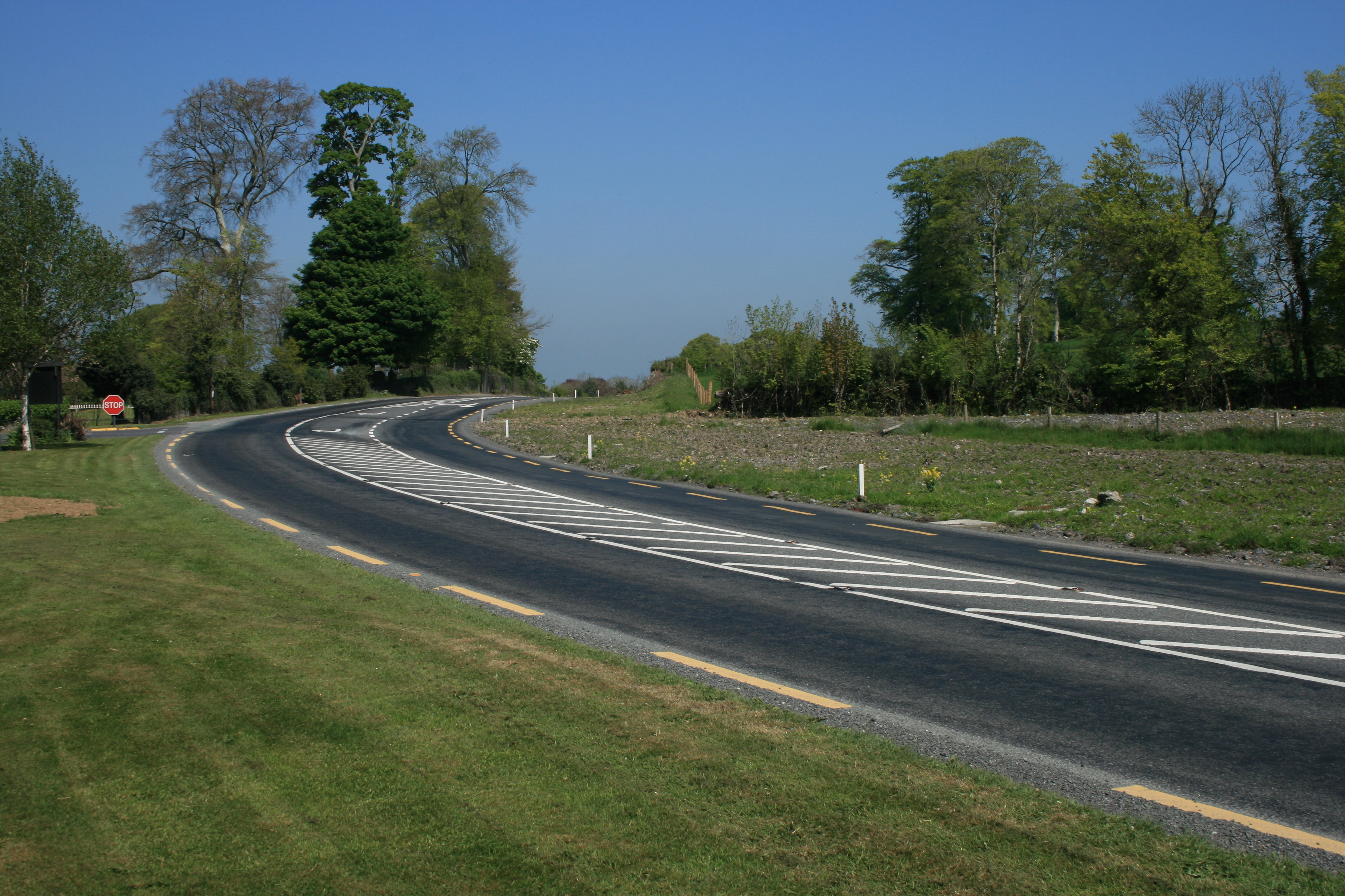
 N52 south of Mullingar - bypassed in 2007
The road is mainly single carriageway two-lane throughout. It has some upgraded sections, but generally the standard is poor or very poor. It starts (from the southwest) at a grade separated junction with the M7 motorway and by-passes Nenagh on its western side as a greenfield single carriageway with hard shoulders. Past Nenagh it is generally a single carriageway with no shoulders all the way to Birr. Many sections of this part of the route are very poor through North Tipperary. The route from Birr to Tullamore was upgraded in recent years and has good alignment, hard shoulders and a good surface as has the section from Tullamore to Kilbeggan which was upgraded in the 1970s.
Leaving Kilbeggan its old route went past the racecourse via Ballinagore. It now joins the new M6 motorway (opened May 2007) south of Kilbeggan and follows it eastwards to the Tyrrellspass exit. From this junction it heads north to Mullingar as the new Tyrrellspass eastern bypass. It then follows the old route for 10 km (6.2 mi) before forming the eastern by-pass of Mullingar (opened May 2007); joins the N4 dual-carriageway briefly before leaving to head east over a very poor road to Delvin, Kells and Ardee before reaching the M1 south of Dundalk. Two kilometers of dual-carriageway take it to the R132 (the old N1) from where it becomes the Dundalk eastern inner relief route, over a new bridge near the harbour and north to the N1.
 N52 Mullingar By-Pass
Tullamore bypass
The Tullamore bypass[1] is a new 14 km (8.7 mi) single carriageway upgrade to the N52. The route leaves the existing N52 approximately 6 km (3.7 mi) southwest of Tullamore town, intersecting with the N80 road, crossing over the Grand Canal, before rejoining the N52 again 3 km (1.9 mi) north of the town. The scheme began construction in April 2008, and was completed in October 2009.
Four metal figures by sculptor Maurice Harron are located where the new roadway cuts through esker ridges. The figures represent symbols of learning and sanctity. Approaching from the north the 1st figure holds up a chalice, the 2nd a book, the 3rd a crosier and the 4th shows the release of a flock of birds representing souls. [2] The installation was funded by the percentage for arts scheme where 1% of the budget is allocated to roadside art.[3]
Lack of priority
- At the N52 junction with the R162 in County Meath the N52 stops and joins the R162 regional road and then leaves it again 100m further south. At this junction the regional road is the main road and is of a higher quality than the National route which crosses it.
- At Dalystown in County Westmeath the N52 has a STOP sign at a junction with a local road which takes precedence over this National route.
See also
- Roads in Ireland
- National primary road
- Motorways in Ireland
- Regional road
References
Roads in Ireland Motorways National primary roads National secondary roads Regional roads (R101–R399) R101 · R102 · R103 · R104 · R105 · R106 · R107 · R108 · R109 · R110 · R111 · R112 · R113 · R114 · R115 · R116 · R117 · R118 · R119 · R120 · R121 · R122 · R123 · R124 · R125 · R126 · R127 · R128 · R129 · R130 · R131 · R132 · R133 · R134 · R135 · R136 · R148 · R149 · R150 · R151 · R152 · R153 · R154 · R155 · R156 · R157 · R158 · R159 · R160 · R161 · R162 · R163 · R164 · R165 · R166 · R167 · R168 · R169 · R170 · R171 · R172 · R173 · R174 · R175 · R176 · R177 · R178 · R179 · R180 · R181 · R182 · R183 · R184 · R185 · R186 · R187 · R188 · R189 · R190 · R191 · R192 · R193 · R194 · R195 · R196 · R197 · R198 · R199 · R200 · R201 · R202 · R203 · R204 · R205 · R206 · R207 · R208 · R209 · R210 · R211 · R212 · R213 · R214 · R229 · R230 · R231 · R232 · R233 · R234 · R235 · R236 · R237 · R238 · R239 · R240 · R241 · R242 · R243 · R244 · R245 · R246 · R247 · R248 · R249 · R250 · R251 · R252 · R253 · R254 · R255 · R256 · R257 · R258 · R259 · R260 · R261 · R262 · R263 · R264 · R265 · R266 · R267 · R268 · R277 · R278 · R279 · R280 · R281 · R282 · R283 · R284 · R285 · R286 · R287 · R288 · R289 · R290 · R291 · R292 · R293 · R294 · R295 · R296 · R297 · R298 · R299 · R310 · R311 · R312 · R313 · R314 · R315 · R316 · R317 · R318 · R319 · R320 · R321 · R322 · R323 · R324 · R325 · R326 · R327 · R328 · R329 · R330 · R331 · R332 · R333 · R334 · R335 · R336 · R337 · R338 · R339 · R340 · R341 · R342 · R343 · R344 · R345 · R346 · R347 · R348 · R349 · R350 · R351 · R352 · R353 · R355 · R356 · R357 · R358 · R359 · R360 · R361 · R362 · R363 · R364 · R365 · R366 · R367 · R368 · R369 · R370 · R371 · R372 · R373 · R374 · R375 · R376 · R377 · R378 · R379 · R389 · R390 · R391 · R392 · R393 · R394 · R395 · R396 · R397 · R398 · R399Regional roads (R400–R699) R400 · R401 · R402 · R403 · R404 · R405 · R406 · R407 · R408 · R409 · R410 · R411 · R412 · R413 · R414 · R415 · R416 · R417 · R418 · R419 · R420 · R421 · R422 · R423 · R424 · R425 · R426 · R427 · R428 · R429 · R430 · R431 · R432 · R433 · R434 · R435 · R436 · R437 · R438 · R439 · R440 · R441 · R442 · R443 · R444 · R445 · R446 · R448 · R449 · R458 · R459 · R460 · R461 · R462 · R463 · R464 · R465 · R466 · R467 · R468 · R469 · R470 · R471 · R472 · R473 · R474 · R475 · R476 · R477 · R478 · R479 · R480 · R481 · R482 · R483 · R484 · R485 · R486 · R487 · R488 · R489 · R490 · R491 · R492 · R493 · R494 · R495 · R496 · R497 · R498 · R499 · R500 · R501 · R502 · R503 · R504 · R505 · R506 · R507 · R509 · R510 · R511 · R512 · R513 · R514 · R515 · R516 · R517 · R518 · R519 · R520 · R521 · R522 · R523 · R524 · R525 · R526 · R527 · R548 · R549 · R550 · R551 · R552 · R553 · R554 · R555 · R556 · R557 · R558 · R559 · R560 · R561 · R563 · R564 · R565 · R566 · R567 · R568 · R569 · R570 · R571 · R572 · R573 · R574 · R575 · R576 · R577 · R578 · R579 · R580 · R581 · R582 · R583 · R584 · R585 · R586 · R587 · R588 · R589 · R590 · R591 · R592 · R593 · R594 · R595 · R596 · R597 · R598 · R599 · R600 · R601 · R602 · R603 · R604 · R605 · R606 · R607 · R608 · R609 · R610 · R611 · R612 · R613 · R614 · R615 · R616 · R617 · R618 · R619 · R620 · R621 · R622 · R623 · R624 · R626 · R627 · R628 · R629 · R630 · R631 · R632 · R633 · R634 · R635 · R637 · R638 · R639 · R659 · R660 · R661 · R662 · R663 · R664 · R665 · R666 · R667 · R668 · R669 · R670 · R671 · R672 · R673 · R674 · R675 · R676 · R677 · R678 · R679 · R680 · R681 · R682 · R683 · R684 · R685 · R686 · R687 · R688 · R689 · R690 · R691 · R692 · R693 · R694 · R695 · R696 · R697 · R698 · R699Regional roads (R700–R940) R700 · R701 · R702 · R703 · R704 · R705 · R706 · R707 · R708 · R709 · R710 · R724 · R725 · R726 · R727 · R729 · R730 · R731 · R733 · R734 · R735 · R736 · R737 · R738 · R739 · R740 · R741 · R742 · R743 · R744 · R745 · R746 · R747 · R748 · R749 · R750 · R751 · R752 · R753 · R754 · R755 · R756 · R757 · R758 · R759 · R760 · R761 · R762 · R763 · R764 · R765 · R766 · R767 · R768 · R769 · R770 · R772 · R773 · R774 · R801 · R802 · R803 · R804 · R805 · R806 · R807 · R808 · R809 · R810 · R811 · R812 · R813 · R814 · R815 · R816 · R817 · R818 · R819 · R820 · R821 · R822 · R824 · R825 · R826 · R827 · R828 · R829 · R830 · R831 · R833 · R834 · R835 · R836 · R837 · R838 · R839 · R840 · R841 · R842 · R843 · R846 · R847 · R848 · R849 · R851 · R852 · R853 · R854 · R855 · R857 · R858 · R859 · R860 · R863 · R864 · R865 · R866 · R867 · R868 · R870 · R871 · R873 · R874 · R875 · R876 · R877 · R880 · R883 · R884 · R885 · R886 · R887 · R888 · R889 · R890 · R891 · R895 · R896 · R898 · R899 · R900 · R901 · R902 · R903 · R904 · R906 · R907 · R908 · R909 · R910 · R911 · R913 · R914 · R915 · R916 · R917 · R918 · R919 · R920 · R921 · R922 · R923 · R924 · R925 · R926 · R927 · R928 · R929 · R930 · R931 · R932 · R933 · R934 · R935 · R936 · R937 · R940Categories:- National secondary roads in the Republic of Ireland
- Roads in County Westmeath
- Roads in County Meath
- Roads in County Offaly
- Roads in County Tipperary
- County Tipperary

Wikimedia Foundation. 2010.