- Tallaght
Infobox Irish Place
name = Tallaght
gaeilge = Tamhlacht
crest
motto = Fulaingt
( _ga. Endurance)
map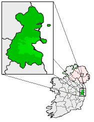
pin coords = left: 32px; top: 100px
north coord = 53.2886 | west coord = 6.3572 | irish grid = O093265
area = | elevation = 90 m
province =Leinster
county = South Dublin County
town pop = 64,227 | rural pop =
census yr = 2006
web =
|Tallaght (pronounced IPA|/'tælæ/; _ga. Tamhlacht) is the largest town, and county seat, of South Dublin County, Ireland. It was one of the earliest settlementsFact|date=May 2007 in the southern part of the island, and one of medieval Ireland's most important monastic centresFact|date=April 2008. The village area, dating from at least the 17th century, occupies a site of significant historical and religious value.
Though Tallaght was little more than a large parish consisting of a village, and perhaps several rural areas, in the 1960s, suburban development began in the 1970s and a new town centre area has been developing since the late 1980s. The administrative headquarters of
South Dublin County Council are located in the town.History
The documented history of Tallaght dates back to early Christendom in Ireland but the many archaeological sites in the area suggest the presence of Bronze Age and perhaps even earlier settlers in the area.
The place name "Tallaght" is derived from the words "támh leacht", meaning a plague burial place. The earliest mention of Tallaght in recorded material is the account of Parthalon in the Annals of the Four Masters who had their residence in the plain between Tallaght and Swords. Parthalon the Greek was said to be one of the early invaders of Ireland. A plague is said to have killed 9,000 of his followers in one week and they were buried at Tallaght and its environs. Thus the place came to be named Taimleach Muintire Parthalon. However, the burials that have been found in the Tallaght area are all normal pre-historic interments, mainly of the Bronze Age, and nothing suggesting a mass grave has so far been recorded here.
With the foundation of the
monastery of Tallaght bySt. Maelruain in 769 A.D. we have a more reliable record of Tallaght's early history. The monastery was a centre of learning and piety and was particularly associated with theCéli Dé spiritual reform movement. It was such an important institution that it and the monastery at Finglas were known as the "two eyes of Ireland". St. Aengus, an Ulsterman, was one of the most illustrious of the Céli Dé and devoted himself to the religious life. Wherever he went he was accompanied by a band of followers who distracted him from his devotions. He secretly travelled to the monastery at Tallaght where he was not known and enrolled as a lay brother. He remained unknown for many years until his identity was discovered by Maeilruain. They later wrote the Martyrology of Tallaght together and St. Aengus also wrote a calendar of saints known as the Féilire of Aengus.St. Maelruain's Church of Ireland now occupies the site of the original monastery. The present day church was built in 1829 and replaced an earlier one to which the still existing tower belonged. The tower is four stories high and has a spiral staircase. An external stairs gives access to the first floor and the spiral stairway to the floors above. The third floor has a vaulted stone ceiling above which is the flat roof and a small turret. In 1662 the churchwardens were granted a sum of £100 in compensation for damage done by Captain Alland who had been stationed there with his troops in 1651. He stripped off the roof of the church and used the timber slates and pews for his own house. He also used the paving stones to pave the entrance to his kitchen and fed his horses from the font.
There are a number of interesting historic features in the grounds of the church. On the left inside the churchyard gate is a font called St. Maelruain's Losset. This is a wide and shallow granite stone trough or font. 'Losat' is an Old Irish word denoting a wooden trough used in former times for kneading bread. It is likely that the country people named it from its similarity in shape to the lossets that they used in their homes. St. Maelruain's Cross lies south of the font. It is a small ancient cross set in a pedestal which is fixed in a circular granite base resembling a mill stone. The pedestal and base were formerly known as Moll Rooney's loaf and griddle and the font was called Moll Rooney's Losset. There are a great many tombstones in the graveyard dating mainly from the 18th and 19th centuries, and some even from the 17th century. One of these commemorates Colonel John Talbot of Belgard who sat in the Parliament of James II and took part in many important military engagements. The graves of the artists Oisin Kelly, Evie Hone and Elizabeth Rivers are in the new graveyard at St. Maelruain's. A survey of the graves was carried out by SDCC which recorded, amongst other information, locations of the graves, observations on their general condition, and details taken from the grave headstones where readable. Copies of this survey are available (for reference only) in the Local Studies section of the library. Also to be seen in the grounds of the church is the remains of the fosse, the ancient curved bank which enclosed Maelruain's monastery. The best view is from the carpark at the rear of Smith's Toystore.
St. Maelruain died in 792 and was buried in Tallaght. The influence of the monastery continued after his death, as can be judged by the fact that, in 806, the monks of Tallaght were able to prevent the holding of the Tailtin Games, because of some infringement of their rights. In 811 the monastery was devastated by the Vikings but the destruction was not permanent and the annals of the monastery continued to be recorded throughout the following centuries. After the Anglo-Norman invasion in 1179 Tallaght and its appurtenances were confirmed to the See of Dublin and became the property of the Archbishop. The complete disappearance of every trace of what must have been an extensive and well organised monastic settlement can only be accounted for by the subsequent history of the place, the erection and demolition of defensive walls and castles, and the incessant warfare and destruction that lasted for hundreds of years.
Throughout the greater part of the 13th century a state of comparative peace existed at Tallaght, but subsequently the O'Byrnes and O'Tooles took offensive action and were joined by many of the Archbishop's tenants. As a result of this the land was not tilled, the pastures were not stocked and the holdings were deserted. In 1310 the bailiffs of Tallaght got a royal grant to enclose the town. No trace of these defensive walls survive and we don't have any evidence of their exact location, except for the name of the Watergate Bridge which spans the Dodder on the Oldbawn Road.
The continuation of such raids prompted the construction, in 1324, of Tallaght castle and it was finished some time before 1349. A century later it was reported to be in need of repair. Tallaght had become an important defensive site on the edge of the Pale. When Archbishop Hoadley replaced Archbishop King in 1729 he found it in ruins, which he demolished and built himself a palace at a cost of £2,500. By 1821 the palace too had fallen into ruin and an Act of Parliament was passed which stated that it was unfit for habitation. The following year it was sold to Major Palmer, Inspector General of Prisons who pulled the palace down and used the materials to build his mansion, Tallaght House, as well as a schoolhouse and several cottages. Tallaght House is now incorporated in the buildings at St. Mary's Priory.
An ancient tower was spared in the demolition of the palace and was later incorporated into the buildings of Saint Mary's Priory where it still stands today. It contains a spiral staircase and was originally four stories high but is now reduced internally to two. Attached to the castle was a long building which was used in the archbishop's time as a brewery and later on as a granary and stables. Under the Dominicans it was converted into a chapel and was used as such until 1883 when the new church was built. The grounds of the Priory, the old palace gardens, still retain many features from the historic past such as the Archbishop's bathhouse, the Friar's Walk and St. Maelruain's Tree.
The old constabulary barracks on the main street was the scene of the engagement known as the Battle of Tallaght, which occurred during the Fenian rising on 5th March 1867. On that night the Fenians moved out to assemble at the appointed place on Tallaght Hill. The large number of armed men alarmed the police in Tallaght who sent warning to the nearest barracks. There were fourteen constables and a head constable under Sub-inspector Burke at Tallaght, and they took up a position outside the barracks where they commanded the roads from both Greenhills and Templeogue. The first body of armed men came from Greenhills and, when they came under police fire, retreated. Next a party came from Templeogue, and were also dispersed. In 1936 a skeleton, sword-bayonet and water bottle were found in a hollow tree stump near Terenure. It is thought that these were the remains of one of the Fenians who had taken refuge there after the Battle of Tallaght and either died of his wounds or was frozen to death.
The 17th and 18th centuries brought many changes to Tallaght. Many mills were built along the Dodder and this brought new prosperity which saw the building of many houses in the area. In 1888 the Dublin & Blessington Steam Tramway opened and it passed through Tallaght Village. This provided a new means of transporting goods and also brought day-trippers from the city.
Modern development
While no plan was formally adopted, Tallaght was laid out as a
new town , as set out in the 1967Myles Wright masterplan forGreater Dublin . This proposed four self-contained new towns at Tallaght,Clondalkin ,Lucan andBlanchardstown . Many of the social and cultural proposals in this plan were ignored byDublin City Council , and contrary to planners' suggestions, Tallaght and the other 'new towns' were not provided with adequate facilities. Characterised by the same problems associated with poorly planned fringe areas of many European cities, during the 1970s and 1980s, Tallaght became synonymous with suburban mismanagement.While it has been absorbed into the larger suburban area of Dublin (including becoming the postal district
Dublin 24 in the late 1980s), Tallaght has developed a distinctive identity, arising largely from its rapid growth during recent decades. Tallaght now has a thriving local arts, cultural, sports, and economic outlook matched by a distinctive sense of place. Resembling a Greek city, Tallaght's Civic Square contains the seat of local authority at County Hall, a newly renovated and well equipped library facility, a theatre building and (in place of a temple) a state of the art 4-storey arts centre (Red). Along with other more local libraries and local arts groups, it can boast another theatre building and a homegrown youth theatre company. It is also the home to the Tallaght Swim Team, theNational Basketball Arena ,Shamrock Rovers F.C. , and several notable martial arts schools andGaelic Athletic Association clubs.Chronology
* 769;
Saint Maelruain 's monastery founded.* 792; death of Saint Maelruain.
* 811; Saint Maelruain's monastery devastated by the
Viking s.* 1179; Tallaght and its hinterland, previously within the Diocese of Glendalough, confirmed as holdings of the See of Dublin.
* 1310;
bailiff s of Tallaght given royal grant to enclose the town.* 1324; building commences on Tallaght Castle.
* 1331-1332; Tallaght Castle plundered by O'Toole of Imaile.
* 1378; Mathew, son of Redmond de Bermingham, takes up station at Tallaght Castle to resist the O'Byrnes.
* 1540; O'Tooles invade and devastate Tallaght Castle and surrounding manors.
* 1635; Old Bawn House built.
* 1729; Tallaght Castle demolished; Archbishop's Palace built by Archbishop Hoadley.
* 1822; Archbishop's Palace demolished by Major Palmer, who then builds Tallaght House.
* 1829;
Church of Ireland parish created.* 1856; Tallaght House is sold to the Dominicans.
* 1864; Saint Mary's Priory built.
* 1867; the battle of Tallaght.
* 1883; New Priory Church built.
* 1888; the
Dublin and Blessington Steam Tramway commences operation, passing through Tallaght village.* 1955; new retreat house built at the Priory, enclosing Tallaght House.
* 1984; Tallaght’s first public library, Castletymon, opened in June.
* 1987;
Alan Dukes outlines the "Tallaght Strategy" to the Tallaght Chamber of Commerce.* 1990; the Square shopping centre opens.
* 1992;
Institute of Technology, Tallaght opens.* 1994;
South Dublin County Council comes into existence, with new headquarters in Tallaght town centre; Tallaght Youth Theatre is founded; Tallaght’s second public library, situated beside the South Dublin County Council offices, opened in December.* 1995; Tallaght Theatre built in
Kilnamanagh .* 1998; Tallaght Hospital opens.
* 1999; Civic Theatre opens adjacent to County Council headquarters in Tallaght centre.
* 2004; the Red Line of the
Luas light rail system opens, connecting Tallaght Central toConnolly Station in Dublin city.* 2008; Extensive rebuilding of Tallaght library is completed.
Geography
Location
Tallaght is centred 13 km southwest of
Dublin city, in the plains by the foothills of the Dublin Mountains. While there is no strict definition, it might be described as beginning west ofTempleogue running west to the border withSaggart , and runs from the boundaries ofGlen na Smol andKnocklyon in the south to south ofClondalkin andWalkinstown .Transport
Tallaght is connected to Dublin city centre by
Dublin Bus services and the Red Line of theLuas light rail system, which opened in September 2004. Though the first stop (Tallaght Cross) of the Red Line is called 'Tallaght', the entire 'Red 4' zone lies within the Tallaght area. Though there are buses to Clondalkin andBallyfermot , andDún Laoghaire , Tallaght is poorly connected to Dublin's other towns and suburbs, as public transport predominantly runs through Dublin city centre; this has led to high levels of car dependence.A metro rail system is currently being planned for Dublin. Two lines have been proposed; Metro North, running from Dublin city to the airport, and Metro West, where by taking a circuitous route, it is proposed to link Tallaght with Dublin's other major western towns including Clondalkin, Lucan, and
Blanchardstown . This metro line will eventually join up with Metro North and continue out toDublin Airport in theCounty of Fingal .It is hoped that these measures will mean that car dependence on most major routes between Tallaght and Dublin will decline over the next number of years.
Population
As there is no specific local administration in the form of a town or city council, there is no legal boundary for Tallaght, and therefore no official population figure. In 1986, the Minister for the Environment removed several localities historically associated with Tallaght when he redrew the District Electoral Divisions. If these areas are included the population can be derived from the 2006 census as 103,301. The 2006 census figure for the remaining electoral divisions is 64,227.
Districts
The greater Tallaght area comprises several districts. Some areas, such as
Templeogue and Knocklyon were historically separate (and physically disconnected) while others likeFirhouse have been part of Tallaght parish for centuries. These, and a number of other distinct places and villages are now accumulated within "Greater Tallaght," and exist under local authority structures, as the electoral area of "Tallaght South."Tallaght town centre occupies the centre-east district, encompassing Belgard Square, the main shopping area (known as the Square), the
Luas Red Line terminus at Tallaght Cross, Tallaght Hospital (the current National Children's Hospital), the Civic Theatre, South Dublin County Library, Red Arts Centre (under construction), Sean Walsh Memorial Park, and several bars, restauraunts and hotels.Tallaght village is situated to the east of the new town centre, lying north of the Tallaght Bypass (N81). It stretches east-west from Main Road and Main Street to the Abberley Court Hotel at the end of High Street, and encompasses Village Green, Tallaght Courthouse, Westpark, and many shops, restaurants and banks. It also houses Tallaght Youth Service, Tallaght's first newspaper printing house, the Tallaght Echo, and Tallaght Community Arts Centre. The Institute of Technology, Saint Mary's priory, and Saint Maelruain's church are located in the historic quarter of Tallaght village.
To the east of the village lies the Tymon North-Balrothery area. This includes housing estates such as Bancroft, Balrothery, Glenview, Castle Park, Saint Aongus, Tymon, Bolbrook and Avonbeg. This part of Tallaght is home to several sporting facilities including the National Basketball Arena, a fitness centre, two swimming pools, an athletics track, and an astroturf soccer facility. Tymon Park is fed by the Poddle, and is Ireland's second largest city park. It borders
Greenhills andTempleogue , and it contains extensive sporting grounds, ponds, Coláiste De Hide, and one of Ireland's largest playgrounds at the Tymon North entrance.To the south of the village lies Old Bawn, once a distinct area, which is bordered by Sean Walsh Memorial (Watergate) Park to the north, Firhouse Road West to the south, Old Bawn Road to the east, and Kiltipper Way to the west. To the east of Old Bawn, estates include Home Lawns, Mountain Park, Millbrook Lawns and Seskin View. Firhouse lies further east, while to the south west, in the mountains, is Bohernabreena.
Immediately west of the town centre are the estates of Virginia Heights and Springfield. Further west are
Jobstown , Kiltalown, Brookfield and Fettercairn.To the far west, bordering with
Saggart , liesCitywest and newer estates such as Deselby, Mountain View, the Belfry, Ardmore, Westbrook Glen, Saggart Abbey, Verschoyle and Carrigmore.To the south of the N81 dual carriageway are Kiltipper, Aylesbury, and Killinarden, which comprises the residential areas of Deer Park, Cushlawn, Donomore, Killinarden Estate and Knockmore.
In the north, Belgard Green, Belgard Heights, and Kingswood are adjacent to
Clondalkin , while Kilnamanagh and Greenhills are situated just southwest of Walkinstown-Crumlin. Tallaght Theatre is situated along the Greenhills Road.Features
Tallaght is home to the Square, one of Ireland's largest shopping centres. The centre consists of three retail levels and is accessible by the
Luas and extensive bus services. Anchor tenants at the centre includeTesco ,Debenhams , Easons, andDunnes Stores , as well as a multiplex 12-screen cinema operated byUnited Cinemas International . Many new retail outlets such asMarks and Spencers ,Penneys , andH&M have been built (or are currently under development) in the new town centre.Fact|date=April 2008Five hotels are located in the town centre: the Plaza Hotel near The Square, the Abberley Court Hotel at High Street, and a new three star
Tower Hotel , opened in August 2007 at Whitestown Way, near Watergate Park. The Glashus Hotel and Tallaght Cross Hotel lie in central Tallaght Cross.The town centre is home to local and central government entities, including South Dublin County Council, the Revenue Commissioners, the Department of Social and Family Affairs, the Health Service Executive (Eastern Region), County Dublin V.E.C., as well as local
FÁS offices. It is also the setting for the County Library, the County Arts Centre (under construction), the Civic Theatre, and many other shops, bars, and restaurants.The
Adelaide and Meath Hospital , incorporating the National Children's Hospital (colloquially known as "Tallaght Hospital") is located nearby. Recently, local people took to the streets, marching in protest at the Government's decision to relocate the National Children's Hospital to the Mater Hospital in north Dublin city.Fact|date=April 2008Across the N81 dual carriageway, south of the town centre, is the site of the 6,000 seat new soccer ground at
Tallaght Stadium beside the South City development and the Tower Hotel. Initially construction was undertaken byShamrock Rovers F.C. on lands belonging to South Dublin County Council, but the project was marred by financial problems, and the site reverted back to council ownership. Work on the site recommenced on 6 May, 2008, [ [http://www.shamrockrovers.ie/newsarchive.php Tallaght Stadium - Building Recommences May 2008]Shamrock Rovers F.C. Published on 07-05-08. Retrieved on 14-05-08.] after a judicial review taken by a local GAA club had been thrown out of court the preceding January. [ [http://www.shamrockrovers.ie/pressrelease.php?subaction=showfull&id=1201265970&archive=&start_from=&ucat=10& Shamrock Rovers F.C ] ] . South of this is Sean Walsh Memorial Park.On 12 July, 1998, Tallaght welcomed the
Tour de France . [ [http://www.ireland.com/newspaper/ireland/1998/0713/98071300035.html The Irish Times - Mon, Jul 13, 1998 - Brisk wind blows riders through Tallaght in a flash Tallaght ] ] Tallaght holds an annualSaint Patrick's Day parade. LastNovember , Tallaght hosted South Dublin County's first annual 'Hallowfest' in celebration of the Gaelic New Year and Festival of the Dead. It has also been home to 'Tallafest' and has a division of South Dublin's 'Fused Festival' every yearFact|date=September 2008. There is a farmers' market held every Friday from 10:00 to 16:00 in High Street.Fact|date=September 2008Recent construction
The town centre has witnessed much construction in recent years, predominantly of new apartment buildings, including Virginia Hall, a twelve storey building on the site of the farmhouse previously known as 'Virginia House' (the base of operations for many years of the Tallaght Community Arts Centre). This new building is currently the tallest in Tallaght. A new arts centre for South Dublin County called Red is currently being completed at a site near to County Hall, just south of the new library extension.
Intensive work will be undertaken in the near future to further integrate Watergate Park with the new town centre. Part of this development will either include transforming a section of the Tallaght Bypass into a boulevard to better integrate the two areas, or the construction of a pedestrian land-bridge between them.
Tallaght village is currently receiving a long awaited facelift in the form of landscaping, works on statues, and new paving.
ITT is in the process of redeveloping land donated by Saint Mary's Priory for use as sports pitches.
Politics
A flag for Tallaght has been proposed by Tallaght Youth Theatre as part of the D'No Project [ www.bebo.com/TYTYouthDrama ] .
On 2 September, 1987,
Alan Dukes , the then leader of the oppositionFine Gael political party, delivered a famous speech to the Tallaght Chamber of Commerce in which the policy which became known as theTallaght Strategy was outlined.Sports
*
Saint Anne's GAA , Saint Marks GAA and Thomas Davis GAA Club are localGaelic Athletic Association clubs.
* TheTallaght Stadium is the future home ofShamrock Rovers F.C.
* TheNational Basketball Arena lies east of the village.
*Firhouse Basketball Club is a local Ladies Basketball club which serves Tallaght.
* [http://www.tallaghtswimteam.com Tallaght Swim Team] is located at the Tallaght Sports Complex, Balrothery, beside Tallaght Community School.
* Brookfield Celtic, one of Dublin's largest underage football clubs, were founded in Tallaght in 1999.
* TheTallaght Outlaws are the localAmerican football team, who play in theIAFL . They play beside the National Basketball Arena.
* Glenanne Sports Club, one of the most successful Irish field hockey teams of recent years, are based in Tallght, playing their home games on the astroturf pitch located in St. Marks Community SchoolPeople
Famous Tallaght people include:
*Evie Hone (1894-1955); artist.
* Malachi Horan (1847-1945); folklorist.
*Katharine Tynan (1861-1931); writer.
* Elizabeth Rivers (1903-1964); wood engraver, figure painter, and illustrator.
*George Otto Simms (1910-1991); theChurch of Ireland Archbishop of Armagh , andPrimate of All Ireland .
*Oisín Kelly (1915-1981); artist and sculptor.
*William Howard Russell (1821-1907); journalist, and world's first war correspondent.
*Dave Allen (1936-2005); comedian and TV presenter.
*Robbie Keane (1980-); football player.
*Richard Dunne (1979-); football player.References
* cite web|url=http://www.southdublincountyhistory.ie/tallaght_history.htm
title=South Dublin County Council history of Tallaght|accessdate=2006-03-31See also
* List of abbeys and priories in County Dublin
* List of towns in Ireland
*Tallaght Strategy External links
* [http://www.sdcc.ie/ South Dublin County Council]
* [http://www.shamrockrovers.ie/ Shamrock Rovers F.C.]
* [http://www.TYTYouthDrama.bebo.com/ Tallaght Youth Theatre]
* [http://www.chaptersofdublin.com/books/ball1-6/Ball3/ball3.1.htm Parish of Tallaght, History of the County of Dublin by Francis Elrington Ball]
* [http://www.chaptersofdublin.com/books/Handcock/tallaghtindex.htm Handcock's History and Antiquities of Tallaght, Second Edition, 1889]###@@@KEYEND@@@###
Wikimedia Foundation. 2010.