Ballybrittas

Ballybrittas

Infobox Irish Place
name = Ballybrittas
gaeilge = temp
crest

motto =
map

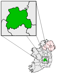
pin coords = left: 83px; top: 71px
north coord =
west coord =
irish grid =
area =
elevation =
province = Leinster
county = County Laois
town pop =
rural pop =
census yr =
web =
|

Ballybrittas ( _ga. Baile Briotáis) is a small village in the northeast of County Laois, Ireland situated on the R445 about 5 km SE of Monasterevin, County Kildare. Formerly passed through by all Dublin - Cork traffic, the village is now bypassed by the M7 motorway (the N7 being realigned by its opening).

Two pubs, two service stations, a shop/post office and a couple of small businesses make up this village. Ballybrittas is also the home village of the famous Award Winning Joinery firm Teamwoodcraft [http://www.teamwoodcraft.com]

The local schools and churches are nearby in Rath and Killenard, while two local Gaelic Athletic Association clubs, Courtwood and O'Dempseys are nearby.

See also

* List of towns in the Republic of Ireland

External links

* [http://www.libraryireland.com/Lewis/LewisB/2-BALLYBRITTAS.php/index.php Library Ireland - historical reference to Ballybrittas]


Wikimedia Foundation. 2010.

Игры ⚽ Нужно сделать НИР?

Look at other dictionaries:

  • Ballybrittas — 52.428980555556 6.6368527777778 Koordinaten: 52° 25′ 44,3″ N, 6° 38′ 12,7″ W Das Portal tomb von Ballybrittas (irisch Baile an Bhriotáis) liegt 4,6 Kilometer südwestlich von Enniscorthy und 300 m nördlich der R127… …   Deutsch Wikipedia

  • Баллибриттас — Деревня Ирландии Баллибриттас англ. Ballybrittas, ирл. Baile Briotáis Страна …   Википедия

  • County Wexford — Contae Loch Garman Coat of arms …   Wikipedia

  • History of County Wexford — Infobox Irish Place name = County Wexford gaeilge = Contae Loch Garman crest motto = Exemplar Hiberniae map area = 2,352 km² county town = Wexford code = WX population = 131,615 census yr = 2006 province = Leinster web = www.wexford.ie |County… …   Wikipedia

  • Bree, County Wexford — Infobox Irish Place name = Bree gaeilge = Brí motto = map pin coords = left: 58px; top: 65px north coord = 52.435| west coord = 6.605 area = | elevation = m ( ft) province = Leinster county = Wexford population = | town pop = | rural pop = census …   Wikipedia

  • County Laois — Contae Laoise Coat of arms Motto: I bp …   Wikipedia

  • List of towns and villages in the Republic of Ireland — This is a link page for cities and towns in Ireland, including villages, townships or urban centres in Dublin. Cities are shown in bold; see Cities in Ireland for an independent list. See also : * List of towns in the Republic of Ireland/Largest… …   Wikipedia

  • N7 road (Ireland) — N7 road Route information Part of …   Wikipedia

  • M7 motorway (Ireland) — This motorway forms part of the N7 route. M7 motorway …   Wikipedia

  • Portarlington, County Laois — Portarlington Cúil an tSúdaire   Town   Portarlington train station …   Wikipedia

Share the article and excerpts

Direct link
Do a right-click on the link above
and select “Copy Link”