- Portarlington, County Laois
-
Portarlington
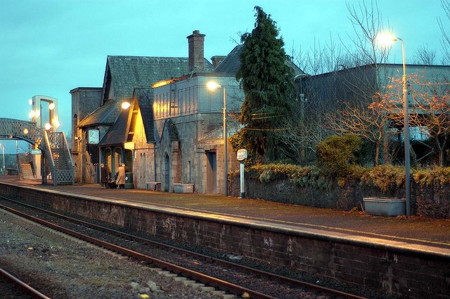
Cúil an tSúdaire— Town — Portarlington train station Location in Ireland
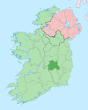
 Portarlington
Coordinates: 53°09′36″N 7°11′24″W / 53.160°N 7.190°WCoordinates: 53°09′36″N 7°11′24″W / 53.160°N 7.190°W Country Ireland Province Leinster County County Laois & County Offaly Elevation 66 m (217 ft) Population (2006)[1] - Urban 6,004 Irish Grid Reference N540125  Island of Irish Rail 1906
- For the Australian town, see Portarlington, Victoria
Portarlington, historically called Cooletoodera[2] (Irish: Cúil an tSúdaire, meaning "Tanner's corner"), is a town in County Laois crossing the boundary into County Offaly, Ireland. The town was recorded in the census of 2006 as having a population of 6,004.
Portarlington lies on the border of County Laois and County Offaly. The River Barrow forms the border.
The town has expanded in recent years, most notably with large numbers of commuters from Dublin and surrounding areas moving in. Much of the town's expanded population are non-Irish nationals working, or seeking work, in the area.
Contents
History
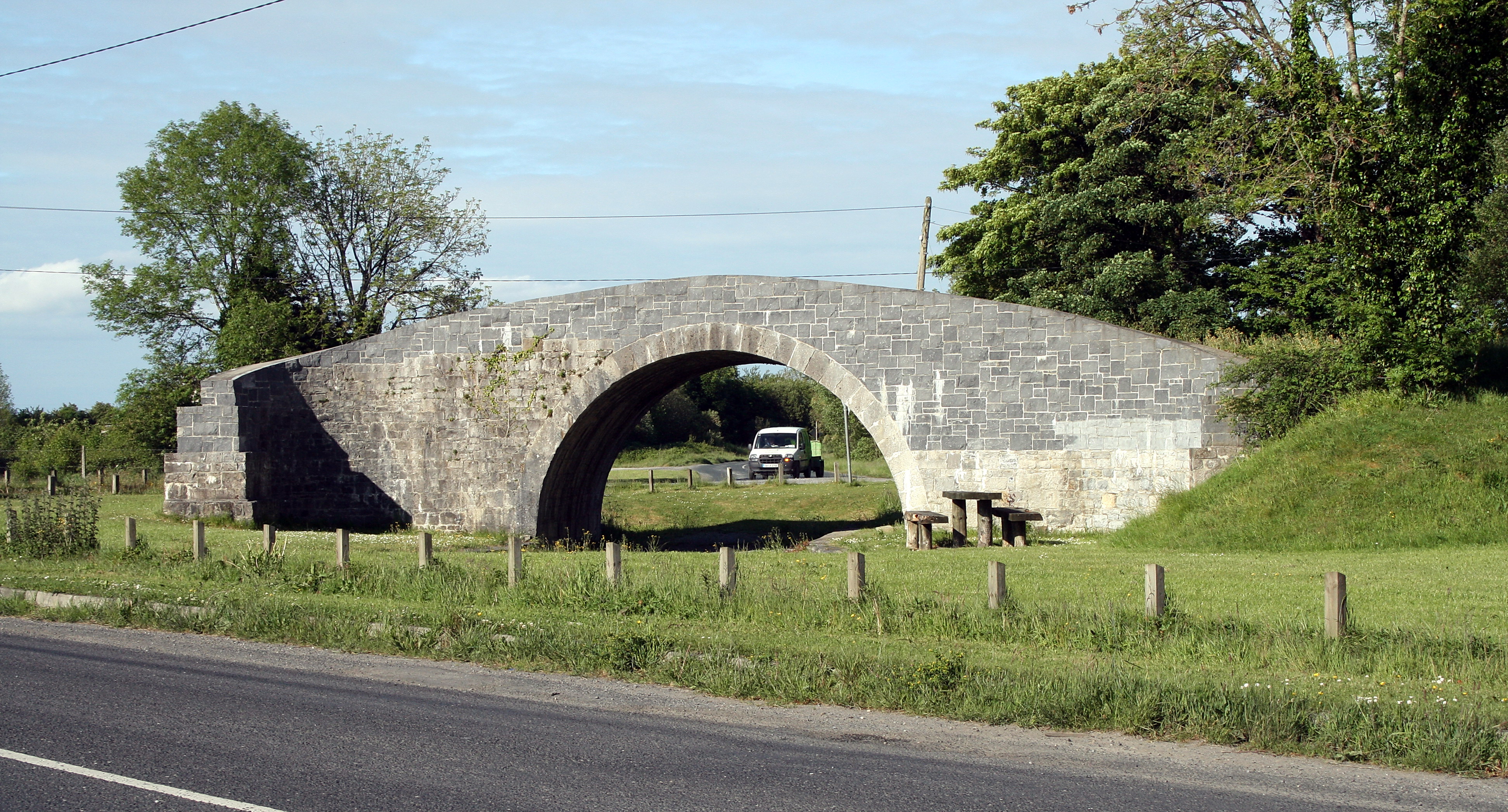
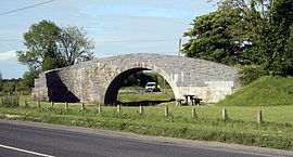 Kilnahown Bridge, a bridge carrying a no longer existing road over a no longer existing canal.
It was founded in 1666, by Sir Henry Bennet, English Home Secretary to Charles II, to whom that King, on his restoration, made a grant of the extensive estates of O'Dempsey, Viscount Clanmaliere, confiscated after the Irish Rebellion of 1641. After some difficulties, the grant passed to Sir Henry Bennet of all the O'Dempsy estates in the King's and Queen's Counties, and on the 14th of April, 1664, he was created Baron Arlington of Arlington in the County of Middlesex. So great was the anxiety of these new settlers to efface all ancient recollections in Ireland, that the Parliament of Orrery and Ormond enacted that the governor and council should be able to give new English names instead of the Irish names of places; and that after a time such new names should be the only ones known or allowed in the country. In accordance with this enactment the borough created in Cooletoodera (Cúil an tSúdaire), received the name of Port-Arlington, or Arlington's Fort. (from Rev. M Comerford "Collections relating to the Dioceses of Kildare and Leighlin" Vol 2 (1883))
Historical populations Year Pop. ±% 1821 2,877 — 1831 3,091 +7.4% 1841 3,106 +0.5% 1851 2,730 −12.1% 1861 2,581 −5.5% 1871 2,424 −6.1% 1881 2,357 −2.8% 1891 2,021 −14.3% 1901 1,943 −3.9% 1911 2,012 +3.6% 1926 1,954 −2.9% 1936 1,851 −5.3% 1946 2,092 +13.0% 1951 2,246 +7.4% 1956 2,720 +21.1% 1961 2,846 +4.6% 1966 2,804 −1.5% 1971 3,117 +11.2% 1981 3,386 +8.6% 1986 3,295 −2.7% 1991 3,211 −2.5% 1996 3,320 +3.4% 2002 4,001 +20.5% 2006 6,004 +50.1% [3][4][5][6][7] The 1690s were marked by 15 or more Huguenot families who were driven from France as religious refugees.Present day one of the Towns main thoroughfares is still named 'French Church Street', with its French church (1694) situated just off the market square.
The outskirts of the parish lies Lea Castle. The remnants of a great Norman castle built in 1260 by William de Vesey. It changed hands many times during its violent history, for example, it was burned by the O'Dempseys in 1284, rebuilt by de Vesey and given to the king, burned along with its town by the Scots army in 1315, burned by the O'Moores in 1346, captured by the O'Dempseys in 1422 and then lost to the Earl of Ormond in 1452, used by Silken Thomas Fitzgerald as a refuge in 1535, mortgaged to Sir Maurice Fitzgerald in 1556, and leased to Robert Bath in 1618. It was used by the confederates as a mint in the 1640s rebellion until Cromwellians blew up the fortifications by stuffing the stairways with explosives. The castle was never used as a fortification again.
Trescon Mass Rock: Just outside the town in an area known as Trescon, a mass rock (Carraig an Aifrinn in Irish) can be found deep in a wooded area.
Trescon mass rock is a stone used in mid-seventeenth century Ireland as a location for Catholic worship. Isolated locations were sought to hold religious ceremony, as Catholic mass was a matter of difficulty and danger at the time as a result of both Cromwell's campaign against the Irish, and the Penal Laws of 1695, whereby discrimination and violence against Catholics was legal. Bishops were banished and priests had to register thereafter. In some cases priest hunters were used.
The rebellion of 1798 resulted in several local men from Lea castle, being apprehended and subsequently put to death by hanging in the town's market square.A memorial in the shape of a Celtic cross with the rebels details was commissioned and erected in 1976.The memorial stands close to the perimeter wall of the French church in the market square .
Imperial political democratic practices was responsible for turning Portarlington into a perfectly rotten Borough.The reason was to preserve the planters positions politically and economically. Below is an extract that shows that a corporation of 15 people were solely responsible for the persistent re-election of perfect strangers to parliament to represent the other 2800 people.
Prior to the legislative Union between Great Britain and Ireland, this borough sent two Members to the Irish Parliament; since 1800 it has returned one to the Imperial Parliament, and so close has been this corporation, that for 50 years previous to the last general election, the nominee of the Dawson family, commonly a total stranger to the borough, was always returned without a contest. According to the Parliamentary Returns of May 1829 and June 1830, the number of electors, resident and non-resident, was 15; that is, all the members of the corporation. Inquiry held 21, 23, and 24 September 1833, before John Colhoun and Henry Baldwin.
Geography
Portarlington is split by the River Barrow, with County Offaly on the north bank and County Laois on the South Bank.The town is mostly flat, with some slight street undulations.The town was partially built on the river's flood plain. Better drainage recently has resulted in fewer floodings to areas close to the town.
Crossing the river northwards into Co Offaly ,the land becomes marshy and wet with extensive peat bogs.These peat bogs are broken by some glacial hills,one such hill is called 'Derryvilla' Hill.These hills have been used for gravel and sand production.
The southern end of the town is dominated visually by another glacial hill, know locally as 'Corrig'. This hill is topped by a stone structure called the 'spire'. The spire was built the latter half of the 19th century. Next to the spire is the town's water supply reservoir. The reservoir uses the gravity afforded by the hill to supply water to the town below.
The land on the south side of town is well drained and rises slowly towards the hill of Corrig. This land is agriculturally productive and market farming is practiced here.
Views from all sides of Corrig can be impressive, with spectacular views of the midlands.
Demographics
1841–1881, the population of Laoise, which was then called the Queens County halved from mass emigration and starvation, in spite of the fact that Co. Laoise and most other counties increased food production throughout the period.
The County suffered badly during the Great Famine (1845–47); the county's population dropped from over 153,000 in 1841 to just over 73,000 in 1881.
Although figures for Portarlington are not readily available, it would be inconceivable to think that the town's population would have fared any better that those of the rest of the county.
Famine graveyards are known locally.
The population of Portarlington (and its environs) has risen by 50.1% from 2002 to 2006:[8]
- 1821 ...2877
- 1831 ...3091
- 1991 ...3221
- 2002 ... 4001
- 2006 ...
Transport
Portarlington is a focal point of the Irish railway network, being situated near a junction for services to the west (Galway, Mayo), the south (Cork, Limerick, Tralee) and the east (Dublin, Kildare). Portarlington halt opened on 26 June 1847.[9]
Due to the excellent rail service there is a very limited road public transport system. Intercity buses are by private operators and only two to date (October 2007) operate some sort of limited service. There is a local-link town service linking Portarlington with Portlaoise and also with Tullamore.
Commerce
The local economy and commerce has been dominated by the agricultural sector for many generations.
In recent years the towns location in relation to Dublin coupled with its railways services, assisted the town to grow, by attracting many people to relocate. This growth in population was a welcomed change from the near population stagnation suffered throughout Ireland for generations. However, recent developments locally and nationally has resulted in the unemployment levels rapidly rising, with ever lengthening dole queues , with recent reprts in The Leinster Express on th 11 August 2010, showing 3,406 people signing on the dole in Portarlington.
Major employers are a shadow of their former selves, Electricity generation at the local power station ended in the early 1990s.The cooling tower and turbine hall have since been demolished.
Industrialised peat production within the semi-state company 'Bord Na Mona' has been decimated.
The production of jewellery and cosmetics ended with the demise of 'Avon' Arlington on the Canal Road. The imposing redbrick Avon factory remains as an empty hulk.
Local Siac Butlers Steel located on the Lea Road is also undergoing serious decline, brought about by the demise of the construction industry.
Flour production still takes place in Odlum's mill.
Sport
Portarlington Sports Clubs Club Sport League Venue Established Gracefield Gaelic Athletic Association Senior Football Championship Gracefield 1920 Portarlington Gaelic Athletic Association Senior Football Championship McCann Park 1893 Portarlington Mud Dogs American Football [I.A.F.L.] Dog Pound 2007 Gracefield FC Soccer [CCFL] Botley Lane 2009 Portarlington RFC Rugby Union Leinster League Lea Road 1974 Solent Kestrels Basketball Superleague Killenard Hall 1996 Arlington F.C. Soccer CCFL Castle Park 1967 Portarlington Tennis Club Tennis Laois League Division 2 Station Road 1954 Heritage Golf Club Golf N/A Killenard Garryhinch Golf Club Golf N/A Mountmellick 1908 Portarlington Tae Kwon Do Club Tae Kwon Do N/A Canal Road Port Coquitlam & District Club Fishing & Hunting N/A Coast Meridian 1956 Culture
The peoples Museum. Situated within the Catholic Club, Main Street Portarlington. The museum is small but holds many different exhibits ranging from local memorabilia and including a Bronze Age Celtic dagger.
The town is probably most famous for its appearance in the 1993 Irish film 'Into the West', a touching story about a family from Ireland's Travelling community. Portarlington, its Savoy cinema (now closed) and the nearby Lea Castle appear in the film. The town is also mentioned in Christy Moore's song Welcome to the cabaret, featured on his 1994 album 'Christy live at the Point'.
An annual French Festival (Festival Francais de Portarlington)is celebrated in Summertime July 15 - 17. Although this has been dormant for the last 7 years some locals have gotten together to revive the lost festival. The festival will be a weekend with a wide range of entertainment to suit all interests with music, dance, sport, history, food, a parade led by the festival Queen which includes local businesses, clubs, groups and schools. Festival goers can obtain many delights at the Town Market such as cheeses, pastries, soaps, accessories to name but a few. A famous French delicacy otherwise known as "Escargot" can be enjoyed by all who take part in the festivals National Snail Eating Championships or "Championnats d'escargots National Eating". Enjoy music and dance to celebrate the French heritage. Some more of the entertainment that will be provided over the weekend includes a carnival, arts & crafts, face painters, bouncing castles and much more.
Outdoor pursuits of angling and hunting are available.
Cuisine in the town is varied with pub grub, Chinese, Indian and several fast food restaurants .
The town has a nightclub and many bars, and live traditional music is performed by the Portarlington Comhaltas Ceoltóirí na nÓg.
Extensive architectural history ranging from the Middle Ages to Huguenot and Georgian houses.
Notable people
- Peter Burrowes (1753–1841) - Irish barrister and politician.
International relations
Twin towns — Sister cities
Portarlington, as designated by Sister Cities International is sister city to:
See also
References
- ^ "Census 2006 – Volume 1 – Population Classified by Area" (PDF). Central Statistics Office Census 2006 Reports. Central Statistics Office Ireland. April 2007. http://www.cso.ie/census/documents/census2006_volume_1_pop_classified_by_area.pdf. Retrieved 2011-06-22.
- ^ Placenames Database of Ireland
- ^ Census for post 1821 figures.
- ^ http://www.histpop.org
- ^ http://www.nisranew.nisra.gov.uk/census
- ^ Lee, JJ (1981). "On the accuracy of the Pre-famine Irish censuses". In Goldstrom, J. M.; Clarkson, L. A.. Irish Population, Economy, and Society: Essays in Honour of the Late K. H. Connell. Oxford, England: Clarendon Press.
- ^ Mokyr, Joel; O Grada, Cormac (November). "New Developments in Irish Population History, 1700-1850". The Economic History Review 37 (4): 473–488. doi:10.1111/j.1468-0289.1984.tb00344.x. http://www3.interscience.wiley.com/journal/120035880/abstract.
- ^ "Demographic context". Offaly County Council Development Plan 2009 - 2015. http://www.offaly.ie/NR/rdonlyres/A4AD027E-87E4-4353-917B-47C75D92768F/1095/Chapter2ContextandChallenges_FEB08.pdf. Retrieved 2008-06-28.
- ^ "Portarlington station". Railscot - Irish Railways. http://www.railscot.co.uk/Ireland/Irish_railways.pdf. Retrieved 2007-09-05.
(See O'Dempsey Chronicles by P.J. Goode)
Places in County Laois Towns Abbeyleix · Durrow · Mountmellick · Mountrath · Portarlington · Portlaoise · Rathdowney · Stradbally
Villages and
TownlandsAghaboe · Arless · Ballacolla · Ballaghmore · Ballickmoyler · Ballinakill · Ballybrittas · Ballybrophy · Ballyfin · Ballyhide · Ballyhuppahane · Ballylinan · Ballyroan · Barrowhouse village · Borris-in-Ossory · Castletown · Clonaghadoo · Clonaslee · Crettyard · Cullohill · Donaghmore · Emo · Errill · Jamestown · Kilbricken · Killeshin · New Inn · Newtown · Raheen · Rosenallis · Shanahoe · Sletty · Spink · The Swan · Timahoe · Vicarstown
Landforms Arderin · Baunreaghcong · Bog of Allen · Castlecomer Plateau · Castleconor · Garraunbaun · Slieve Bloom Mountains
List of townlands in County Laois · Category:Mountains and hills of County Laois · Category:Rivers of County Laois · Category:Geography of County LaoisCategories:- Portarlington, County Laois
- Towns and villages in County Laois
- Populated places established in 1666


Wikimedia Foundation. 2010.