- County Dublin
-
For other uses, see Dublin (disambiguation).
County Dublin
Contae Bhaile Átha Cliath
Coat of armsMotto: Beart do réir ár mbriathar (Irish)
"Action to match our speech"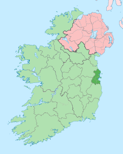
Country Ireland Province Leinster County seat Dublin Government – Teachta Dála 19 Labour Party TDs
17 Fine Gael TDs
4 Sinn Féin TDs
4 ULA TDs
3 Independent TDsArea – Total 921 km2 (355.6 sq mi) Area rank 30th Population (2011) 1,270,603 – Rank 1st Car plates D County Dublin (Irish: Contae Átha Cliath) is a county in Ireland. The county contains the city of Dublin, the capital of Ireland, and is located on the east coast of Ireland in the province of Leinster. County Dublin was one of the first of the parts of Ireland to be shired by King John of England following the Norman invasion of Ireland. The population of the county, including Dublin City, was 1,270,603 in 2011, according to the census of that year.[1]
Contents
Dissolution
It is no longer one of the administrative counties of Ireland as in 1994, the administrative county (which did not include the county borough of Dublin) was dissolved and the area divided into the modern administrative counties of Dun Laoghaire-Rathdown, Fingal and South Dublin. Today, these areas, along with Dublin city, collectively make up the Dublin Region[2] (Réigiúin Átha Cliath) and come under the remit of the Dublin Regional Authority.
The area held formal county status until its dissolution as such in 1994, with Section 9 Part 1(a) of the Local Government (Dublin) Act, 1993 stating that as of 1 January 1994 "the county shall cease to exist."[3] At that time, and in response to a European Council report highlighting Ireland as the most centralised[citation needed] country in the European Union, it was decided that a single County Dublin was unmanageable and undemocratic from a local government perspective. The county was formally abolished and replaced with Dun Laoghaire-Rathdown, Fingal, and South Dublin, each with its own county seat.
In discussing the legislation to dissolve Dublin County Council, Avril Doyle, a Teachta Dála, said, "The Bill before us today effectively abolishes County Dublin, and as one born and bred in these parts of Ireland I find it rather strange that we in this House are abolishing County Dublin. I am not sure whether Dubliners realise that that is what we are about today, but in effect that is the case."[4]
Despite the legal status of the Dublin region, the term "County Dublin" is still in common usage. Many organisations and sporting teams continue to organise on a "County Dublin" or "Dublin Region" basis. The region formerly known as "County Dublin" is now defined in legislation solely as the "Dublin Region" under the Local Government Act, 1991 (Regional Authorities) (Establishment) Order, 1993,[2] and this is the terminology officially used by the four Dublin administrative councils in press releases concerning the former county area. The term Greater Dublin Area, which might consist of some or all of the Dublin Region along with counties of Kildare, Meath and Wicklow, has no legal standing.
The latest Ordnance Survey Ireland "Discovery Series" (Third Edition 2005) 1:50,000 map of the Dublin Region, Sheet 50, shows the boundaries of the city and three surrounding counties of the region. Extremities of the Dublin Region, in the north and south of the region, appear in other sheets of the series, 43 and 56 respectively.
Local government and politics
 Dublin Region
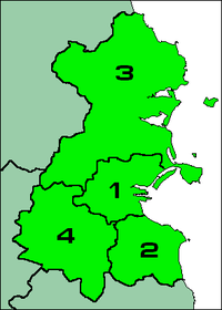
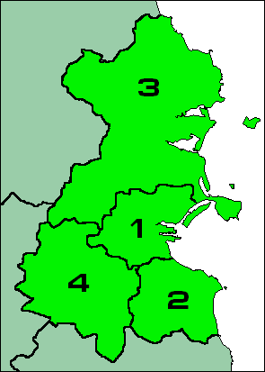
A corporate body for the government of the city with a status of county borough has existed for centuries. Dublin County Council was abolished in 1994 and was replaced by three new county councils. In summary, the local authority divisions within the Dublin Region are the following:
Name Area Population 1 Dublin City 114.99 km2 (44.40 sq mi) 525,383 2 Dun Laoghaire-Rathdown 127.31 km2 (49.15 sq mi) 206,995 3 Fingal 454.60 km2 (175.52 sq mi) 273,051 4 South Dublin 222.74 km2 (86.00 sq mi) 265,174 They rank equally as first level local administrative units of the NUTS 3 Dublin Region for Eurostat purposes. There are 34 LAU 1 entities in the Republic of Ireland. Each local authority is responsible for certain local services such as sanitation, planning and development, libraries, the collection of motor taxation, local roads and social housing. The county is part of the Dublin constituency for the purposes of European elections. For elections to Dáil Éireann, the county is divided into twelve constituencies: Dublin Central, Dublin Mid West, Dublin North, Dublin North Central, Dublin North East, Dublin North West, Dublin South, Dublin South Central, Dublin South East, Dublin South West, Dublin West and Dún Laoghaire. Together they return 47 deputies (TDs) to the Dáil.
Media
- The local radio stations include 98FM, FM104, 103.2 Dublin City FM, Dublin's Q102, Spin 1038, Dublin's Country Mix 106.8, Phantom 105.2 and Radio Nova.
- The local newspapers include Dublin Penny Journal, The Echo, The Northside People, The Southside People, Liffey Champion and The Metro Herald.
Most of the area can receive the five main UK television channels on analogue television as well as the main Irish channels, along with Sky TV and UPC cable television.
Transport
- Road: The major roads are the N2, N3, N4 and N7 national primary roads, and the M1, M11 and M50 motorways.
- Heavy rail: The InterCity and Commuter rail services (Iarnród Éireann).
- Light rail: The Luas tram system serving Dublin City and its suburbs.
- Rapid transit: The DART and the proposed Dublin Metro line.
- Port: Dublin Port and Dún Laoghaire Harbour.
Towns and suburbs
Historical populations Year Pop. ±% 1653 18,847 — 1659 21,827 +15.8% 1821 335,892 +1438.9% 1831 380,167 +13.2% 1841 372,773 −1.9% 1851 405,147 +8.7% 1861 410,252 +1.3% 1871 405,262 −1.2% 1881 418,910 +3.4% 1891 419,216 +0.1% 1901 448,206 +6.9% 1911 477,196 +6.5% 1926 505,654 +6.0% 1936 586,925 +16.1% 1946 636,193 +8.4% 1951 693,022 +8.9% 1956 705,781 +1.8% 1961 718,332 +1.8% 1966 795,047 +10.7% 1971 852,219 +7.2% 1979 983,683 +15.4% 1981 1,003,164 +2.0% 1986 1,021,449 +1.8% 1991 1,025,304 +0.4% 1996 1,058,264 +3.2% 2002 1,122,821 +6.1% 2006 1,187,176 +5.7% 2011 1,270,603 +7.0% [5][6][7][8][9][10] - Adamstown
- Artane
- Ashtown
- Balbriggan
- Baldoyle
- Balgriffin
- Ballinteer
- Ballsbridge
- Ballyboden
- Ballybrack
- Ballybough
- Ballyfermot
- Ballygall
- Ballymount
- Ballymun
- Ballyroan
- Balrothery
- Bayside
- Beaumont
- Belfield
- Blackrock
- Blanchardstown
- Bluebell
- Booterstown
- Brittas
- Broadstone
- Cabinteely
- Cabra
- Carrickmines
- Castleknock
- Chapelizod
- Cherrywood
- Churchtown
- Clondalkin
- Clonsilla
- Clonskeagh
- Clontarf
- Coolmine
- Coolock
- Corduff
- Cornelscourt
- Crumlin
- Dalkey
- Darndale
- Dartry
- Deansgrange
- Dollymount
- Dolphin's Barn
- Donabate
- Donaghmede
- Donnybrook
- Donnycarney
- Drimnagh
- Drumcondra
- Dún Laoghaire
- Dundrum
- East Wall
- Edmondstown
- Fairview
- Finglas
- Firhouse
- Foxrock
- Garristown
- Glasnevin
- Glasthule
- Glencullen
- Glenageary
- Goatstown
- Grangegorman
- Harold's Cross
- Howth
- Inchicore
- Irishtown
- Islandbridge
- Jobstown
- Kill O' The Grange
- Kilbarrack
- Killester
- Killiney
- Kilmacud
- Kilmainham
- Kilnamanagh
- Kilternan
- Kimmage
- Kinsealy
- Knocklyon
- Leopardstown
- Loughlinstown
- Lucan
- Lusk
- Malahide
- Marino
- Milltown
- Monkstown
- Mount Merrion
- Mulhuddart
- Newcastle
- Naul
- Oldbawn
- Ongar
- Palmerstown
- Phibsborough
- Portmarnock
- Portobello
- Raheny
- Ranelagh
- Rathcoole
- Rathfarnham
- Rathgar
- Rathmichael
- Rathmines
- Rialto
- Ringsend
- Rush
- Saggart
- Sallynoggin
- Sandycove
- Sandyford
- Sandymount
- Santry
- Shankill
- Skerries
- Smithfield
- Stepaside
- Stillorgan
- Stoneybatter
- Sutton
- Swords
- Tallaght
- Templeogue
- Terenure
- The Coombe
- Tyrrelstown
- Walkinstown
- Whitechurch
- Whitehall
- Windy Arbour
See also
- For the baronial sub-divisions of the old county
- List of abbeys and priories in the Republic of Ireland (County Dublin)
- List of mountains and hills of County Dublin
- List of rivers in County Dublin
- List of subdivisions of County Dublin
- List of townlands of County Dublin
References
- ^ Census of Population 2011: Preliminary Results, Central Statistics Office. Retrieved 30 October 2011
- ^ a b "Local Government Act, 1991 (Regional Authorities) (Establishment) Order, 1993". http://www.irishstatutebook.ie/ZZSI394Y1993.html. Retrieved 2009-07-31.
- ^ Act of the Oireachtas: Local Government (Dublin) Act, 1993 (Section 9 Part 1(a))
- ^ Dáil Éireann: Parliamentary Debates (3 November, 1993)
- ^ For 1653 and 1659 figures from Civil Survey Census of those years, Paper of Mr Hardinge to Royal Irish Academy March 14, 1865.
- ^ "Census for post 1821 figures". http://www.cso.ie/census.
- ^ "Histpop - The Online Historical Population Reports Website homepage". http://www.histpop.org. Retrieved 4 December 2010.
- ^ "Northern Ireland Census of Population". NISRA. http://www.nisranew.nisra.gov.uk/census. Retrieved 4 December 2010.
- ^ Lee, JJ (1981). "On the accuracy of the Pre-famine Irish censuses". In Goldstrom, J. M.; Clarkson, L. A.. Irish Population, Economy, and Society: Essays in Honour of the Late K. H. Connell. Oxford, England: Clarendon Press.
- ^ Mokyr, Joel; O Grada, Cormac (November). "New Developments in Irish Population History, 1700-1850". The Economic History Review 37 (4): 473–488. doi:10.1111/j.1468-0289.1984.tb00344.x. http://www3.interscience.wiley.com/journal/120035880/abstract
External links
- Dublin Regional Authority
- Architecture of County Dublin
- Civil parishes of County Dublin, from Ireland.com
- Score for 'Quality of Life' in County Dublin
Divisions of County Dublin, Ireland Cities 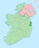
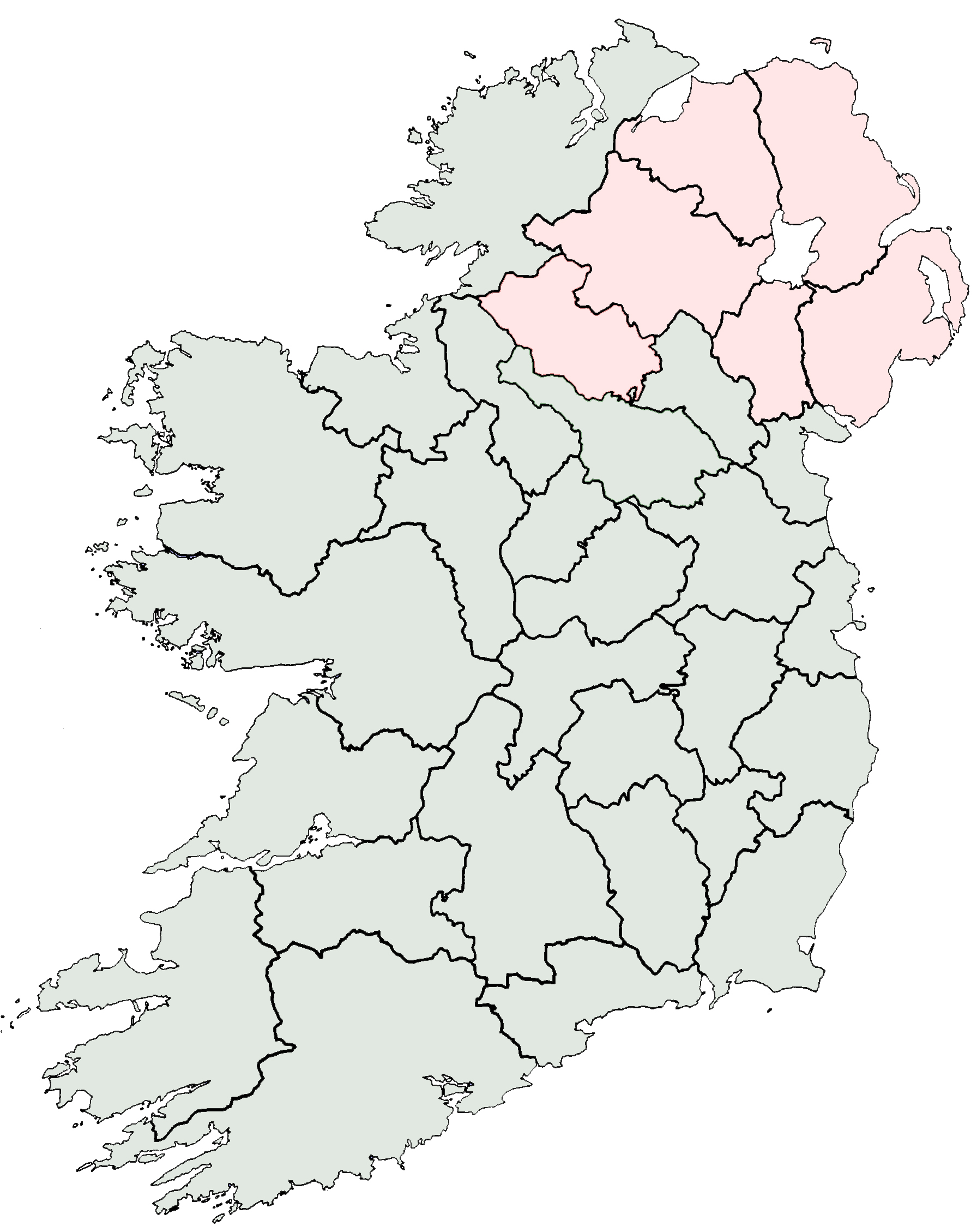
Counties Districts See also Counties of Ireland The counties are listed per provinceConnacht 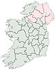
Munster Leinster Ulster Italics denote non-administrative counties. Brackets denote eponymous cities or non-traditional counties. † denotes counties of Northern IrelandRivers of County Dublin Baleally Stream · Ballinascorney Stream · Ballyboughal River · Ballyogan Stream · Ballymaice Stream · Balsaggart Stream · Bartramstown River · Blackbanks Stream · Blackditch Stream · Bloody Stream · Boggeen Stream · Boherboy Stream · Bracken River · River Bradoge · Bride's Glen Stream · Bride's Stream · Broadmeadow River · Brockey Stream · Brook Stream · Brownsbarn Stream · River Camac · Carrickbrack Stream · Carrickmines River · Carysfort-Maretimo Stream · Castle Stream · Cemetery Drain · Claremont Stream · Commons Water · Coolcour Brook · Corduff River · Cot Brook · County Brook · Creosote Stream · Crinken Stream · Cuckoo Stream · Delvin River · River Dodder · Drimnagh Castle Stream · Elm Park Stream · Fettercairn Stream · Finglas River · Finglaswood Stream · Forrest Little Stream · Fox Stream · Foxrock Stream · Furry Glen Stream · Gallanstown Stream · Gallblack Stream · Gay Brook Stream · Glasthule Stream · Glenamuck Stream · Glenaulin Stream · Glencullen River · Golf Stream · Grange Stream · Griffeen River · Hampstead Stream · Hazelbrook Stream · Hurley River · Jobstown Stream · Kealy's Stream · Kilbarrack Stream · Kill o' the Grange Stream · River Liffey · Lissenhall Stream · Little Dargle River · Mabestown Stream · Magazine Stream · Mareen's Brook · Mayne River · Mill Stream · Milverton Stream · Monkstown Stream · Muckross Stream · Naniken River · Nutley Stream · Offington Stream · Owendoher River · East Pinkeen Stream · West Pinkeen Stream · Piperstown Stream · River Poddle · Portrane Stream · Priory Stream · Racecourse Stream · Richardstown River · River Delvin · Robinhood Stream · Rush Town Stream · Santa Sabina Stream · Santry River · Scribblestown Stream · Shallon Stream · Shanganagh River · Slade Brook · Slang River · Sluice River · St. Laurence's Stream · St. Margaret's Stream · Stein River · Swan River · Tallaght Stream · River Tolka · Trimleston Stream · Tromanallison · Turnapin Stream · Turvey River · Viceregal Stream · Wad River · Walkinstown Stream · Ward River · Whitechurch Stream · Whitewater Brook · Wimbletown Stream
List of rivers in County Dublin · List of rivers in IrelandMountains and hills of County Dublin Athgoe Hill · Ballybetagh Hill · Ballymorefinn Hill · Barnaslingan · Ben of Howth · Black Hill · Carrickgollogan · Corrig Mountain · Cruagh Mountain · Dalkey Hill · Glassamucky Mountain · Glendoo Mountain · Holtrass Hill · Killakee Mountain · Killegar · Killiney Hill · Kilmashogue Mountain · Kippure · Knockananiller Hill · Knockandinny · Knockannavea · Knockanvinidee · Knocknagun · Larch Hill · Lugg · Lugmore · Montpelier Hill · Mountseskin · Naul Hills · Newtown Hill · Piperstown · Prince William's Seat · Saggart Hill · Seahan · Seefin · Seefingan · Shamrogue Hill · Shielmartin Hill · Slievenabawnoge · Tallaght Hill · Three Rock Mountain · Tibradden Mountain · Two Rock Mountain · Verschoyles Hill · Windmillhill
Irish mountains by province: Connacht · Leinster · Munster · UlsterCategories:- County Dublin
- Leinster
- Counties of the Republic of Ireland


Wikimedia Foundation. 2010.