- Mulhuddart
-
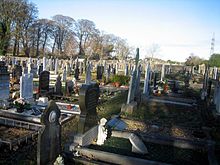 Mulhuddart Graveyard
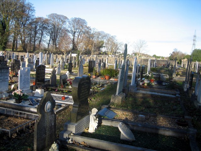
Mulhuddart (Irish: Mullach Eadrad, meaning "the hill of the milking place") is a suburb situated to the north-west of Dublin city, in the barony of Castleknock, Ireland. The River Tolka passes near the village.
Contents
Location and access
The N3 dual carriageway now by-passes the village. It is located near Blanchardstown, now also a suburb of Dublin.
Mulhuddart village essentially comprises a main street, which was the old Navan Road, on which there are a petrol station, a few shops and cafés and a school. Though the village has been by-passed, an under-pass connects the main street to Blakestown. Mulhuddart includes the suburban localities of Ladyswell, and Manorfield, together with townlands such as Priesttown. Newer estates to the west of the village such as Swallowbrook and Pheasant's Run are within the townland of Mulhuddart.
Located on the outskirts of the village is the Damastown Industrial Estate, one of Dublin's largest industrial estates which includes a large IBM campus employing over 4,000 people. To the north is the village of Tyrrelstown, with a sizable modern housing development.
History
Placenames
The origins and meaning of the name Mulhuddart are unknown. However a number of explanations are offered, the most likely being that the name came from the Irish Mullach Eadartha meaning "the hill of the milking place". In ancient Ireland, cows were driven out onto upland pastures during the summer months and special places were designated for their milking.
Many townland names surrounding the village owe their origins to Norman settlers who colonised the area after the Norman capture of Dublin in 1170. "Buzzardstown" is so called after the family of William Bossard and "Tyrrellstown" is named after a branch of the Tyrrells, who were created barons of Castleknock in 1173.
The townland of Goddamendy is perhaps the only townland in Ireland containing a prayer in its name. Tradition has it that when a priest arrived late for the anointing of a dying man, the dead man's relative cursed the priest, who replied "May God amend thee!"[citation needed]
Features
There are a number of antiquities and old houses in the area. These include the ruins of the Church of Mary, Our Lady's Well, Mulhuddart National School and Parlickstown House. The Ordnance Survey of Ireland Sheet 50 map also shows a graveyard and burial ground at Cloghran.
Muluddart Church, the Church of Mary, stands above the village on a hill which until recently, before housing development began to encroach, afforded fine views of the Wicklow Mountains (the mountains are still visible, though not as prominently). The church stands on a curved mound, suggesting it was built on the site of an earlier church which was protected by an enclosure. The current ruins post-date the Anglo-Norman settlement of the area.
Government and representation
Mulhuddart is located in the Fingal County Council area (following the abolition of County Dublin as an administrative division of the state)[1] and in the 2009 local elections for the Castleknock ward, which covers the Mulhuddart area, the following candidates were elected to the four seats (with percentage share of first preference vote): Joe Higgins (Socialist Party) 28.07%, Eithne Loftus (Fine Gael) 22.45%, Peggy Hamill (Labour) 16.32% and Mags Murray (Fianna Fáil) 12.44%.[2]
Mulhuddart is in the Dublin West Dail constituency.
See also
References
- ^ Local Government Act, 2001 Part one, schedule five, pp195.
- ^ Local elections 2009 http://electionsireland.org/result.cfm?election=2009L&cons=35
- "Mulhuddart, A History of a Suburban Village", published as part of a larger book by the parish of Mulhuddart to commemorate the opening of its new Church in 1993.
Coordinates: 53°24′10″N 6°23′55″W / 53.402893°N 6.398721°W
Categories:- Towns and villages in Fingal
Wikimedia Foundation. 2010.