- South Tipperary
-
South Tipperary
Tiobraid Árann Theas— County — 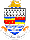
Coat of armsMotto: Vallis Aurea Siurensis (Latin)
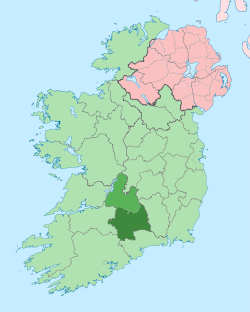
"The Golden Vale of the Suir"Country Ireland Province Munster County seat Clonmel Government - Type County Council Area - Total 2,257 km2 (871.4 sq mi) Population (2011) 88,433 Car plates TS Website southtipperary.ie South Tipperary (Irish: Tiobraid Árann Theas) is a county in Ireland. It is part of the South-East Region and is also located in the province of Munster. South Tipperary County Council is the local authority for the county. It consists of 52% of the land area of the traditional county of Tipperary. The population of the county is 88,433 according to the 2011 census.
Contents
Geography and political subdivisions
The region is part of the central plain of Ireland, but the diversified terrain contains several mountain ranges: the Knockmealdown, the Galtee. No part of the county touches the coast. The county is drained by the River Suir. The centre is known as 'the Golden Vale', a rich pastoral stretch of land in the Suir basin which extends into counties Limerick and Cork.
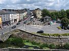
The county was established in 1898 and has had a county council ever since, with separate assize courts since 1838. The county seat is Clonmel; other important urban centres include Carrick-on-Suir, Cashel, Cahir, and Tipperary. The county's motto is Vallis Aurea Siurensis (Latin: The Golden Vale of the Suir).
Vital statistics for 2004 released by the Central Statistics Office show that South Tipperary has the lowest rate of neo-natal mortality in the country, at 0.9 occurrences per 1000 people. This compares with 2.9 for North Tipperary, and 3.4 for Dublin City.[citation needed]
Baronies
There are six historic baronies in South Tipperary: Clanwilliam, Iffa and Offa East, Iffa and Offa West, Kilnamanagh Lower, Middle Third and Slievardagh.
Civil parishes and townlands
Main article: List of civil parishes of South TipperaryCivil parishes in Ireland were delineated after the Down Survey as an intermediate subdivision, with multiple townlands per parish and multiple parishes per barony. The civil parishes had some use in local taxation and were included on the nineteenth century maps of the Ordnance Survey of Ireland.[1] For poor law purposes, District Electoral Divisions replaced civil parishes in the mid-nineteenth century. There are 123 civil parishes in the county.[2]
Local government and politics
The administrative county of Tipperary (South Riding) was established in 1898 and continued in existence until 2002. The area also had a separate existence as a judicial county following the establishment of assize courts in 1838. The council's name changed to South Tipperary County Council under the Local Government Act 2001. The Council oversees the county as an independent local government area. Per Schedule 8 of the Local Government Act 2001, the Council resolved to give to the office of its chairperson and vice-chairperson the title of “Mayor” or “Deputy Mayor”, respectively. The Council is made up of 21 representatives, directly elected through the system of proportional representation by means of a single transferable vote. The present Council was elected at the local elections held in June 2004.
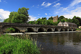 Ardfinnan Castle, Ardfinnan.
The functions of the Council are divided into reserved and executive functions. Reserved functions are carried out by the members and relate primarily to policy issues, including the county development plan and the annual budget. Executive functions are the responsibility of the county manager. These include the day to day administration of services.
Under the provisions of the Local Government Act 1991, (Regional Authorities) (Establishment) Order, 1993,[3] the territory of South Tipperary is defined as being in the South-East Region. This region is a NUTS III region of the European Union. The county of North Tipperary, by contrast, is part of the Mid-West Region Region. At a NUTS II level, both counties are in the Southern and Eastern region.
For the purposes of elections to Dáil Éireann, the bulk of the county is part of the constituency of Tipperary South[4] The constituency returns 3 deputies to Dáil Éireann. Some northern portions of the county lie in the constituency of Tipperary North. For elections to the European Parliament, the county is part of the South constituency which returns 3 MEPs.
Irish language
Native Irish speakers existed in South Tipperary until the middle of the 20th century. Recordings of the dialect before the last native speakers died have been made available through a project of the Royal Irish Academy Library.[5]
Leading population centers Rank Town Population Barony
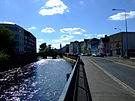
Clonmel
(County Town)
Cahir1 Clonmel 17,008 Iffa and Offa East 2 Carrick-on-Suir 5,906 Iffa and Offa East 3 Tipperary 5,065 Clanwilliam 4 Cahir 3,904 Iffa and Offa West 5 Cashel 2,936 Middle Third 6 Killenaule 1,774 Slievardagh 7 Fethard 1,374 Middle Third 8 Bansha 1,090 Clanwilliam based on Irish Census 2006 Records References
- ^ "Interactive map (civil parish boundaries viewable in Historic layer)". Mapviewer. Ordnance Survey of Ireland. http://ims0.osiemaps.ie/website/publicviewer/main.aspx. Retrieved 9 March 2010.
- ^ Placenames Database of Ireland - Tipperary civil parishes.
- ^ Official Irish Statues website. Local Government Act 1991, (Regional Authorities) (Establishment) Order.
- ^ "Electoral (Amendment) Act 2009: Schedule". Irish Statute Book database. http://www.irishstatutebook.ie/2009/en/act/pub/0004/sched.html. Retrieved 29 September 2010.
- ^ The Doegen Records Web Project (2009). "Recordings of Séamas Ó Liatháin" (in Irish). Royal Irish Academy. http://dho.ie/doegen/search/node/S%C3%A9amas%20%C3%93%20Liath%C3%A1in. Retrieved 18 February 2010.
External links
Counties of Ireland The counties are listed per provinceConnacht Munster Clare · Cork (Cork City) · Kerry · Limerick (Limerick City) · Tipperary (North Tipperary • South Tipperary) · Waterford (Waterford City)
Leinster Ulster Italics denote non-administrative counties. Brackets denote eponymous cities or non-traditional counties. † denotes counties of Northern IrelandLocal administrative units of Ireland The councils are listed per NUTS 3 region.Border Region Cavan County Council · Donegal County Council · Leitrim County Council · Louth County Council · Monaghan County Council · Sligo County Council
West Region Galway City Council · Galway County Council · Mayo County Council · Roscommon County Council
Midlands Region Laois County Council · Longford County Council · Offaly County Council · Westmeath County Council
Mid-East Region Meath County Council · Kildare County Council · Wicklow County Council
Dublin Region Fingal County Council · Dublin City Council · Dún Laoghaire-Rathdown County Council · South Dublin County Council
South-East Region Carlow County Council · Kilkenny County Council · South Tipperary County Council · Waterford City Council · Waterford County Council · Wexford County Council
South-West Region Cork City Council · Cork County Council · Kerry County Council
Mid-West Region Clare County Council · Limerick City Council · Limerick County Council · North Tipperary County Council
Places in South Tipperary Towns Villages Ardfinnan · Ballingarry · Ballyclerahan · Ballylooby · Ballyporeen · Bansha · Boytonrath · Cappawhite · Clogheen · Clonoulty · Coalbrook · Cullen · Donohill · Dualla · Dundrum · Emly · Garranlea · Golden · Gortnahoe · Hollyford · Husseystown · Killenaule · Kilsheelan · Kilmoyler · Lisronagh · Marlfield · Mullinahone · New Birmingham · Newcastle · New Inn · Newtown · Ninemilehouse · Rosegreen · Rossmore · SkeheenarinkyBaronies Clanwilliam · Iffa and Offa East · Iffa and Offa West · Kilnamanagh Lower · Middle Third · SlievardaghList of townlands in County Tipperary · Category:Mountains and hills of County Tipperary · Category:Rivers of County Tipperary · Category:Geography of South Tipperary · Baronies of Tipperary
Categories:- County Tipperary
- Counties of the Republic of Ireland
- South Tipperary
- Local administrative units of the Republic of Ireland
- Munster
Wikimedia Foundation. 2010.

