- County Down
-
County Down
Contae an Dúin
Coontie Doon / Countie Doun
Coat of armsMotto: Absque Labore Nihil (Latin)
"Nothing Without Labour"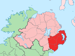
Country United Kingdom Region Northern Ireland Province Ulster County seat Downpatrick Area – Total 945.2 sq mi (2,448 km2) Area rank 12th Population (2001) 492,840 – Rank 4th Contae an Dúin is the Irish name, Countie Doun[1] and Coontie Doon[2] are Ulster Scots spellings. County Down (named after its county town, Downpatrick) is one of six counties that form Northern Ireland, situated in the north-east of the island of Ireland. Adjoined to the south-east shore of Lough Neagh, the county covers an area of 2,448 km², with a population of about 492,840. It is also one of the thirty-two traditional counties of Ireland, lying within the province of Ulster.
The county was archaically called Downshire. It borders County Antrim to the north, the Irish Sea to the east and south, County Armagh to the west, and County Louth to the southwest. In the east of the county is Strangford Lough and the Ards Peninsula. The largest town is Bangor, on the northeast coast. Three other large towns and cities are on its border: Newry lies on the western border with County Armagh, while Lisburn and Belfast lie on the northern border with County Antrim. Down contains both the southernmost point of Northern Ireland (Cranfield Point) and the easternmost point of Ireland (Burr Point).
It is one of only two counties of Ireland to presently have a majority of the population from a Protestant community background, according to the 2001 census. The other is County Antrim.
Contents
Geography
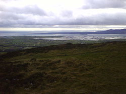
 Mourne Mountains
Down contains two significant peninsulas: Ards Peninsula and Lecale peninsula.
The county has a coastline along Belfast Lough to the north and Carlingford Lough to the south (both of which have access to the sea). Strangford Lough lies between the Ards Peninsula and the mainland. Down also contains part of the shore of Lough Neagh. Smaller loughs include Lough Island Reavy.
The River Lagan forms most of the border with County Antrim. The River Bann also flows through the southwestern areas of the county. Other rivers include the Clanrye and Quoile.
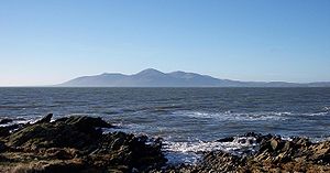
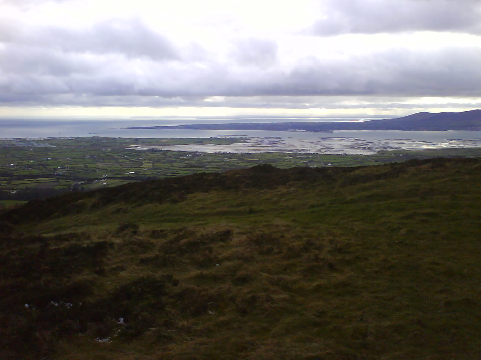
 The mouth of Carlingford Lough from Knockree in south County Down
There are several islands off the Down coast: Mew Island, Light House Island and the Copeland Islands, all of which lie to the north of the Ards Peninsula. Gunn Island lies off the Lecale coast. In addition there are a large number of small islands in Strangford Lough.
County Down is where, in the words of the famous song by Percy French, "The mountains of Mourne sweep down to the sea", and the granite Mourne Mountains continue to be renowned for their beauty. Slieve Donard, at 849 m (2,785 ft), is the highest peak in the Mournes and in Northern Ireland. Another important peak is Slieve Croob, at 534 m (1,752 ft), the source of the River Lagan.
Places of interest
- An area of County Down is known as the Brontë Homeland (situated between Rathfriland and Banbridge, where Patrick Brontë had his church), after Patrick Brontë (originally Brunty), father of Anne, Charlotte, Emily Brontë, and Branwell Bronte. Patrick Bronte was born in this region.
- The city of Newry in the south of the county contains St Patrick's (Church of Ireland, 1578), overlooking the city centre from Church street, on the east side of the city, which is considered to be Ireland's first ever Protestant church.[citation needed] Newry is also the home of the first summit-level canal ever to be built in the British Isles.[citation needed]
- Down is also home to Exploris, the Northern Ireland Aquarium, located in Portaferry, on the shores of Strangford Lough, on the Ards Peninsula.
- The Old Inn in Crawfordsburn is one of Ireland's oldest hostelries, with records dating back to 1614. It is predated however by Donaghadee's Grace Neill's which was opened in 1611. The Old inn claims that people who have stayed there include Jonathan Swift, Dick Turpin, Peter the Great, Lord Tennyson, Charles Dickens, Anthony Trollope, former US president George H. W. Bush, and C. S. Lewis, who honeymooned there.[3]
- Scrabo Tower, in Newtownards, was built as a memorial to Charles Stewart, 3rd Marquess of Londonderry.
- Saint Patrick is reputed to be buried at Down Cathedral in Downpatrick, reputedly alongside St. Brigid[citation needed] and St. Columba[citation needed].
- Saul, County Down (from the Irish: Sabhall meaning "Barn" – where Saint Patrick said his first mass in Ireland
Settlements
Historical populations Year Pop. ±% 1659 15,183 — 1821 325,410 +2043.3% 1831 352,012 +8.2% 1841 361,446 +2.7% 1851 320,817 −11.2% 1861 299,302 −6.7% 1871 277,294 −7.4% 1881 248,190 −10.5% 1891 224,008 −9.7% 1901 205,889 −8.1% 1911 204,303 −0.8% 1926 209,228 +2.4% 1937 210,687 +0.7% 1951 241,181 +14.5% 1961 266,939 +10.7% 1966 286,631 +7.4% 1971 311,876 +8.8% 1981 417,978 +34.0% 1991 454,411 +8.7% 2001 489,004 +7.6% [4][5][6][7][8][9] Cities
(population of 75,000 or more at 2001 Census)[10]
- Belfast (east)
- Newry (partially in County Armagh; has city status)
Large towns
(population of 18,000 or more and under 75,000 at 2001 Census)[10]
Medium towns
(population of 10,000 or more and under 18,000 at 2001 Census)[10]
Small towns
(population of 4,500 or more and under 10,000 at 2001 Census)[10]
Small villages or hamlets
(population of less than 1,000 at 2001 Census)[10]
- Atticall
- Annsborough
- Ballyhalbert
- Ballyhornan
- Ballykinler
- Ballymartin
- Bryansford
- Burren
- Cabra, County Down
- Carrowdore
- Clough
- Cloughey
- Crawfordsburn
- Donaghcloney
- Dromara
- Gilnahirk
- Groomsport
- Hilltown
- Killinchy
- Killough
- Lawrencetown
- Leitrim
- Listooder
- Longstone
- Loughbrickland
- Loughinisland
- Mayobridge
- Saul
- Scarva
- Seaforde
- Sheeptown
- Strangford
Subdivisions
Baronies
Main article: Baronies of Ireland- Ards Lower (from the Irish: Aird)
- Ards Upper
- Castlereagh Lower
- Castlereagh Upper
- Dufferin (from the Irish: Duifrian)
- Iveagh Lower, Lower Half (from the Irish: Uíbh Eachach)
- Iveagh Lower, Upper Half
- Iveagh Upper, Lower Half
- Iveagh Upper, Upper Half
- Kinelarty (from the Irish: Cineál Fhártaigh)
- Lecale Lower (from the Irish: Leath Cathail)
- Lecale Upper
- Lordship of Newry
- Mourne (from the Irish: Múrna)
Parishes
Main article: List of civil parishes of County DownTownlands
Main article: List of townlands in County DownSport
County Down holds one of Northern Irelands' best known and most successful rugby clubs, Ballynahinch Rugby Football Club (BRFC), situated 3 miles outside Ballynahinch town. Hinch RFC have gained the following titles, IRFU Club Of The Year 1998, Ulster Club Of The Year 1998 - 2002 - 2003 - 2009.
In Gaelic Football the county has also been successful. They are the first team out of the nine counties of Ulster to win an All-Ireland status in 1960 and from then on they have won four more All-Ireland titles making it a total of five (1960, 1961, 1968, 1991, 1994). They have only lost once in an All-Ireland final, when they were defeated by Cork in 2010 by only one point. They are the only county that have never been beaten by Kerry in the All-Ireland Championship. They also brought the biggest crowds ever to Croke park with a total attendance of 90,556 in 1961, which has never been surpassed.
They currently have four minor all Ireland titles (1977, 1987, 1999 and 2005), twelve Ulster titles (1959, 1960, 1961, 1963, 1965, 1966, 1968, 1971, 1978, 1981, 1991, 1994) and one under 21 all Ireland title (1979).
They have ten minor Ulster titles (1958, 1960, 1962, 1963, 1966, 1977, 1979, 1986, 1987, 1999), and nine under 21 Ulster titles (1958, 1960, 1962, 1963, 1966, 1977, 1979, 1986, 1987, 1999) following second on the table as Tyrone is first with 11.
Main article: Down GAASee also
- Abbeys and priories in Northern Ireland (County Down)
- List of civil parishes of County Down
- List of places in County Down
- List of townlands in County Down
- Lord Lieutenant of Down
- High Sheriff of Down
References
- ^ 2008 Annual Report in Ulster Scots North-South Ministerial Council.
- ^ 2006 Annual Report in Ulster Scots North-South Ministerial Council.
- ^ Crawfordsburn Old Inn website
- ^ For 1653 and 1659 figures from Civil Survey Census of those years, Paper of Mr Hardinge to Royal Irish Academy March 14, 1865.
- ^ Census for post 1821 figures.
- ^ Histpop.org
- ^ NISRA.gov.uk
- ^ Lee, JJ (1981). "On the accuracy of the Pre-famine Irish censuses". In Goldstrom, J. M.; Clarkson, L. A.. Irish Population, Economy, and Society: Essays in Honour of the Late K. H. Connell. Oxford, England: Clarendon Press.
- ^ Mokyr, Joel; O Grada, Cormac (November). "New Developments in Irish Population History, 1700-1850". The Economic History Review 37 (4): 473–488. doi:10.1111/j.1468-0289.1984.tb00344.x. http://www3.interscience.wiley.com/journal/120035880/abstract.
- ^ a b c d e f g "Statistical classification of settlements". NI Neighbourhood Information Service. http://www.ninis.nisra.gov.uk/mapxtreme_towns/statistical%20classification.htm. Retrieved 23 February 2009.
Further reading
- Harris, Walter (attributed). 1744. The Ancient and Present Stare of the County of Down...'Dublin.
- The Memoirs of John M. Regan, a Catholic Officer in the RIC and RUC, 1909–48, Joost Augusteijn, editor, District Inspector, Co. Down 1930s, 1919, ISBN 978-1-84682-069-4.
External links
- County Down at the Open Directory Project
- County Down tourism
- Armagh and Down tourism
- Culture Northern Ireland - Industrial Heritage of County Down
- Down Gaelic Athletic Association/Cummann Lúthchleas Gael Coiste An Dún
- Genealogy indexes for County Down
- Ardglass fishing port on East Down coast
Counties and cities of Northern Ireland Counties Cities Counties of Ireland The counties are listed per provinceConnacht 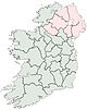
Munster Leinster Ulster Italics denote non-administrative counties. Brackets denote eponymous cities or non-traditional counties. † denotes counties of Northern IrelandCategories:


Wikimedia Foundation. 2010.