- Donaghcloney
-
Coordinates: 54°25′12″N 6°15′37″W / 54.419979°N 6.260319°W
Donaghcloney Irish: Domhnach Cluana 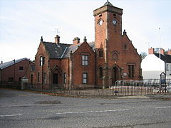
St Patrick's church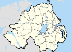

Donaghcloney shown within Northern IrelandPopulation 972 (2001 Census) Irish grid reference J129537 - Belfast 23 mi (37 km) District Craigavon County County Down Country Northern Ireland Sovereign state United Kingdom Post town CRAIGAVON Postcode district BT66 Dialling code 028, +44 28 EU Parliament Northern Ireland UK Parliament Upper Bann NI Assembly Upper Bann List of places: UK • Northern Ireland • Down Donaghcloney or Donacloney (from Irish: Domhnach Cluana, meaning "church of the meadow")[1][2] is a small village and townland in County Down, Northern Ireland. It lies on the River Lagan between Lurgan, Dromore and Banbridge. In the 2001 Census it had a population of 972.
Contents
Linen industry
Donaghcloney is a typical Ulster village linked to the Irish linen industry since 1742. The most recent Ewart Liddell company was formed in 1973 by a merger between William Ewart and Sons which started business in Belfast in 1814 and William Liddell and Company which started in Donaghcloney in 1866. Their factory was the biggest Irish linen, Jacquard weaving company in Ireland, and made the linen for the RMS Titanic[3], however it is now shut. The name lives on as a sales and marketing company, Liddell Linens, a subsidiary of Hilden Ltd.
Sport
The village has a history of cricket playing over many generations with the Donaghcloney Cricket Club.
Education
- Donaghcloney Primary School
2001 Census
Donaghcloney is classified as a small village by the Northern Ireland Statistics and Research Agency (NISRA) (i.e. with population between 500 and 1,000 people). On Census day (29 April 2001) there were 972 people living in Donaghcloney. Of these:
- 21.8% were aged under 16 years and 21.9% were aged 60 and over,
- 48.6% of the population were male and 51.4% were female,
- 4.0% were from a Catholic background and 93.5% were from a Protestant background,
- 2.5% of people aged 16-74 were unemployed.
 Mill Pond at the abandoned Ewart Riddell Weaving Factory
For more details see: NI Neighbourhood Information Service
People
Loyalist Robin "the Jackal" Jackson, former leader of the Ulster Volunteer Force's (UVF) Mid-Ulster Brigade, was a notable resident of Donaghcloney up until his death of lung cancer at the age of 52 on 30 May 1998.
References
Categories:- Villages in County Down
- Townlands in County Down


Wikimedia Foundation. 2010.