- Bryansford
Infobox Irish Place
name = Bryansford
irish =
crest
motto =
map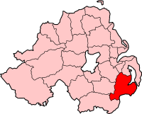
pin coords =
north coord =
west coord =
area =
province =Ulster
county =County Down
NI district = Down District
UK constituency = South Down
EU constituency = Northern Ireland
stdcode = 028, +437
posttown = Castlewellan
postcode = BT33
population = 392
census yr = 2001
web =
|Bryansford (In Irish "Áth Bhriain") is a
village inCounty Down ,Northern Ireland , situated between the towns of Newcastle,Dundrum andCastlewellan . It lies in the foothills of theMourne Mountains and is the location ofTollymore Forest Park . It had a population of 392 people in the 2001 Census.It is located in the
Down District Council area.Places of interest
The Kilcoo Parish Church was built in 1712 by the Annesley family, whose family seat is in nearby Castlewellan.
Percy Jocelyn , the Bishop of Clogher from 1820 to 1822, is thought to have been buried in the Roden familty vault in the church. [ [http://clogher.anglican.org/1500/index.php?p=postref The Church of Ireland Diocese of Clogher] ]Tollymore Forest Park is also located in the village. The park covers 630 hectares and was previously the property of theEarl of Roden .People
*Sir
Norman Stronge was born in the village.
*Niall Kane, local watchmaker.port
The village has a successful
Gaelic football team, Bryansford GAC. The team have won theUlster Senior Club Football Championship twice, in 1969 and 1970. [ [http://www.bryansford.com/history.html Bryansford GAC] ]2001 Census
Bryansford is classified as a rural settlement by the [http://www.nisra.gov.uk/ NI Statistics and Research Agency (NISRA)] On Census day (
29 April 2001 ) there were 392 people living in Bryansford. Of these:
*27.6% were under 16 years old and 14.8% were aged 60 and above
*49.5% of the population were male and 50.5% were female
*61.4% were from a Catholic Community Background and 34.3% were from a 'Protestant and Other Christian (including Christian related)' Community Background.
*1.2% of people aged 16–74 were unemployed. [ [http://www.ninis.nisra.gov.uk/mapxtreme/report.asp?INIT=YES&POSTCODE=BT330PT&DESC=FromGeneral&CurrentLevel=COA&ID=95NN230007&Name=95NN230007&Tab=COA NI Neighbourhood Information Service] ]References
ee also
*
List of villages in Northern Ireland
Wikimedia Foundation. 2010.