- Gilnahirk
Infobox Irish Place
name = Gilnahirk
irish = Giolla na hAdhairce
scots = Stae Brae
crest
motto =
map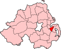
pin coords = left: 165px; top: 84px
north coord = 54.5831 | west coord = -5.8397
area = | elevation =
province =Ulster
county =County Down
NI district =Castlereagh Borough Council
UK constituency = East Belfast
EU constituency = Northern Ireland
stdcode = 028, +44 28
posttown = Belfast
postcode = BT5
population =
census yr =
web =
|Gilnahirk (derive|Irish|Giolla na hAdhairce|The boy of the horn, Ulster Scots: "Stae Brae") is a
suburb ofBelfast ,Northern Ireland . It is within theCastlereagh Borough Council area and is located in the East Belfast constituency. It is a largely middle-class area with a mainlyProtestant population. It lies around 5 miles (8 km) east south-east ofBelfast City Hall .Geographic and historical information
Gilnahirk is a name that dates back to the
Middle Ages , whenever it was necessary for an area to have a "watchboy" called a "gil" on the top of the highest hill to look out for incoming enemies. "Hirk" means hill. Therefore, Gilnahirk means "watchboy on top of a hill".Neighbouring areas
*
Braniel
*Cherryvalley
* TullycarnetExternal links
* [http://www.ballyhack.co.uk/ Serving Gilnahirk]
* [http://www.cherryvalleyvillage.co.uk/ CherryvalleyVillage website]
* [http://www.castlereagh.gov.uk/ Castlereagh Borough Council official website]
* [http://www.nisra.gov.uk/census/maps/castlereagh/outputareas/Gilnahirk.asp Official boundary]
* [http://www.27thbelfastscouts.co.uk/ 27th Belfast Scouts official website]
* [http://www.axcis.co.uk/26055.html Gilnahirk Primary School]
* [http://www.knock.co.uk/portal.aspx Our Lady & St. Patrick's College official website]
* [http://www.gilnahirkbaptist.org.uk/ Gilnahirk Baptist Church official Web site]
* [http://www.historyfromheadstones.com/index.php?displaygraveyardinfo&graveyard_name=Gilnahirk%20Pres Gilnahirk Presbyterian Graveyard]
* [http://www.bbc.co.uk/ww2peopleswar/stories/11/a8533811.shtml Gilnahirk's Best Kept Secret] (from the BBC's World War 2 public archive)
Wikimedia Foundation. 2010.