Gransha

Gransha

Infobox Irish Place
name = Gransha
gaeilge = Geransha
crest

motto =
map

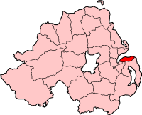
pin coords = left: 175px; top: 75px
north coord = 54.700 | west coord = 5.667
area = | elevation =
town = Bangor
NI district = North Down Borough
UK constituency = North Down
EU constituency = Northern Ireland
stdcode = 028, +44 28
posttown = Bangor
postcode = BT19, BT20
county = County Down
population = 15,000
census yr = 2001
web =
|

Gransha is a district on the south-east side of Bangor, County Down in Northern Ireland. It is an area of the south of the town, with a population of approximately 15,000, third behind other Bangor districts, e.g. Kilcooley (23,000), Ballyholme (22,000).

Gransha is one of the oldest areas in Bangor but has expanded over the years to include housing developments such as Hanover, Cranely, Sunningdale and Gransha Green (Navar Drive). The area has become well established over the years and is perceived to be quiet, pleasant and popular, but more recently has been surpassed by Old Gransha on the known Ashbury side.

Prior to becoming a residential area, Gransha was mainly farmland, some of which was previously owned by the Irvine family. When development took place, some streets were given the name of the previous owners. There are still working farms at the Gransha Roundabout and at the other end of the suburb, with houses back onto the countryside.

Gransha has one post-primary school: the Clanmorris Campus of Bangor Academy (Formerly Gransha Boys High before the amalgamation with Bangor High). The site is slated for another redevelopment in the next few years and is due to become the home of Bangor Grammar School.

External links

* [http://www.bangorfm.co.uk Bangor FM - Bangor's Radio Station]
* [http://www.granshaequestrian.co.uk Grahsha Equestrian Centre - Horse Riding Club]


Wikimedia Foundation. 2010.

Игры ⚽ Нужно решить контрольную?

Look at other dictionaries:

  • Bangor, County Down — Infobox UK place official name= Bangor irish name= Beannchor scots name= local name= static static image caption= map type= Northern Ireland latitude= 54.66 longitude= 5.67 belfast distance= population= 58,388 (2001 Census) irish grid reference=… …   Wikipedia

  • Oakgrove Integrated College — Established 1992 Type Integrated secondary school Location Stradreagh Gransha Park …   Wikipedia

  • William Fleming (Irish republican) — For other people of the same name, see William Fleming (disambiguation). Derry Brigade Memorial, Bogside, Derry, August 2009 William James Paul Fleming (1965 – 6 December 1984) was a volunteer in the Derry Brigade of the Provisional Irish… …   Wikipedia

  • List of townlands in County Monaghan — This is a link page for townlands in County Monaghan in the Republic of Ireland. In any such case where two or more townlands share the same name, the Civil Parish in which the townland lies is denoted directly afterward in brackets. NOTOC AAcres …   Wikipedia

  • Gorgon class monitor — HMS Gorgon Class overview Name: Gorgon Builders: Armstrong Whitworth …   Wikipedia

  • Downpatrick — Coordinates: 54°19′19″N 5°42′11″W / 54.322°N 5.703°W / 54.322; 5.703 …   Wikipedia

  • Newcastle, County Down — Coordinates: 54°12′36″N 5°52′55″W / 54.21°N 5.882°W / 54.21; 5.882 …   Wikipedia

  • Newtownards — Coordinates: 54°35′28″N 5°40′48″W / 54.591°N 5.68°W / 54.591; 5.68 …   Wikipedia

  • County Down — Contae an Dúin Coontie Doon / Countie Doun Coat of arms …   Wikipedia

  • Newry — For other uses, see Newry (disambiguation). Coordinates: 54°10′34″N 6°20′56″W / 54.176°N 6.349°W / 54.176; 6.349 …   Wikipedia

Share the article and excerpts

Direct link
Do a right-click on the link above
and select “Copy Link”