- Seahill
Infobox Irish Place
name = Seahill
irish =
crest
motto =
map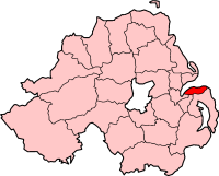
pin coords = left: 172px; top: 75px
north coord = | west coord =
area = | elevation =
province =Ulster
county =County Down
NI district = North Down Borough
UK constituency = North Down
EU constituency = Northern Ireland
stdcode = 028, +44 28
posttown =Holywood
postcode = BT18
population = 1,186
census yr = 2001
web =
|Seahill is a
village inCounty Down ,Northern Ireland , south west ofHelens Bay and about 7 km east ofHolywood . It is separated fromCraigavad andCultra to the west by the Royal Belfast Golf Club. In the 2001 Census it had a population of 1,186 people. It is within theBelfast Metropolitan Urban Area. Seahill is a commuter settlement for Belfast with few services and community facilities, and without a true focal point. However, the villages close proximity to the North Down coastal path and views over Belfast Lough make it a popular and competitve housing market. It largely evolved in the mid-19th century.2001 Census
Seahill is classified as a village by the [http://www.nisra.gov.uk/ NI Statistics and Research Agency (NISRA)] (ie with population between 1,000 and 2,250 people). On Census day (
29 April 2001 ) there were 1,186 people living in Seahill. Of these:
*19.3% were aged under 16 years and 25.6% were aged 60 and over
*50.3% of the population were male and 49.8% were female
*15.3% were from aCatholic background and 75.6% were from a Protestant background
*1.4% of people aged 16-74 were unemployedFor more details see: [http://www.ninis.nisra.gov.uk/ NI Neighbourhood Information Service]
Transport
Seahill railway station was opened on4 April 1966 . [cite web | title=Seahill station | work=Railscot - Irish Railways | url=http://www.railscot.co.uk/Ireland/Irish_railways.pdf | accessdate=2007-08-28]References
*Draft Belfast Metropolitan Area Plan 2015
See also
*
List of villages in Northern Ireland
*List of towns in Northern Ireland
Wikimedia Foundation. 2010.