- Cloghy
-
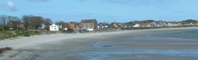
 Cloghy Bay
Cloghy or Cloughy (from Irish: Clochaigh meaning "stony place")[1][2] is a small village and townland in County Down, Northern Ireland, on the east (Irish Sea) coast of the Ards Peninsula. It had a population of 752 people in the 2001 Census. It lies within the Borough of Ards.
Contents
Places of interest
- Kirkistown Castle is an impressive tower house built in 1622 by Roland Savage. It post-dates the Plantation but is fully in the late medieval tower-house tradition. Parts of the bawn wall survive with three-quarter round flanker towers at the angles. The tower was remodelled in gothic style in 1800. The Environment and Heritage Service opened it to the public for the first time in 2001.
- The South and North Rocks off Cloghy have always been deemed two of the most deadly hazards off the coast of the Ards Peninsula. In the 25 years between 1875 and 1900, 75 boats and 29 men were lost.
Demographics
Cloghy is classified as a small village by the Northern Ireland Statistics and Research Agency (NISRA) (ie with population between 500 and 1,000 people). On Census day (29 April 2001) there were 752 people living in Cloghy. Of these:
- 20.7% were aged under 16 years and 23.7% were aged 60 and over
- 50.4% of the population were male and 49.6% were female
- 20.5% were from a Catholic background and 74.6% were from a Protestant background
- 2.6% of people aged 16-74 were unemployed
For more details see: NI Neighbourhood Information Service
Sport
Kirkistown car racing circuit is just over a mile from Cloghy.
References
External links
Categories:- Villages in County Down
Wikimedia Foundation. 2010.