- Mitchelstown Cave
-
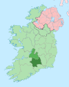
Mitchelstown Cave Location Between Mitchelstown, County Cork and Cahir, County Tipperary Discovery 1833 Geology Limestone Access Show cave access only Mitchelstown Cave is a limestone cave near Burncourt South Tipperary, Ireland. Situated 12 kilometres (7.5 mi) from Mitchelstown, County Cork, it became the first cave in Ireland to be developed for the public in 1972.[1]
The cave is located in the townland of Coolagarranroe,[2] off the R639 between Mitchelstown and Cahir. It is a privately-owned local landmark and tourist destination, with a number of caverns open to the public through a guided tour. Noteworthy speleothems include the Tower of Babel column. The largest cavern, known as the Concert Hall, has hosted musical events including a performance by the Celtic Tenors.[1]
Contents
History
While the presence of a cave had been known in the area at least as far back as 1777 (often referred to as the "old cave"),[3] Mitchelstown Cave (or the "new cave") was discovered by Michael Condon, a farm worker on 8 May 1833.[4] It was first explored and mapped in 1834 by James Apjohn,[5] and subsequently visited by a large number of eminent naturalists and speleologists including Édouard-Alfred Martel in 1895 and H. Lyster Jameson, who first described the fauna found within the cave.[3] In 1908 the cave was thoroughly explored and resurveyed by Dr. C. A. Hill, Dr. A. Rule, Harold Brodrick of the Yorkshire Ramblers' Club and Robert Lloyd Praeger.[3]
References
- ^ a b Hayes Curtin, Brian (2011-01-26). "Going underground". Cork Independent. http://www.imallow.ie/?nc=1&ns=1028. Retrieved 2011-04-30.
- ^ Coleman, J. C. (1965). The Caves of Ireland. Tralee, Co. Kerry: Anvil Press. pp. 18–22.
- ^ a b c Hill, C. A. (1908). "Mitchelstown Cave (abstract)". Irish Naturalist (Dublin: Eason & Son) 25: 239. http://www.archive.org/stream/irishnaturalist17roya#page/238/mode/2up/search/Mitchelstown+. Retrieved 2011-04-30.
- ^ Foot, Arthur Wynne (1878). "An account of a visit to the cave of Dunmore, Co. Kilkenny, with some remarks on human remains found therein". Journal of the Royal Society of Antiquaries of Ireland. 4 (Dublin) I: 67. http://www.archive.org/stream/journalofroyalso11royauoft#page/67. Retrieved 2010-11-06.
- ^ Apjohn, Dr. (1834–1835). "On the Mitchelstown Cave". Dublin Penny Journal 3–4: 203–208. http://books.google.co.uk/books?id=9gLSAAAAMAAJ&lpg=PA203&ots=Y0-vUbli8h&dq=doctor%20%2Bapjohn&pg=PA203#v=onepage&q=doctor%20%20apjohn&f=false. Retrieved 2011-04-30.
Further reading
- Apjohn, Dr. (1834–1835). "On the Mitchelstown Cave". Dublin Penny Journal 3–4: 203–208. http://books.google.co.uk/books?id=9gLSAAAAMAAJ&lpg=PA203&ots=Y0-vUbli8h&dq=doctor%20%2Bapjohn&pg=PA203#v=onepage&q=doctor%20%20apjohn&f=false.
- Coleman, J. C. (1965). The Caves of Ireland. Tralee, Co. Kerry: Anvil Press. pp. 18–22.
External links
Places in South Tipperary County town: Clonmel Towns Villages Ardfinnan · Ballingarry · Ballyclerahan · Ballylooby · Ballyporeen · Bansha · Boytonrath · Cappawhite · Clogheen · Clonoulty · Coalbrook · Cullen · Donohill · Dualla · Dundrum · Emly · Garranlea · Golden · Gortnahoe · Hollyford · Husseystown · Killenaule · Kilsheelan · Kilmoyler · Lisronagh · Marlfield · Mullinahone · New Birmingham · Newcastle · New Inn · Newtown · Ninemilehouse · Rosegreen · Rossmore · SkeheenarinkyBaronies Clanwilliam · Iffa and Offa East · Iffa and Offa West · Kilnamanagh Lower · Middle Third · SlievardaghList of townlands in County Tipperary · Category:Mountains and hills of County Tipperary · Category:Rivers of County Tipperary · Category:Geography of South Tipperary · Baronies of Tipperary Coordinates: 52°19′N 8°05′W / 52.31°N 8.08°W

This caving-related article is a stub. You can help Wikipedia by expanding it.

