- Orange Line (MBTA)
-
ORANGE LINE
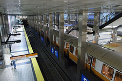
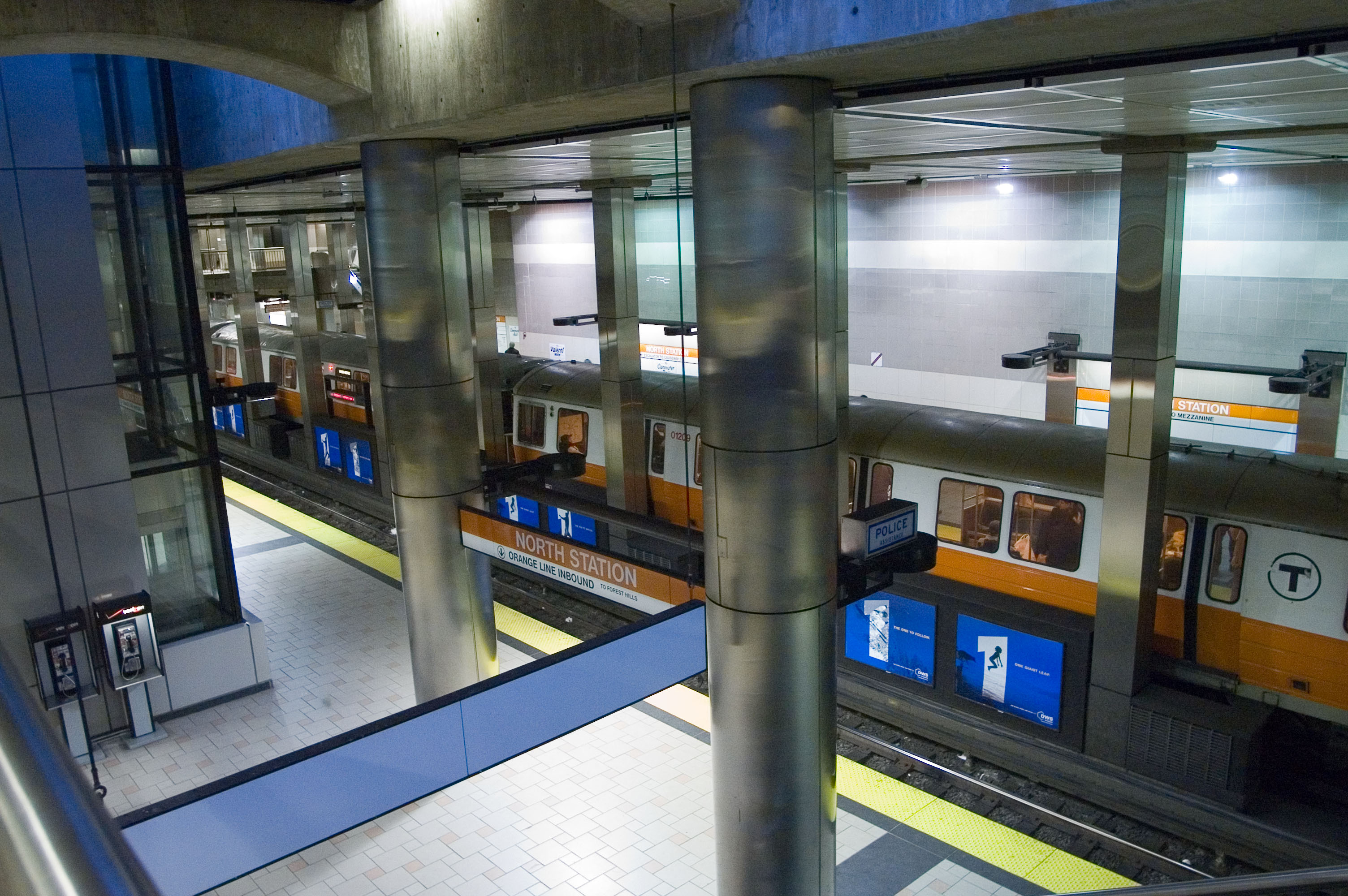
Inbound train at North StationOverview Type Rapid transit Status Operational Locale Boston, Massachusetts Termini Oak Grove
Forest HillsStations 19 (1 planned) Daily ridership 184,961 (FY2010)[1] Operation Opened 1901 Owner MBTA Operator(s) MBTA Rolling stock 01200 series Technical Line length 11 miles (18 km) Track gauge 4 ft 8 1⁄2 in (1,435 mm) Electrification Third Rail Route map LegendLegend
Haymarket North Extension 
Oak Grove 

Malden Center (Commuter Rail) Wellington 

Mystic River 
Assembly Square (planned opening: 2013) Sullivan Square Community College 

Charles River 

North Station (Amtrak, Commuter Rail) 
Washington Street Subway 
Haymarket 


State (Blue Line) Downtown Crossing (Red Line) Chinatown Southwest Corridor Tufts Medical Center 
Back Bay (Amtrak, Commuter Rail) 

Mass Ave Ruggles (Commuter Rail) Roxbury Crossing Jackson Square Stony Brook Green Street 
Forest Hills (Commuter Rail) The Orange Line is one of the four subway lines of the Massachusetts Bay Transportation Authority. It extends from Forest Hills in Jamaica Plain, Boston in the south to Oak Grove in Malden, Massachusetts in the north. It meets the Red Line at Downtown Crossing, the Blue Line at State, and the Green Line at Haymarket and North Station. It connects with Amtrak and Commuter Rail service at Back Bay and North Station, and just the commuter rail at Ruggles station in Roxbury and at Forest Hills. From 1901 to 1987 it provided the first elevated rapid transit in Boston; the last elevated section was torn down in 1987 when the southern portion of the line was moved to the Southwest Corridor.
Contents
History
See also: History of the MBTANames
The current name, assigned in the 1960s, is derived from Orange Street, an old name for the section of Washington Street immediately south of downtown under which the Washington Street Tunnel, forming the center of the line, still runs.[2][3] Cars throughout the Boston rapid transit network were formerly painted orange or with orange stripes by MBTA predecessors, and restored streetcars on the Ashmont-Mattapan High Speed Line wear their historical orange livery, but this is largely coincidental.
Several stations were renamed in 1967 and 1987 from the names of the nearest street intersections to those of local landmarks; for example, "Boylston-Essex" eventually was renamed "Chinatown".
Construction
 The Charlestown El running over the old Charlestown Bridge
The Main Line of the electric Boston Elevated Railway opened in segments in 1901. It proceeded from Everett along the Charlestown Elevated to the Canal Street Incline near North Station. It was carried underground by the Tremont Street Subway (now the Green Line) returning above ground at the Pleasant Street Incline (now closed, located just outbound of Boylston Station). A temporary link connected it to the Washington Street Elevated, which in 1901 ran from this point via Washington Street to Dudley Square (which is most of what is now Phase 1 of the Silver Line).
Also in 1901, the Atlantic Avenue Elevated opened, branching at Causeway Street to provide an alternate route through downtown Boston (along the shoreline, where today there is no rail transit) to the Washington Street Elevated.
In 1908, the Washington Street Tunnel opened, allowing Main Line service to travel from the Charlestown Elevated, underground via new portals at the Canal Street Incline, under downtown, and back up again to meet the Washington Street Elevated and Atlantic Avenue Elevated near Chinatown. Use of the Tremont Street Subway was returned to streetcars exclusively.
By 1909, the Washington Street Elevated had been extended to Forest Hills. Trains from Washington Street were routed through the new subway, either all the way to Everett, or back around in a loop via both the subway and the Atlantic Avenue Elevated.
Closure of Atlantic Elevated and ownership changes
Following a 1928 accident at a tight curve on Beach Street, the southern connection between South Station and Washington Street was closed, breaking the loop. By 1938, the entire Atlantic Avenue Elevated had been closed, leaving the subway as the only route through downtown - what is now the Orange Line between Haymarket and Chinatown stations.
Ownership of the railway was transferred from the private Boston Elevated Railway to the public Metropolitan Transit Authority (MTA) in 1947, reconstituted as the modern Massachusetts Bay Transportation Authority in 1964.
Rerouting of Charlestown and Everett service
 The old Main Line Elevated and related lines
The Boston Transportation Planning Review looked at the line in the 1970s, considering extensions to the beltway Route 128 with termini at Reading in the north and Dedham in the south. As a result of this review, the Charlestown Elevated - which served the Charlestown neighborhood north of downtown Boston and the suburb Everett - was demolished in 1975. The Haymarket North Extension rerouted the Orange Line through an underwater crossing of the Charles River. Service in Charlestown was replaced with service along Boston and Albany tracks under Interstate 93, ultimately to Wellington and Oak Grove in Malden, Massachusetts instead of Everett. The service to Everett was not replaced.
Closure of Washington Street elevated
Construction of Interstate 95 into downtown Boston was cancelled in 1972 after local protest over the necessary demolition. However, land for the Southwest Corridor through Roxbury had already been cleared of buildings. Instead of a highway, the Orange Line subway would be re-routed into the corridor. In 1987, the Washington Street Elevated was torn down as part of this re-routing, the last of the original elevated portions to be demolished.
Between April 30 and May 3, 1987, the Washington Street Elevated south of the Chinatown station was closed to allow the Orange Line to be tied into the new Southwest Corridor. On May 4, 1987, the Orange Line was rerouted out of the southern end of the Washington Street Tunnel and onto the new Southwest Corridor. Instead of rising into elevated tracks, it instead veered west at the Massachusetts Turnpike and followed the Pike and the old Boston and Albany Railroad right-of-way to the existing MBTA Commuter Rail stop at Back Bay. It then continued along new tracks, partially covered and partially open but depressed, to Forest Hills. This right-of-way is also shared by Amtrak as part of the national Northeast Corridor.
While ending up more or less in the same place, the new routing bypassed Washington Street significantly to the west; local residents were promised replacement service. Originally, plans provided for light rail vehicle service on the streets, from Washington Street to Dudley Square, then diverting southeast-ward on Warren Street towards Dorchester. In 2002, Phase 1 of the Silver Line bus rapid transit was added to connect Washington Street to the downtown subways, attempting to address this. This was controversial, as many residents would prefer the return of rail transportation.
Renovations during the Big Dig
Haymarket and North Station received major renovations during the Big Dig in the 1990s and first decade of the 21st century, as the Causeway Street Elevated portion of the Green Line was buried, its physical connection to the Orange Line was improved to make transfers easier, the Canal Street Incline was finally closed, and the Green Line was re-rerouted through a new portal closer to the river, near the Zakim Bunker Hill Bridge.
Historical routes
1901-1908 1908-1938 1938-1975 LegendCharlestown Elevated 
Sullivan Square 
Thompson Square City Square 
Charles River 

Atlantic Avenue Elevated (r) 

North Station 
Canal Street Incline | Battery Street Tremont Street Subway (l) 
Haymarket 
Adams Square 


Scollay Square | State Street (East Boston Tunnel) Rowes Wharf (BRB&L ferry) Park Street | South Station (Dorcester Tunnel) Boylston Pleasant Street Portal | Beach Street Pleasant Street 


Washington Street Elevated Dover Northampton 
Dudley LegendCharlestown Elevated Everett opened 1919 Mystic River Sullivan Square Thompson Square City Square Charles River Atlantic Avenue Elevated (r) North Station Canal Street Incline | Battery Street Washington Street Subway (l) Friend-Union Milk-State | State Street (East Boston Tunnel) Rowes Wharf (BRB&L ferry) Summer | South Station (Dorcester Tunnel) Boylston-Essex 
Beach Street Washington Street Elevated Dover Northampton Dudley Egleston Green Street (opened 1912) Forest Hills LegendCharlestown Elevated Everett Mystic River Sullivan Square Thompson Square City Square Charles River North Station Canal Street Incline Washington Street Subway Friend-Union Milk-State (Blue Line) Winter-Summer (Red Line) Boylston-Essex Washington Street Elevated Dover Northampton Dudley Egleston Green Street Forest Hills 1975-1987 1987-present Notes LegendHaymarket North Extension Oak Grove Malden Center (Commuter Rail) Wellington Mystic River Sullivan Square Community College Charles River North Station (Amtrak, Commuter Rail) Washington Street Subway Haymarket State (Blue Line) Washington (Red Line) Essex Washington Street Elevated Dover Northampton Dudley Egleston Green Street Forest Hills LegendHaymarket North Extension Oak Grove Malden Center (Commuter Rail) Wellington Mystic River Assembly Square (planned to open in 2013) Sullivan Square Community College Charles River North Station (Amtrak, Commuter Rail) Washington Street Subway Haymarket State (Blue Line) Downtown Crossing (Red Line) Chinatown Southwest Corridor Tufts Medical Center Back Bay (Amtrak, Commuter Rail) Mass Ave Ruggles (Commuter Rail) Roxbury Crossing Jackson Square Stony Brook Green Street Forest Hills (Commuter Rail) - The Forest Hills extension of the Washington Street Elevated opened in 1909; the infill station at Green Street opened in 1912.
- The section of the Atlantic Avenue elevated between South Station and the junction near Dover was closed in 1928 after an accident.
- Haymarket and State got their modern names in 1967. Downtown Crossing and Chinatown also changed names in 1967, but changed again in 1987.
- Oak Grove opened in 1977, two years after the rest of the Haymarket North Extension.
- Tufts Medical Center was New England Medical Center until 2010.
Future plans
Assembly Square
Main article: Assembly Square (MBTA station)An infill station, Assembly Square, at Assembly Square in Somerville is presently expected to open in 2014. The new station, located on the bank of the Mystic River between Wellington and Sullivan Square stations, will serve a new development at Assembly Square.[4]
Station listing
Station Time to
Downtown Crossing
(min)[5]Opened Transfers and notes  Oak Grove
15 March 20, 1977 Malden Center13 December 27, 1975 Commuter Rail: Haverhill/Reading Line Wellington10 September 6, 1975 Assembly Square9 Expected to open in 2013 Sullivan Square7 April 7, 1975 Separate station from one on the Charlestown Elevated closed April 4, 1975 Community College5 April 7, 1975 Serves Bunker Hill Community College North Station3 April 7, 1975 Green Line and Commuter Rail north side lines Haymarket2 November 30, 1908 Green Line
Originally Friend-Union until January 25, 1967 State1 November 30, 1908 Blue Line
Originally Milk-State until January 24, 1967 Downtown Crossing0 November 30, 1908 Red Line, Green Line and Silver Line
Originally Winter-Summer until January 22, 1967, then Washington until May 3, 1987 Chinatown2 November 30, 1908 Silver Line
Originally Boylston-Essex until February 10, 1967, then Essex until May 3, 1987 Tufts Medical Center3 May 4, 1987 Silver Line
Originally New England Medical Center until April 2010 Back Bay6 May 4, 1987 Amtrak station
Commuter Rail: Providence/Stoughton Line, Framingham/Worcester Line, Franklin Line and Needham Line
Also called Back Bay/South End Massachusetts Avenue8 May 4, 1987 Ruggles9 May 4, 1987 Commuter Rail: Providence/Stoughton Line, Franklin Line and Needham Line Roxbury Crossing10 May 4, 1987 Jackson Square12 May 4, 1987 Stony Brook14 May 4, 1987 Green Street16 May 4, 1987 Separate station from one on the former Washington Street Elevated closed April 30, 1987 Forest Hills18 May 4, 1987 Commuter Rail: Needham Line
Separate station from one on the former Washington Street Elevated closed April 30, 1987
Former terminus of Green Line E branchEquipment
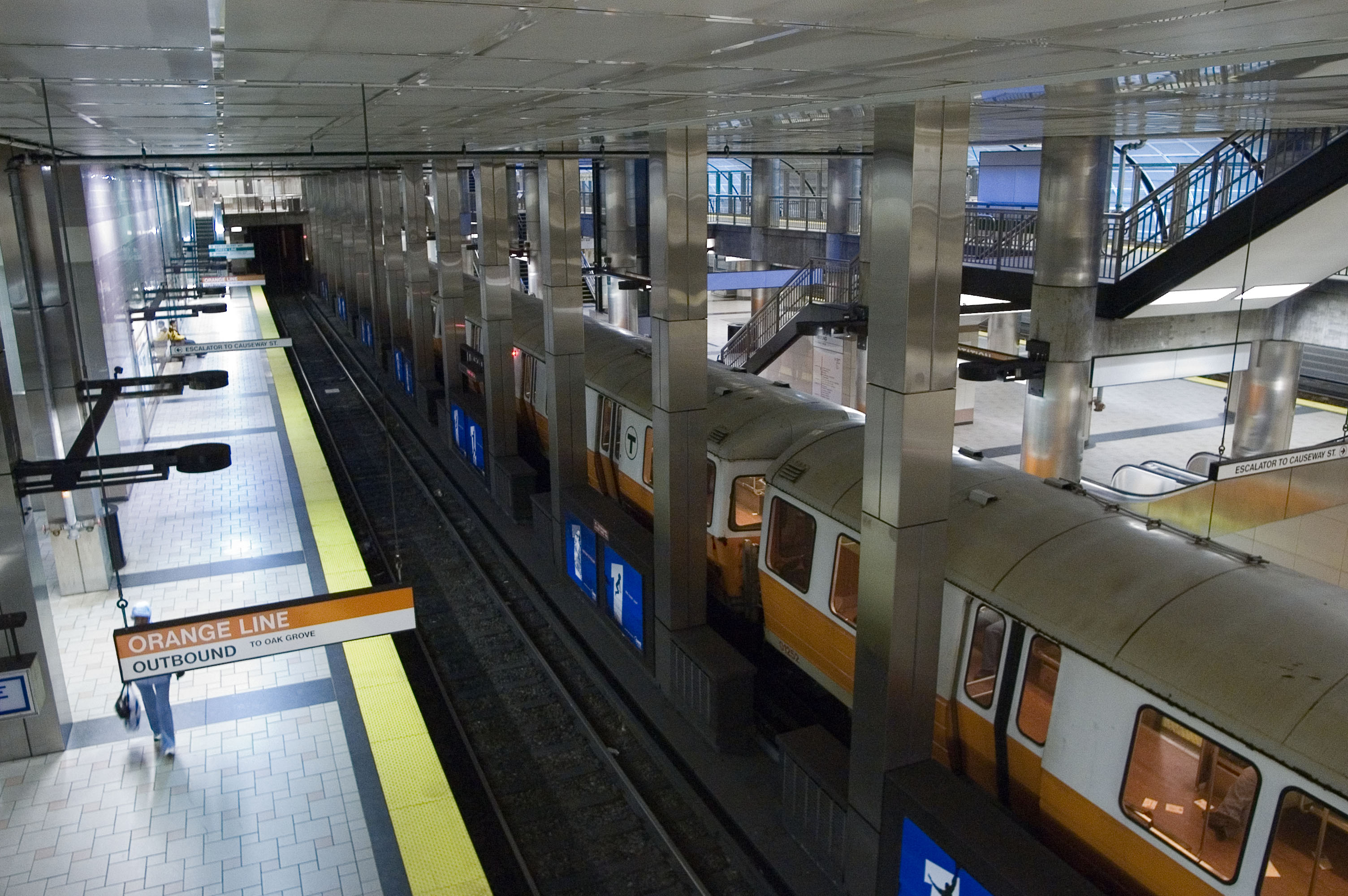
 Outbound Train at North Station
The Orange Line is standard gauge heavy rail, and uses third rail for power. The current fleet is the 01200 series, built 1980-1981 by Hawker Siddeley Canada Car and Foundry (now Bombardier Transportation) of Thunder Bay, Ontario, Canada. They are 65 feet (20 m) long and 111 inches (2.8 m) wide, with three pairs of doors on each side. They are based on the PA3 model used by PATH in New Jersey. There are 120 cars, numbered 01200-01319. All in-service Orange Line trains run in six-car configurations.
Year Built Make Model Length ft ( mm) Width in ( mm) Gauge Road Numbers 1980–1981 Hawker Siddeley Canada PA3 65 ft (19,812 mm) 111 in (2,819 mm) 4 ft 8 1⁄2 in (1,435 mm) 1200–1319 New trains
It was announced in the Spring of 2009 that the planning process for new Orange and Red Line vehicles had begun. The simultaneous order calls for 146 Orange Line cars (to replace the whole fleet) and 74 Red Line cars (presumably to replace the 1500s and 1600s, of which there were 76, with 72 still in service). This order would be similar to the current Orange Line cars and the old Blue Line cars, ordered at the same time and largely identical except for size. The new cars would enter service between 2013 and 2017. The announcement also suggested that new Green Line cars will be planned at about the same time, although these cars would not be similar to the Orange and Red Line cars due to the differing natures of the lines.[6]
Facilities
The Orange Line has two tracks (one in each direction) except for a third track between Wellington and the Charles River portal.[7] This track can be used to bypass construction on the other two, or for testing newly delivered cars for the Orange and Blue lines. The primary maintenance and storage facility is at Wellington Station.[7] Had the Orange Line been extended to Reading, the third track would have become an express track.
Accessibility
See also: MBTA accessibilityAll stations on the Orange Line are handicapped accessible. Work on State to make it fully accessible from the Blue Line was completed in Spring 2011 and officially announced on May 26th, 2011.[8]
References
- ^ "Ridership and Service Statistics, Twelfth Edition". Massachusetts Bay Transportation Authority. 2009. p. 6. http://www.mbta.com/uploadedfiles/documents/Bluebook%202010.pdf. Retrieved December 16, 2010.
- ^ Orange Street on Map of Boston 1775
- ^ Kleespies, Gavin W. and MacDonald, Katie. "Transportation History". Harvard Square Business Association. http://www.harvardsquare.com/History/Glimpses/Transportation.aspx. Retrieved 4 October 2011.
- ^ http://www.assemblysquare.com/news.html
- ^ From Association for Public Transportation, Car-Free in Boston, A Guide for Locals and Visitors, 10th ed. (2003), p.117, and MBTA website, roughly interpolated by distance between stations.
- ^ http://www.mbta.com/uploadedfiles/Accessibility/Access%20in%20Motion_Spring09%20-%20Word.doc
- ^ a b http://world.nycsubway.org/us/boston/orange.html
- ^ http://www.mbta.com/about_the_mbta/news_events/?id=21720
External links
- MBTA - Orange Line
- Orange Line from nycsubway.org - Includes detailed description and photos
- Jamaica Plain Historical Society - Orange Line Memories
- Jamaica Plain Historical Society - Orange Line Replaced Old Railroad Embankment
Currently operating heavy rail rapid transit systems in the United States Massachusetts Bay Transportation Authority (Blue, Orange, and Red Lines) · MTA (New York City Subway and Staten Island Railway) · Port Authority Trans-Hudson · Southeastern Pennsylvania Transportation Authority (Market–Frankford and Broad Street lines) · PATCO Speedline · Baltimore Metro Subway · Washington Metro · Metropolitan Atlanta Rapid Transit Authority · Miami Metrorail · San Juan Tren Urbano · Cleveland Red Line · Chicago 'L' · Bay Area Rapid Transit · Los Angeles Metro Rail (Red and Purple Lines)
Categories:- MBTA Rapid Transit
- Orange Line (MBTA)
- Massachusetts Bay Transportation Authority
- Old Colony Railroad lines
- Railway lines opened in 1901
- 1901 establishments in the United States
- Standard gauge railways in the United States


Wikimedia Foundation. 2010.