- Green Line (MBTA)
Infobox rail line
name = MBTA Green Line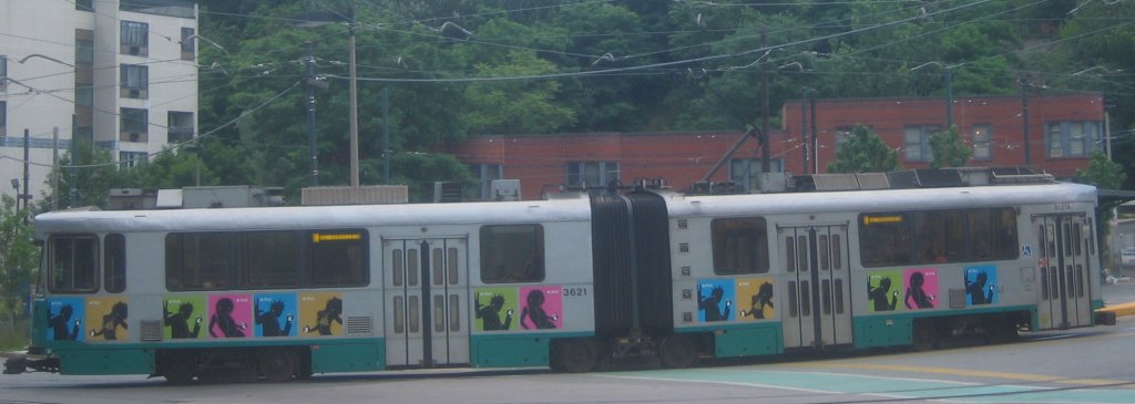
image_width = 250px
caption = Green Line train at the Heath Street station
type =Light rail
system =
status =
locale =Boston, Massachusetts
start = East terminals:
Lechmere (E)North Station (C)
Government Center (B, D)
end = West terminals:
Boston College (B)
Cleveland Circle (C)
Riverside (D)
Heath Street (E)
stations = 66 (total)
routes =- "B" Branch (Commonwealth Ave)
- "C" Branch (
Beacon Street ) - "D" Branch (Highland)
- "E" Branch (
Huntington Avenue )
ridership = 267,400American Public Transportation Association, [http://www.apta.com/research/stats/ridership/riderep/documents/08q1lr.pdf Light Rail Transit Ridership Report] , First Quarter 2008.]
open = 1897
close =
owner = MBTA
operator = MBTA
character = Subway, grade-separated ROW, street-running
stock =Kinki Sharyo Type 7
Ansaldobreda Type 8
linelength =
tracklength =
notrack =
gauge = RailGauge|sg (Standard gauge )
el =
speed =
elevation =
The Green Line is alight rail /streetcar system run by theMassachusetts Bay Transportation Authority (MBTA) in the Boston,Massachusetts area of theUnited States . It is the oldest line of Boston's subway, which is known locally as the 'T'. The Green Line runs underground downtown and on the surface in outlying areas. With a daily weekday ridership of 267,400, it is also the most heavily-used light rail line in the country. The line was given the green color because it goes primarily though an area called theEmerald Necklace of Boston.Fact|date=November 2007 The four branches are the remnants of a once large system of streetcar lines, begun in 1856 with theCambridge Horse Railroad . TheTremont Street Subway carries cars of all branches under downtown, and is the oldest subway tunnel inNorth America , opened in stages betweenSeptember 1 ,1897 andSeptember 3 ,1898 to take streetcars off surface streets.Description
The modern-day Green Line has its northern terminus at Lechmere station in eastern Cambridge. From there it runs south in the
Tremont Street Subway under downtown Boston, and west in theBoylston Street Subway to Kenmore. Along the way, the "E" Branch splits to the southwest just west of Copley into theHuntington Avenue Subway , eventually running onto the surface and ending at Heath Street. The "B", "C", and "D" Branches all diverge west of Kenmore. From south to north, the "D" Branch surfaces onto the grade-separatedHighland Branch , a branch of theBoston and Albany Railroad until 1958, running to Riverside. The "C" Branch surfaces onto Beacon Street, running to Cleveland Circle, and the "B" Branch runs along Commonwealth Avenue to Boston College.The "A" Branch ran to Watertown until 1969. Although the route-letter scheme had been introduced two years prior to its closure, the "A" designation was never signed on streetcars operating to Watertown. It was, however, included in the destination signs on the Boeing-Vertol LRVs ordered in the mid-1970s, when reopening the Watertown service was still under consideration. The A line tracks remained in non-revenue service to access maintenance facilities at Watertown until 1994.
The elevated part north of downtown was closed from June, 2004 until
November 12 ,2005 for replacement of theCauseway Street Elevated with a tunnel underNorth Station . [ [http://www.boston.com/news/local/massachusetts/articles/2005/11/11/lechmere_science_park_stations_reopen/ Lechmere, Science Park stations reopen - The Boston Globe ] ] The historicconcrete Lechmere Viaduct across theCharles River remains.The original Tremont Street Subway south of Boylston has been closed since 1962, as the lines feeding into it have been replaced by bus service. The
Pleasant Street Portal at its south end has been covered over, but there are plans to build a new portal and reuse part of the tunnel for the Silver Linebus rapid transit line.Rolling stock and accessibility
Active fleet
The Green Line's rolling stock as of the end 2007 includes:
ee also
*
Boston-area streetcar lines
*MBTA accessibility
*US Standard Light Rail Vehicle Notes
References
*Jonathan Belcher, " [http://members.aol.com/eddanamta/busfiles/contents.pdf Changes to Transit Service in the MBTA District, 1964-2003] " (PDF), "Rollsign",
November 28 ,2003
*http://members.aol.com/rtspcc/roster/MBTAroster.htmlExternal links
* [http://www.mbta.com/schedules_and_maps/subway/lines/?route=GREEN MBTA - Green Line]
* [http://members.aol.com/netransit/private/tss/tss.html 100 Years of the Tremont Street Subway] (a detailed history)
* [http://www.wizeguides.com/wizeguides/ Interactive Map (Unofficial)]
* [http://www.greenlineextension.org Green Line Extension Project Website]
* [http://www.somervillestep.org STEP (Somerville Transportation Equity Partnership)]
* [http://www.medfordgreenline.org/ Medford Green Line Neighborhood Alliance (MGNA)]
* [http://www.eot.state.ma.us/default.asp?pgid=content/grLineExt&sid=about Mass.gov Executive Office of Transportation Plans for Green Line Extension]
* [http://www.jphs.org/transportation/streetcars-in-jamaica-plain-a-history.html Jamaica Plain Historical Society - Streetcars in Jamaica Plain: A History]
* [http://cdl.library.cornell.edu/cgi-bin/moa/pageviewer?frames=1&cite=http%3A%2F%2Fcdl.library.cornell.edu%2Fcgi-bin%2Fmoa%2Fmoa-cgi%3Fnotisid%3DABS1821-0021-9&coll=moa&view=50&root=%2Fmoa%2Fmanu%2Fmanu0021%2F&tif=00011.TIF&pagenum=6 The Bentley-Knight Electric Railway System] from "The Manufacturer and Builder", January, 1889
* [http://ktk.bidmc.harvard.edu/slrv/ Operation manual for SLRV (Boeing) cars]
* [http://www.youtube.com/watch?v=n64duG73Sak Video of LRV Boeing 3461 being scrapped at Riverside yard]
Wikimedia Foundation. 2010.