- Green Line "B" Branch
Infobox rail line
name = Green Line "B" Branch
Commonwealth Avenue Branch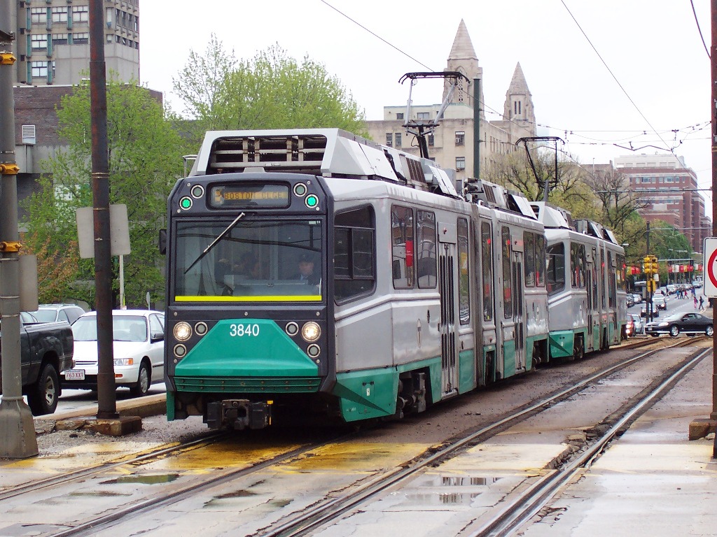
image_width = 250px
caption = Ansaldobreda Type 8 #3840 waits at a red light on Commonwealth Avenue at Carlton Street.
type =Light rail
system = Green Line
status =
locale =Greater Boston
start = Government Center
end = Boston College
stations = 25
routes =
ridership = 30,745 (1995 typical weekday, surface boardings only) [http://www.bostonmpo.org/bostonmpo/resources/CMS/Entrances.pdf]
open = 1932 (in current form)
close =
owner = MBTA
operator = MBTA
character = Underground (Kenmore and eastward)
Street-running (west of Kenmore)
stock =Kinki Sharyo Type 7
Ansaldobreda Type 8
linelength =
tracklength =
notrack =
gauge = RailGauge|sg
el =
speed =
elevation =The "B" Branch, also called the Commonwealth Avenue Branch or Boston College Branch, is a branch of the
Massachusetts Bay Transportation Authority Green Line in theBoston, Massachusetts area, along whichlight rail vehicle s run on a surface right-of-way down the middle of Commonwealth Avenue. After going underground via theBlandford Street Incline , the tracks merge with the "C" and "D" Branches into Kenmore station. From there theBoylston Street Subway andTremont Street Subway carry "B" cars to downtown Boston, with regular service turning around at Government Center as of November 2005.History
In 1896, tracks were laid on Commonwealth Avenue from Chestnut Hill Avenue west to the Newton town line at Lake Street, and around the same time the
Commonwealth Avenue Street Railway opened, extending the tracks through Newton toNorumbega Park ; this later became part of theMiddlesex and Boston Street Railway . Trains between Lake Street and downtown Boston used tracks on Beacon Street, now part of the "C" Branch. FromKenmore Square they continued east on Beacon Street, then turned south on Massachusetts Avenue and east on Boylston Street to Park Square. In 1900 tracks were installed on the rest of Commonwealth Avenue, from Chestnut Hill Avenue east to existing tracks atPackard's Corner , later part of the "A" Branch. This enabled trains to use Commonwealth Avenue between Lake Street and Kenmore Square. In 1909, the tracks were electrified. [ [http://www.bahistory.org/Clevcirclehist.html Cleveland Circle History ] ]The
Tremont Street Subway opened onSeptember 1 ,1897 , and then or soon after the Commonwealth Avenue line was rerouted to turn around at Park Street via theBoylston Street Incline at thePublic Gardens . TheBoylston Street Subway opened onOctober 3 ,1914 , extending the underground portion to theKenmore Incline just east of Kenmore Square. OnOctober 23 ,1932 theBlandford Street Incline opened along with the underground Kenmore station, giving the line its present configuration.Until the 1920s, a streetcar line that has since become the MBTABus|65 bus ran along Commonwealth Avenue from Boston College east to Chestnut Hill Avenue, then south on Chestnut Hill Avenue and east on Beacon Street from Cleveland Circle to Washington Square, turning southeast to Brookline Village. After this was replaced by bus service in the 1920s (along with a rerouting), no
revenue service used the tracks on Chestnut Hill Avenue, but they have remained for "B" Branch trains to access theReservoir Carhouse at Cleveland Circle on the "C" Branch.From 1942 to 1967, the route was known by the map number of MBTABus|62. Since then it has been the "B" Branch.
A turnback loop at
Boston University Field was present from 1915 toJanuary 14 ,1962 , and was used for service to special events.On
February 7 ,1931 , the Commonwealth Avenue service was extended east through downtown to loop at Lechmere rather than Park Street. Since then, the following changes in east terminal have been made:
*November 20 ,1961 : cut back to Park Street
*November 18 ,1964 : extended Monday-Saturday to Government Center
*January 1967: cut back to Park Street all times due to problems at the Government Center loop
*March 25 ,1967 : extended toNorth Station
*June 17 ,1967 : cut back to Government Center
*September 9 ,1967 : extended to North Station
*September 14 ,1967 : cut back to Government Center due to problems at the North Station loop
*March 21 ,1970 : extended to Haymarket, looped empty at North Station
*December 26 ,1970 : extended to North Station
*March 25 ,1974 : extended to Lechmere
*January 1 ,1977 : cut back to North Station weekdays only
*March 19 ,1977 : extended to Lechmere all times
*June 18 ,1977 : cut back to Government Center all times
*September 9 ,1977 : extended to Lechmere all times
*September 9 ,1978 : cut back to Government Center nights and Sundays
*March 24 ,1979 : cut back to Government Center middays and Saturdays, with only rush hour trips continuing to Lechmere
*March 21 ,1980 : cut back to Park Street all times
*April 4 ,1981 : extended to North Station (PCC cars looped at Government Center)
*July 30 ,1983 : cut back to Government CenterIn the past, the B branch has been heavily criticized by riders for its slow service. It is slower than the C branch, in part because of its greater density of stops, and both branches are slower then the D branch, which has the lowest stop density and a dedicated right-of-way.
In late 2003, the MBTA proposed eliminating five stops along the branch (Greycliff Road, Mount Hood Road, Summit Avenue, Fordham Road, and Chiswick Road.) This was seen as a way to speed up service for riders, while also reducing the MBTA's maintenance costs. Many riders welcomed the change, noting the stops' low ridership and close proximity to more popular stops. Others felt that the change did not go far enough, noting that the total time savings would be small (a few minutes out of a 45-minute trip) and the B branch would still be the slowest Green Line branch by far. Many riders questioned why the MBTA did not propose closing any of the stops east of Packard's Corner, even though this would improve travel times for a large number of riders and several of these stops were only a few hundred feet apart.
In early 2004, four of the five stops (Greycliff Road, Mount Hood Road, Summit Avenue, Fordham Road) were closed in a pilot stop elimination program. The fifth (Chiswick Road) was spared, after elderly residents of the nearby Jewish Community Housing facility rallied to its defense. In 2005, after a survey showed that 73% of 1,142 riders surveyed approved of the closures, the MBTA announced that the four stops would be closed permanently. [ [http://www.boston.com/news/local/articles/2005/03/16/t_drops_4_green_line_stops_after_results_of_rider_survey?mode=PF T drops 4 Green Line stops after results of rider survey] ,
The Boston Globe March 16, 2005]tation listing
External links
* [http://www.mbta.com/schedules_and_maps/subway/lines/?route=GREEN Green Line schematic]
References
* [http://members.aol.com/eddanamta/busfiles/contents.pdf Changes to Transit Service in the MBTA district] (
PDF )
* [http://www.publictransit.us/ptlibrary/specialreports/Railopenings.pdf U.S. Urban Rail Transit Lines Opened From 1980] (PDF )
Wikimedia Foundation. 2010.