Park Street (MBTA station)

Park Street (MBTA station)

Infobox Station
name=Park Street Station


image_size=
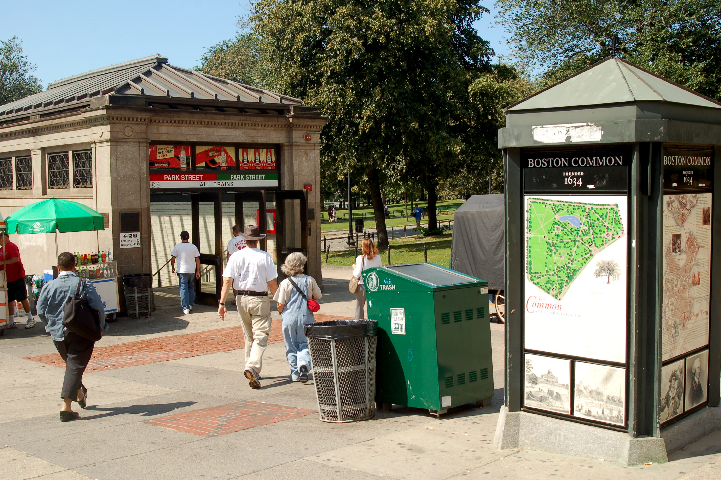
image_caption=An Entrance to the MBTA's Park Street Station in Boston Mass, August 2008
coordinates = coord|42|21|23.11|N|71|3|45.33|W|name=Park Street MBTA Station|display=inline,title|type:railwaystation
address=Corner of Boston Common at intersection of Tremont, Park and Winter Streets, Downtown Boston
line=Rail color box|system=MBTA|line=RedRail color box|system=MBTA|line=Green|note=All Branches
other=Rail color box|system=MBTA|line=OrangeRail color box|system=MBTA|line=Silver(Via walkway leading to Downtown Crossing Station) | platform=
parking=
bicycle=
passengers=
pass_year=
pass_percent=
opened=September 3, 1897 (Green Line)
March 23, 1912 (Red Line)
July 30, 2002 (Silver Line)
rebuilt=
ADA=Yes
code=
owned=Massachusetts Bay Transportation Authority
zone=

Park Street Station of the MBTA, located at the intersection of Park Street and Tremont Street in Boston at a corner of Boston Common, is the main transfer point between the Green Line and the Red Line. Throughout the green and red lines, trains labeled "inbound" are headed towards this station, while those labeled "outbound" are headed away.

The Green Line portion of this station was originally constructed in 1897, making it one of the two oldest subway stations in the United States, along with Boylston. The Red Line portion beneath it, sometimes called "Park Street Under", was constructed in 1912.

Facilities

*Underground Winter Street Concourse to Downtown Crossing, for a connection to the Orange Line and Silver Line buses.

Nearby destinations

*the Massachusetts State House, seat of the state's government
*Boston Common
*Suffolk University
*Emerson College
*Freedom Trail
*the Boston Paulist Center
*theater and cinema
*shops and restaurants

Bus connections

*MBTABus|43 Ruggles Station
*MBTABus|55 Jersey & Queensberry via Copley Sq. & Ipswich St.

Accessibility

Park Street Station is wheelchair accessible, after a renovation completed in 2004. The Red Line station has both island and side platforms. Only the island platform has elevator access. "See also:" MBTA accessibility.

Gallery

Trivia

Park Street makes a cameo appearance in the first paragraph of the 1927 H. P. Lovecraft story, "Pickman's Model." It also appears near the end of his 1936 novella "At the Mountains of Madness."

External links

* [http://world.nycsubway.org/perl/show?18186 nycsubway.org] - Historical photo of Park Street in 1980
* [http://world.nycsubway.org/perl/show?18218 nycsubway.org] - Another historical photo of Park Street in 1980


Wikimedia Foundation. 2010.

Игры ⚽ Нужен реферат?

Look at other dictionaries:

  • Park Street — may refer to:* Park Street, Boston, Massachusetts, USA * Park Street (MBTA station), Boston, USA * Park Street, Hertfordshire, England ** Park Street railway station in Hertfordshire * Park Street, Kolkata, India * Park Street, Bristol, England * …   Wikipedia

  • Newton Street (MBTA station) — NEWTON STREET Silver Line bus shelter at Newton St. Station statistics Add …   Wikipedia

  • Morton Street (MBTA station) — MORTON STREET Station statistics Address 865 Morton Street Mattapan, MA 02126 Coordinates …   Wikipedia

  • Heath Street (MBTA station) — Infobox Station name=Heath Street image size=275 image caption=Turnaround address=Heath Street at VA Hospital, Boston line= other= platform=1 side platform tracks=1 balloon loop parking= bicycle= passengers= pass year= pass percent=… …   Wikipedia

  • Kent Street (MBTA station) — Infobox Station name=Kent Street type=MBTA Light rail image size= image caption= address=Beacon Street and Powell Street Brookline, Massachusetts coordinates=coord|42.344125| 71.113885|display=inline,title line= other= structure= platform=2… …   Wikipedia

  • Tappan Street (MBTA station) — Infobox Station name=Tappan Street type=MBTA Light rail image size= image caption= address=Beacon Street and Tappan Street Brookline, Massachusetts coordinates=coord|42.338469| 71.138705|display=inline,title line= other= structure= platform=2… …   Wikipedia

  • Hawes Street (MBTA station) — Infobox Station name=Hawes Street type=MBTA Light rail image size= image caption= address=Beacon Street and Hawes Street. Brookline, Massachusetts coordinates=coord|42.34487| 71.111129|display=inline,title line= other= structure= platform=2 side… …   Wikipedia

  • Park Street, Boston — This article refers to Park Street in Boston. For other Park Streets, please see the Park Street disambiguation page. Park Street is a small but notable road in the center of Boston, Massachusetts. It begins at the top of Beacon Hill, at the… …   Wikipedia

  • Green Street (MBTA station) — Infobox Station name=Green Street image size=275 image caption= address=150 Green Street at 380 Armory Street, Jamaica Plain coordinates = coord| 42.3102| 71.1078 |display=inline,title|type:railwaystation line=rail color… …   Wikipedia

  • St. Marys Street (MBTA station) — St. Marys Street is a stop on the C branch of the Massachusetts Bay Transportation Authority s Green Line, located just west of the intersection of Beacon Street and Park Drive in Boston, Massachusetts. This station is near several restaurants… …   Wikipedia

Share the article and excerpts

Direct link
Do a right-click on the link above
and select “Copy Link”