- Green Line "E" Branch
Infobox rail line
name = Green Line "E" Branch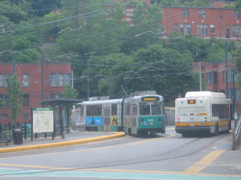
image_width = 250px
caption = MBTA Green Line "E" streetcar at the Heath Street loop
type =Light rail
system = Green Line
status =
locale =Greater Boston
start = Lechmere
end = Heath Street
stations = 20
routes =
ridership =
open = 1883
close =
owner = MBTA
operator = MBTA
character = Underground (Symphony and eastward)
Grade-separated ROW (Northeastern to Brigham Circle)
Street-running (Brigham Circle to Heath Street)
stock =Kinki Sharyo Type 7
Ansaldobreda Type 8
linelength =
tracklength =
notrack =
gauge = RailGauge|sg
el =
speed =
elevation =
infobox rdt|MBTA Green Line E|The "E" Branch or Arborway Branch is a
streetcar line in theBoston, Massachusetts area, operating as a branch of theMassachusetts Bay Transportation Authority Green Line. Since 1985, service beyond Heath Street has been "temporarily" suspended, with the 39 bus providing service beyond. The part leading from Brigham Circle to Heath Street is the only remaining section of street-running tracks in regular use by the MBTA; all other lines are on private right-of-way or in medians.Northeast of the street-running section, the tracks run in the median of Huntington Avenue before running into the Huntington Avenue Subway via the Northeastern Incline. Just west of Copley, an at-grade junction connects the line into the other Green Line branches in the Boylston Street Subway, where they all run together to downtown. Regular "E" service turns around at Lechmere as of November 2007.
History
The first
street railway line to serve the area of the "E" Branch was built by the West Roxbury Railroad and immediately leased by the Metropolitan Railroad in 1857. Thehorse car line ran along Tremont Street from downtown, then continued south on Columbus Avenue, Centre Street and South Street to end at the Jamaica Plain Carhouse in Jamaica Plain. Paralleling this to the east was a Metropolitan Railroad line along Washington Street from Dudley out to Forest Hills.Those tracks were electrified in 1891, and in 1902 they were extended the last bit to the Arborway Carhouse, connecting the line to the tracks along Washington Street and establishing Arborway as a transfer point. In 1903 Arborway trains began running into the subway.
Tracks that later became part of the "E" Branch were built in 1859 along Huntington Avenue from Brigham Circle west into Brookline, as part of a branch from the original Jamaica Plain route, later used by the MBTABus|66 route. A new cutoff was built from this route via Huntington Avenue ca. 1883, allowing cars to run to Park Square via existing tracks on Boylston Street. In 1906 the connection along South Huntington Avenue was built to connect this newer route on Huntington to the older route on Centre. Additionally, between 1888 and 1897, the "Dudley Street Crossover" was built along Centre Street (moved to Roxbury Street by 1925) to connect the line to an existing loop west from Dudley to Eliot Square. This allowed Jamaica Plain cars to run to Dudley and towards downtown from there.
The Huntington Avenue line was electrified in 1894. The Boylston Street Incline to the
Tremont Street Subway opened onSeptember 1 ,1897 as part of the first section of subway, and Huntington Avenue cars were rerouted into it (though those cars didn't use the Jamaica Plain line until 1903 - see above). Tremont Street cars were likely moved to the subway onOctober 1 ,1897 , when the next section of subway to thePleasant Street Incline opened, though fromJune 10 ,1901 toNovember 29 ,1908 that portal was closed to all butWashington Street Elevated trains.The
Washington Street Elevated openedJune 10 ,1901 to Dudley, and many streetcar routes that had operated via Dudley were truncated there with a transfer to the El. This included the Jamaica Plain route via Dudley. The extension of the Elevated to Forest Hills (adjacent to Arborway) onNovember 22 ,1909 provided a faster route downtown from Arborway (above the Washington Street streetcar lines), but the Jamaica Plain cars used a completely different route to get there.The tracks on Huntington Avenue from Brookline to South Huntington Avenue were last used on
September 9 ,1938 by cars from Brookline Village into the subway, as well as what became the MBTABus|66 Allston - Dudley bus (this was also the last use of the tracks on Tremont Street west of Columbus Avenue). The cars from Brookline Village had been truncated from earlier lines running further into Brookline (later the MBTABus|58 and MBTABus|60 buses), and onSeptember 10 they started running as short-turn trips on Huntington Avenue to Brigham Circle.The Huntington Avenue Subway opened on
February 16 ,1941 , taking Huntington Avenue cars (the last to use the Boylston Street Portal) underground for a larger part of their route.The final pattern of streetcars serving the line was:
*MBTABus|39 from Arborway into the subway via Huntington Avenue, with short-turn cars to Northeastern University and Brigham Circle
*MBTABus|41 from the Jamaica Plain Carhouse to Dudley via Columbus Avenue
*MBTABus|57 from a short-turn loop at Heath Street into the subway via Huntington AvenueService straight through to downtown on Columbus Avenue and Tremont Street was only provided by MBTABus|43 cars, which began at Egleston Square and continued into the subway at thePleasant Street Incline , using the same tracks as the 41 for a section.The 41 last ran streetcars on
June 7 ,1949 , and the 43 cars last ran to EglestonJune 14 ,1956 , leaving only the 39 and 57. In 1967 these lines were redesignated as the "E" Branch of the Green Line, with short-turn Heath Street service onrollsign s with a slash through the E.Over the years, due to shortages in carsFact|date=June 2008 (especially caused by the opening and popularity of the
Green Line "D" Branch ), sections of the line were replaced by bus service; the bus was always referred to as the 39 and ran to Copley with free transfers. The final day of streetcars to Arborway wasDecember 27 ,1985 . In December 1989 the 39 was extended to Back Bay (with free transfers to the Orange Line), the southern end was renamed Forest Hills, and the fare structure was changed from Green Line fares to normal bus fares. (As of January 1, 2007, all Green Line fares are at the subway level, as part of a system-wide streamlining. System wide, bus-to-subway and subway-to-bus transfers are free with paid subway fare, for users of the plastic CharlieCard only.)The following changes have been made to the terminals since 1961:
*BeforeSeptember 11 ,1961 : Arborway cars and short-turn Northeastern University cars ran to Park Street, short-turn Heath Street cars ran toNorth Station
*September 11 ,1961 : Heath Street short-turn cars discontinued, with all cars looping at Park Street
*December 26 ,1964 : Heath Street short-turn cars readded weekdays and Saturdays from 06:30 to 09:00 and 13:30 to 17:30, turning at Government Center
*January 1965: Heath Street short-turn cars cut back to Park Street
*March 25 ,1967 : Heath Street short-turn cars extended to Government Center
*June 24 ,1967 : Heath Street short-turn Saturday cars discontinued
*March 19 ,1977 : Heath Street short-turn cars extended to North Station
*June 18 ,1977 : Heath Street short-turn cars cut back to Government Center
*June 26 ,1982 : after closures for rebuilding, full service reopens, with Arborway and Heath Street (rush hours only) cars running to Park Street, and no more Northeastern University short-turn cars
*January 2 ,1983 : Heath Street short-turn service extended to middays and extended to Lechmere
*February 11 ,1983 : Heath Street short-turn cars cut back to Park Street
*December 28 ,1985 : Service from Heath Street to Arborway "temporarily" replaced by 39 bus, and short-turn cars also replaced for track reconstruction.
*July 26 ,1986 : Service restored to Brigham Circle, running to Lechmere weekdays and Government Center nights and weekends
*June 20 ,1987 : Extended to Lechmere all times
*November 4 ,1989 : Service restored to Heath Street with completion of reconstruction
*June 28 ,2004 : Cut back to new North Station station during construction of new tunnel towards Lechmere; went only to Haymarket onJune 26 andJune 27
*November 12 ,2005 : Extended to Lechmere all times
*September 2 ,2006 : Cut back from Heath Street to Brigham Circle due to a track improvement project
*December 30 2006 : Service restored to Heath Street with completion of reconstructionArborway restoration controversy
To settle a lawsuit with the
Conservation Law Foundation the Massachusetts Executive Office of Transportation and Construction (EOTC) agreed toenvironmental mitigation for increased automobile emissions due to theCentral Artery/Tunnel Project (CA/T). In 2000, an Administrative Consent Order (ACO) affirmed specific project commitments, including restoration of streetcar service beyond Heath Street to Arborway. Restoration was also included in the State Implementation Plan for the Clean Air Act (SIP) which is required by theEnvironmental Protection Agency due to non-attainment ofNational Ambient Air Quality Standards . [http://www.ctps.org/bostonmpo/pmt/PMT-ES.pdf] [http://www.mass.gov/dep/bwp/daqc/files/regs/7c.htm#36]After some MBTA and community opposition, a revised settlement resulted in the substitution of other projects with similar air quality benefits. EOTC promised to consider other transit enhancements in the Arborway corridor. [ [http://jamaicaplaingazette.com/node/1685 Arborway public transit meetings to begin | Jamaica Plain Gazette ] ] Some community activists are still lobbying for streetcar restoration.
The 39 Forest Hills Sta. - Back Bay Sta. via Huntington Ave.
bus provides all service beyond Heath Street, with free transfers to all branches of the Green Line at Copley and the Orange Line at Back Bay. dubious The route overlaps with the remaining streetcar service, and is used as a backup during service disruptions.tation listing
References
* [http://members.aol.com/eddanamta/busfiles/contents.pdf Changes to Transit Service in the MBTA district] (
PDF )
* [http://www.jphs.org/transportation/streetcars-in-jamaica-plain-a-history.html Streetcars in Jamaica Plain: A History]
* [http://www.publictransit.us/ptlibrary/specialreports/Railopenings.pdf U.S. Urban Rail Transit Lines Opened From 1980] (PDF )External links
* [http://www.mbta.com/schedules_and_maps/subway/lines/?route=GREEN#Heath%20Street%20(E) MBTA - Green Line "E" Branch map]
* [http://www.mbta.com/traveling_t/schedules_buses_findbus.asp?routenumber=39&imageField2.x=68&imageField2.y=3 MBTA - Route 39 Forest Hills Sta. - Back Bay Sta. via Huntington Ave.]
* [http://www.mbta.com/projects_underway/arboway.asp MBTA - Arborway Restoration Project]
* [http://www.arborway.info/ Arborway Rail Restoration Project Advisory Committee (ARRPAC)] , empaneled by the MBTA in early 2002 to review and guide restoration project
* [http://www.arborway.net/lrv/index.html The Arborway Committee] , seeking enforcement of restoration requirement
* [http://www.btwt.org/ Better Transit Without Trolleys] , "a coalition of residents and businesses in Jamaica Plain"
Wikimedia Foundation. 2010.