Maple-Union Corners

Maple-Union Corners
Maple-Union Corners
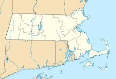
Maple-Union Corners is located in Massachusetts
Location: Springfield, Massachusetts
Coordinates: 42°6′5″N 72°34′56″W / 42.10139°N 72.58222°W / 42.10139; -72.58222Coordinates: 42°6′5″N 72°34′56″W / 42.10139°N 72.58222°W / 42.10139; -72.58222
Built: 1832
Architect: Multiple
Architectural style: No Style Listed
Governing body: Private
NRHP Reference#:

76000243

[1]
Added to NRHP: April 26, 1976

Maple-Union Corners is a historic site at 77, 83, 76-78, 80-84 Maple Street in Springfield, Massachusetts.

It was built in 1832 and added to the National Register of Historic Places in 1976.

References


Wikimedia Foundation. 2010.

Игры ⚽ Нужно решить контрольную?

Look at other dictionaries:

  • Maple Leaf, Toronto — Maple Leaf   Neighbourhood   Position of Maple Leaf Maple Leaf is a neighbourhood in the city of Toronto, Ontario …   Wikipedia

  • Maple Valley, Washington — City of Maple Valley, Washington   City   Logo …   Wikipedia

  • Toronto Maple Leafs — Leafs redirects here. For other sports clubs named Toronto Maple Leafs , see Toronto Maple Leafs (disambiguation). For other uses, see Leafs (disambiguation). Toronto Maple Leafs …   Wikipedia

  • National Register of Historic Places listings in Springfield, Massachusetts — Location of Springfield in Massachusetts This is a list of the National Register of Historic Places listings in Springfield, Massachusetts. This is intended to be a complete list of the properties and districts on the National Register of… …   Wikipedia

  • Madison, Wisconsin — Infobox Settlement official name = City of Madison nickname = Mad Town or Mad City motto = imagesize = image caption = image mapsize = 250px map caption = Location of Madison in Dane County, Wisconsin subdivision type = Municipality subdivision… …   Wikipedia

  • Madison (Wisconsin) — Pour les articles homonymes, voir Madison. Madison …   Wikipédia en Français

  • List of communities in Ontario — Communities in the province of Ontario, Canada Note: this is an incomplete list of communities, not necessarily organized municipalities. For organized municipalities see list of municipalities in Ontario and for census subdivisions see list of… …   Wikipedia

  • New York State Route 104 — This article is about the current alignment of NY 104. For previous alignments of NY 104, see New York State Route 104 (disambiguation). NYS Route 104 …   Wikipedia

  • List of county routes in Dutchess County, New York — Dutchess County, New York maintains a system of signed county routes primarily to serve local traffic between the various communities in the county. Route numbers generally increase progressively based on the alphabetical order of the towns where …   Wikipedia

  • United States — a republic in the N Western Hemisphere comprising 48 conterminous states, the District of Columbia, and Alaska in North America, and Hawaii in the N Pacific. 267,954,767; conterminous United States, 3,022,387 sq. mi. (7,827,982 sq. km); with… …   Universalium

Share the article and excerpts

Direct link
Do a right-click on the link above
and select “Copy Link”