- New York State Route 104
-
This article is about the current alignment of NY 104. For previous alignments of NY 104, see New York State Route 104 (disambiguation).
NYS Route 104

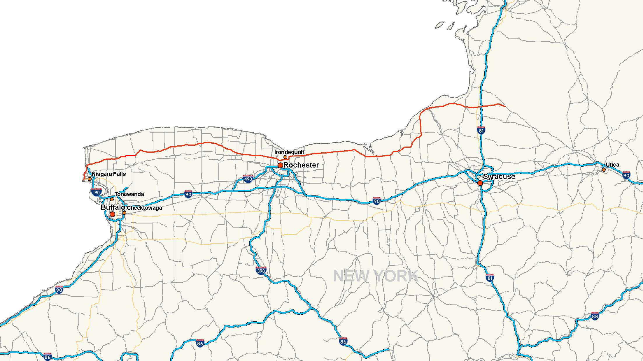
Map of western and central New York with NY 104 highlighted in redRoute information Maintained by NYSDOT and the city of Niagara Falls Length: 182.41 mi[3] (293.56 km) Existed: ca. 1972[1][2] – present Major junctions West end:  NY 384 in Niagara Falls
 US 62 in Niagara Falls
 I-190 in Lewiston
 NY 78 near Lockport
 NY 98 near Albion
 NY 390 in Greece
 NY 590 in Irondequoit
 NY 14 near Sodus
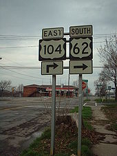
 NY 481 in Oswego
 I-81 in Mexico
East end:  NY 13 in Williamstown
Location Counties: Niagara, Orleans, Monroe, Wayne, Cayuga, Oswego Highway system Numbered highways in New York
Interstate • U.S. • N.Y. (former) • Reference • County←  NY 103
NY 104A  →
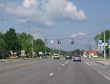
→New York State Route 104 (NY 104) is a 182.41-mile (293.56 km) long east–west state highway in Upstate New York, United States. It spans six counties and enters the vicinity of four cities—Niagara Falls, Lockport, Rochester, and Oswego—as it follows a routing largely parallel to that of the southern shoreline of Lake Ontario, along a ridge of the old shoreline of Glacial Lake Iroquois.[4] The western terminus of NY 104 is at an intersection with NY 384 in Niagara Falls, Niagara County, while its eastern terminus is at a junction with NY 13 in the town of Williamstown, Oswego County. The portion of NY 104 between Rochester and the village of Webster east of the city is a limited-access highway known as the Keeler Street Expressway west of NY 590 and the Irondequoit – Wayne County Expressway east of NY 590; from Williamson to Oswego, NY 104 is a super two highway.
The majority of Ridge Road and modern NY 104 from the village of Red Creek to the town of Mexico were originally designated as part of Route 30, an unsigned legislative route, early in the 20th century. All of Ridge Road and its continuation through Oswego to the hamlet of Maple View gained a signed designation by 1926 and became part of U.S. Route 104 (US 104), a United States Numbered Highway extending from Niagara Falls to Maple View, ca. 1935. US 104, which never connected to US 4, its implied parent route, was redesignated as NY 104 ca. 1972. As part of the redesignation, NY 104 was extended east to NY 13 in Williamstown over what had been New York State Route 126.
Over time, the 104 designation, whether it be US 104 or NY 104, has been shifted from surface streets to expressways and super twos, particularly from Rochester east to Oswego. The first such realignment occurred in the 1940s in Wayne County and was completed by the realignment of NY 104 onto the Irondequoit – Wayne County Expressway near Webster in the 1980s.
Contents
Route description
Niagara County
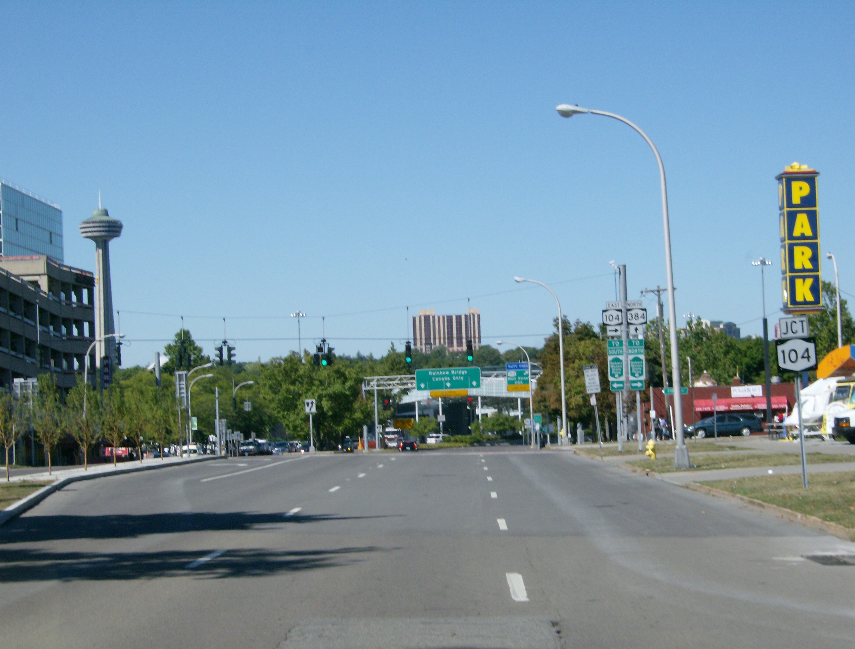
NY 104 begins near the Rainbow Bridge at the intersection of First Street and Niagara Street (NY 384) in downtown Niagara Falls. The Seaway Trail crosses over NY 384 and follows NY 104 north on First Street for one block to the Robert Moses State Parkway, where the byway and NY 104 veer onto Main Street. NY 104 follows Main Street through the largely commercial west side of the city and intersects the northern terminus for both US 62 (Ferry Avenue and Walnut Avenue) and US 62 Business (Pine Avenue). North of US 62 Business, the area becomes more residential as NY 104 meets NY 182 southeast of the Whirlpool Rapids Bridge. To the north, the name of NY 104 changes to Lewiston Road as it passes by the south campus of Niagara University. Near the northern extent of the campus, NY 104 intersects the western terminus of NY 31, here named College Avenue. At the city limits, NY 104 meets the northbound Robert Moses State Parkway by way of a half-interchange.[5][6] The portion of NY 104 between Third Street and the Lewiston town line is maintained by the city of Niagara Falls, and is the only part of NY 104 that is not maintained by the New York State Department of Transportation.[7][8][9]
Now in the town of Lewiston, NY 104 comes within view of the Niagara River gorge and begins to run along its eastern rim. NY 104 meets the northern-most point of NY 61 at the northern campus of Niagara University. Past NY 61, the route passes by the Niagara Power Visitors Center and over the Robert Moses Niagara Power Plant. On the opposite side of the plant, NY 104 connects with Interstate 190 (I-190) at exit 25 via Upper Mountain Road and passes under the eastern approach to the Lewiston–Queenston Bridge, which links I-190 with Ontario's Highway 405.[5]
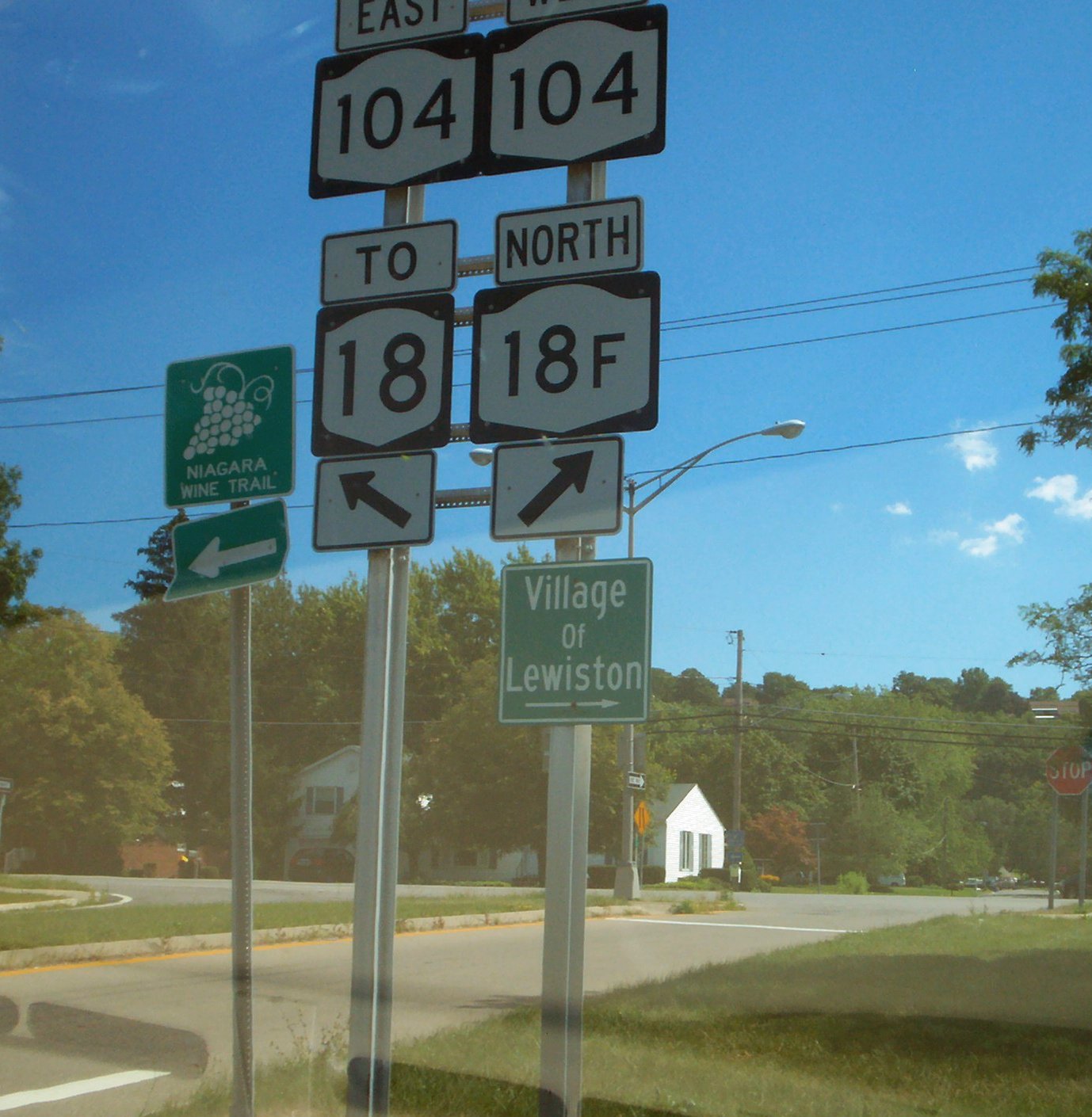
Past I-190, NY 104 begins to deviate from the Niagara River. It heads through a small neighborhood situated between the Moses Parkway and NY 104 and intersects the northern end of NY 265. North of this junction, NY 104 curves northeast to descend the Niagara Escarpment. As it heads downward in elevation, it intersects the western terminus of NY 18 by way of an interchange. As part of the same exit, NY 104 meets the parkway one more time as well as the southern terminus of NY 18F near the village of Lewiston. Here, the Seaway Trail leaves NY 104 to follow NY 18F. East of the exit, NY 104 intersects NY 18 again by way of another interchange.[5][6]
East of Lewiston village, NY 104 follows Ridge Road through a sparsely populated area of Niagara County. Much of this portion of NY 104 is bordered on its southern end by the Tuscarora Indian Reservation. At the Lewiston hamlet of Dickersonville, the extents of the reservation head south, and development along NY 104 increases slightly. NY 104 meets the northern terminus of NY 429 at the Lewiston–Cambria town line and crosses over NY 425 at Streeters Corners. Just east of this location is an intersection with NY 93 in the community of Molyneaux Corners. The two routes form a concurrency east to Warrens Corners, a hamlet situated on the Cambria–Lockport town line, where NY 93 turns south to serve the city of Lockport.[5]
NY 104 heads northeast through the extreme northwest corner of the town of Lockport to the town line, where it turns eastward to straddle the boundary between the towns of Lockport and Newfane. As it approaches the hamlet of Wrights Corners, the amount of development along NY 104 increases substantially with the level of development peaking at the junction of NY 104 and NY 78. The two routes join for roughly 0.35 miles (0.56 km) into the town of Newfane before splitting north of the hamlet. Ridge Road continues northeast through a residential district, which gives way to open fields once more at Ridgewood. NY 104 turns east here, passing through the town of Hartland and intersecting the southern terminus of NY 148 and the northern terminus of NY 271. The route crosses into Orleans County at a junction with the southern terminus of NY 269, which straddles the county line.[10]
Orleans and Monroe Counties
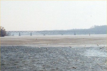
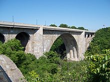 The Veterans Memorial Bridge over the Genesee River.
The route heads northeast through the town of Ridgeway to the hamlet of the same name, where NY 104 meets NY 63. NY 63 joins NY 104 east along Ridge Road for about 300 yards (270 m) before continuing north toward Lake Ontario. NY 104, meanwhile, continues through the rural towns of Ridgeway and Gaines to a junction with NY 279 north of Albion. Not far to the east, NY 104 intersects NY 98, the primary north–south highway through Albion, in the hamlet of Childs.[10] Just past the intersection on the north side of the road are two of the three cobblestone buildings of the Cobblestone Historic District, a National Historic Landmark.[citation needed]
Farther east, Ridge Road enters the town of Murray, where it meets the northern terminus of NY 387 and intersects NY 237 in the hamlet of Murray. The two routes join for just under a mile (1.6 km) before NY 237 breaks away to the south toward Holley. NY 104 exits Orleans County 2 miles (3.2 km) later in the same fashion as it entered: by intersecting a state highway. After meeting the southern terminus of NY 272, NY 104 crosses into Monroe County and becomes West Ridge Road as it heads through the town of Clarkson. In the densely-populated hamlet of the same name, NY 104 intersects NY 19. The open fields return east of the hamlet, and largely surround Ridge Road as NY 104 intersects NY 260. NY 104 heads onward into Parma, where it widens to four lanes and has a junction with NY 259 in Parma Corners.[11]
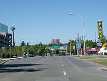
 Keeler Street Expressway (NY 104) eastbound at Hudson Avenue
East of Parma Corners, development on NY 104 steadily increases as it heads toward the town of Greece. By the Parma–Greece town line, where NY 104 intersects the southern terminus of NY 261, Ridge Road is lined with commercial properties of varying size. Continuing east, NY 104 meets the northern terminus of NY 386. Between NY 386 and NY 390 exit 24, NY 104 passes by several large shopping malls, the largest of which is The Mall at Greece Ridge at the intersection of NY 104 and Long Pond Road. At NY 390, NY 104 widens to six lanes as it heads toward Rochester. It enters the city limits upon meeting Mount Read Boulevard at an interchange.[12]
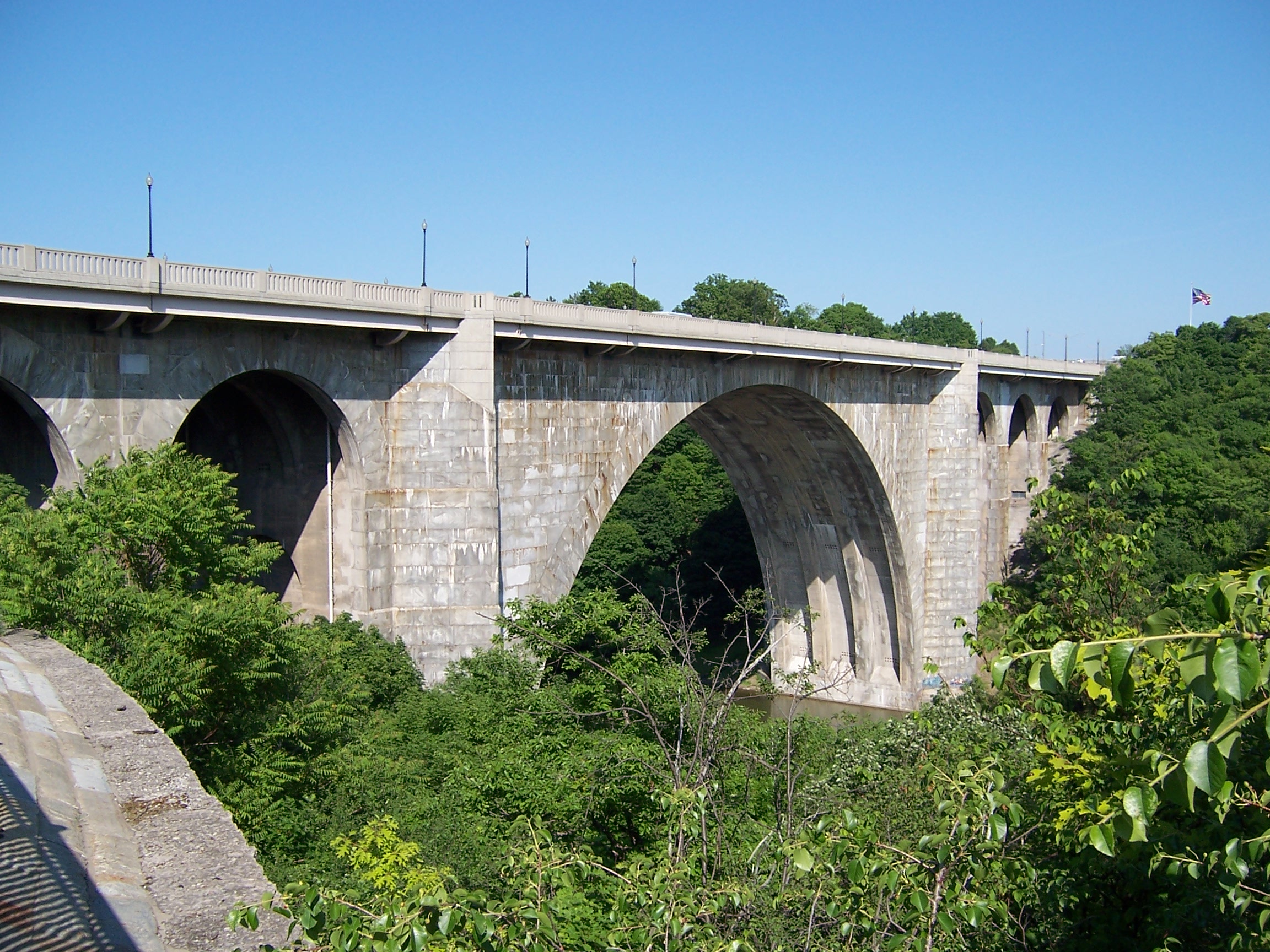
In Rochester, NY 104 passes through an area known as Kodak Park, the large industrial complex owned by Eastman Kodak that occupies an entire neighborhood. In the middle of the complex, NY 104 crosses the Rochester and Southern Railroad and the CSX Transportation-owned Charlotte Running Track and intersects the eastern terminus of NY 18. Continuing east, NY 104 crosses the Genesee River gorge on the Veterans Memorial Bridge. On the opposite bank, it loses the name West Ridge Road and becomes a limited-access highway known as the Keeler Street Expressway.[12]
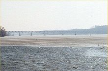 The Irondequoit Bay Bridge carries NY 104 from Irondequoit to Webster.
North of the first exit with St. Paul Street, Ridge Road resurfaces as East Ridge Road, which parallels the expressway to the north. NY 104 continues through Rochester and Irondequoit, connecting to North Clinton Avenue, Seneca Avenue, Hudson Avenue, Carter Street, Portland Avenue, North Goodman Street and Culver Road by way of interchanges. Between the Goodman Street and Culver Road exits, NY 104 passes the Medley Centre. East of Culver, NY 104 encounters NY 590 and connects to NY 590 southbound by way of an interchange. East Ridge Road runs through the middle of this interchange, although there are no connections between Ridge and NY 104. There is also no access from NY 104 eastbound to NY 590 northbound; eastbound traffic must take Culver Road in order to go north toward Sea Breeze. Just east of the NY 590 interchange, NY 104 becomes the Irondequoit – Wayne County Expressway and crosses the Irondequoit Bay by way of the Irondequoit Bay Bridge.[12]
On the other side of the bridge in the town of Webster, NY 104 has exits leading to Bay Road, Five Mile Line Road, Hard Road, and Holt Road prior to entering the village of Webster. Within the village, NY 104 meets NY 250 (North Avenue) and Phillips Road by way of interchanges before reentering the surrounding town. The expressway loosely parallels the southern edge of the primary Xerox campus to an exit with Salt Road, where it downgrades to a divided highway as it continues east to Basket Road and the Monroe–Wayne county line, partially delimited by NY 404.[12]
Wayne and Cayuga Counties
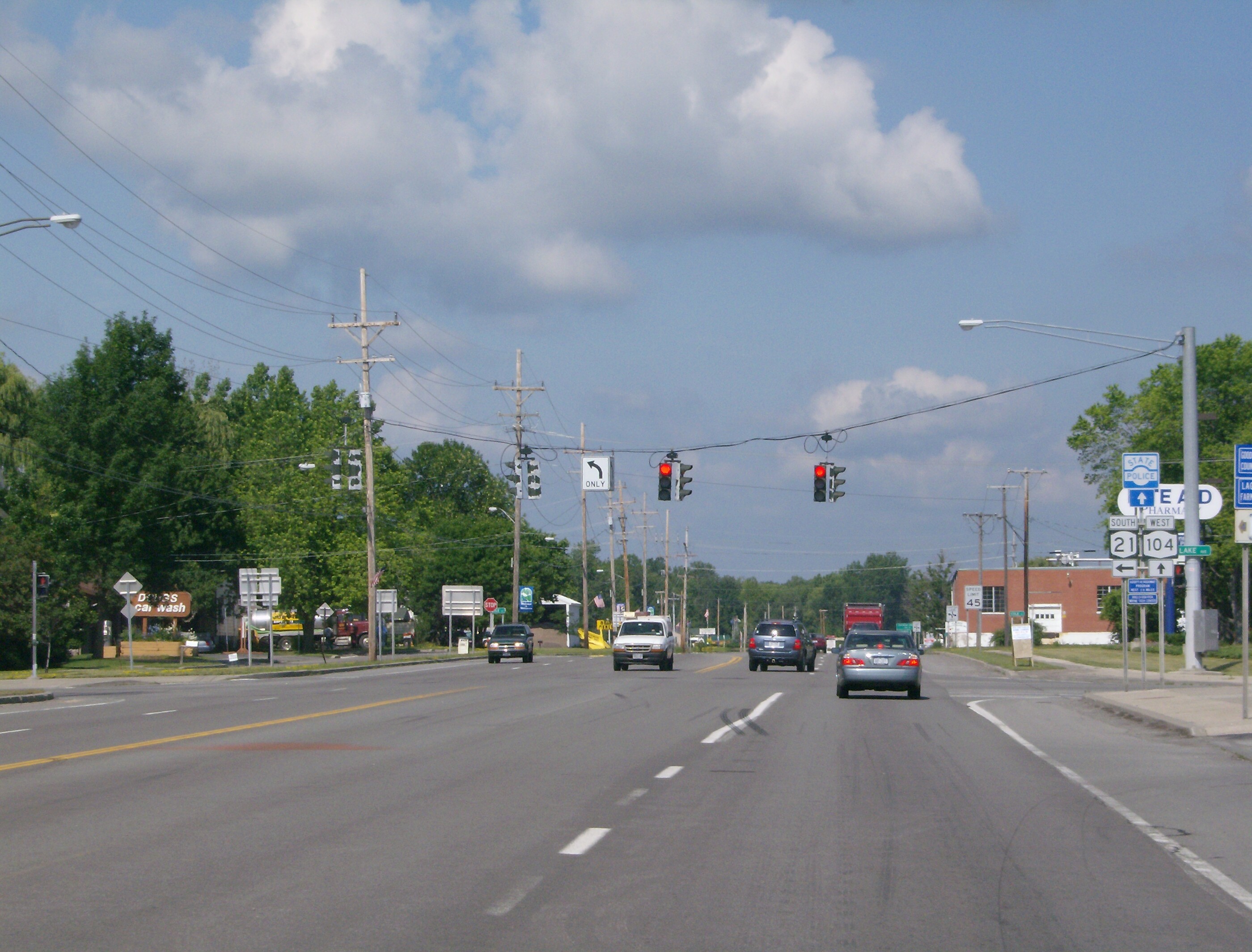
As Ridge Road follows NY 104 to the south, Route 104 continues east through Ontario, where it meets the northern terminus of NY 350 in Ontario Center. The four-lane divided highway continues east to Williamson, where the median separating the two directions of NY 104 comes to an end west of the hamlet of Williamson. In the center of the hamlet, NY 104 intersects the northern terminus of NY 21. NY 104 narrows to two lanes east of Williamson as development along the route declines once more, giving way to open fields and thick forests.[13]
Near the center of the county in the town of Sodus, NY 104 serves as the northern terminus of NY 88 northwest of the village of Sodus. While NY 88 heads east into the village, NY 104 bypasses Sodus to the north. East of the village, Ridge Road and NY 104 intersect as Ridge Road flips to the north side of Route 104. The two highways follow parallel routings southeast toward Alton, where NY 104 intersects NY 14. East of Alton, the gap between the two widens as Ridge Road veers north to access Sodus Bay. NY 104, meanwhile, follows a nearly linear routing into the town of Huron, the location of a junction with NY 414.[13]
NY 104 continues on the eastward routing to the vicinity of the village of Wolcott, where it connects to the northern terminus of NY 89 via a half-diamond interchange south of the village. Northeast of this location in the town of Wolcott, Ridge Road intersects NY 104 once again, returning to the south side of the route. The two roads follow parallel routings once more to a junction south of Red Creek. At this rural intersection, NY 104 acts as the western terminus of both NY 104A and NY 370, both occupying an extension of Ridge Road. Just east of the intersection is the Wayne–Cayuga county line. Only 7 miles (11 km) of the route are situated in Cayuga County, and the only junction of note within the county is with NY 38, which it meets in the Sterling hamlet of Martville. East of the junction, NY 104 turns sharply to the northeast and enters Oswego County.[13]
Oswego County
The route continues northeast through the town of Hannibal to the village of the same name. Instead of entering the community, NY 104 bypasses it to the east. It intersects NY 3 east of Hannibal and heads north toward Lake Ontario. In the town of Oswego, NY 104 meets the eastern terminus of NY 104A and assumes its northeasterly routing. It is here that the Seaway Trail rejoins NY 104. NY 104 heads along the Lake Ontario shoreline to the lakeside city of Oswego, the first location with significant development along the route since Williamson. The route intersects Sweet Road, a connector leading to the campus of SUNY Oswego, just west of the city limits.[6][13]
 An old "To US 104" shield on Lake Street in Oswego.
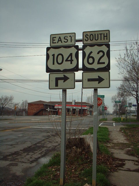
NY 104 enters the city as the two-laned West Seneca Street. At Baylis Street, the road widens to four lanes separated by a median. After seven blocks, NY 104 veers onto West Bridge Street, a four-lane street with no median. NY 104 continues along Bridge Street into downtown, where it intersects the northern terminus of NY 48 on the west bank of the Oswego River and the northern terminus of NY 481 on the east bank. As NY 104 heads through eastern Oswego, it separates from East Bridge Street and curves east to follow a more inland routing. The route reverts back to two lanes as it exits the city limits.[14]
The high level of development along NY 104 continues to the Scriba hamlet of the same name, where it begins to become more sporadic and give way to fields and dense forests. NY 104 heads northeast to New Haven and a junction with NY 104B. While NY 104B heads northeast toward the lakeshore as part of the Seaway Trail, NY 104 cuts southeast to serve the village of Mexico. In the village center, NY 104 briefly overlaps NY 3 and intersects the northern terminus of NY 69. The route continues due east through the rural town of Mexico to the small hamlet of Maple View, centered around the junction between NY 104 and US 11. Just outside the hamlet, NY 104 meets I-81 at exit 34. Past I-81, NY 104 heads east and southeast for nine miles (14 km) through the predominantly rural towns of Albion and Williamstown to its eastern terminus at a junction with NY 13.[6][14]
History
Early designations
 NY 104 was US 104 from the mid-1930s to the early 1970s.
In 1908, the New York State Legislature established Route 30, an unsigned legislative route extending from Niagara Falls, Niagara County in the southwest to Rouses Point, Clinton County, in the northeast. From Rochester to Red Creek, Route 30 was assigned to Ridge Road. Between Red Creek and the hamlet of Union Square (now Maple View) in the town of Mexico, it included most of modern NY 104. At the same time, the roadway alongside the Niagara River between Ridge Road in Lewiston and Pine Avenue in downtown Niagara Falls was designated, but not signed, as part of Route 18.[15][16] By 1914, Route 30 was amended to also include the section of Ridge Road from Porter (modern NY 429) to Ridgeway (NY 63).[15][16][17] In 1914,[17][18] another section—from Ridgeway to the Orleans–Monroe county line—was also included in Route 30's definition as a spur route.[15][16] The spur route became part of Route 30 on March 1, 1921, when the mainline route was realigned to follow Ridge Road between Ridgeway and Rochester.[19]
When the first set of posted routes in New York were assigned in 1924, the segments of Route 30 from Rochester to Red Creek and from Oswego to Maple View became part of NY 3. Between Red Creek and Oswego, NY 3 was routed on what is now NY 104A. Farther west, the portion of Route 18 from Niagara Falls to Lewiston was included as part of NY 34.[20] By 1926, all of legislative Route 30 west of Rochester was designated as part of NY 31.[21] In the late 1920s, however, NY 31 was realigned to follow Ridge Road west from Porter to Lewiston.[22][23] In the 1930 renumbering of state highways in New York, NY 34 became part of an extended NY 18 while NY 3E was assigned to the portion of former legislative Route 30 between Red Creek and Oswego.[24][25] NY 3E was renumbered to NY 3F ca. 1932.[26][27]
Establishment of US 104
 Sign assembly for US 62 and US 104 in Niagara Falls. US 104 had long since been redesignated as NY 104 by the time of this photo.
US 104 was assigned across Upstate New York ca. 1935, extending from Niagara Falls to Maple View via Lewiston, Rochester, and Oswego. It overlapped NY 18 from Niagara Falls to Lewiston and replaced NY 3 and NY 31 from Lewiston to Maple View (except from Red Creek to Oswego, where US 104 followed NY 3F instead). As a result, NY 31 was shifted south onto most of its modern alignment while NY 3 was rerouted south of Watertown to follow what had been NY 3D. Although US 104 was technically a child route of US 4, it did not connect to US 4.[28][29] A highway extending eastward from US 11 and US 104 at Maple View to NY 13 in Williamstown was designated as NY 126 ca. 1940.[30][31]
When it was first assigned, US 104 dipped south to serve downtown Rochester instead of bypassing it to the north. US 104 left Ridge Road at Lake Avenue and followed Lake Avenue south to Main Street in downtown. It followed Main Street and Winton Road to Empire Boulevard, where it turned east to rejoin Ridge Road in Webster.[29] Ca. 1937, it was rerouted to continue east on Ridge Road over the Veterans Memorial Bridge and through Irondequoit to Culver Road. US 104 turned here, following Culver Road south to Empire Boulevard and the latter east to Winton Road, where it reconnected to its original routing through the city. The realignment created a significant overlap with NY 18, which joined US 104 in the vicinity of Kodak Park and separated at Culver Road, where it headed north instead.[32][33]
Conversion to expressways
Work began in the 1940s on new super two alignments for US 104 in Wayne, Cayuga, and Oswego Counties. The new highway was built on a routing parallel to that of Ridge Road and served as a bypass of the communities along Ridge Road. The first portion of the super two, extending from the Monroe–Wayne county line at Union Hill to west of Sodus, was built in the mid-1940s and completed by 1947.[34][35] An extension of the highway around Sodus to NY 414 in Huron was constructed in the mid-1960s and opened by 1968. In between the end of the super two and Ridge Road, US 104 was routed on Lake Bluff Road.[36][37] The remainder of the super two between Huron and Red Creek was finished by 1974.[38] East of the super two, a bypass was constructed around the village of Hannibal during the early 1960s and opened to traffic by 1964.[36][39]
 Northbound on Culver Road (former US 104) in Irondequoit just north of NY 104
Similar conversion projects were also conducted elsewhere. In Irondequoit, the portion of the Sea Breeze Expressway (now NY 590) from Empire Boulevard to Culver Road opened in the late 1950s. US 104 and NY 18 were extended eastward along East Ridge Road to meet the expressway at what is now exit 11. Both designations entered the freeway; however, NY 18 followed the roadway north to Culver Road while US 104 progressed south to Empire Boulevard, where it rejoined its former surface alignment towards Webster.[40][41] The 0.71 miles (1.14 km) of Empire Boulevard between the Rochester city line and the Sea Breeze Expressway remains state-maintained to this day as NY 941B, an unsigned reference route.[3]
In the mid-1960s, construction began on the Keeler Street Expressway, a limited-access highway extending across Irondequoit from the Genesee River (at the Veterans Memorial Bridge) to the Sea Breeze Expressway. The first section from North Goodman Street to the Sea Breeze Expressway was completed by 1968[36][37] while the remainder opened in late 1969.[37][42] The name of the expressway was derived from Keeler Street, a small residential street that originally connected to East Ridge Road and St. Paul Street by way of a traffic circle on the east bank of the Genesee River. The street was turned into a dead-end street as a result of the expressway's construction.[43][44][45][46] US 104 was moved from East Ridge Road to the expressway, which remains known, albeit infrequently, as the Keeler Street Expressway to this day. NY 18 remained on East Ridge Road, however, reducing the overlap between US 104 and NY 18 to just the portion on the Veterans Bridge.[47] NY 18 was truncated to its current eastern terminus ca. 1973, eliminating the overlap entirely.[48][49]
 Reference marker for NY 104 on NY 404 in Webster. NY 404 is the former alignment of NY 104 through eastern Monroe County.
The first segment of an eastward extension of the Keeler Street Expressway, named the Irondequoit – Wayne County Expressway, opened ca. 1971 between the Sea Breeze Expressway (at this point designated as part of NY 47) and Five Mile Line Road. In between, US 104 crossed Irondequoit Bay by way of the Irondequoit Bay Bridge.[42][47] US 104's former surface alignment between NY 47 and Five Mile Line Road was redesignated NY 404[47][50] while US 104 was temporarily realigned onto Five Mile Line Road between the expressway and Ridge Road to connect to its former alignment.[51]
Redesignation and completion
The segment of I-81 through central New York was built on an alignment that closely paralleled US 11 from the Pennsylvania state line northward to the city of Watertown. The portion of I-81 near Maple View was completed in late 1961,[52] at which time US 104 was extended 1 mile (1.6 km) eastward over NY 126 to meet the new highway. NY 126 was truncated on its west end to the I-81 interchange as a result.[53] US 104 was redesignated as NY 104 ca. 1972,[1][2] making the route the third to bear the NY 104 designation. As part of the change, NY 104 was extended east to NY 13, completely supplanting NY 126.[49][54]
By 1978, the frontage roads between Five Mile Line Road and NY 250 in Webster were completed. NY 104 was rerouted eastward along the roadways while NY 404 was extended over NY 104's old alignment to NY 250 in Webster.[51] The section from NY 250 to the existing expressway at the Wayne County line was built in the late 1970s[55][56] while the main carriageway of NY 104 between Five Mile Line Road and NY 250 was completed in the early 1980s. NY 404 was extended east along the former alignment of NY 104 to the county line upon the total completion of the Five Mile Line Road – NY 250 segment.[57][58]
Suffixed routes
NY 104 has two suffixed routes, both of which were assigned ca. 1935.[28][29]
- NY 104A (17.38 miles or 27.97 kilometres) is an alternate route of NY 104 between Red Creek, Wayne County, and the town of Oswego, Oswego County.[3]
- NY 104B (6.07 miles or 9.77 kilometres) is a spur in Oswego County that extends from NY 104 in New Haven to NY 3 in Texas.[3]
NY 104 Truck

NYS Route 104 Truck
Location: Rochester–Irondequoit New York State Route 104 Truck is a 1.3-mile (2.1 km) long truck route of NY 104 through the city of Rochester and town of Irondequoit in Monroe County. The route, which exists in the eastbound direction only, extends from the ramps connecting NY 104 to St. Paul Street east along East Ridge Road to Hudson Avenue, where it turns south to access NY 104.[46] A 0.9-mile (1.4 km) long segment of NY 104 Truck follows the former alignment of US 104 east along East Ridge Road from St. Paul Street to Hudson Avenue.[37][46]
Major intersections
County Location Mile[3] Destinations Notes Niagara Niagara Falls 0.00 NY 384 (Niagara Street)0.16 US 62 south (Ferry Avenue)0.35 US 62 north (Walnut Avenue)Northern terminus of US 62 0.51 
US 62 Bus. (Pine Avenue)Western terminus of US 62 Business 1.42  NY 182 (Cleveland Avenue)
2.51  NY 31 (College Avenue)
Western terminus of NY 31 3.33  Robert Moses Parkway
Town of Lewiston 3.69  NY 61 (Hyde Park Boulevard)
Northern terminus of NY 61 4.88 I-190Exit 25 (I-190) 5.41  NY 265 (Military Road)
Northern terminus of NY 265 5.95  NY 18
NY 18Western terminus of NY 18 6.49  NY 18F / Robert Moses Parkway
Southern terminus of NY 18F 7.17 NY 18Porter 14.24  NY 429
Hamlet of Ransomville; northern terminus of NY 429 Cambria 17.28  NY 425
Hamlet of Streeters Corners 18.85  NY 93 west
Hamlet of Molyneaux Corners; western terminus of NY 93 / NY 104 overlap 21.12 NY 93 eastHamlet of Warren Corners; eastern terminus of NY 93 / NY 104 overlap Lockport–Newfane town line 25.10 NY 78 southHamlet of Wrights Corners; southern terminus of NY 78 / NY 104 overlap Newfane 25.41 NY 78 northHamlet of Wrights Corners; northern terminus of NY 78 / NY 104 overlap Hartland 33.07  NY 148
Northern terminus of NY 148 37.06  NY 271
Northern terminus of NY 271 37.60  NY 269
Southern terminus of NY 269 Orleans Ridgeway 41.34  NY 63 south
Western terminus of NY 63 / NY 104 overlap 41.50 NY 63 northEastern terminus of NY 63 / NY 104 overlap Gaines 50.64  NY 279
Hamlet of Gaines 51.84 NY 98Hamlet of Childs Murray 56.99  NY 387
Northern terminus of NY 387 59.45  NY 237 north
Western terminus of NY 104 / NY 237 overlap 60.32 NY 237 southEastern terminus of NY 104 / NY 237 overlap 62.30  NY 272
Southern terminus of NY 272 Monroe Clarkson 66.11  NY 19
NY 1968.09  NY 260
Parma 73.08  NY 259
Hamlet of Parma Corners Town of Greece 75.11  NY 261 (Manitou Road)
Southern terminus of NY 261 76.28  NY 386 (Elmgrove Road)
Northern terminus of NY 386 79.16 NY 390Exit 24 (NY 390) Rochester 81.02 NY 18 (Dewey Avenue)Eastern terminus of NY 18 West end of freeway section 81.91 Maplewood Drive 82.27 St. Paul Street To Seneca Park Zoo; eastbound exit and westbound entrance 82.69 North Clinton Avenue / Seneca Avenue To Seneca Park Zoo; western terminus of frontage roads 83.35 Hudson Avenue Eastbound exit only 83.74 Carter Street / Portland Avenue (east) / Hudson Avenue (west) Irondequoit 84.40 Goodman Street / Portland Avenue (west) To Rochester General Hospital; eastern terminus of frontage roads 85.33 Culver Road (Seaway Trail) 85.91 NY 590 south – RochesterIrondequoit Bay Bridge Town of Webster 88.24 Bay Road 90.28 Five Mile Line Road Western terminus of frontage roads 90.98 Hard Road / Holt Road Eastbound exit and entrance 91.87 Hard Road / Holt Road Westbound exit and entrance Village of Webster 92.57  NY 250 – Webster
Eastern terminus of frontage roads 93.15 Phillips Road To Xerox Wilson Center; eastbound exit and westbound entrance Town of Webster 94.12 Salt Road East end of freeway section 95.43  NY 404 (County Line Road)
Eastern terminus of NY 404 Wayne Ontario 98.92  NY 350 (Ontario Center Road)
Hamlet of Ontario Center; northern terminus of NY 350 Williamson 104.97  NY 21 (Lake Avenue)
Northern terminus of NY 21 Town of Sodus 110.49  NY 88
NY 88Northern terminus of NY 88 116.28 NY 14Hamlet of Alton Huron 120.35  NY 414
Northern terminus of NY 414 Town of Wolcott 125.56  NY 89
NY 89Interchange; northern terminus of NY 89 129.72  NY 104A / NY 370
Western terminus of NY 104A and NY 370 Cayuga Sterling 134.85  NY 38
NY 38Hamlet of North Victory Oswego Village of Hannibal 139.84  NY 34
NY 34Northern terminus of NY 34 141.30  NY 3
NY 3Town of Oswego 147.31 NY 104AHamlet of Southwest Oswego; eastern terminus of NY 104A Oswego 152.12  NY 48 (West Fifth Street)
Northern terminus of NY 48 152.53 NY 481 (East First Street)Northern terminus of NY 481 New Haven 161.67  NY 104B
Western terminus of NY 104B Village of Mexico 166.72 NY 3 westWestern terminus of NY 3 / NY 104 overlap 166.96 NY 3 eastEastern terminus of NY 3 / NY 104 overlap 167.10  NY 69
NY 69Northern terminus of NY 69 Town of Mexico 171.38  US 11
US 11172.53 I-81Exit 34 (I-81) Williamstown 182.41 NY 131.000 mi = 1.609 km; 1.000 km = 0.621 mi See also
- Former alignments
- Ridge Road, from the Veterans Memorial Bridge to Red Creek
- New York State Route 404, NY 590 in Rochester to NY 104 in Union Hill
- New York State Route 370, small portion of Ridge Road near Red Creek
- New York State Route 104A, partially former US 104 in Red Creek
References
- ^ a b Gulf Oil Company (1971). Ontario (Map). Cartography by Rolph-McNally Limited. http://www.ontarioroadmaps.ca/Oil_Companies/Gulf/1971_CDN/Municipalities/NiagaraFrontier.jpg. Retrieved April 4, 2009.
- ^ a b Texaco (1972). Ontario (Map). Cartography by H.M. Gousha Company. http://www.ontarioroadmaps.ca/Oil_Companies/Texaco/1972_US/Municipalities/Buffalo.jpg. Retrieved April 4, 2009.
- ^ a b c d e "2008 Traffic Volume Report for New York State" (PDF). New York State Department of Transportation. June 16, 2009. pp. 158–161, 272. https://www.nysdot.gov/divisions/engineering/technical-services/hds-respository/NYSDOT%20TVR%202008%20by%20Route.pdf. Retrieved January 29, 2010.
- ^ Tesmer, Irving H.; Bastedo, Jered C. (1981). Colossal Cataract: The Geologic History of Niagara Falls. SUNY Press. p. 48. ISBN 9780873955225. http://books.google.com/books?id=_IFDxu0oGQMC&pg=PA48&lpg=PA48&dq=route+104+iroquois+lake&source=bl&ots=24qg1HxIRy&sig=qq_wWKRZRddKvm_U-Qm0wpd2buQ&hl=en&ei=zY5nS-iBNcuo8Abq4LC1Bw&sa=X&oi=book_result&ct=result&resnum=1&ved=0CAcQ6AEwAA#v=onepage&q=route%20104%20iroquois%20lake&f=false. Retrieved February 2, 2010.
- ^ a b c d Yahoo! Inc. Yahoo! Maps – Niagara County, New York (Map). Cartography by NAVTEQ. http://maps.yahoo.com/#mvt=h&lat=43.158567&lon=-78.91964&zoom=13. Retrieved May 14, 2009.
- ^ a b c d National Scenic Byways Program. "Seaway Trail – New York – Print-n-Go". http://www.byways.org/explore/byways/2200/print_n_go.html. Retrieved May 14, 2009. The driving directions option was selected and used to determine the Seaway Trail's routing.
- ^ New York State Department of Transportation (March 2, 2009). "Region 3 Inventory Listing". https://www.nysdot.gov/divisions/engineering/technical-services/highway-data-services/inventory-listing. Retrieved May 14, 2009.
- ^ New York State Department of Transportation (March 2, 2009). "Region 4 Inventory Listing". https://www.nysdot.gov/divisions/engineering/technical-services/highway-data-services/inventory-listing. Retrieved May 14, 2009.
- ^ New York State Department of Transportation (March 2, 2009). "Region 5 Inventory Listing". https://www.nysdot.gov/divisions/engineering/technical-services/highway-data-services/inventory-listing. Retrieved May 14, 2009.
- ^ a b Google, Inc. Google Maps – eastern Niagara and western Orleans Counties (Map). Cartography by Google, Inc. http://maps.google.com/maps?ie=UTF8&ll=43.259706,-78.370285&spn=0.176268,0.445633&t=h&z=12. Retrieved May 14, 2009.
- ^ Google, Inc. Google Maps – eastern Orleans and western Monroe Counties (Map). Cartography by Google, Inc. http://maps.google.com/maps?ie=UTF8&t=h&ll=43.263706,-77.977867&spn=0.176257,0.445633&z=12. Retrieved May 14, 2009.
- ^ a b c d Google, Inc. Google Maps – eastern Monroe County (Map). Cartography by Google, Inc. http://maps.google.com/maps?ie=UTF8&t=h&ll=43.22144,-77.602272&spn=0.176379,0.445633&z=12. Retrieved May 14, 2009.
- ^ a b c d Google, Inc. Google Maps – Ontario to Oswego (Map). Cartography by Google, Inc. http://maps.google.com/maps?ie=UTF8&t=h&ll=43.321681,-76.942062&spn=0.352177,0.891266&z=11. Retrieved May 14, 2009.
- ^ a b Google, Inc. Google Maps – Oswego to Williamstown (Map). Cartography by Google, Inc. http://maps.google.com/maps?ie=UTF8&t=h&ll=43.468868,-76.205978&spn=0.351322,0.891266&z=11. Retrieved May 14, 2009.
- ^ a b c State of New York Department of Highways (1909). The Highway Law. Albany, New York: J. B. Lyon Company. pp. 60, 63–64. http://books.google.com/books?id=jZ0AAAAAMAAJ&printsec=frontcover#PPA60,M1. Retrieved May 14, 2009.
- ^ a b c New York State Department of Highways (1920). Report of the State Commissioner of Highways. Albany, New York: J. B. Lyon Company. p. 544. http://books.google.com/books?id=Sj4CAAAAYAAJ&printsec=titlepage#PPA544,M1. Retrieved May 14, 2009.
- ^ a b State of New York Commission of Highways (1919). The Highway Law. Albany, New York: J. B. Lyon Company. pp. 82–84. http://books.google.com/books?id=hZ4AAAAAMAAJ&pg=PA83. Retrieved November 28, 2010.
- ^ State of New York Department of Highways (1913). The Highway Law. Albany, New York: J.B. Lyon Company. pp. 80–81. http://books.google.com/books?id=mBksAAAAYAAJ&pg=PA81. Retrieved November 28, 2010.
- ^ New York State Legislature (1921). "Tables of Laws and Codes Amended or Repealed". Laws of the State of New York passed at the One Hundred and Forty-Fourth Session of the Legislature. Albany, New York: J. B. Lyon Company. pp. 42, 66. http://books.google.com/books?id=6pE4AAAAIAAJ&pg=PA42. Retrieved April 17, 2010.
- ^ "New York's Main Highways Designated by Numbers". The New York Times: p. XX9. December 21, 1924.
- ^ State of New York Department of Public Works (1926). Official Map Showing State Highways and other important roads (Map). Cartography by Rand McNally and Company.
- ^ Standard Oil Company of New York (1927). Road Map of New York in Soconyland (Map). Cartography by General Drafting.
- ^ Standard Oil Company of New York (1929). New York in Soconyland (Map). Cartography by General Drafting.
- ^ Dickinson, Leon A. (January 12, 1930). "New Signs for State Highways". The New York Times: p. 136.
- ^ Standard Oil Company of New York (1930). Road Map of New York (Map). Cartography by General Drafting.
- ^ Standard Oil Company (1931). New York (Map). Cartography by General Drafting.
- ^ Texas Oil Company (1932). Texaco Road Map – New York (Map). Cartography by Rand McNally and Company.
- ^ a b Texas Oil Company (1934). Road Map of New York (Map). Cartography by Rand McNally and Company.
- ^ a b c Sun Oil Company (1935). Road Map & Historical Guide – New York (Map). Cartography by Rand McNally and Company.
- ^ Standard Oil Company (1939). New York (Map). Cartography by General Drafting.
- ^ Gulf Oil Company (1940). New York Info-Map (Map). Cartography by Rand McNally and Company.
- ^ Standard Oil Company (1936). New York (Map). Cartography by General Drafting.
- ^ Standard Oil Company (1937). New York (Map). Cartography by General Drafting.
- ^ Esso (1942). New York with Pictorial Guide (Map). Cartography by General Drafting.
- ^ State of New York Department of Public Works. Official Highway Map of New York State (Map). Cartography by General Drafting (1947–48 ed.).
- ^ a b c Sinclair Oil Corporation (1964). New York and Metropolitan New York (Map). Cartography by Rand McNally and Company.
- ^ a b c d Esso (1968). New York (Map). Cartography by General Drafting (1969–70 ed.).
- ^ Gulf Oil Company (1974). New York and New Jersey Tourgide Map (Map). Cartography by Rand McNally and Company.
- ^ Sinclair Oil Corporation (1962). New York and Metropolitan New York (Map). Cartography by Rand McNally and Company.
- ^ Esso (1958). New York with Special Maps of Putnam–Rockland–Westchester Counties and Finger Lakes Region (Map). Cartography by General Drafting (1958 ed.).
- ^ Gulf Oil Company (1960). New York and New Jersey Tourgide Map (Map). Cartography by Rand McNally and Company.
- ^ a b National Bridge Inventory, a database compiled by the United States Department of Transportation Federal Highway Administration, available at www.nationalbridges.com. Accessed August 15, 2007.
- ^ Perry, N.W. "Interchange of the Week – Week 6". Empire State Roads. Archived from the original on December 22, 2007. http://web.archive.org/web/20071222012714/http://www.empirestateroads.com/week/week6.html. Retrieved April 4, 2009.
- ^ "Vintage Views – Former US 104 traffic circle". http://www.vintageviews.org/vv-r/river/cards/grb014.html. Retrieved April 4, 2009.
- ^ Army Map Service (1947). Rochester East Quadrangle (Map). 1:25,000. New York 1:25,000. http://cartweb.geography.ua.edu:9001/StyleServer/calcrgn?cat=North%20America%20and%20United%20States&item=States/New%20York/AMS/Rochester%20East.sid&wid=500&hei=400&props=item(Name,Description),cat(Name,Description)&style=simple/view.xsl&plugin=true. Retrieved May 13, 2009.
- ^ a b c Google, Inc. Google Maps – overview map of NY 104 Truck (Map). Cartography by Google, Inc. http://www.google.com/maps?f=d&source=s_d&saddr=St+Paul+St&daddr=43.191723,-77.612792&geocode=FeQIkwIdxqJf-w%3B&hl=en&mra=dme&mrcr=0&mrsp=1&sz=18&sll=43.191833,-77.61335&sspn=0.002757,0.006963&ie=UTF8&ll=43.19136,-77.613671&spn=0.002757,0.006963&t=h&z=18. Retrieved April 4, 2009. The Street View feature was used to determine the routing of NY 104 Truck.
- ^ a b c Humble Oil & Refining Company (1971). New York (Map). Cartography by General Drafting.
- ^ Gulf Oil Company (1972). New York and New Jersey Tourgide Map (Map). Cartography by Rand McNally and Company (1972 ed.).
- ^ a b Shell Oil Company (1973). New York (Map). Cartography by H.M. Gousha Company (1973 ed.).
- ^ State of New York Department of Transportation (January 1, 1970) (PDF). Official Description of Touring Routes in New York State. http://www.greaternyroads.info/pdfs/state70.pdf. Retrieved April 4, 2009.
- ^ a b United States Geological Survey (1978). Webster Quadrangle – New York (Map). 1:24,000. 7.5 Minute Series (Topographic). http://www.nysgis.state.ny.us/gisdata/quads/drg24/usgspreview/index.cfm?code=o43077b4. Retrieved April 4, 2009.
- ^ Sunoco (1961). New York and Metropolitan New York (Map). Cartography by H.M. Gousha Company (1961–62 ed.).
- ^ Esso (1962). New York with Sight-Seeing Guide (Map). Cartography by General Drafting.
- ^ New York State Thruway Authority (1971). New York Thruway (Map). Cartography by Rand McNally and Company (10th ed.).
- ^ Exxon (1977). New York (Map). Cartography by General Drafting (1977–78 ed.).
- ^ Exxon (1979). New York (Map). Cartography by General Drafting.
- ^ State of New York (1981). I Love New York Tourism Map (Map). Cartography by Rand McNally and Company.
- ^ Rand McNally and Company (1985). New York (Map). ISBN 0-528-91040-X.
External links
Categories:- State highways in New York
- Limited-access roads in New York
- Transportation in Niagara County, New York
- Transportation in Cayuga County, New York
- Transportation in Monroe County, New York
- Transportation in Orleans County, New York
- Transportation in Oswego County, New York
- Transportation in Wayne County, New York


Wikimedia Foundation. 2010.