- New York State Route 21
-
"NY 21" redirects here. NY 21 may also refer to New York's 21st congressional district.This article is about the current alignment of NY 21. For the former alignment of NY 21 in Dutchess County, see New York State Route 21 (1924–1930).
NYS Route 21
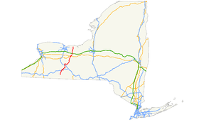
Map of New York with NY 21 highlighted in redRoute information Maintained by NYSDOT and the village of Palmyra Length: 99.99 mi[2] (160.92 km) Existed: 1930[1] – present Major junctions South end:  NY 417 in Andover
 I-86 / NY 17 in Almond

 I-390 / NY 15 in Wayland

 US 20 / NY 5 in Canandaigua

 I-90 / Thruway in Manchester
North end:  NY 104 in Williamson
Location Counties: Allegany, Steuben, Ontario, Yates, Wayne Highway system Numbered highways in New York
Interstate • U.S. • N.Y. (former) • Reference • County←  NY 20SY
NY 22  →
→New York State Route 21 (NY 21) is a state highway extending for 99.99 miles (160.92 km) through the western part of New York in the United States. The southern terminus of the route is at NY 417 in Andover. The northern terminus is at NY 104 in Williamson. In between, NY 21 serves the cities of Hornell and Canandaigua and intersects several major east–west routes, including the Southern Tier Expressway near Hornell, the conjoined routes of U.S. Route 20 (US 20) and NY 5 in Canandaigua, the New York State Thruway in Manchester, and NY 31 in Palmyra.
NY 21 originally extended from the Pennsylvania state line in the south to Lake Ontario in the north when it was assigned as part of the 1930 renumbering of state highways in New York. South of Hornell, the route followed modern NY 36. NY 21 was rerouted to follow its current alignment south of Hornell in the 1950s and truncated on its northern end to Williamson in 1980. Other changes, namely realignments to bypass communities along the route, have also occurred.
Contents
Route description
Andover to Naples
NY 21 begins at NY 417 in Andover. The route continues north, paralleling the Western New York and Pennsylvania Railroad to Alfred Station (east of Alfred), where it meets the eastern terminus of NY 244. NY 21 heads northeast through Almond to Hornell, briefly paralleling the Southern Tier Expressway (Interstate 86 or I-86 and NY 17) before intersecting NY 36 in the center of Hornell. NY 21 turns north onto NY 36, separating from the Southern Tier Line and forming a concurrency with NY 36 north along the Maple City Bypass. At North Hornell, the two routes split near I-86/NY 17 exit 34.[3]
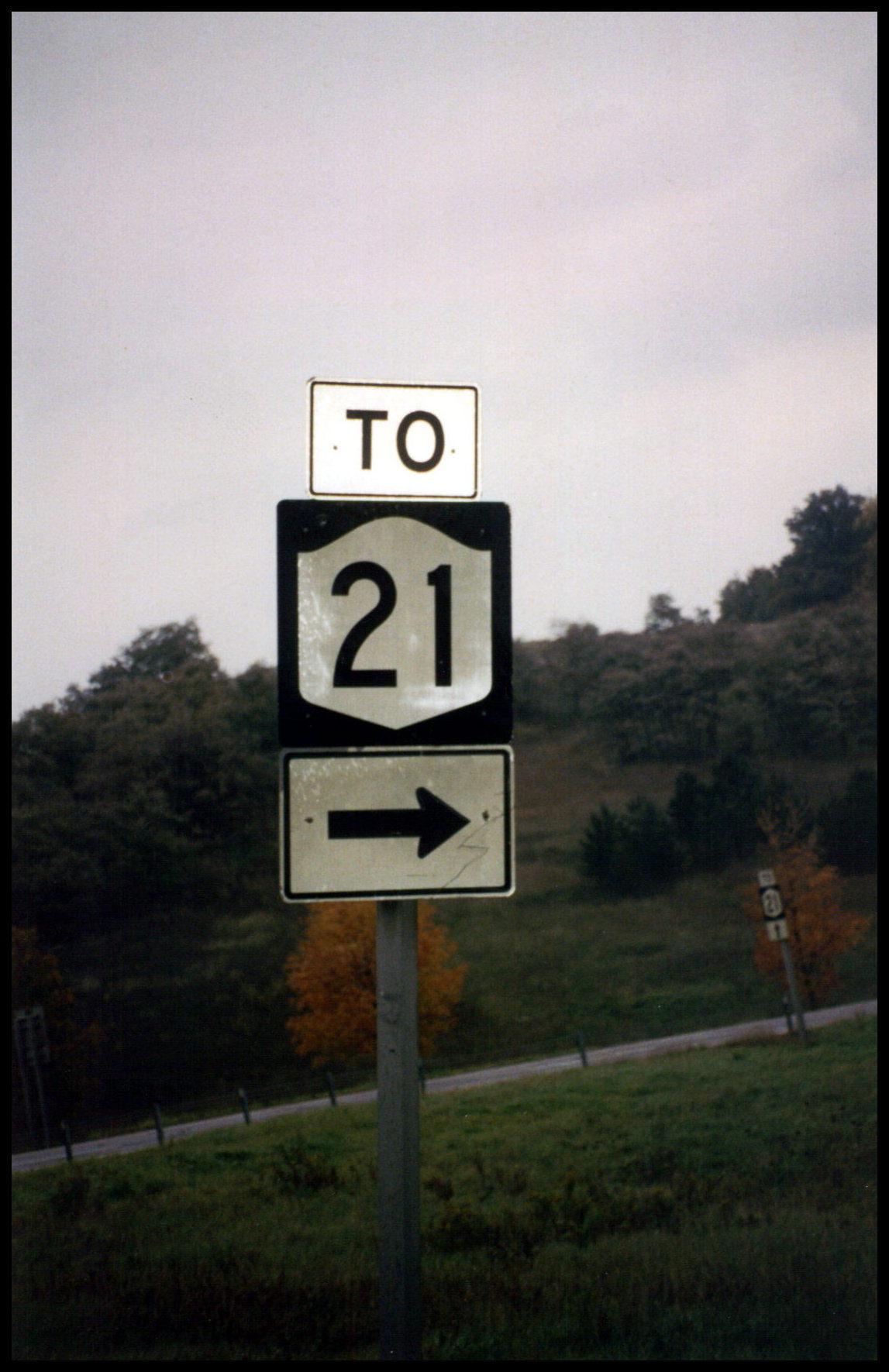
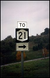 To NY 21 from the NY 17 interchange
From Hornell, NY 21 heads northeast through Fremont to Haskinville, passing west of Look Lake, then north to Wayland, where it intersects I-390 and NY 15 at exit 3 south of the village. NY 15 begins here and joins NY 21 north into the village. In the center of Wayland, NY 15 and NY 21 separate upon intersecting NY 63. Past Wayland, NY 21 follows an east–west alignment to North Cohocton, where it meets the northern terminus of NY 371. Upon exiting the village, NY 21 turns to the northeast toward Naples. South of the village, NY 21 intersects the northern end of NY 53; north of the village, the route passes the southern terminus of NY 245.[3]
Naples to Williamson
NY 21 continues north through the hills of rural Ontario County, where it meets the southern terminus of NY 64 in Bristol Springs adjacent to Canandaigua Lake. The route remains in close proximity to the lake to the town of Canandaigua, where it meets US 20 and NY 5 (Western Boulevard) west of the city of Canandaigua. NY 21 turns east, following US 20 and NY 5 around the southwestern portion of the city. The overlap between the three routes ends 1.5 miles (2.4 km) later at South Main Street, where NY 21 joins NY 332 (which begins at the intersection) north through downtown Canandaigua. At Gibson Street, NY 21 breaks from NY 332 and exits the city to the northeast.[3]
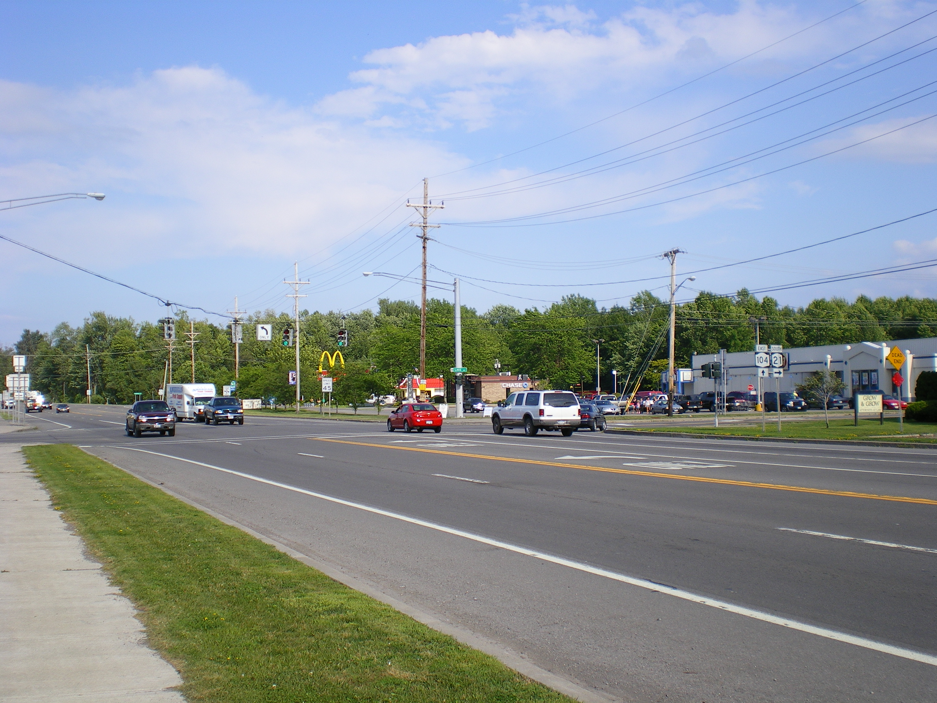
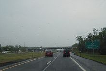 Signage for NY 21 on the New York State Thruway
Outside the Canandaigua city limits, the area surrounding NY 21 becomes rural once again. The route heads north through farmland to the adjacent villages of Shortsville and Manchester, where NY 21 intersects both NY 96 and the New York State Thruway (I-90) at exit 43 just north of Manchester. Past the Thruway, NY 21 becomes rural in nature once more as it passes through the northern portion of Ontario County. Upon crossing into Wayne County, the area around NY 21 becomes more developed as it enters Palmyra.[3]
Within the village, NY 21 briefly overlaps NY 31 along East Main Street before crossing both the Erie Canal and the CSX Transportation-owned Rochester Subdivision as it exits the village.[3] The portion of NY 21 between the southern village line and NY 31 is maintained by the village.[4] From Palmyra to Williamson, the land surrounding NY 21 is predominantly rural in nature. However, midway between the two locations, NY 21 comes close to Marion, which it bypasses to the west. In Williamson, NY 21 comes to an end at NY 104.[3]
History
Origins
Prior to the American Revolution, the path of modern NY 21 north of Canandaigua was part of an old Native American trail connecting Seneca Lake to Lake Ontario by way of Canandaigua Lake. The trail began in the vicinity of Geneva and went west to Canandaigua on a path now occupied by US 20 and NY 5. It continued north from Canandaigua, passing through the villages of Palmyra and Marion before reaching the Lake Ontario shoreline at Pultneyville. Construction to convert the Canandaigua–Marion section of the trail into a road was completed in 1794.[5] The remainder of the trail north to Pultneyville was converted into a road approximately three years later.[6]
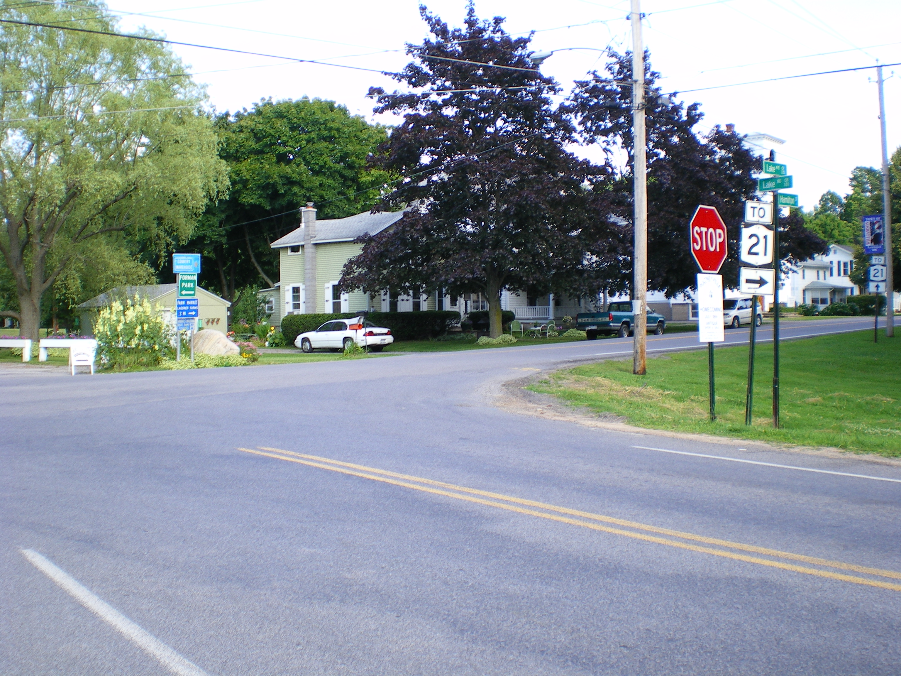
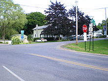 The junction of Lake Road and Hamilton Street in Pultneyville, which was NY 21's northern terminus from 1930 to 1980.
The Canandaigua–Pultneyville highway served as a post road in the years that followed. At some point, the section of the highway between Palmyra and Marion, initially a corduroy road, was rebuilt as a plank road and tolled. The highway fell into disrepair over the years, leading travelers to conceive ways to avoid paying toll. The toll booths were eventually removed. The road was later covered with dirt and served as a stage road.[6] By the 1920s, the state of New York had assumed ownership of the Canandaigua–Pultneyville highway. In the mid-1920s, it became part of NY 72, a north–south highway extending from NY 52 in Naples to the Lake Ontario shoreline in Pultneyville by way of the western side of Canandaigua Lake.[7][8]
Establishment
In the 1930 renumbering of state highways in New York, NY 72 became part of NY 21, a new route extending from the Pennsylvania state line at Troupsburg to Pultneyville. It followed what is now NY 36 from the state line to Hornell and modern County Route 121 (CR 121), NY 415, and NY 371 between Loon Lake and North Cohocton (via Cohocton). The remainder of NY 21 roughly followed its current alignment. At the same time, what is now NY 21 from Andover to Hornell was designated as the western half of NY 17F[1] while the section between Loon Lake and modern NY 415 was assigned NY 371.[9] The remaining piece around Wayland was part of NY 2 south of Wayland and part of the new NY 39 from Wayland to North Cohocton. NY 39 overlapped NY 21 from North Cohocton to Naples, where it forked from NY 21 and continued east on modern NY 245.[1]
Several portions of current NY 21 south of Naples had carried designations prior to 1930. In 1924, the Andover–Hornell segment was designated as part of NY 17; at the same time, the short piece between modern NY 415 and the center of Wayland became part of NY 4. By 1926, the portion connecting Wayland to Naples was included in the new NY 52.[7][8] NY 4 was renumbered to NY 2 in 1927 to eliminate numerical duplication with the new US 4.[10]
Realignments and truncations
 Northern terminus of NY 21 at NY 104 in Williamson
The alignments of NY 21 and NY 371 between Loon Lake and North Cohocton were flipped ca. 1937, routing NY 21 through the village of Wayland instead. The realignment extended NY 21's overlap with NY 39 west to Wayland and created an overlap with NY 2 south of the village.[11][12] NY 2 was absorbed into an extended US 15 (now NY 15) by the following year.[13] In the early 1940s, the NY 17F designation was eliminated and replaced with an extended NY 36 from Andover to Hornell.[14][15] The alignments of NY 36 and NY 21 south of Hornell were flipped in the early 1950s, placing both routes on their current alignments south of the city.[16][17]
On April 1, 1980, NY 21 was truncated to its present northern terminus at NY 104 in Williamson as part of a highway maintenance swap between New York State and Wayne County. In the swap, ownership and maintenance of NY 21 north of Williamson was transferred from the state of New York to the county in exchange for maintenance of NY 441 between the Monroe–Wayne county line and NY 350.[18] The former routing of NY 21 north to Lake Road (CR 101) in Pultneyville is now designated as CR 120.[19]
Until the 1980s, NY 21 entered Canandaigua on Bristol Street and followed it to South Main Street (then-US 20 and NY 5), where it joined its current alignment. When the Western Bypass around the southwestern fringe of the city was constructed in the late 1970s and early 1980s, US 20 and NY 5 were realigned to follow the highway around the city. NY 21 was also realigned at this time to follow its modern routing on the bypass and South Main Street.[20][21] The segment of Bristol Street vacated by NY 21 between the Western Bypass and the Canandaigua city line was maintained by the New York State Department of Transportation as unsigned NY 943A until September 1, 1996, when maintenance of the road was turned over to the town of Canandaigua.[18][22] However, the designation remained in NYSDOT documents until 2007.[23][24]
NY 21A
NY 21A was an alternate route of NY 21 along the eastern side of Canandaigua Lake. When it was assigned as part of the 1930 renumbering of state highways in New York, it began at NY 21 north of the village of Naples and ran along the east shore of the lake to eastern Canandaigua, where it ended at US 20 and NY 5. In between, NY 21A passed through the lakeside hamlet of Vine Valley.[25] The route was truncated ca. 1939 to begin in Vine Valley, separating it from its parent route.[13][26] It was eliminated entirely in the early 1940s when most of NY 21A was absorbed by NY 364.[14][15]
Major intersections
County Location Mile[2] Destinations Notes Allegany Village of Andover 0.00 NY 417Town of Alfred 8.80  NY 244
Hamlet of Alfred Station; eastern terminus of NY 244 Village of Almond 12.78 I-86 / NY 17Exit 33 (I-86 / NY 17) Steuben Hornell 17.45  NY 36 south
Southern terminus of NY 21 / NY 36 overlap 19.97 NY 36 northNorthern terminus of NY 21 / NY 36 overlap Town of Wayland 36.89 I-390 / NY 15Exit 3 (I-390); southern terminus of NY 15; southern terminus of NY 15 / NY 21 overlap 37.05  NY 415
Northern terminus of NY 415 Village of Wayland 38.75  NY 15 north / NY 63
Northern terminus of NY 15 / NY 21 overlap; southern terminus of NY 63 Town of Cohocton 45.52  NY 371
Hamlet of North Cohocton; northern terminus of NY 371 Ontario Village of Naples 50.04  NY 53
NY 53Northern terminus of NY 53 51.50  NY 245
Southern terminus of NY 245 South Bristol 57.68  NY 64
NY 64Hamlet of Bristol Springs; southern terminus of NY 64 Town of Canandaigua 70.81 US 20 west / NY 5 westWestern terminus of US 20 / NY 5 / NY 21 overlap City of Canandaigua 72.44  US 20 east / NY 5 east / NY 332
Eastern terminus of US 20 / NY 5 / NY 21 overlap; southern terminus of NY 21 / NY 332 overlap; southern terminus of NY 332 73.39 NY 332 northNorthern terminus of NY 21 / NY 332 overlap Hopewell 76.61  NY 488
Hamlet of Chapin; southern terminus of NY 488 Village of Manchester 80.59  NY 96
NY 9680.87 I-90 / ThruwayExit 43 (I-90 / Thruway) Wayne Village of Palmyra 86.87  NY 31 west
Western terminus of NY 21 / NY 31 overlap 87.49 NY 31 eastEastern terminus of NY 21 / NY 31 overlap Williamson 99.99 NY 1041.000 mi = 1.609 km; 1.000 km = 0.621 mi References
- ^ a b c Dickinson, Leon A. (January 12, 1930). "New Signs for State Highways". The New York Times: p. 136.
- ^ a b "2008 Traffic Data Report for New York State" (PDF). New York State Department of Transportation. June 16, 2009. pp. 147–148. https://www.nysdot.gov/divisions/engineering/technical-services/hds-respository/NYSDOT_Traffic_Data_Report_2008.pdf. Retrieved December 8, 2009.
- ^ a b c d e f I Love New York (2007). 1977–2007 I Love New York State Map (Map).
- ^ New York State Department of Transportation (1998). Palmyra Digital Raster Quadrangle (Map). 1:24,000. http://www.nysgis.state.ny.us/gisdata/quads/drg24/dotpreview/index.cfm?code=p21. Retrieved December 9, 2009.
- ^ "Old Road". Newark Courier-Gazette. 2002. http://www.cgazette.com/towns/Marion/history/1032439912062.htm. Retrieved December 29, 2009.
- ^ a b "Early Marion History". Newark Courier-Gazette. 2003. http://www.cgazette.com/towns/Marion/history/1045657378532.htm. Retrieved December 29, 2009.
- ^ a b "New York's Main Highways Designated by Numbers". The New York Times: p. XX9. December 21, 1924.
- ^ a b Rand McNally and Company (1926). Rand McNally Auto Road Atlas (western New York) (Map). http://www.broermapsonline.org/members/NorthAmerica/UnitedStates/Midatlantic/NewYork/unitedstates1926ra_008.html. Retrieved December 30, 2009.
- ^ Standard Oil Company of New York (1930). Road Map of New York (Map). Cartography by General Drafting.
- ^ Automobile Blue Book. 1 (1927 ed.). Chicago: Automobile Blue Book, Inc. 1927. This edition shows U.S. Routes as they were first officially signed in 1927.
- ^ Standard Oil Company (1936). New York (Map). Cartography by General Drafting.
- ^ Standard Oil Company (1937). New York (Map). Cartography by General Drafting.
- ^ a b Thibodeau, William A. (1938). The ALA Green Book (1938–39 ed.). Automobile Legal Association.
- ^ a b Gulf Oil Company (1940). New York Info-Map (Map). Cartography by Rand McNally and Company.
- ^ a b Esso (1942). New York with Pictorial Guide (Map). Cartography by General Drafting.
- ^ Sunoco (1952). New York (Map). Cartography by Rand McNally and Company.
- ^ Esso (1954). New York with Special Maps of Putnam–Rockland–Westchester Counties and Finger Lakes Region (Map). Cartography by General Drafting (1955–56 ed.).
- ^ a b New York State Legislature. "New York State Highway Law § 341". http://public.leginfo.state.ny.us/menugetf.cgi?COMMONQUERY=LAWS. Retrieved December 30, 2009.
- ^ New York State Department of Transportation (1999). Pultneyville Digital Raster Quadrangle (Map). 1:24,000. http://www.nysgis.state.ny.us/gisdata/quads/drg24/dotpreview/index.cfm?code=n21. Retrieved December 30, 2009.
- ^ Exxon (1979). New York (Map). Cartography by General Drafting.
- ^ State of New York (1981). I Love New York Tourism Map (Map). Cartography by Rand McNally and Company.
- ^ New York State Department of Transportation (October 2004) (PDF). Official Description of Highway Touring Routes, Scenic Byways, & Bicycle Routes in New York State. https://www.nysdot.gov/divisions/operating/oom/transportation-systems/repository/tour_route_0.pdf. Retrieved July 16, 2009.
- ^ New York State Department of Transportation (October 2007). Official Description of Highway Touring Routes, Bicycling Touring Routes, Scenic Byways, & Commemorative/Memorial Designations in New York State.
- ^ "2007 Traffic Data Report for New York State" (PDF). New York State Department of Transportation. July 25, 2008. p. 340. https://www.nysdot.gov/divisions/engineering/technical-services/hds-respository/NYSDOT_Traffic_Data_Report_2007.pdf. Retrieved December 30, 2009.
- ^ Automobile Legal Association (ALA) Automobile Green Book, 1930–31 and 1931–32 editions, (Scarborough Motor Guide Co., Boston, 1930 and 1931). The 1930–31 edition shows New York state routes prior to the 1930 renumbering
- ^ Standard Oil Company (1939). New York (Map). Cartography by General Drafting.
External links
Categories:- State highways in New York
- Transportation in Yates County, New York
- Transportation in Allegany County, New York
- Transportation in Ontario County, New York
- Transportation in Steuben County, New York
- Transportation in Wayne County, New York


Wikimedia Foundation. 2010.