- Naples (village), New York
-
Naples, New York — Village — Location within the state of New York
 Naples, New York
Coordinates: 42°36′58″N 77°24′9″W / 42.61611°N 77.4025°WCoordinates: 42°36′58″N 77°24′9″W / 42.61611°N 77.4025°W Country United States State New York County Ontario Area - Total 1.0 sq mi (2.5 km2) - Land 1.0 sq mi (2.5 km2) - Water 0.0 sq mi (0.0 km2) Elevation 804 ft (245 m) Population (2000) - Total 1,072 - Density 1,097.3/sq mi (423.7/km2) Time zone Eastern (EST) (UTC-5) - Summer (DST) EDT (UTC-4) ZIP code 14512 Area code(s) 585 FIPS code 36-49429 GNIS feature ID 0958258 Naples is a village in Ontario County, New York, USA. The population was 1,072 at the 2000 census.
The Village of Naples is in the Town of Naples. Naples is in the center of an important grape-growing region.
Contents
History
The village, one of the first places populated by pioneers, was first settled around 1790. The Naples Academy was founded in 1860. The village was incorporated in 1894. The Village of Naples has had votes on three different occasions in reference to dissolving the village into the Town of Naples, with all three results going against the proposal...the latest being in June 2005 (1994 and 2001 were the other two times). The Naples Branch of the Lehigh Valley Railroad terminated here.
Geography
Naples is located at 42°36′57″N 77°24′9″W / 42.61583°N 77.4025°W (42.616047, -77.402601)[1].
According to the United States Census Bureau, the village has a total area of 1.0 square miles (2.5 km²).None of the area is covered with water.
The village is southwest of Canandaigua Lake, one of the Finger Lakes.
New York State Route 21, New York State Route 53, and New York State Route 245 converge on the village, along with County Roads 33 and 36.
Naples Creek flows around the east side of the river toward Canandaigua Lake.
Has about 1000 citizens following the 2000 census.
Demographics
As of the census[2] of 2000, there were 1,072 people, 453 households, and 284 families residing in the village. The population density was 1,097.3 people per square mile (422.3/km²). There were 500 housing units at an average density of 511.8 per square mile (197.0/km²). The racial makeup of the village was 98.60% White, 0.56% Asian, 0.47% from other races, and 0.37% from two or more races. Hispanic or Latino of any race were 1.21% of the population.
There were 453 households out of which 31.6% had children under the age of 18 living with them, 45.3% were married couples living together, 13.0% had a female householder with no husband present, and 37.3% were non-families. 32.0% of all households were made up of individuals and 15.7% had someone living alone who was 65 years of age or older. The average household size was 2.37 and the average family size was 2.98.
In the village the population was spread out with 26.8% under the age of 18, 5.4% from 18 to 24, 26.9% from 25 to 44, 25.0% from 45 to 64, and 16.0% who were 65 years of age or older. The median age was 39 years. For every 100 females there were 94.2 males. For every 100 females age 18 and over, there were 83.4 males.
The median income for a household in the village was $34,219, and the median income for a family was $42,841. Males had a median income of $34,107 versus $21,563 for females. The per capita income for the village was $16,067. About 12.0% of families and 13.2% of the population were below the poverty line, including 18.0% of those under age 18 and 17.4% of those age 65 or over.
Trivia
- Boy Scout Troop 40 has been active for more than 75 years. An early Scoutmaster was Roger Killian, who inspired many young men despite their previous tendencies towards waywardness.
References
- ^ "US Gazetteer files: 2010, 2000, and 1990". United States Census Bureau. 2011-02-12. http://www.census.gov/geo/www/gazetteer/gazette.html. Retrieved 2011-04-23.
- ^ "American FactFinder". United States Census Bureau. http://factfinder.census.gov. Retrieved 2008-01-31.
- Cornell University. Naples: Credits. Retrieved Jun 21, 2007.
External links
Municipalities and communities of Ontario County, New York County seat: Canandaigua Cities 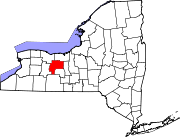
Towns Bristol | Canadice | Canandaigua | East Bloomfield | Farmington | Geneva | Gorham | Hopewell | Manchester | Naples | Phelps | Richmond | Seneca | South Bristol | Victor | West Bloomfield
Villages Bloomfield | Clifton Springs | Manchester | Naples | Phelps | Rushville‡ | Shortsville | Victor
Hamlets Centerfield | Fishers | Gorham | Hall | Honeoye | Stanley
Footnotes ‡This populated place also has portions in an adjacent county or counties
Categories:- Villages in New York
- Rochester, New York metropolitan area
- Populated places established in 1790
- Populated places in Ontario County, New York


Wikimedia Foundation. 2010.