- Robert Moses State Parkway
-
This article is about the Niagara Falls parkway. For the Long Island causeway, see Robert Moses Causeway.
Robert Moses State Parkway

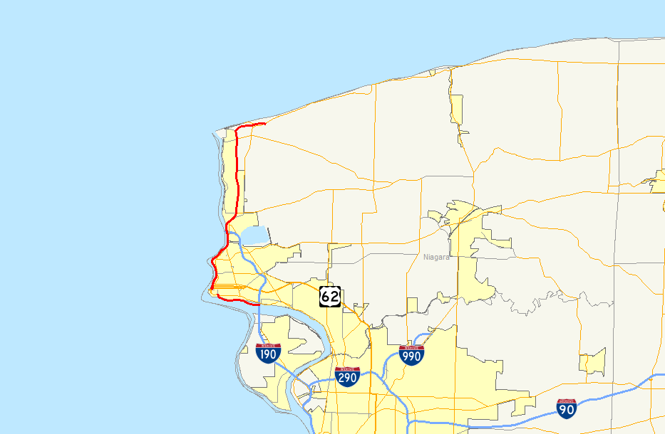
Map of the Niagara Region with the Robert Moses State Parkway highlighted in redRoute information Existed: early 1960s[1] – present Southern segment Length: 3.24 mi[2] (5.21 km) South end:  LaSalle Expressway in Niagara Falls
North end: Buffalo Avenue in Niagara Falls Northern segment Length: 15.18 mi[2] (24.43 km) South end:  NY 104 in Niagara Falls
Major
junctions: I-190 in Lewiston
North end:  NY 18 in Porter
Location Counties: Niagara Highway system Numbered highways in New York
Interstate • U.S. • N.Y. (former) • Reference • CountyThe Robert Moses State Parkway is an 18.42-mile (29.64 km) long north–south highway in western Niagara County, New York, United States. Its southern terminus is at the LaSalle Expressway on the east bank of the Niagara River in Niagara Falls. The northern terminus is at NY 18 at Four Mile Creek State Park in Porter near Lake Ontario. Originally, the parkway was one continuous road; however, due to low usage, a portion of the parkway near Niagara Falls was removed, separating the parkway into two sections. The length of the parkway is designated as New York State Route 957A by the New York State Department of Transportation. A 1.16-mile (1.87 km) long spur connecting the Robert Moses Parkway to Fort Niagara State Park near Youngstown is designated as New York State Route 958A. Both reference route designations are unsigned.
The parkway, a divided highway for most of its route, is one of the most unorthodox parkways in New York State, similar to Ocean Parkway on Long Island. Some portions, mainly between downtown Niagara Falls and Lewiston, are not built to freeway standards, and the parkway as a whole has gradually been relegated due to low usage.
Contents
Route description
The Robert Moses State Parkway begins as a westward continuation of a spur off the LaSalle Expressway in Niagara Falls, New York.[2][3] It connects with Interstate 190 and NY 384 just west of its official southern terminus and passes under the North Grand Island Bridge as it heads west along the Niagara River. The only interchange along this portion of the route comes 3 miles (5 km) west of I-190, where the parkway connects to a spur leading into Niagara Falls State Park. The parkway itself turns north here and returns to grade level at Buffalo Avenue, where the Moses Parkway terminates and continues north as John B. Daly Boulevard (designated but not signed as NY 952B by the New York State Department of Transportation). One block to the north of this intersection is NY 384, which also comes within one block of the northern portion of the parkway.
 Approaching the Fort Niagara spur on the northbound Moses Parkway
The parkway resumes north of downtown at an intersection with Main Street (NY 104). It heads north as a four-lane divided highway, passing the northern extents of Niagara Falls State Park and the Aquarium of Niagara as it parallels the Niagara Gorge. Roughly 0.5 miles (0.8 km) from NY 104, the parkway downgrades into a two-lane highway. The Robert Moses Parkway continues on, passing over the Whirlpool Rapids Bridge's eastern approach (and thus NY 182's western terminus) as it approaches and serves Whirlpool State Park. North of the park, the highway curves northeastward, matching the curvature of the gorge in the area. After serving the Devil's Hole State Park and interchanging with NY 104, it passes over the Robert Moses Niagara Power Plant. Many features are within view at this point: to the west of the parkway at this point are the Sir Adam Beck Hydroelectric Power Stations; to the north are the Lewiston–Queenston Bridge and the Niagara River's course for miles ahead. The parkway interchanges with I-190 via Upper Mountain Road before passing under the bridge and re-widening to four lanes.
Just north of the bridge, the Robert Moses Parkway approaches the edge of the Niagara Escarpment. Here, it is possible to see for several miles in any direction. Looking north, the remainder of the Niagara River can be seen, as can its mouth at Lake Ontario. The parkway descends the escarpment and meets NY 18F and NY 104 just east of the village of Lewiston. North of Lewiston, the Parkway follows a largely north–south routing as it passes through largely rural sections of the towns of Lewiston and Porter. During this stretch, it has an exit to Pletcher Road, which links the parkway to Joseph Davis State Park.
At the village of Youngstown, the Robert Moses Parkway interchanges with NY 93. North of the village, the parkway's median widens as it interchanges with a short spur (designated but not signed as NY 958A) leading to Fort Niagara State Park and Fort Niagara within. Past this junction, the parkway turns east and begins to parallel Lake Ontario. It passes under NY 18F and interchanges with Four Mile Creek Drive, the entry road for Four Mile Creek State Park, before terminating at an at-grade intersection with NY 18.
History
Proposals for a limited-access highway to connect downtown Niagara Falls with the proposed Niagara Thruway, a spur of the New York State Thruway, surfaced by the 1950s. The general routing of the highway would begin at the Rainbow Bridge in downtown and parallel NY 384 on its north side to the North Grand Island Bridge, where it would turn south to meet the northern terminus of the Niagara Thruway.[4][5] However, by the 1960s, a new alignment along the bank of the Niagara River and through the Niagara Falls State Park was selected instead. Two portions of the "Niagara Parkway", as it was then known, were completed by 1962. The first extended from the Niagara Thruway (Interstate 190) to the Rainbow Bridge. Another, representing a northward extension of the parkway, was open along the Niagara Gorge's eastern edge from Niagara Avenue to U.S. Route 104 in Lewiston. At the time, the sections from the Rainbow Bridge to Niagara Street and US 104 to Ridge Road in Lewiston were under construction.[6] Both were open to traffic by 1964.[7] An extension of the parkway, now named the "Robert Moses State Parkway" after public works developer Robert Moses, north to NY 18 in Porter was completed by 1968. A spur to Fort Niagara was built as part of the extension.[8]
 Looking north at the parkway from the pedestrian bridge near the Aquarium of Niagara. This part was undergoing a partial conversion into a recreation trail in 2001
The Robert Moses Parkway was to have been part of a vast network of limited-access highways in the Buffalo area. Under the 1971 Regional Highway Plan for the Buffalo – Niagara Falls area, the parkway would have been paralleled by a westward extension of the LaSalle Expressway, which would have extended from the Rainbow Bridge to I-190 along the proposed routing shown on maps 20 years before. Farther north, the northern end of the Robert Moses Parkway in Porter would have linked to a western extension of the Lake Ontario State Parkway.[9] Neither proposal ever came to fruition.
The portion of the Robert Moses Parkway within Niagara Falls State Park was closed and largely removed in the late 1980s as a result of a movement to restore the park to the original layout conceived for it by landscape architect Frederick Law Olmsted.[1] As a result, the parkway became discontinuous. Its southern segment now began at the pre-existing interchange with Quay Street (John B. Daly Boulevard), which remained virtually untouched, while the southern end of the northern segment was reconfigured in the vicinity of downtown to terminate at an at-grade intersection with Main Street (NY 104).[10] Traffic must now employ NY 384 to bridge the two sections of the parkway. The portions of the Robert Moses Parkway that still exist within Niagara Falls State Park are mostly in the vicinity of the Rainbow Bridge and are used for park business only.
Additional downgrading of the highway has occurred in other areas. From Cedar Street in downtown Niagara Falls to I-190 in Lewiston, the southbound lanes were gradually converted into a recreation/bike trail during the 2000s, funneling all traffic into the former northbound lanes and turning the parkway into a two-lane highway.[citation needed] Future changes have been proposed for the parkway, which has been referred to as a barrier between the city of Niagara Falls and the riverfront of the Niagara River.[1][11] One proposed change calls for the replacement of the former Quay Street interchange with a roundabout, a project which would have cost $12 million to complete in 2006.[11] A second would remove the former routing of the parkway through the southeastern portion of Niagara Falls State Park, which would force all parkway traffic to enter Niagara Falls via John B. Daly Boulevard.[1] There are no set timelines for either project.
Exit list
The entire route is in Niagara County. All exits are unnumbered.
Location Mile[2] Exit Destinations Notes Niagara Falls 0.00 LaSalle Expressway spurEastward continuation of the Robert Moses Parkway 0.02 
 I-190 / Thruway / NY 384 – Buffalo, Canada
Southbound exit and northbound entrance Niagara Falls State Park Northbound exit only 3.24 Buffalo Avenue At-grade intersection; roadway continues north as John B. Daly Boulevard (NY 952B) Gap in parkway 3.24 NY 104 (Main Street)At-grade intersection; roadway continues southward as Rainbow Boulevard 5.04 Findlay Drive At-grade intersection Lewiston 6.64 NY 104 – Devil's Hole, Niagara University, Power VistaNorthbound entrance and exit 7.98 I-190 – Niagara Falls, CanadaNo southbound exit; access via Upper Mountain Road 9.68  NY 18F / NY 104 (Ridge Road) – Lewiston Artpark
Southern terminus of NY 18F 12.37 Pletcher Road – Joseph Davis State Park Youngstown 15.51  NY 93 – Youngstown
15.94 To NY 18F (NY 958A) – Fort NiagaraFort Niagara spur Porter 18.09 Four Mile Creek State Park Northbound exit and southbound entrance 18.42 NY 18 (Lake Road)At-grade intersection 1.000 mi = 1.609 km; 1.000 km = 0.621 mi Fort Niagara spur
The entire route is in Porter, Niagara County. All exits are unnumbered.
Mile[2] Exit Destinations Notes 0.00  Robert Moses Parkway NY 18F – Fort Niagara
Southbound exit and northbound entrance 1.16 Fort Niagara State Park 1.000 mi = 1.609 km; 1.000 km = 0.621 mi See also
- Niagara Parkway, the counterpart to the Robert Moses State Parkway on the Canadian side of the Niagara River
References
- ^ a b c d McKinley, Dave (December 2008). "Robert Moses Parkway Talk Draws Big Falls Crowd". WGRZ (Buffalo, New York). http://www.wgrz.com/news/NFVoice_article.aspx?storyid=62706. Retrieved April 10, 2009.
- ^ a b c d e "2008 Traffic Volume Report for New York State" (PDF). New York State Department of Transportation. June 16, 2009. p. 279. https://www.nysdot.gov/divisions/engineering/technical-services/hds-respository/NYSDOT%20TVR%202008%20by%20Route.pdf. Retrieved August 2, 2010.
- ^ New York State Department of Transportation (1996). Tonawanda West Digital Raster Quadrangle (Map). 1:24,000. http://www.nysgis.state.ny.us/gisdata/quads/drg24/dotpreview/index.cfm?code=p7. Retrieved April 10, 2009. The highway linking the Robert Moses Parkway to the LaSalle Expressway is part of the same internal state highway (SH C68002) as the westernmost portion of the LaSalle mainline, making it a spur of the LaSalle.
- ^ Sunoco (1952). New York (Map). Cartography by Rand McNally and Company.
- ^ Esso (1954). New York with Special Maps of Putnam–Rockland–Westchester Counties and Finger Lakes Region (Map). Cartography by General Drafting (1955–56 ed.).
- ^ Esso (1962). New York with Sight-Seeing Guide (Map). Cartography by General Drafting.
- ^ Sinclair (1964). New York and Metropolitan New York (Map). Cartography by Rand McNally and Company.
- ^ Esso (1968). New York (Map). Cartography by General Drafting (1969–70 ed.).
- ^ City of Niagara Falls (1971). Regional Highway Plan for Buffalo and Niagara Falls (Map). http://www.gribblenation.net/nypics/planned/buffalo/buffalo.jpg. Retrieved April 10, 2009.
- ^ Rand McNally (1995). New York (Map). ISBN 0-528-96764-9.
- ^ a b Michelmore, Bill (December 7, 2008). "Hearing set on proposed redesign of parkway". The Buffalo News.
External links
Categories:- Parkways in New York
- Transportation in Niagara County, New York
- Transportation in Niagara Falls, New York
- Robert Moses projects
- Demolished highways in the United States


Wikimedia Foundation. 2010.