- North Truro, Massachusetts
-
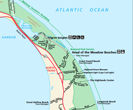
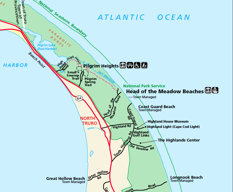
North Truro is a village in the town of Truro, Massachusetts, United States. Due to its proximity to urbanized Provincetown, it is somewhat more densely developed than the rest of the town, with houses and small resort facilities lining the two main thoroughfares, U.S. Route 6 and MA Route 6A. It is home to Truro Vineyards, one of two operating wineries (the other is in Falmouth) on Cape Cod. North Truro is located at 42°03′35″N 70°08′31″W / 42.05972°N 70.14194°W.
From December, 1969 until early 1970, North Truro was the location of Operation Have Horn, the launching of sounding rockets under project Nike-Hydac. On completion of the operation, the used devices were returned to the White Sands Missile Range. These experiments were conducted at the now closed North Truro Air Force Station.
North Truro is also home to Highland Links Golf Course, Massachusetts's oldest links course. The course runs along the highland cliffs on the Atlantic coast, and encompasses the Highland Light.
See also
External links
Municipalities and communities of Barnstable County, Massachusetts City 
Towns CDPs Bourne | Brewster | Buzzards Bay | Chatham | Dennis | Dennis Port | East Dennis | East Falmouth | East Harwich | East Sandwich | Falmouth | Forestdale | Harwich Center | Harwich Port | Mashpee Neck | Monomoscoy Island | Monument Beach | New Seabury | North Eastham | North Falmouth | Northwest Harwich | Orleans | Pocasset | Popponesset Island | Popponesset | Provincetown | Sagamore | Sandwich | Seabrook | Seconsett Island | South Dennis | South Yarmouth | Teaticket | West Chatham | West Dennis | West Falmouth | West Yarmouth | Woods Hole | Yarmouth Port
Other
villagesBarnstable Village | Centerville | Cotuit | Craigville | Hyannis | Marstons Mills | Menauhant | North Harwich | North Truro | Osterville | Pleasant Lake | South Harwich | West Barnstable | West Harwich
Categories:- Villages in Barnstable County, Massachusetts
- Massachusetts geography stubs

Wikimedia Foundation. 2010.