- Yarmouth, Massachusetts
:"There are other places named
Yarmouth ."Infobox Settlement
official_name = Yarmouth, Massachusetts
nickname =
motto =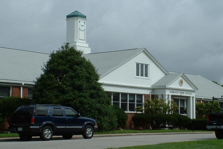
imagesize =
image_caption = Yarmouth Town Offices
image_
mapsize = 250px
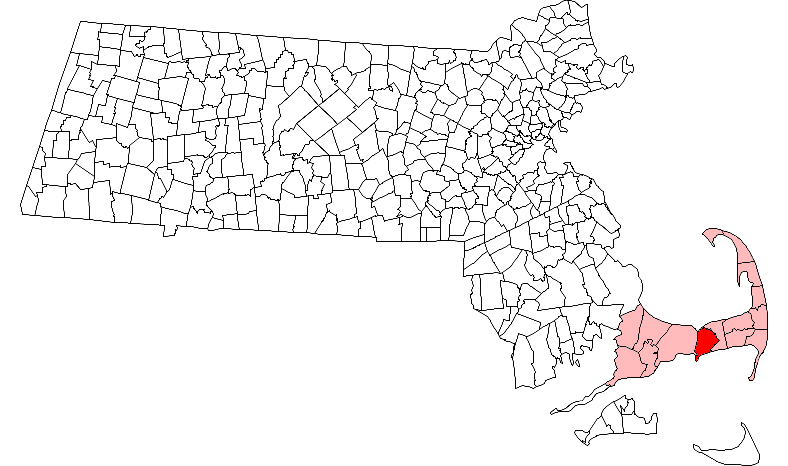
map_caption = Location in Barnstable County in Massachusetts
mapsize1 =
map_caption1 =
subdivision_type = Country
subdivision_name =United States
subdivision_type1 = State
subdivision_name1 =Massachusetts
subdivision_type2 = County
subdivision_name2 = Barnstable
established_title = Settled
established_date = 1639
established_title2 = Incorporated
established_date2 = 1639
established_title3 =
established_date3 =
government_type =Open town meeting
leader_title =
leader_name =
leader_title1 =
leader_name1 =
area_magnitude =
area_total_km2 = 73.1
area_total_sq_mi = 28.2
area_land_km2 = 62.8
area_land_sq_mi = 24.3
area_water_km2 = 10.3
area_water_sq_mi = 4.0
population_as_of = 2000
settlement_type = Town
population_total = 24807
population_density_km2 = 395.0
population_density_sq_mi = 1023.0
elevation_m = 9
elevation_ft = 30
timezone = Eastern
utc_offset = -5
timezone_DST = Eastern
utc_offset_DST = -4
latd = 41 |latm = 42 |lats = 20 |latNS = N
longd = 70 |longm = 13 |longs = 45 |longEW = W
website = [http://www.yarmouth.ma.us/ www.yarmouth.ma.us]
postal_code_type = ZIP code
postal_code = 02664
area_code = 508 / 774
blank_name = FIPS code
blank_info = 25-82525
blank1_name = GNIS feature ID
blank1_info = 0618262
footnotes =Yarmouth is a town in Barnstable County,
Massachusetts ,United States , Barnstable County being coextensive withCape Cod . The population was 24,807 at the 2000 census.For geographic and demographic information on specific parts of the town of Yarmouth, please see the articles on South Yarmouth, West Yarmouth, and Yarmouth Port.
History
The first attempt to settle Yarmouth was made by Rev.
Stephen Bachiler and his followers in the winter of 1637/8. However, this settlement was abandoned due to the severity of the winter "and others undertook it". [Anderson, Robert Charles,"The Great Migration Begins", Boston, MA: New England Historic Genealogical Society, 1995, I:66 from Winthrop's Journal 1:313.] Yarmouth was organized and named in1639 . It originally was founded by the Pilgrims, and covered lands currently part of the towns of Barnstable, Brewster, Chatham and Harwich. Farming and the sea provided the industry for the early settlers to the town, with both the northern and southern ports being active in industry. This brought wealth to Yarmouth, which can still be seen today in its historic districts. The railroad came in the mid-1800s, and helped Yarmouth become a tourist destination. Today the town is mostly known for its tourist industry and shopping, as it is the home of the originalChristmas Tree Shops on Route 6A in the village of Yarmouthport. ["Cape Cod, Martha's Vineyard and Nantucket Street Atlas." South Easton, MA: Arrow Maps Inc., 2004, p. 96.]Geography
According to the
United States Census Bureau , the town has a total area of 28.2square mile s (73.1km² ), of which, 24.2 square miles (62.8 km²) of it is land and 4.0 square miles (10.3 km²) of it (14.07%) is water. Yarmouth is bordered byCape Cod Bay to the north, Dennis to the east,Nantucket Sound to the south, and Barnstable to the west. Yarmouth is approximately seventy-five miles southeast of Boston.The Bass River and its tributaries make up the majority of the town's border with Dennis. There are also several smaller ponds throughout the town. The Cape Cod Bay shore is marshy, with several creeks flowing into it. The town's southern shore is known for its beaches, from the west jetty of the Bass River to Great Island, on the east and south sides of Hyannis Harbor. The town has no state forests or wildlife management areas, although there are many such natural, unprotected areas in town. The town is also the site of four golf courses, a rod and gun club, and a Boy Scout camp.
Transportation
Cape Cod's three major east-west routes,
U.S. Route 6 , Route 6A and Route 28, all run through the town. Unlike many towns on the Cape, there are no other state routes crossing between the three roads, with all crossing routes being local roads. There are two exits off of Route 6 (also known as the Mid-Cape Highway) in town.Freight rail service is provided by the
Massachusetts Coastal Railroad from the Barnstable town line to just west of Station Avenue south of U.S. Route 6, where a trash transfer station is located. Trash is loaded onto rail cars at the transfer station and hauled to the SEMASS waste-to-energy plant in Rochester. A portion of the Hyannis branch also passes through the western part of Yarmouth. TheCape Cod Central Railroad operates seasonal tourist excursions from nearby Hyannis to Sandwich and Sagamore. The nearest inter-city (Amtrak ) passenger rail stations are Boston'sSouth Station and Providence. The nearestMBTA commuter rail stations are Kingston/Route 3 and Middleborough/Lakeville, providing direct service to Boston.There are also several bike paths throughout town.
The nearest airport is the
Barnstable Municipal Airport , just over the town line. The nearest national and international air service can be reached atLogan International Airport in Boston.Demographics
As of the
census GR|2 of 2000, there were 24,807 people, 11,520 households, and 6,900 families residing in the town. Thepopulation density was 1,023.0 people per square mile (395.0/km²). There were 16,605 housing units at an average density of 684.8/sq mi (264.4/km²). The racial makeup of the town was 95.23% White, 1.34% African American, 0.33% Native American, 0.53% Asian, 0.04% Pacific Islander, 0.94% from other races, and 1.59% from two or more races. Hispanic or Latino of any race were 1.44% of the population.There were 11,520 households out of which 19.1% had children under the age of 18 living with them, 47.3% were married couples living together, 9.7% had a female householder with no husband present, and 40.1% were non-families. 34.0% of all households were made up of individuals and 19.8% had someone living alone who was 65 years of age or older. The average household size was 2.11 and the average family size was 2.68.
In the town the population was spread out with 17.2% under the age of 18, 4.6% from 18 to 24, 23.3% from 25 to 44, 24.7% from 45 to 64, and 30.1% who were 65 years of age or older. The median age was 49 years. For every 100 females there were 85.6 males. For every 100 females age 18 and over, there were 80.8 males.
The median income for a household in the town was $39,808, and the median income for a family was $48,148. Males had a median income of $37,090 versus $26,741 for females. The
per capita income for the town was $22,731. About 5.2% of families and 7.5% of the population were below thepoverty line , including 11.1% of those under age 18 and 3.6% of those age 65 or over.Government
Yarmouth is represented in the
Massachusetts House of Representatives as a part of the First and Second Barnstable Districts. The town is represented in theMassachusetts Senate as a part of the Cape and Islands Districts, which includes all of Cape Cod, Martha's Vineyard and Nantucket except the towns of Bourne, Falmouth, Sandwich and a portion of Barnstable. [ [http://www.mass.gov/legis/citytown.htm Index of Legislative Representation by City and Town, from Mass.gov] ] The town is home to the Second Barracks of Troop D of theMassachusetts State Police . [ [http://www.mass.gov/?pageID=eopsterminal&L=5&L0=Home&L1=Law+Enforcement+%26+Criminal+Justice&L2=Law+Enforcement&L3=State+Police+Troops&L4=Troop+D&sid=Eeops&b=terminalcontent&f=msp_divisions_field_services_troops_troop_d_msp_field_troop_d_station_d2&csid=Eeops Station D-2, SP Yarmouth] ]On the national level, Yarmouth is a part of
Massachusetts's 10th congressional district , and is currently represented byBill Delahunt . The state's senior (Class I) member of theUnited States Senate , re-elected in 2006, isTed Kennedy . The junior (Class II) Senator, up for re-election in 2008, isJohn Kerry .Yarmouth is governed by the
open town meeting form of government, and is led by atown administrator and aboard of selectmen . There is a central police station, and one firehouse, post office and library each in South Yarmouth, West Yarmouth and Yarmouth Port.Education
Yarmouth schools make up one-half of the Dennis-Yarmouth Regional School District. Yarmouth operates two elementary schools (Laurence C. MacArthur and Station Avenue) which serve students from pre-kindergarten through third grade, as well as the Marguerite E. Small School for grades 4 & 5, and the Mattacheese Middle School for grades 6 through 8. The town is the home to
Dennis-Yarmouth Regional High School , where both towns send their students. Their team colors are green and white, and their mascot is the dolphin.Students who live in Yarmouth may also attend
Cape Cod Regional Technical High School in Harwich for grades 9-12. In addition, they may choose to attend Saint Pius X School for grades pre-kindergarten through 8, or any of the other private schools in neighboring Barnstable.Notable residents
*Timothy Alden, (1771-1839), born in Yarmouth, Congregational Church clergyman and founder of
Allegheny College cite book | title = Who Was Who in America, Historical Volume, 1607-1896 | publisher = Marquis Who's Who | location = Chicago | date = 1967]References
External links
* [http://www.yarmouthcapecod.com Yarmouth Chamber of Commerce official website]
* [http://www.yarmouth.ma.us/ Town of Yarmouth official website]
* [http://web.archive.org/web/20060206153417/http://www.yarmouthcapecod.com/Visitors_Center/visitors_center.html Official Yarmouth tourist information website]
Wikimedia Foundation. 2010.